Category: News

Updates and impact from Friends of Olympic National Park.

  • Kayaking in Olympic National Park: Lakes and Rules

    Kayaking in Olympic National Park: Lakes and Rules

    Kayaking in Olympic National Park means clear, deep lakes ringed by forest and mountains. The park names Lake Crescent, Lake Ozette and Lake Quinault as its most popular and accessible places to paddle a kayak, canoe or paddleboard. Here is where to launch, where the park says you can rent a boat, and the rules and cold water risks to know first.

    Quick answer

    Where can you go kayaking in Olympic National Park?

    The most popular places for kayaking in Olympic National Park are Lake Crescent, Lake Ozette and Lake Quinault. Lake Crescent has launches at Storm King and Fairholme and rentals at Log Cabin Resort and Lake Crescent Lodge. Wear a life jacket, dress for water below 50 degrees, and paddle early before afternoon winds.

    • Life jackets are required by law
    • Free boat cleaning stations at three Lake Crescent sites
    • Personal watercraft such as Jet Skis are not allowed
    • Wilderness permit needed to camp by boat

    The three big paddling lakes compared

    Here is how they compare. This summary comes from the park’s boating page as of October 2026; check it before you go, because launches and rentals can change.

    LakeLaunchesRentals the park listsWatch for
    Lake CrescentStorm King Ranger Station, Fairholme; Log Cabin Resort dock for a feeLog Cabin Resort, Lake Crescent LodgeAfternoon winds and waves of a foot or more
    Lake OzetteOzette Ranger Station, Ozette Campground (Swan Bay is also listed)None listedSudden strong winds and waves
    Lake QuinaultFalls Creek and Willaby, run by the U.S. Forest ServiceLake Quinault LodgeAfternoon winds

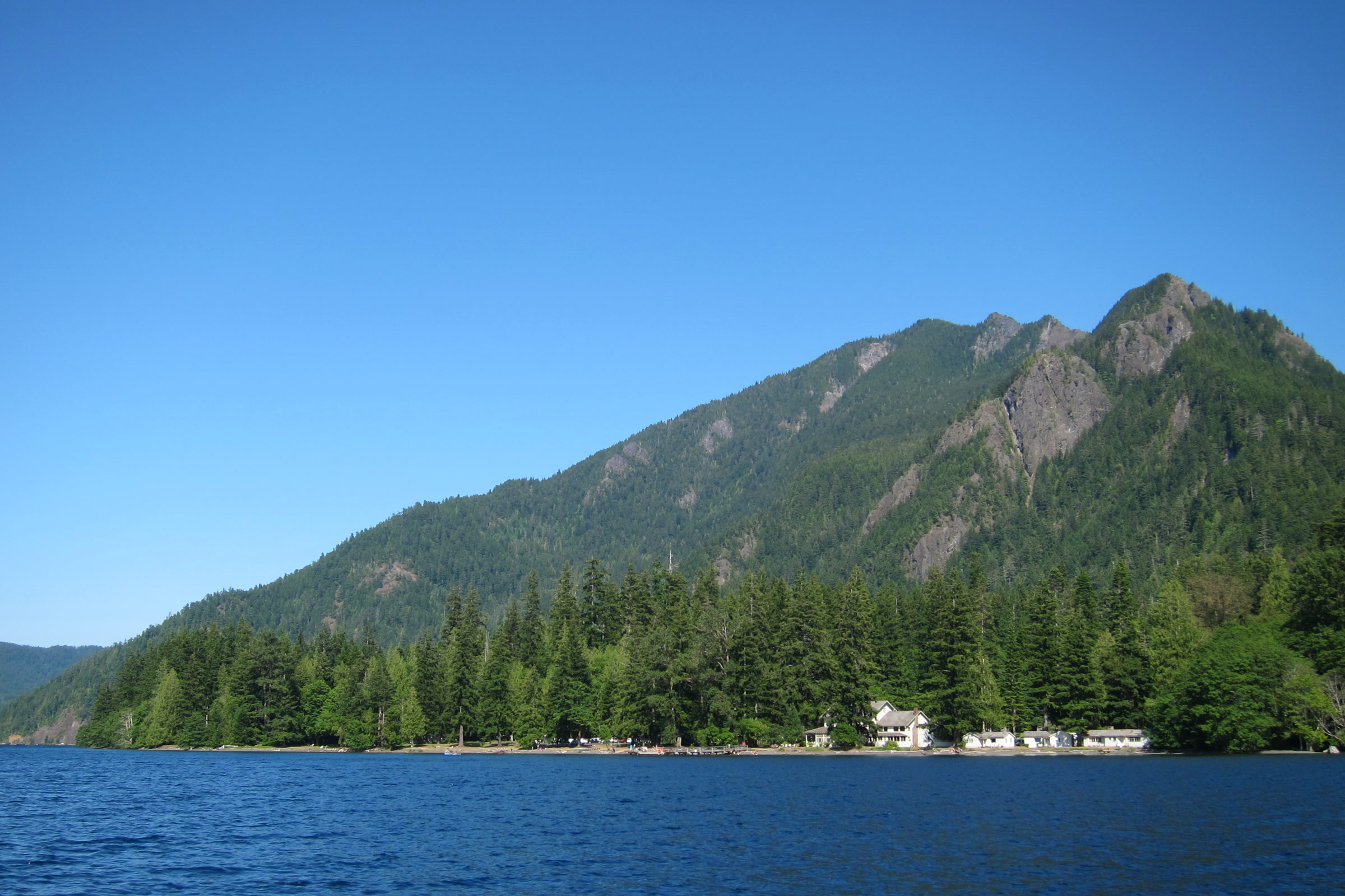
    Lake Crescent kayaking

    The park describes Lake Crescent as big, deep and blue, and says paddling is best in the early morning, when winds are most likely to be calm. Winds often come up in the afternoon and can quickly build waves of a foot or more, so plan your paddle for the morning.
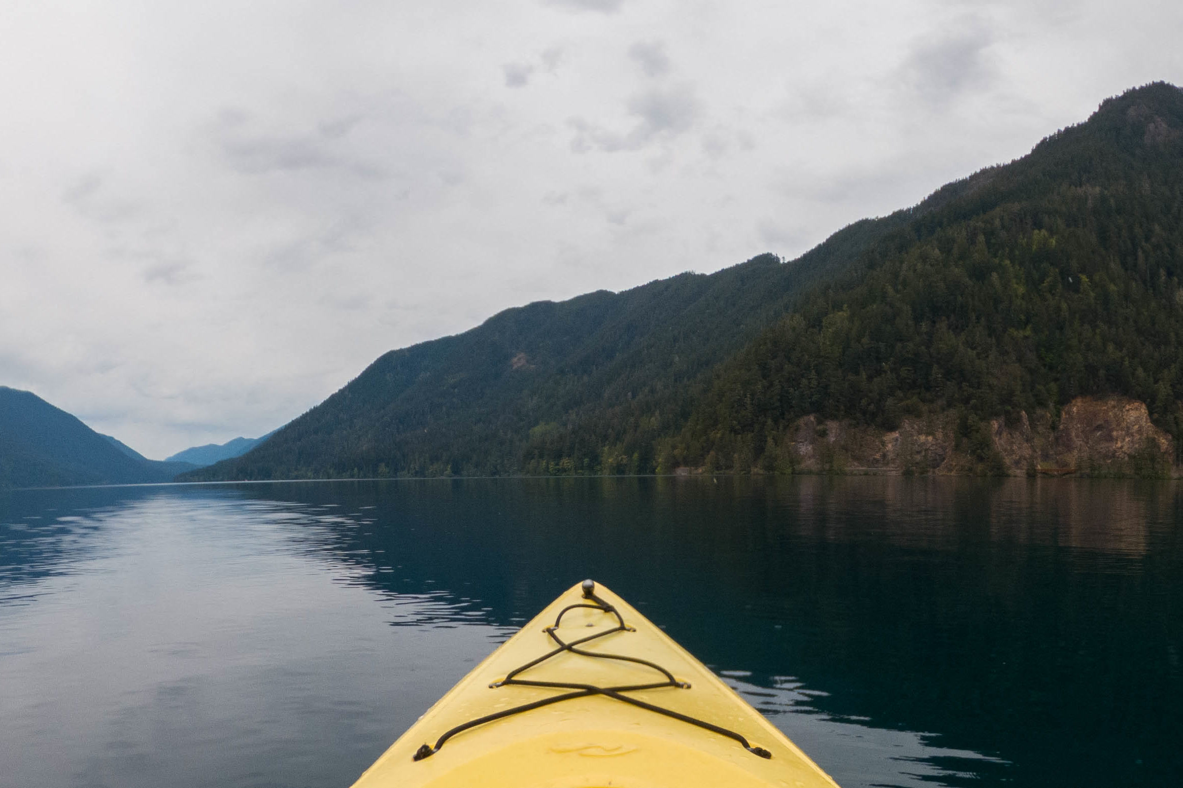
    The yellow bow of a kayak pointing across still, dark Lake Crescent toward steep forested mountains under grey clouds
    Calm water on Lake Crescent, seen from a kayak. Photo: Sea Cow / Wikimedia Commons (CC BY-SA 4.0)

    Boats launch at Storm King Ranger Station and Fairholme, and for a fee from the dock at Log Cabin Resort. The park lists kayak and canoe rentals at two concession operated lodges, Log Cabin Resort and Lake Crescent Lodge. At Log Cabin Resort you pay inside the main lodge building, then head to the rental building.
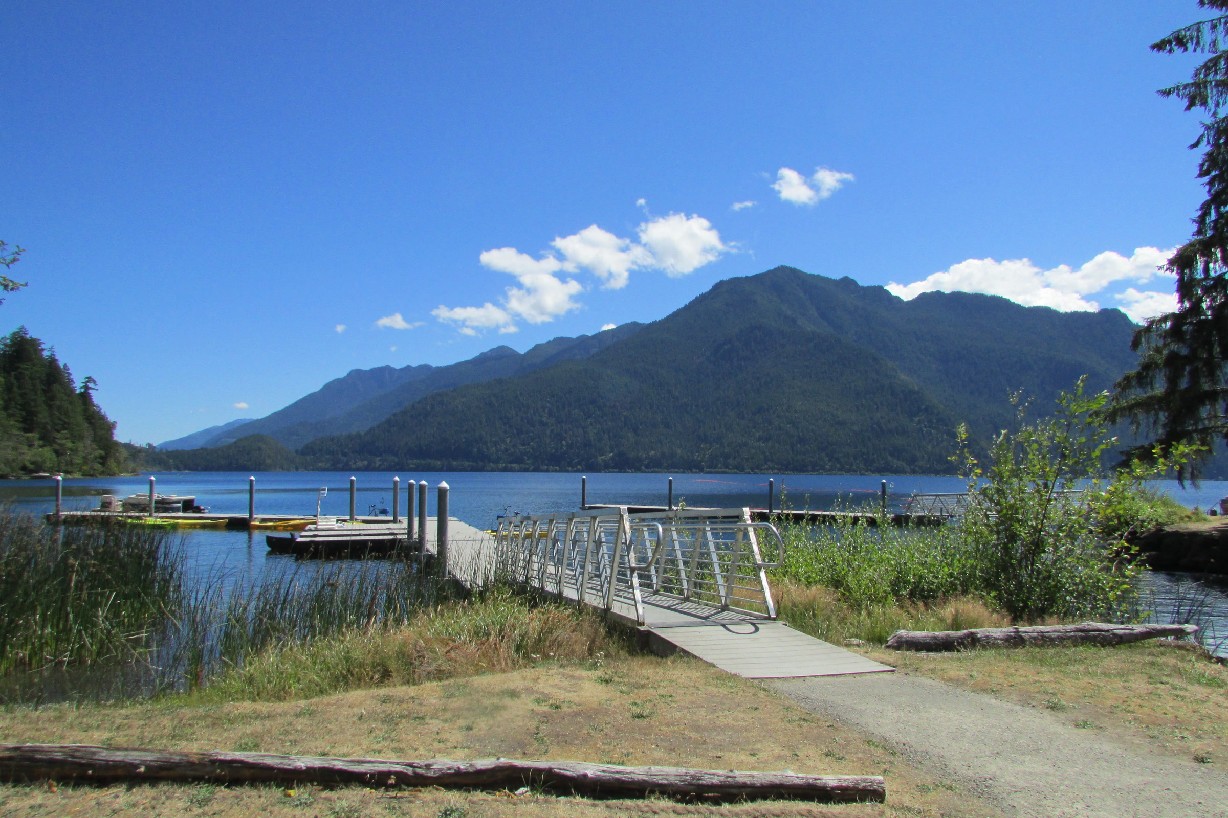
    A wooden dock and walkway reaching into Lake Crescent at Log Cabin Resort, with forested mountains and blue sky beyond
    The dock at Log Cabin Resort on Lake Crescent in August. Photo: Chris Light / Wikimedia Commons (CC BY-SA 4.0)

    Motorboats share the lake, but they may not exceed 5 mph or make a wake within 300 feet of any shoreline. Our Lake Crescent guide covers the lake’s history and trails, and the Mount Storm King trail gives a view straight down onto the water.
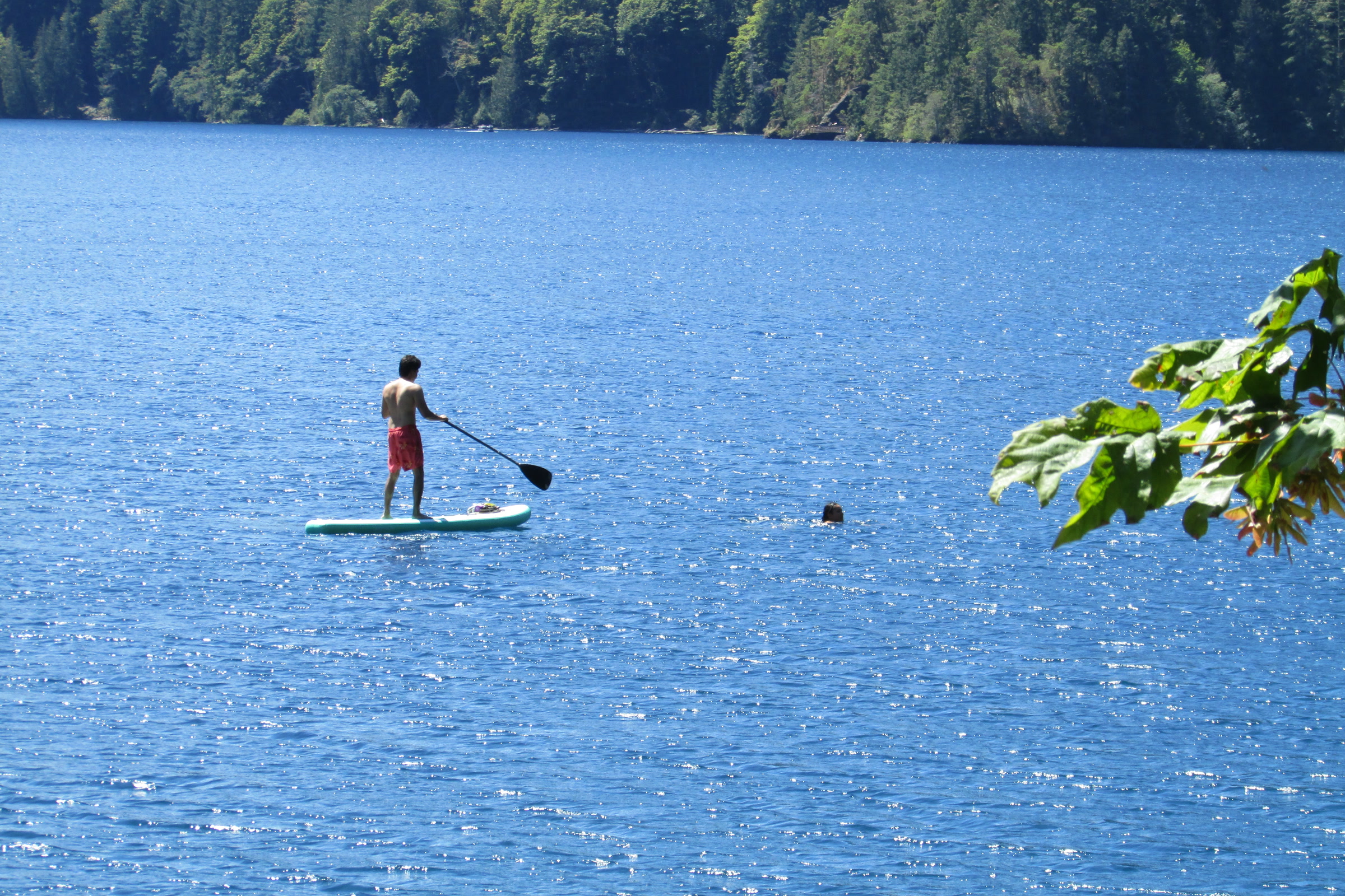
    A paddleboarder seen from behind, standing on a board on sparkling blue Lake Crescent near the north shore
    Paddleboarding near East Beach Road on Lake Crescent. Photo: Chris Light / Wikimedia Commons (CC BY-SA 4.0)

    Lake Ozette paddling

    Near the coast and filled with water lilies in summer, Lake Ozette is the third largest lake in Washington, according to the park. Its “Lake Ozette by Water” page lists launch sites at the Ozette Ranger Station and Swan Bay, rates the paddling easy to difficult depending on wind, and names July through October as the best season, with the least wind and the warmest water.
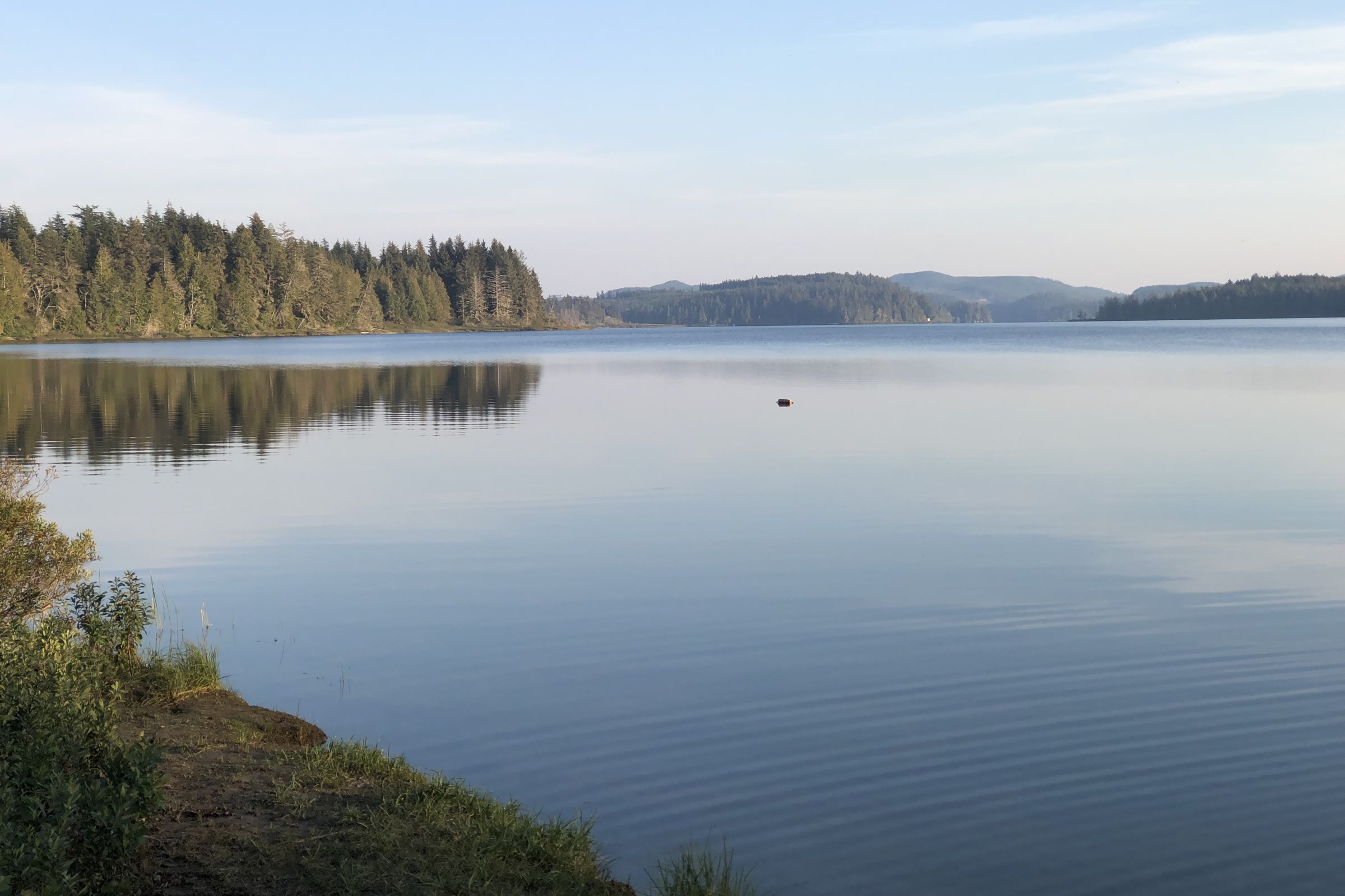
    Glassy Lake Ozette at dusk, seen from the campground shore, with low forested hills and a pale sky reflected in the water
    Lake Ozette from the campground on a still October evening. Photo: The Greater Southwestern Exploration Company / Wikimedia Commons (CC BY 2.0)

    Don’t let a calm morning fool you. The park warns that high winds and waves of 1 to 2 feet are common, that the lake can turn very windy quickly, and that there have been a number of cold water drownings here. Wear your life jacket at all times. Our Ozette Triangle and Cape Alava guide covers the coastal trails that start nearby.

    Camping by boat at Ozette

    Ericson’s Bay camp, about 4 miles by water, is the main boat in destination, with a few small sites along the shore and on islands. You need a wilderness permit, all food and scented items must go in a bear canister, and groups are limited to 12. Pets are not allowed at boat in lake camps. Our guide to Olympic National Park wilderness permits explains how to book.

    Lake Quinault

    Set in a rain forest valley, Lake Quinault has mountain views and old growth forest on its shores. The park lists two launches at the U.S. Forest Service’s Falls Creek and Willaby campgrounds, boat rentals at Lake Quinault Lodge, and warns that afternoon winds are common.
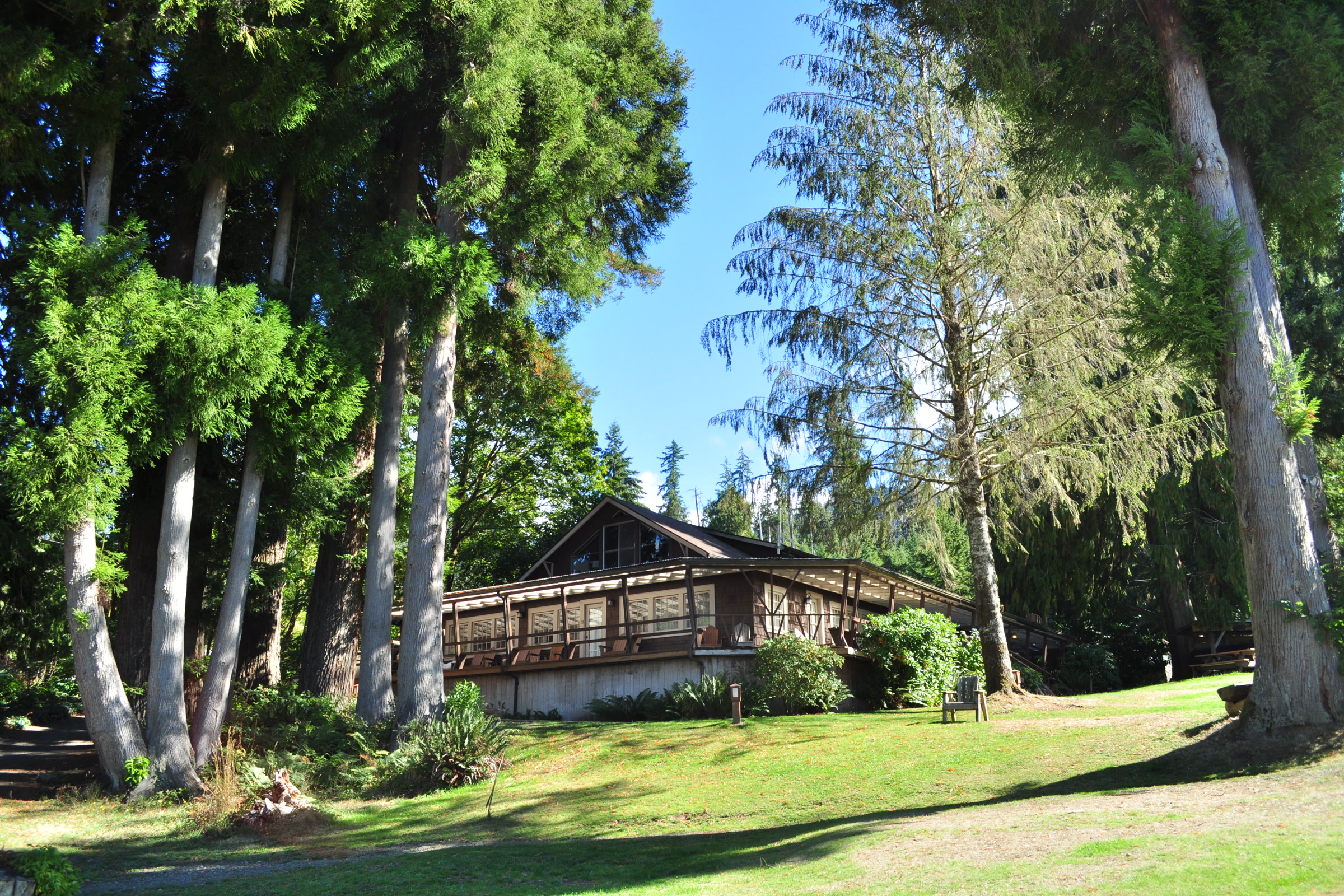
    A timbered boathouse building on a sunny lawn beneath tall conifers and maples at Lake Quinault Lodge
    The boathouse at Lake Quinault Lodge. Photo: Joe Mabel / Wikimedia Commons (CC BY-SA 4.0)

    The lake itself is not park water. The U.S. Forest Service says Lake Quinault is owned and managed by the Quinault Indian Nation, and that a permit from the Nation is required to access the lake. Please check the Nation’s current rules before you put a boat in, and respect its authority on the water.

    Rivers and the former Lake Mills

    The park also lists river runs on the Elwha, Hoh, Queets, Quinault and Sol Duc, rated from Class II to Class V. It says to check river flows, scout for log jams, and stop at a ranger station to ask about closures. Lake Mills is gone: after the Glines Canyon Dam was removed, the reservoir drained back to river. Because of the Elwha River Restoration, the park says boating is closed from the Smokey Hill Trail (formerly the Upper Lake Mills Trail) downstream to the former Altair Campground.
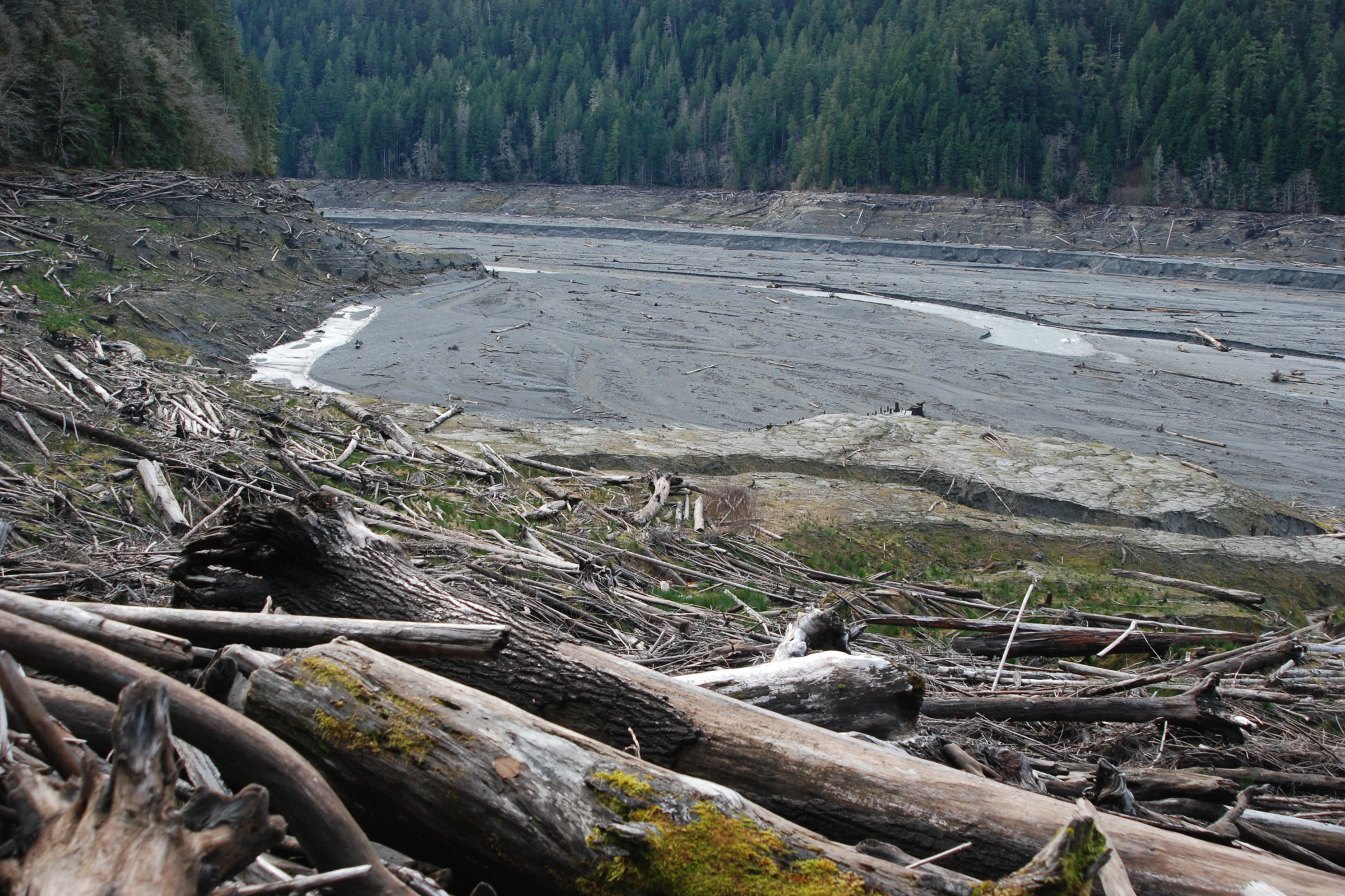
    Driftwood logs piled on the bank above the drained Lake Mills basin, a wide grey plain of sediment with the Elwha River and forested slopes beyond
    The drained Lake Mills basin in January 2013, after the Glines Canyon Dam came out. NPS Photo / J. Burger

    The park also urges boaters to stay away from the former Elwha Dam site outside the park, where rebar and metal from the old foundation sit close to the surface. As of October 2026, the Elwha road is closed to vehicles beyond Madison Falls, so check road status first. Our story of Elwha River dam removal explains what happened.

    Rules and safety, as of October 2026

    • Life jackets. A personal flotation device and proper safety equipment are required by law.
    • Cold water. The park says water temperatures are consistently below 50 degrees and hypothermia is a risk, and recommends wet suits or dry suits for kayaking and canoeing.
    • Clean, drain, dry. Use the free cleaning stations at Fairholme, Storm King and Log Cabin Resort before and after you paddle, to keep invasive species such as zebra mussels out.
    • Motor rules. Personal watercraft are banned, and Washington requires motorized boat operators to hold a boating education card.

    Bringing a boat from out of state? The Washington Department of Fish and Wildlife requires an aquatic invasive species prevention permit for watercraft not registered in Washington, but exempts small craft that need no registration, such as canoes and kayaks. Rules change, so check the NPS boating page before you go.

    How Friends of Olympic National Park helps

    We are Friends of Olympic National Park (FONP), a volunteer led friends group in Port Angeles. Clean water and healthy shores matter to us, and our volunteers pull invasive plants on the Olympic Peninsula and join cleanups each year. If you love paddling these lakes, see our volunteer opportunities.

    Frequently asked questions

    Can you rent kayaks at Lake Crescent?

    Yes. As of October 2026 the park lists kayak and canoe rentals at the concession operated Log Cabin Resort and Lake Crescent Lodge. Check with the lodges for seasons and prices.

    Can you paddleboard on Lake Crescent?

    Yes. The park welcomes paddleboards at its free cleaning stations, and the park’s page for the Log Cabin Resort rental invites visitors to explore the lake by boat, kayak or paddleboard. Wear a life jacket and paddle early, before the afternoon wind.

    How cold is the water in Olympic National Park lakes?

    The park says water temperatures are consistently below 50 degrees and hypothermia is a risk, so it recommends wet suits or dry suits for kayaking and canoeing.

    Can you camp by kayak on Lake Ozette?

    Yes, with a wilderness permit. Ericson’s Bay camp, about 4 miles by water, is the main destination, and food must be stored in a bear canister.

    Are Jet Skis allowed in Olympic National Park?

    No. Personal watercraft such as Jet Skis are not allowed anywhere in the park.
  • Why the Olympics Are So Wet: The Rain Shadow Explained

    Why the Olympics Are So Wet: The Rain Shadow Explained

    Drive from the Hoh Rain Forest to Sequim and you leave some of the wettest spots in the continental United States for a town that gets about 16 inches of rain a year. The west side of the Olympic Peninsula is drenched, while the northeast corner sits in a rain shadow so dry that farmers irrigate their fields. The cause is the Olympic Mountains themselves, standing in the path of storms off the Pacific.

    Quick answer

    What is the Olympic rain shadow?

    The Olympic rain shadow is the dry area northeast of the Olympic Mountains. Pacific storms are forced up the western slopes and drop most of their moisture there, so the Hoh Rain Forest averages about 135 inches of rain a year. By the time the air crosses the range, little is left: Sequim averages about 16 inches.

    • Coast and west valleys: 100 to 170 inches a year
    • Park headquarters in Port Angeles: 25 to 30 inches
    • Sequim: roughly 16 inches a year
    • Most precipitation falls from November to April

    How a rain shadow forms

    The park’s weather brochure explains that the ocean is the source of most of the peninsula’s weather. Storm clouds full of moisture move inland, run into the foothills, and are forced upward. As the air rises it cools and the pressure drops, so it can hold less water. The surplus falls as rain in the lowlands and as snow in the high country.

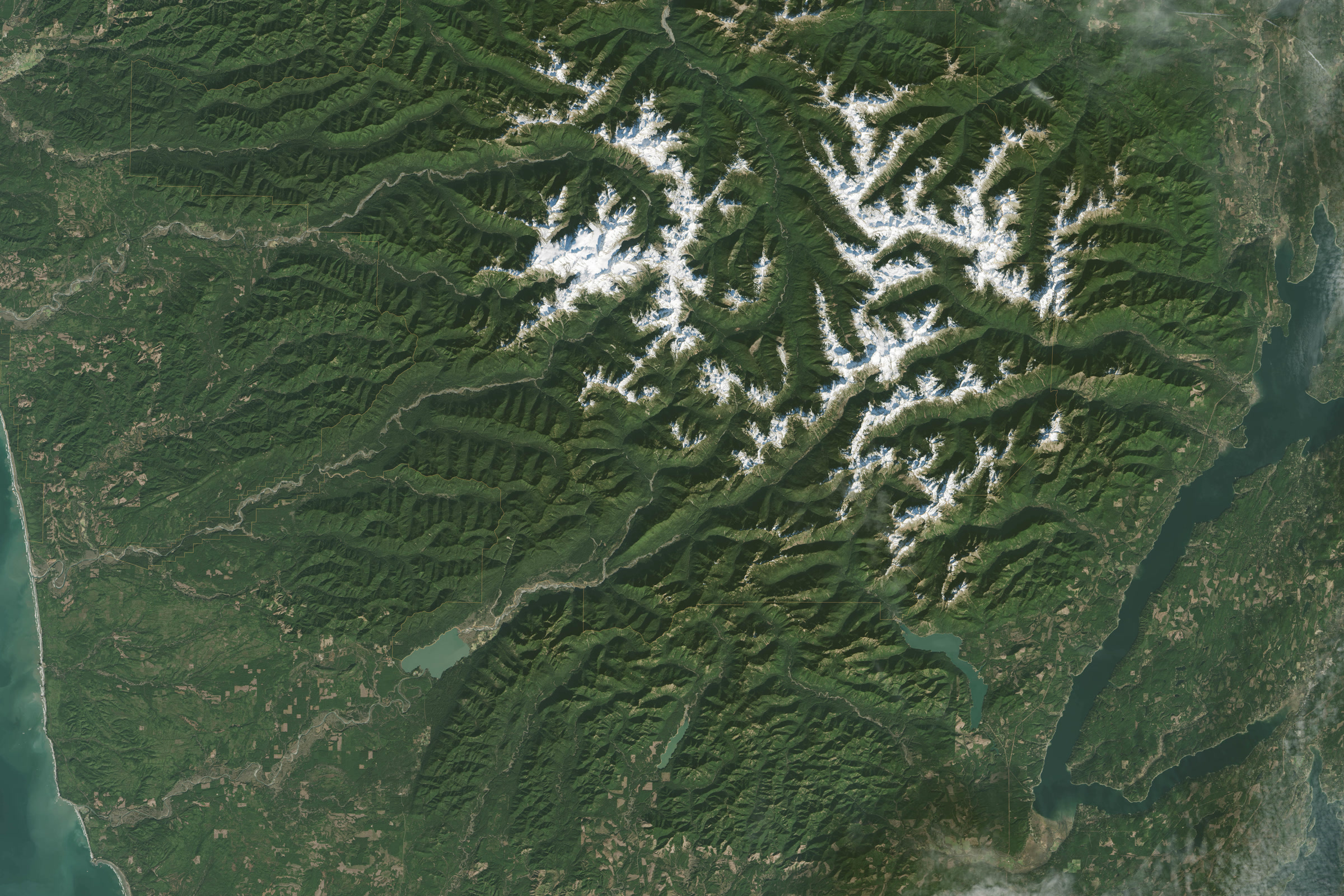
    Satellite view of the Olympic Mountains, with snowy peaks in the centre surrounded by green forested ridges and river valleys
    The Olympic Mountains from space, the barrier every Pacific storm must cross. Photo: NASA / Landsat 8

    The storms keep moving east, losing more moisture as they go. Once the air passes the crest it sinks down the far side. Sinking air warms, and because it has already lost much of its water, its humidity falls. Clouds thin out and rain becomes scarce, leaving a dry “shadow” downwind of the peaks.

    Up high, the moisture comes down as snow. Mount Olympus, the highest point on the peninsula at 7,980 feet, is estimated to get more than 50 feet of snow a year. Our post on how the Olympic Mountains formed tells the story of the range itself.

    The wet side: coast and rain forest valleys

    The park’s weather page gives 100 to 170 inches of rain a year along the coast and in the west facing valleys. The brochure calls the west side valleys the wettest spots in the continental United States, and says the Hoh Rain Forest records an average of almost 12 feet of rain a year. Heavy fog can add more than 30 inches of moisture to the forest on top of that.

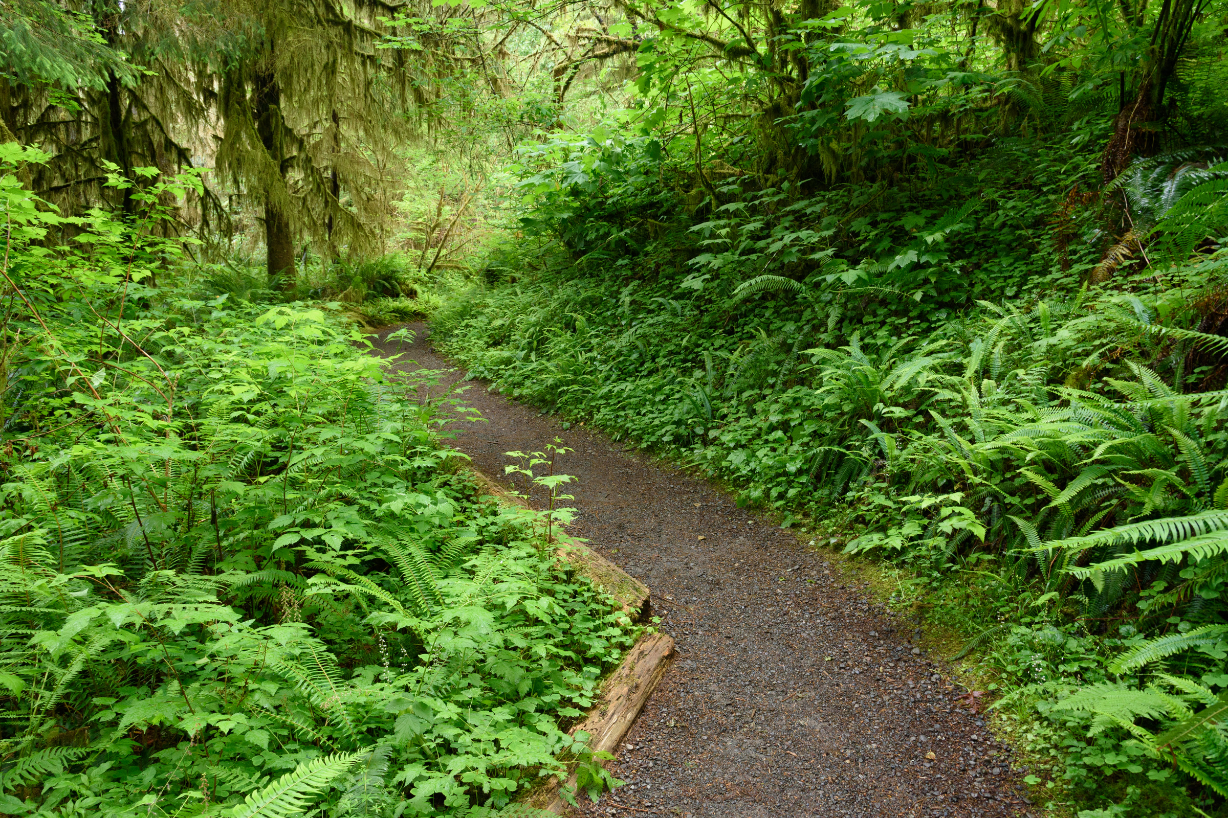
    A gravel trail winding through dense green ferns, shrubs and moss covered trees in the Quinault Rain Forest
    Lush growth along a trail in the Quinault Rain Forest in June. Photo: King of Hearts / Wikimedia Commons (CC BY-SA 4.0)

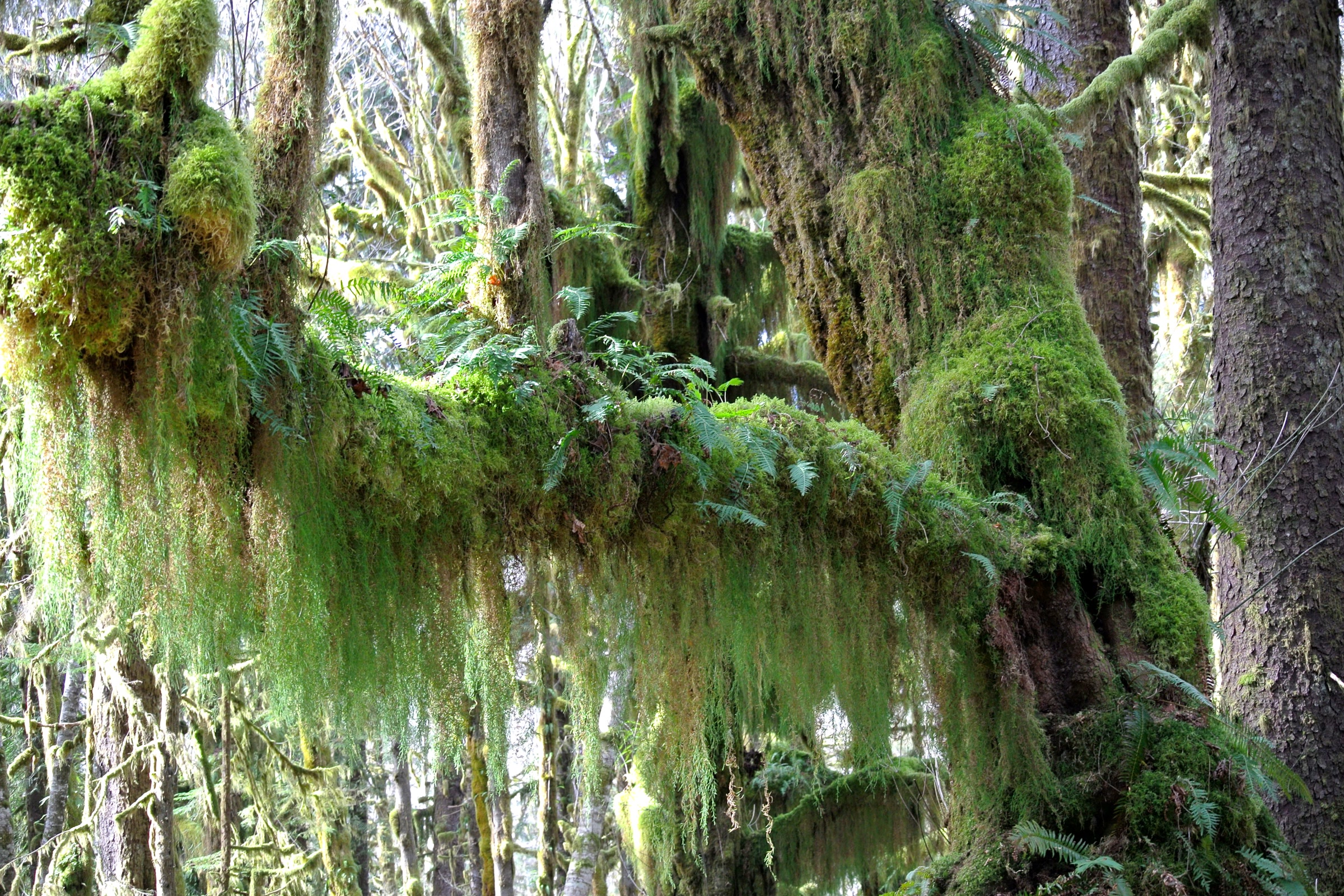
    All that water is why the Hoh and Quinault valleys grow temperate rain forests, with moss hanging from the maples and spruce. Our guide to the temperate rainforests of Olympic National Park covers the trees and plants, and mosses and lichens of the Olympic rainforest looks at the smallest growth that thrives on the damp.

    The dry side: Port Angeles, Sequim and the northeast

    The drop off to the east is steep. Olympic National Park Headquarters in Port Angeles averages only 25 to 30 inches a year, according to the park. Farther east, the brochure says, the northeastern peninsula lies in a dry rain shadow and the town of Sequim gets roughly 16 inches of rain a year.

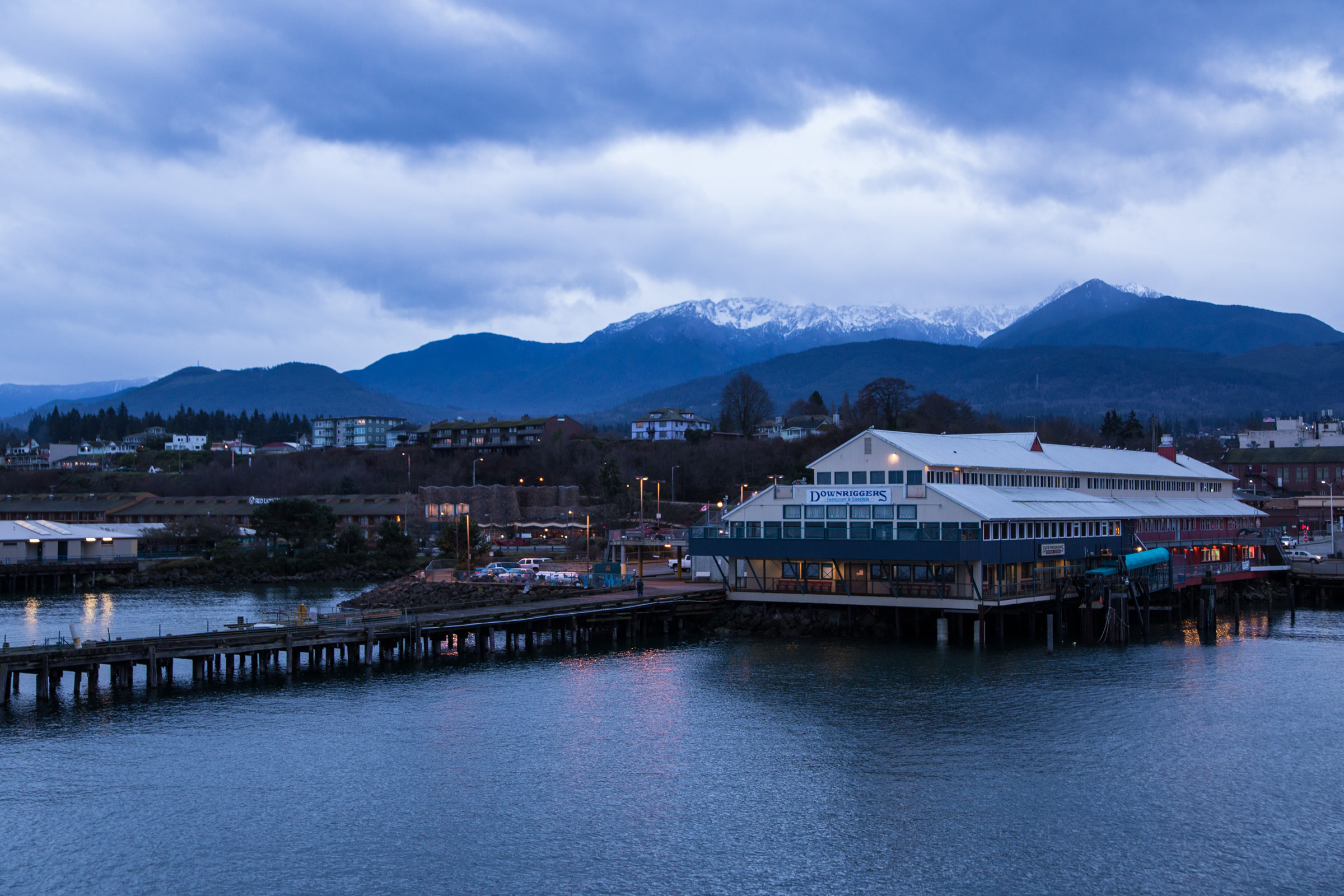
    Port Angeles waterfront and pier buildings at dusk in January, with snow covered Olympic Mountains under grey clouds behind the town
    Port Angeles in January, seen from the ferry, with snow on the Olympics behind. Photo: Jonathan Miske / Wikimedia Commons (CC BY-SA 2.0)

    That gap is remarkable on the ground. The park notes that Sequim farmers irrigate their fields and that a few prickly pear cacti grow there, less than 35 miles from lush rain forest. Inside the park, the change shapes the forests too: the western valleys are dominated by temperate rain forest, while the eastern slopes hold drier lowland forests.

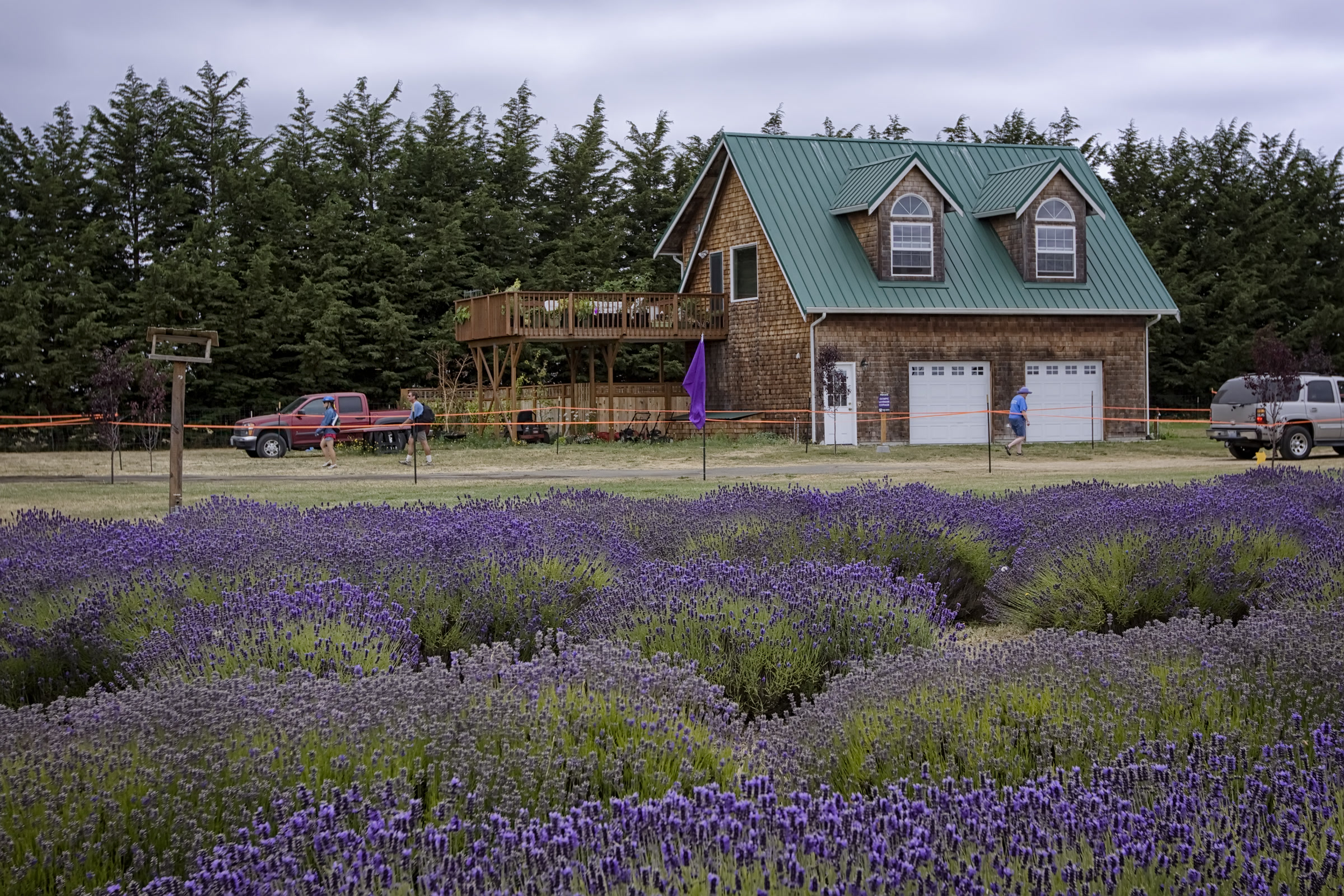
    Rows of purple lavender in bloom in front of a wooden farmhouse with a green roof at Olympic Lavender Farm near Sequim
    Lavender in July at a farm near Sequim, in the rain shadow. Photo: Steven Pavlov / Wikimedia Commons (CC BY-SA 4.0)

    Olympic Peninsula rainfall compared

    Here are the yearly averages the park publishes for four places, plus one from the state climate office. Different weather stations and record periods give different numbers, so treat these as a guide to the contrast rather than exact totals.

    Average yearly precipitation, west to northeast

    PlaceSettingInches a yearSource
    QuinaultWindward side of the Olympics151.45Washington State Climate Office
    HohRain forest valley135.0NPS
    KalalochPacific coast103.00NPS
    Port AngelesNorth shore25.9NPS
    SequimNortheast rain shadow15.80NPS

    The Washington State Climate Office notes that while the Cascades cause the state’s most distinct rain shadow, the Olympics produce one too. Its own figure for Sequim is 23.98 inches, higher than the park’s, which shows how much the station matters. Either way, Sequim gets a small fraction of what falls on the Quinault.

    When the rain falls

    The park says most precipitation falls between November and April. Summers are drier everywhere, but the west side is still wetter than the rain shadow in every season, as the brochure’s average monthly rainfall shows.

    Average monthly rainfall by season, Hoh vs Sequim

    SeasonHoh (inches a month)Sequim (inches a month)
    Winter18.331.61
    Spring10.330.94
    Summer3.330.79
    Autumn13.001.91

    Much of the winter moisture lands as snow up high. The park says Hurricane Ridge traditionally records 30 to 35 feet of snow a year, which is why our Hurricane Ridge in winter guide matters for anyone heading up the road from Port Angeles.

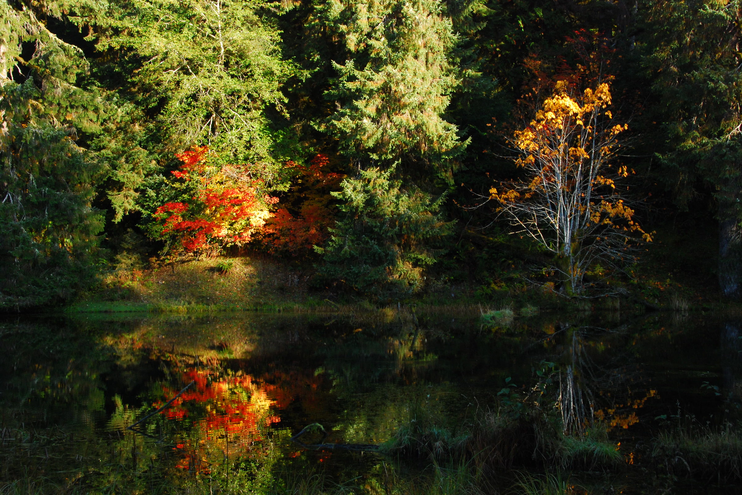
    A still pond in the Hoh Rain Forest reflecting dark conifers and bright orange and yellow autumn leaves
    A Hoh pond in late October, as the wet season begins. NPS Photo

    What the rain shadow means for your visit

    • Pack for both sides. A sunny morning in Port Angeles can turn into a soaking afternoon at the Hoh. Our list of what to pack for Olympic National Park covers rain gear and layers.
    • Know the gap. Over a year the northeast gets a small fraction of the coast’s rain, as the figures above show, so weather in Sequim tells you little about the Hoh.
    • Expect rain any time. The park warns that rain is always possible and that hikers should be ready for thunderstorms, especially at higher elevations.
    • Plan by season. Our best time to visit Olympic National Park guide walks through what each season brings.
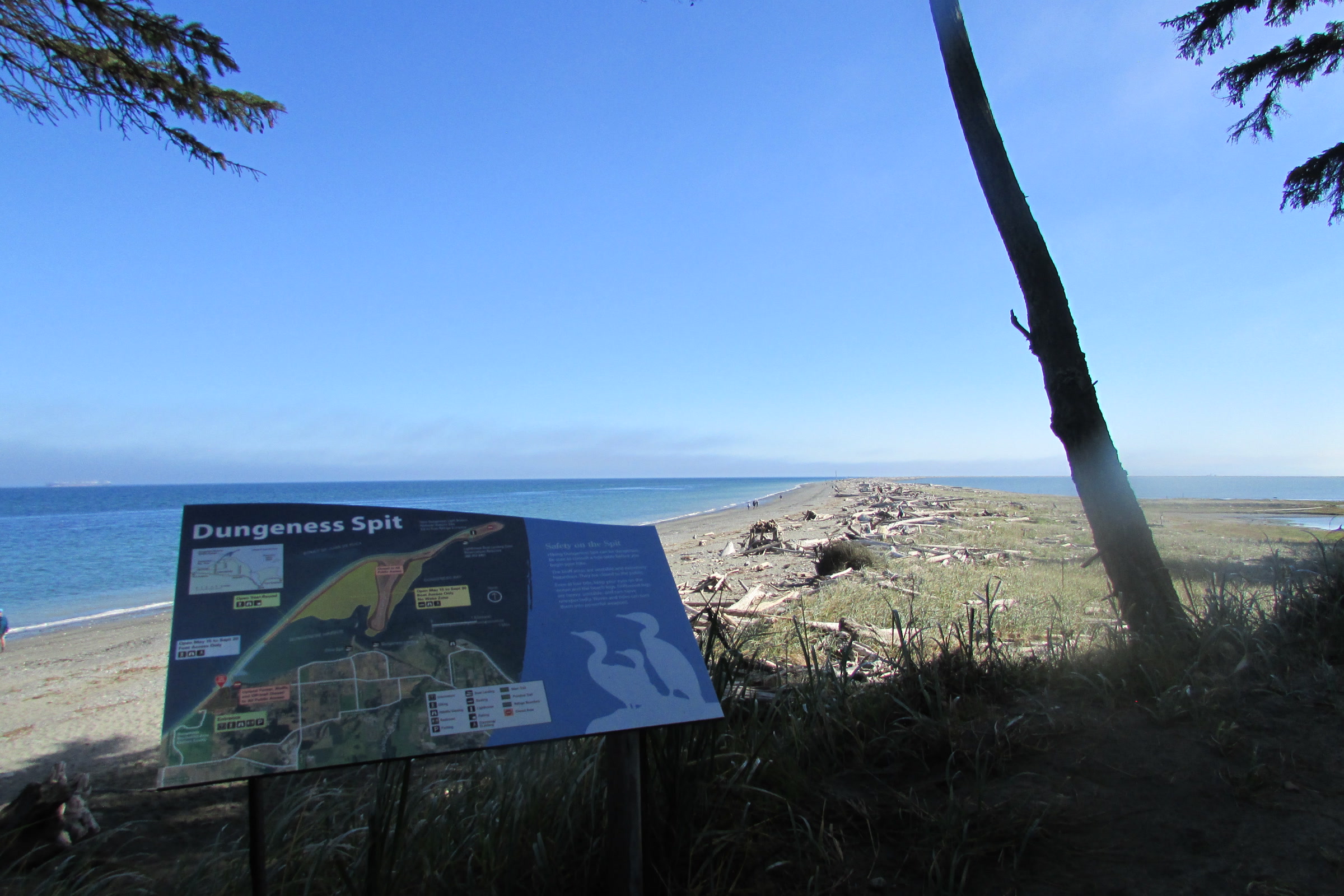
    Dungeness Spit curving out into calm blue water under a clear sky, seen from a forested bluff with an interpretive sign
    Dungeness Spit near Sequim on a clear August morning. This is outside the park. Photo: Chris Light / Wikimedia Commons (CC BY-SA 4.0)

    How Friends of Olympic National Park helps

    We are Friends of Olympic National Park (FONP), a volunteer led friends group based in Port Angeles, right on the edge of the rain shadow. Our volunteers adopt a trail, join cleanups and host the Winter Perspectives lecture series. If the park’s wild weather and the forests it feeds matter to you, please become a member.

    Frequently asked questions

    Why is Sequim so dry?

    Sequim sits in the rain shadow of the Olympic Mountains. Pacific storms drop most of their moisture on the western slopes, so the park says Sequim gets roughly 16 inches of rain a year.

    How much rain does the Hoh Rain Forest get?

    The park says the Hoh Rain Forest records an average of almost 12 feet of rain a year. Its weather brochure lists 135.0 inches as the yearly average.

    How much rain does Port Angeles get?

    The park says its headquarters in Port Angeles averages only 25 to 30 inches a year, far less than the coast. Sequim, farther east, is drier still.

    When is the rainy season on the Olympic Peninsula?

    The park says most precipitation falls between November and April. Summer is drier, but rain is always possible.

    Does the rain shadow affect the park itself?

    Yes. The park says the western valleys are dominated by temperate rain forests, while the drier eastern slopes hold lowland forests instead.

  • Mosses and Lichens of the Olympic Rain Forest

    Mosses and Lichens of the Olympic Rain Forest

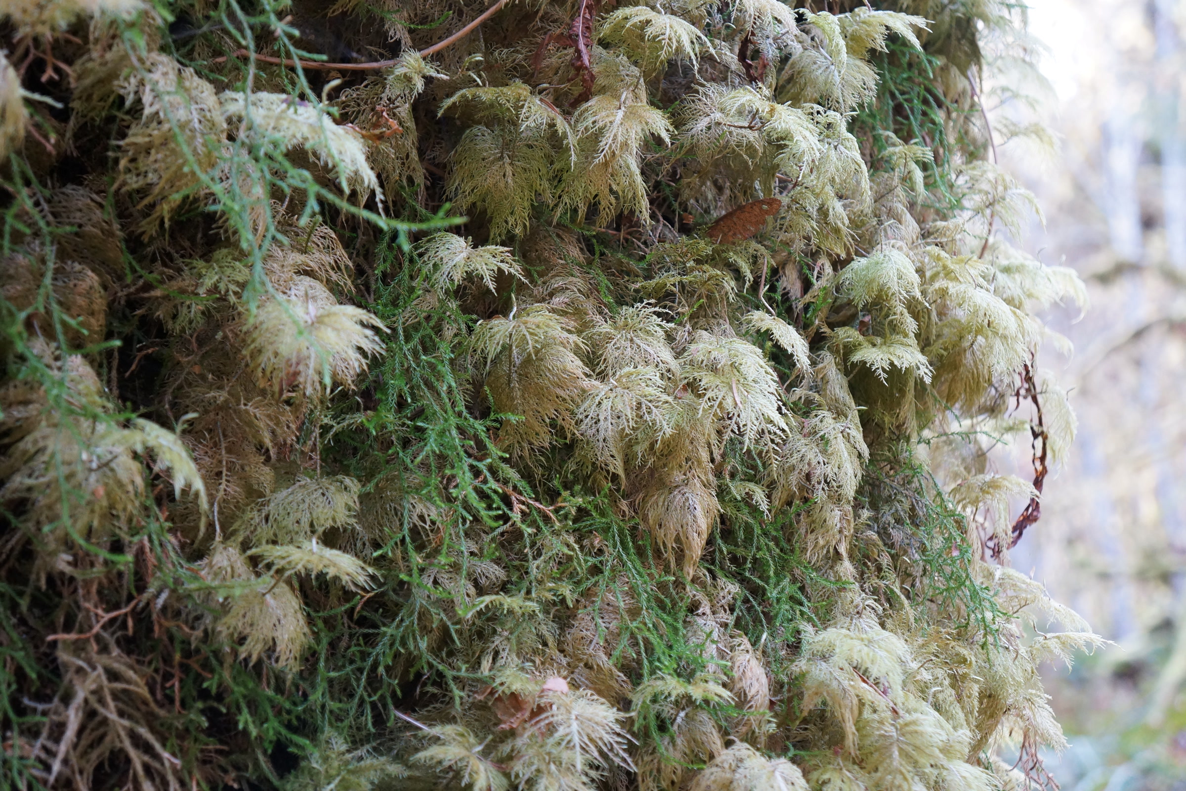
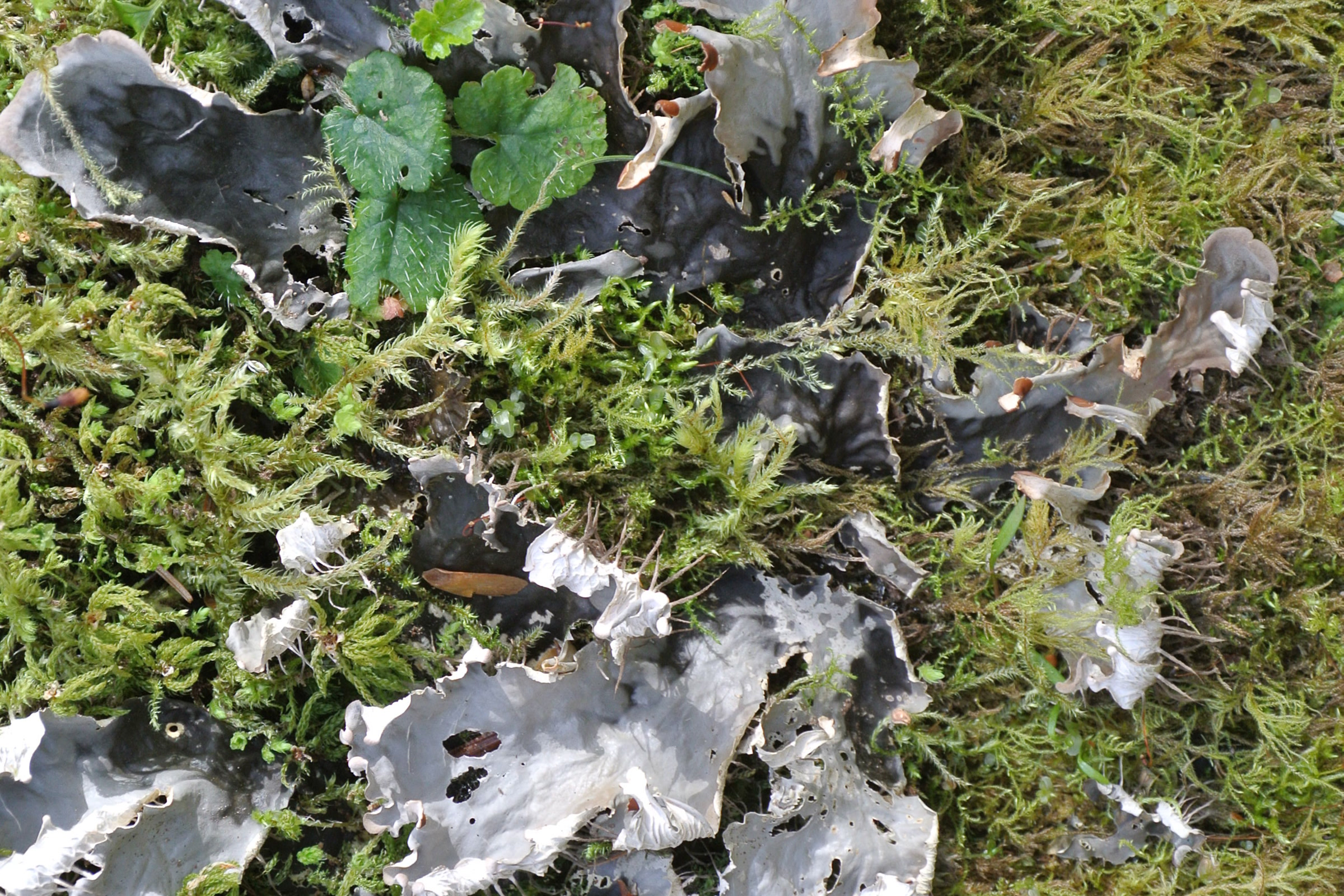
    Mosses and lichens are what make the Olympic rain forest look the way it does: green curtains on the maples, pale beards swinging from the branches, and soft carpets over every fallen log. Our guide to the temperate rainforests of Olympic National Park covers the valleys and the big trees. This one looks closely at the small things that cover them.

    Quick answer

    What mosses and lichens grow in the Olympic rain forest?

    The Olympic rain forest holds hundreds of species of mosses and lichens, the park says. Common ones include stair-step moss, cat-tail moss, Oregon beaked moss, spike mosses and club mosses, plus lichens such as lungwort, old man’s beard and witch’s hair. Many grow as epiphytes on trees. Look, photograph, and leave them in place.

    • Rain forest precipitation: 140 to 167 inches a year
    • Mosses have no true roots, stems or leaves
    • Hanging “moss” on branches is usually a lichen
    • Removing plants or their parts from a national park is prohibited

    Why the rain forest is so mossy

    Water is the answer. The park says precipitation in its rain forest ranges from 140 to 167 inches a year, and fog adds more moisture that mosses absorb directly.

    That matters because mosses are non-vascular. As the NPS page on Olympic’s mosses explains, they have no true leaves, stems or roots and no waxy outer coating, so they depend on constant moisture. In a place this wet, they can grow almost anywhere.

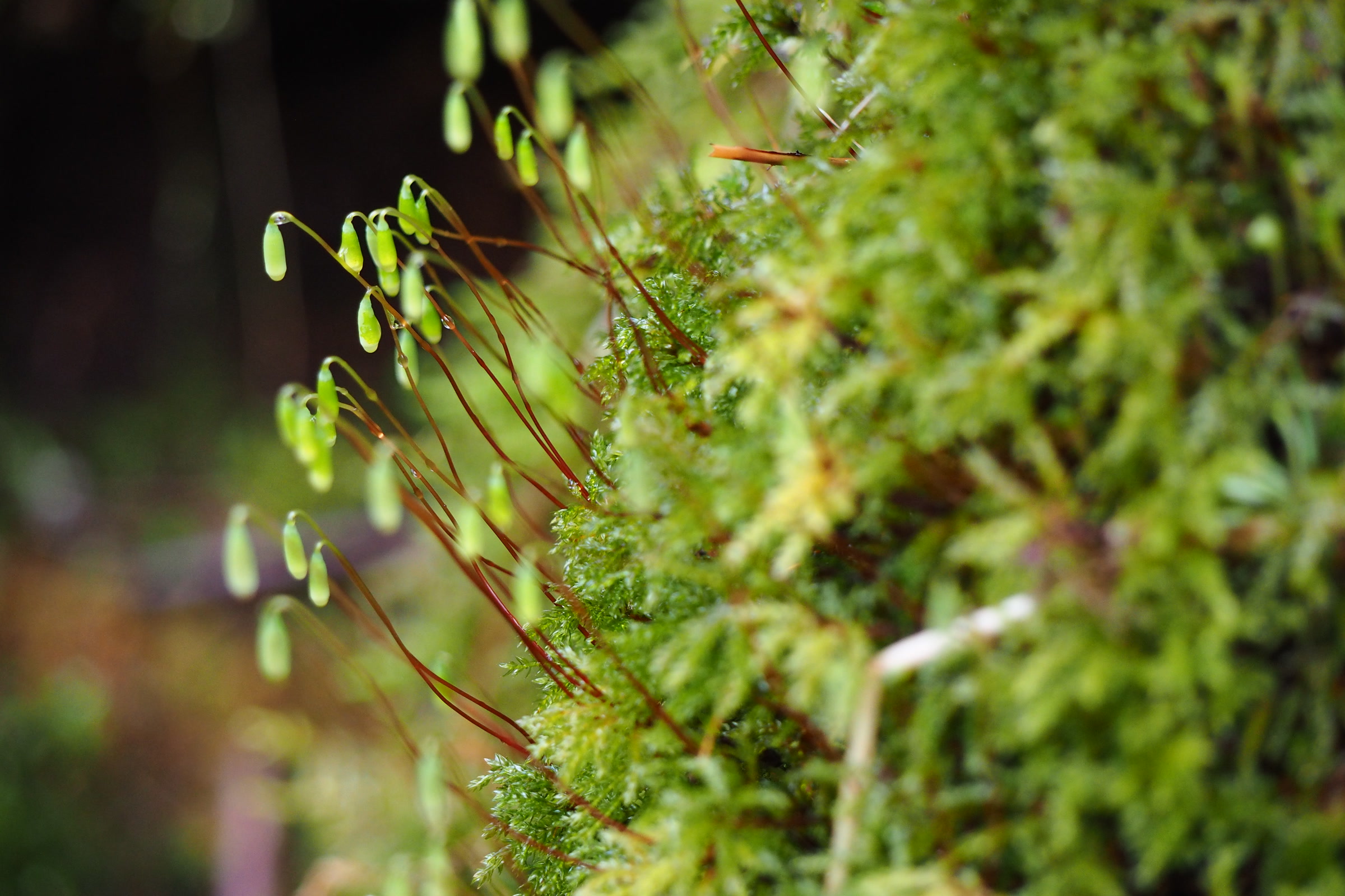
    A cushion of bright green moss in the Hoh Rain Forest with slender reddish stalks rising from it, each tipped with a small green capsule
    Moss up close in the Hoh Rain Forest. NPS Photo

    Mosses, lichens and epiphytes: what’s the difference?

    People use “moss” for almost anything green and fuzzy, but the park separates a few groups. Epiphytes are simply plants that grow on other plants, and in the rain forest that includes mosses, ferns and spike mosses on the trunks and branches of bigleaf maples.

    Mosses and lichens compared

    GroupWhat it isExamples at Olympic
    MossesNon-vascular; no true roots, stems or leavesStair-step moss, cat-tail moss, Oregon beaked moss
    Spike mosses and club mossesNamed by the park among its moss varietiesOregon selaginella on bigleaf maples
    LichensA partnership of a fungus with green algae or cyanobacteriaLungwort, old man’s beard, witch’s hair
    LiverwortsNamed by the park alongside mosses and lichensAmong the hundreds of species in the rain forest

    Rain forest mosses to look for

    Stair-step moss

    The park names stair-step moss among the mosses that together form a small but varied forest of their own. Look closely at a mossy log or stump and you may see its feathery fronds stacked in tiers.

    Close view of feathery, pale green fronds of stair-step moss growing in layered tiers in the Hoh Rain Forest
    Stair-step moss in the Hoh Rain Forest. NPS Photo / C. Bubar

    Cat-tail moss

    Cat-tail moss, Isothecium stoloniferum, is on the park’s list of common rain forest epiphytes. Like the other epiphytes on that list, it grows on trees rather than on the forest floor.

    Oregon beaked moss

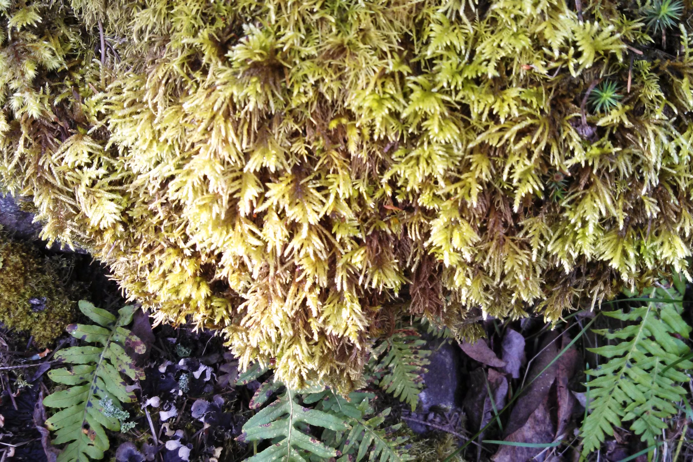
    The University of British Columbia’s coastal plants guide calls Oregon beaked moss (Kindbergia oregana) a common moss of lowland coastal rainforests. It often forms loose mats on logs, tree bases, rocks and humus. Its shoots branch regularly, like a flat feather, and its stem leaves are heart shaped and sharply pointed.

    A loose yellow green mat of Oregon beaked moss with neatly branched, feather shaped shoots spilling over a log above sword fern fronds in Shoreline, Washington
    Oregon beaked moss, photographed in Shoreline, Washington, not in the park. Photo: brewbooks / Wikimedia Commons (CC BY-SA 2.0)
    Spike mosses and club mosses

    The park lists spike mosses and club mosses among its moss varieties. Oregon selaginella, Selaginella oregana, is one of the common epiphytes, growing on bigleaf maple trunks and limbs along with ferns such as licorice fern.

    Lichens of the Olympic Peninsula rain forest

    A lichen is not a plant at all. The park describes it as a partnership between a fungus and green algae or cyanobacteria, and says the lichens hanging from high limbs are important to the forest.

    Old man’s beard and witch’s hair

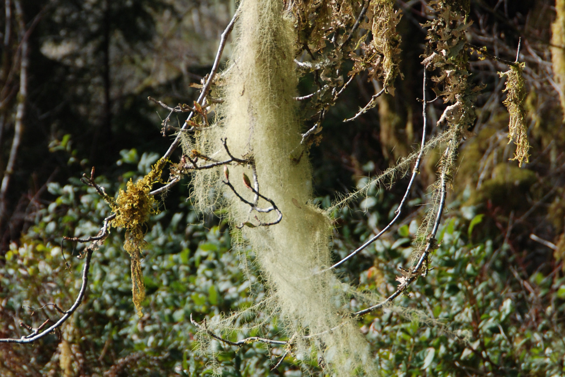
    Much of the pale, stringy “moss” swaying from branches is really lichen. The park names old man’s beard and witch’s hair as two that hang from the limbs here.

    A long pale green strand of hanging beard lichen draped over bare twigs above the understory in the Quinault Rain Forest
    A strand of hanging beard lichen in the Quinault Rain Forest. NPS Photo / C. Bubar

    Lungwort, or Lobaria

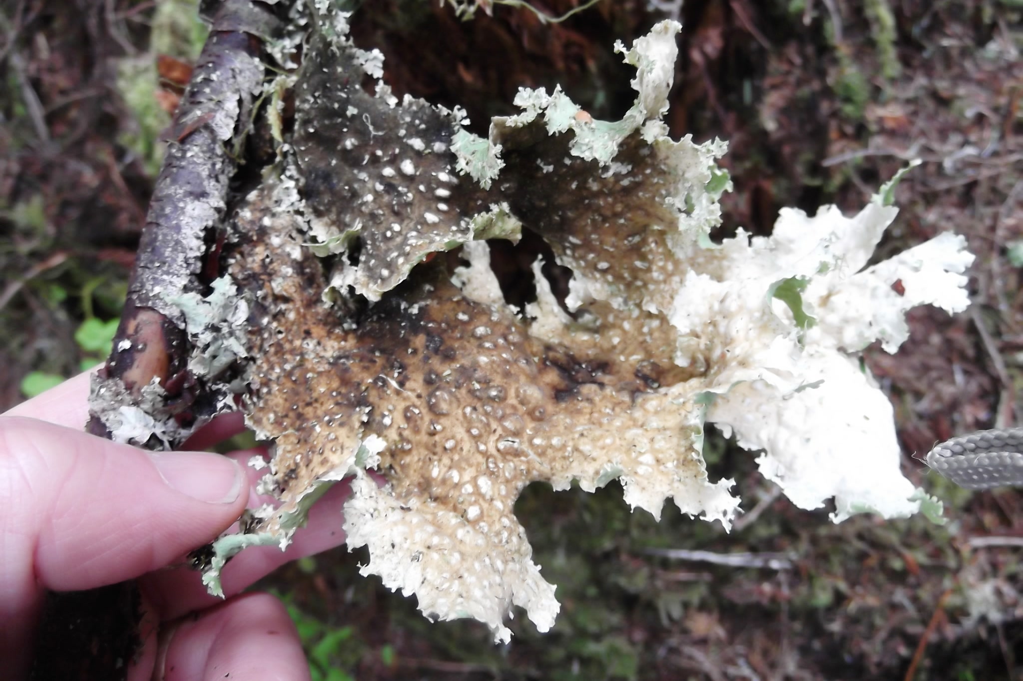
    Lungwort, a leafy lichen in the genus Lobaria, is on the park’s list of common epiphytes. A 1976 Forest Service study of western Washington forests found that Lobaria oregana was the main nitrogen fixer in old-growth conifer forests. In other words, it pulls nitrogen from the air that the whole forest can use.

    The same study called it a late successional species, missing from forests cut on short cycles. It also found the lichen fixed less nitrogen after exposure to acid, and the National Park Service notes that lichens are sensitive to air quality.

    A hand holding a fallen twig with a ruffled, pale green and brown lobe of Oregon lungwort lichen, Lobaria oregana, at Mount Rainier National Park
    Lobaria oregana found on a fallen twig at Mount Rainier National Park, not Olympic. Photo: brewbooks / Wikimedia Commons (CC BY-SA 2.0)

    Moss, nurse logs and new trees

    Moss is often the first thing to colonize a fallen log. The park explains that these logs then become nurseries for seeds, saplings and ferns, and that ferns and tree seedlings can even sprout on mossy branches high above the ground.

    The trees themselves are their own story, told in our guide to the trees of Olympic National Park. The fungi that share these logs are in our mushroom season guide.

    Grey leafy lichen lobes lying among green moss and small leaves on the forest floor of the Hoh Rain Forest
    Leafy lichens and moss on the Hoh Rain Forest floor. NPS Photo / C. Bubar

    Leave the moss where it grows

    Federal park rules prohibit possessing, damaging or removing plants or their parts from a national park, and moss is no exception. A 2005 U.S. Geological Survey inventory of the park’s mosses, liverworts and lichens was meant partly to help protect rare species and assess damage from illegal harvest.

    • Stay on the trail so you don’t crush moss and lichens underfoot.
    • Don’t peel moss off logs or pull lichens from branches, even for a photo.
    • Leave fallen pieces on the ground; they are part of the forest floor.
    • Take a hand lens and a camera instead of a bag.

    The Hall of Mosses, an easy loop with about 100 feet of climb, is the classic place to see all of this. Our Hoh River Trail guide covers the longer walk up the same valley.

    How Friends of Olympic National Park helps

    We are Friends of Olympic National Park (FONP), a volunteer led friends group in Port Angeles. Our guided nature walks, including insect, mushroom and wildflower walks, help people slow down and notice small living things like these. Our adopt-a-trail crew cares for the Heart O’ the Forest Trail. If you love the rain forest, become a member and help us keep going.

    Frequently asked questions

    Is the hanging moss in the Hoh Rain Forest really moss?

    Often not. The park explains that much of the stringy growth hanging from branches is lichen, a partnership between a fungus and algae or cyanobacteria. Old man’s beard and witch’s hair are two examples.

    Why is there so much moss in the Olympic rain forest?

    The rain forest gets 140 to 167 inches of precipitation a year, plus fog. Mosses have no true roots and no waxy coating, so they absorb water directly and thrive where it stays wet.

    What are epiphytes?

    Epiphytes are plants that grow on other plants. In the Olympic rain forest, mosses, licorice fern, spike mosses and lichens such as lungwort grow on the trunks and limbs of trees like bigleaf maple.

    Can you take moss from Olympic National Park?

    No. Federal park rules prohibit possessing, damaging or removing plants or their parts from a national park. Leave moss and lichens where they are, including pieces that have fallen.

    Where is the best place to see moss in Olympic National Park?

    The Hall of Mosses loop in the Hoh Rain Forest is a well known spot. The Quinault valley also has bigleaf maples hung with thick curtains of moss.

  • Olympic Coast Marine Mammals: Whales, Seals and Otters

    Olympic Coast Marine Mammals: Whales, Seals and Otters

    Olympic Coast marine mammals are some of the best reasons to linger on a headland with binoculars. Gray whales pass on their way north, sea otters float in the kelp, and harbor seals and sea lions rest on the rocks. This guide covers who lives here, when to look, and how to watch without disturbing them.

    Quick answer

    What marine mammals live on the Olympic Coast?

    The Olympic Coast is home to or visited by 29 marine mammal species, NOAA says. Among them are gray whales, humpbacks, orcas, harbor seals, Steller and California sea lions, and sea otters. Watch from shore with binoculars and stay at least 100 yards from seals and sea lions.

    • 29 marine mammal species in the national marine sanctuary
    • Gray whales migrate north past the park from March into May
    • Sea otters were reintroduced to Washington in 1969 and 1970
    • Seal pup alone on the beach? Leave it and stay back

    Olympic Coast marine mammals: who lives here

    Offshore of the park’s wilderness beaches lies Olympic Coast National Marine Sanctuary, managed by NOAA. The sanctuary says 29 species of marine mammals live in or migrate through its waters. Closer in, the park notes that the Quillayute Needles National Wildlife Refuge, about 800 rocks, reefs and islands, gives seals and sea lions places to haul out in protected water.

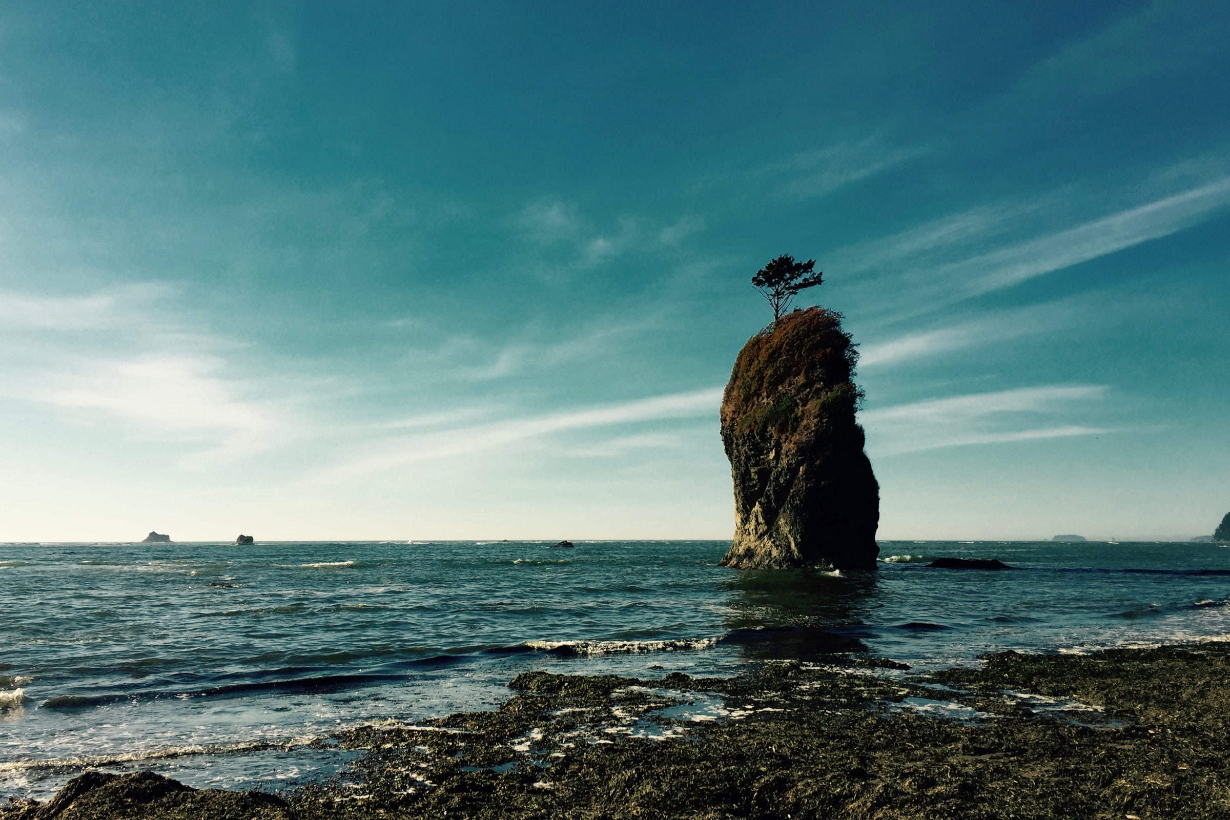
    A tall sea stack topped with a single tree standing in the surf off a rocky, seaweed covered shore on the Olympic Coast under a streaky blue sky
    Sea stacks and offshore rocks give seals and sea lions places to rest. Photo: NOAA Office of National Marine Sanctuaries

    Whales on the Olympic Coast

    NOAA names the North Pacific gray whale and the humpback as the most common baleen whales here. The most common toothed whales are the harbor porpoise and the killer whale, or orca.

    Gray whales

    The park says gray whales migrate north past the coast from March into May, heading for summer feeding grounds in the Bering Sea. Look for their spouts or their mottled, barnacle covered backs. Some stay to feed in late spring and summer, including at the mouths of the Hoh and Quillayute rivers, where they scoop up bottom sediment and filter out small crustaceans.

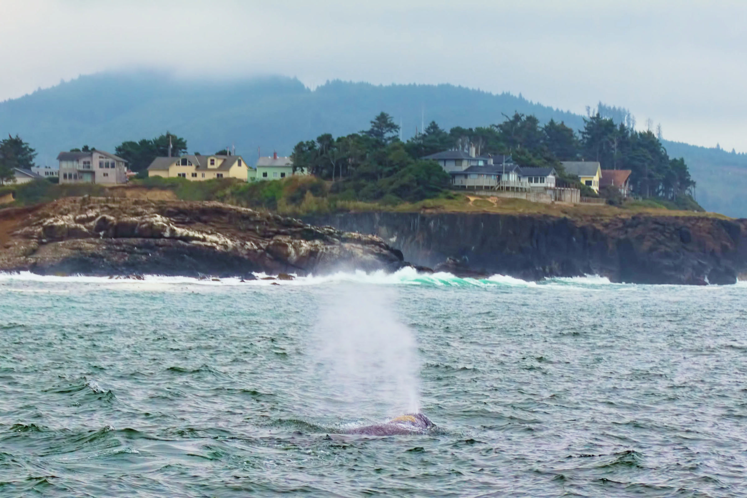
    A gray whale blowing a tall misty spout as its mottled back breaks the surface near a rocky headland with houses, off Yachats, Oregon
    A gray whale spout, the sign to watch for. This one was off Yachats, Oregon, not Olympic. Photo: Sandy Horvath-Dori / Wikimedia Commons (CC BY 2.0)

    Gray whales are also a recovery story. Overhunting left them critically low, and the park notes they have recovered enough to be removed from Endangered Species Act protection.

    Humpbacks and orcas

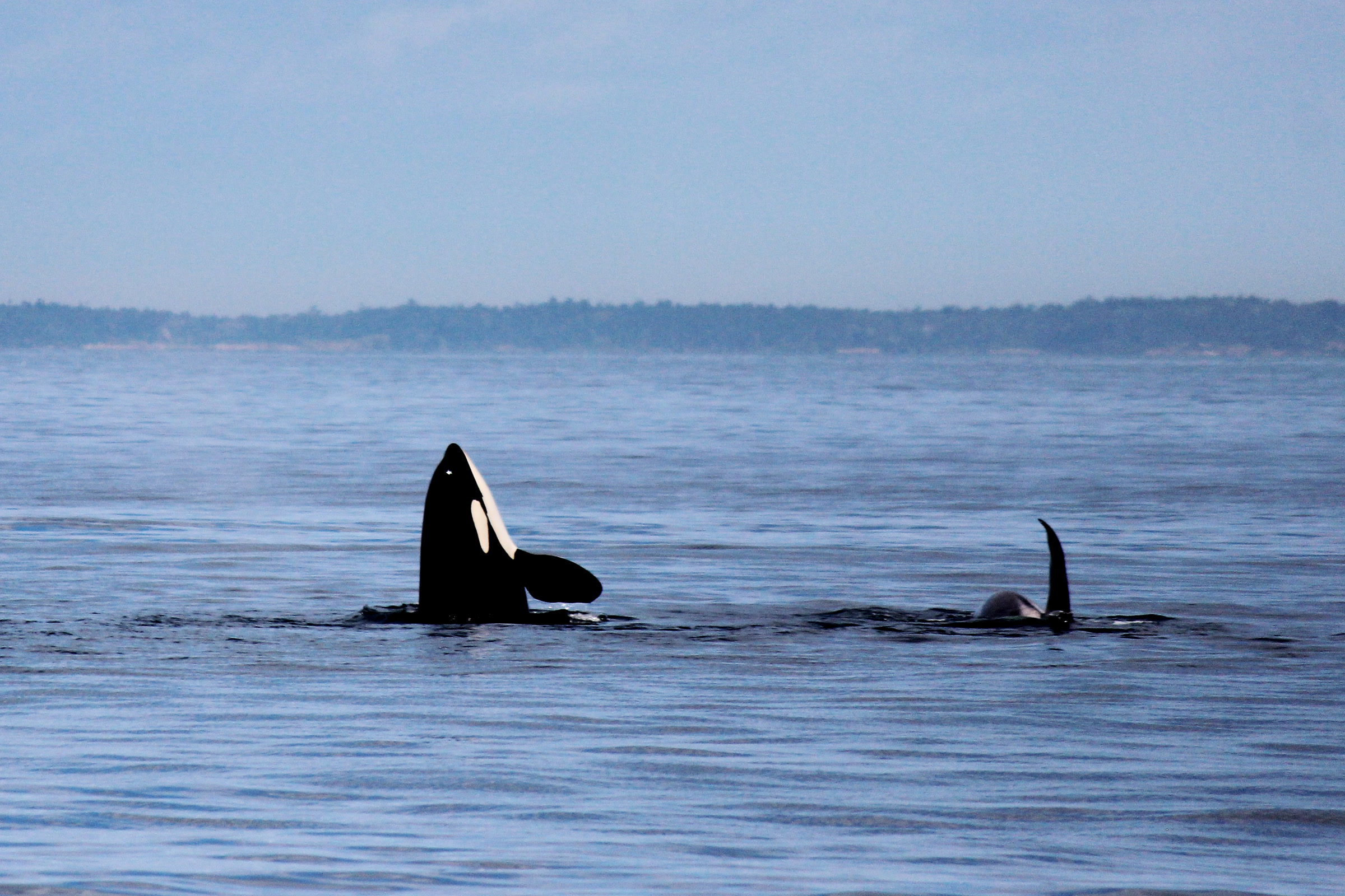
    NOAA describes the endangered Southern Resident orcas as living in tight family groups led by females, and as known for breaching, spyhopping and slapping the water with their tails or flippers. Sanctuary and NOAA Fisheries staff work together to understand them better.

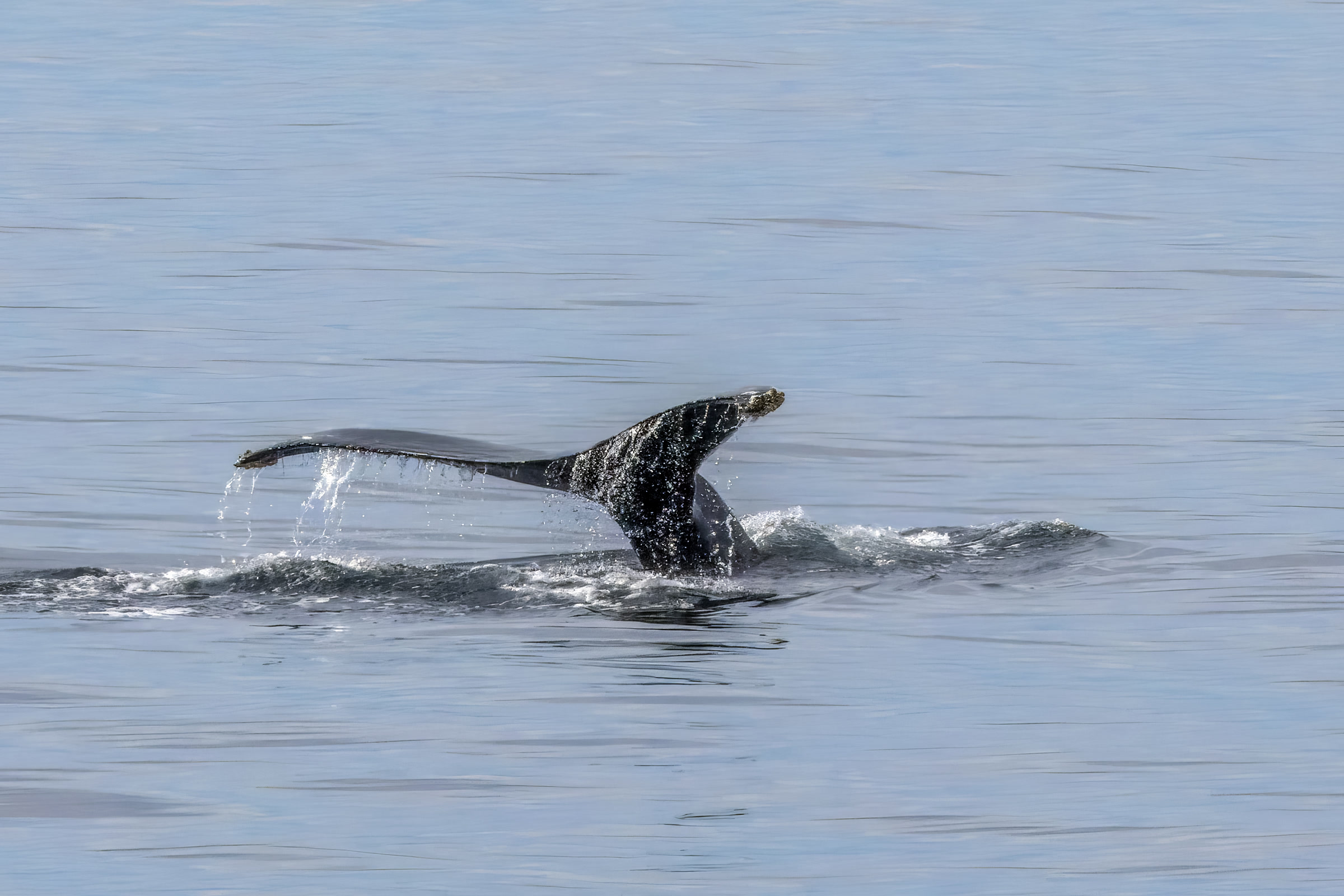
    The dark tail flukes of a young humpback whale lifting out of calm grey water as it dives in the Salish Sea, Washington
    A young humpback diving in the Salish Sea, east of the outer coast. Photo: Charles J. Sharp / Wikimedia Commons (CC BY-SA 4.0)

    Harbor seals and sea lions

    NOAA lists harbor seals and elephant seals as the earless seals of the Olympic Coast, and Steller and California sea lions as the eared ones. NPS says seals, sea lions and sea otters haul out on shore to rest, give birth or molt.

    Molting happens in late spring to early summer, and the park warns it can make an animal look sick or even bloody. That is normal. Steller sea lions are another recovery story: their eastern population was taken off the threatened list in 2013.

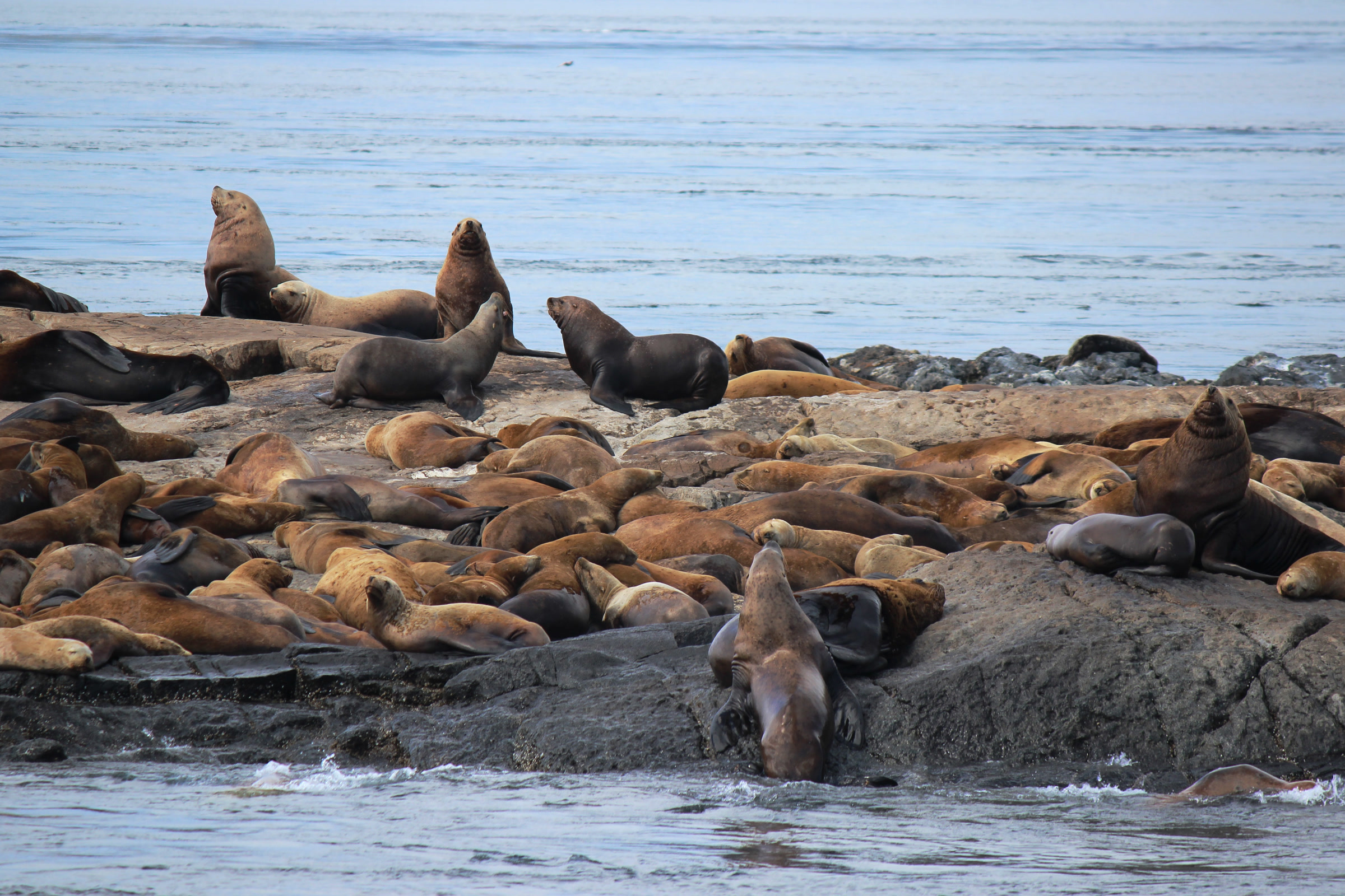
    Dozens of brown sea lions crowded together resting on a flat offshore rock, a few raising their heads, with open sea behind
    Sea lions resting on an offshore rock in the sanctuary. Photo: Karlyn Langjahr / NOAA

    Sea otters in Washington

    Sea otters were hunted out of Washington waters by the early 1900s. According to the Washington Department of Fish and Wildlife (WDFW), today’s population grew from 59 otters reintroduced in 1969 and 1970. The state still lists them as threatened.

    WDFW says they live from south of Destruction Island north to Cape Flattery, and east into the Strait of Juan de Fuca to Pillar Point. Look in rocky areas and kelp beds within about a mile of shore, where they eat urchins, crabs, clams, mussels, snails and chitons.

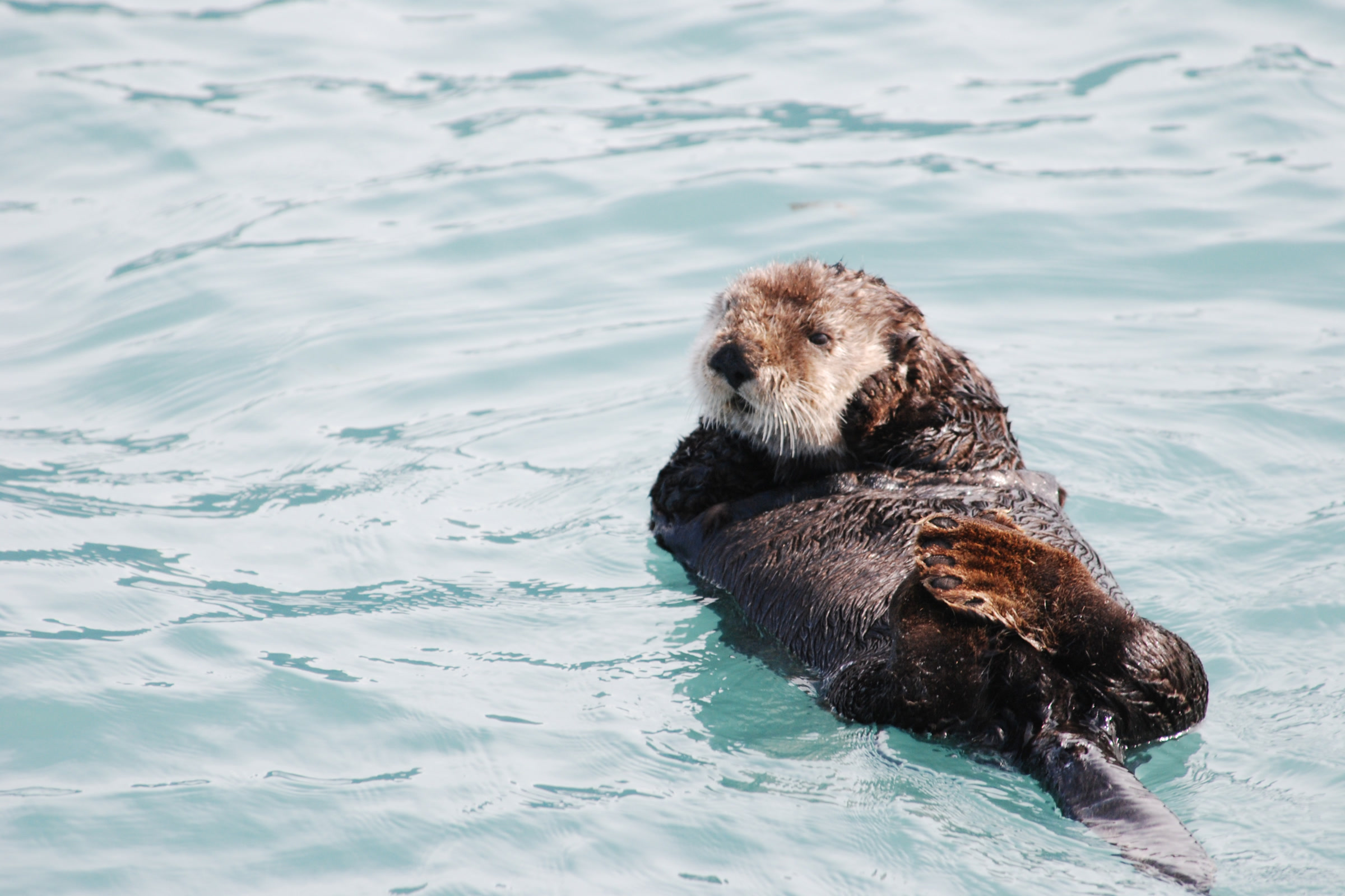
    A sea otter with a pale head floating on its back in blue green water, front paws folded on its chest
    A sea otter in Olympic Coast National Marine Sanctuary. Photo: NOAA Office of National Marine Sanctuaries

    How far to stay back

    The park’s rule of thumb is simple: if an animal moves because of you, you are too close. Park regulations prohibit feeding, touching, teasing, frightening or intentionally disturbing wildlife, and federal law protects marine mammals from harassment.

    Viewing distances by animal, as of October 2026

    Animal or activityDistanceSource
    Seals and sea lionsAt least 100 yards, you and your petsNOAA Fisheries
    WhalesAt least 100 yardsNOAA Fisheries
    Bigg’s orcas, Puget Sound200 yardsNOAA Fisheries
    Southern Resident orcas, Puget Sound1,000 yardsNOAA Fisheries
    Aircraft over beaches, rocks and islands2,000 feet aboveNOAA sanctuary

    Drones are not allowed in Olympic National Park without the superintendent’s written approval. Check the NPS marine mammals page before you go.

    If you find a seal pup on the beach

    A pup alone on the sand is usually not an orphan. NOAA Fisheries says it is normal for mothers to leave pups behind, and that pups may stay in one spot for days. The mother may not come back if people are too close.

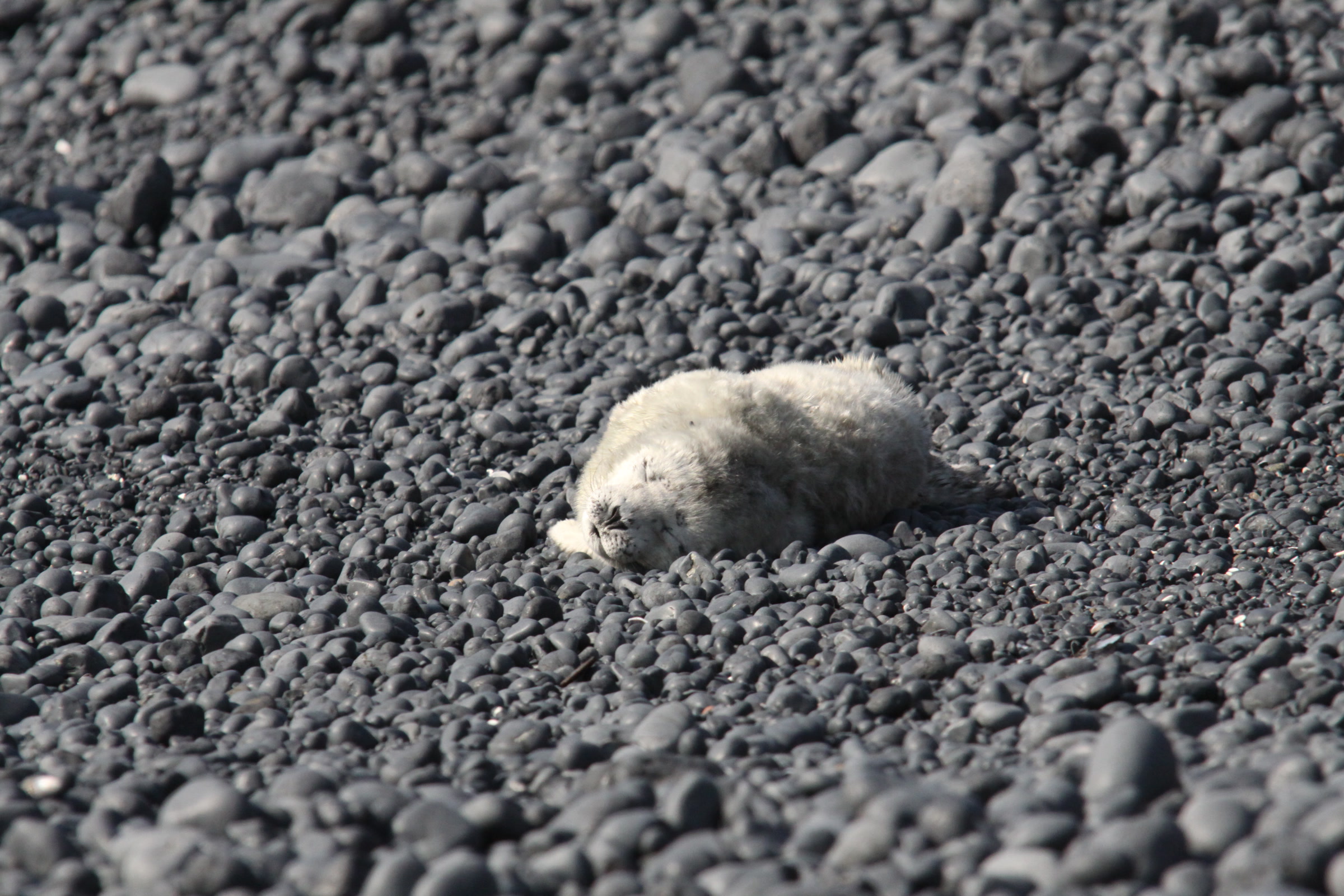
    A newborn harbor seal pup with pale fur curled up alone on a dark cobble beach at Yaquina Head, Oregon
    A harbor seal pup resting alone at Yaquina Head, Oregon. Pups like this are usually waiting for their mother. Photo: Bureau of Land Management
    1. Leave it where it is. Never touch, feed or move a pup; NOAA says moving animals lowers their odds of survival.
    2. Back away to at least 100 yards and keep other people back too.
    3. Keep dogs leashed and away; NOAA notes pets can separate mothers from pups.
    4. If it looks injured or in danger, call the West Coast Marine Mammal Stranding Network at 866-767-6114 or tell a ranger. Don’t try a rescue yourself.
    5. To report harassment, call the NOAA Fisheries enforcement hotline at 800-853-1964.

    For an injured sea otter, the park lists a separate line, 877-326-8837. NOAA’s Share the Shore guidance has the full advice. Pets are not allowed on most park beaches; our post on dogs in Olympic National Park lists the exceptions.

    Whale watching on the Olympic Coast: when and where

    Spring is the best bet for gray whales, from March into May. Pick a high spot with a wide ocean view, bring binoculars, and scan for spouts on a calm day. In 2013 The Whale Trail dedicated a sign at Kalaloch Lodge, the first on Washington’s outer coast and the first inside the park.
    For a shore walk with an ocean view, try Ruby Beach, Rialto Beach and Hole in the Wall, or a low tide visit from our tide pools guide. If you paddle, read our kayaking guide first and give animals room on the water too.

    How Friends of Olympic National Park helps

    We are Friends of Olympic National Park (FONP), a volunteer led friends group based in Port Angeles. Our volunteers join beach cleanups in Olympic National Park, removing marine debris from the coast these animals depend on. A gift helps keep that work going, so please consider a way to support Olympic National Park.

    Frequently asked questions

    When is the best time to see gray whales on the Olympic Coast?

    The park says gray whales migrate north past the coast from March into May. Some stay to feed in late spring and summer, including at the mouths of the Hoh and Quillayute rivers.

    Are there sea otters in Washington?

    Yes. Sea otters were hunted out of Washington by the early 1900s and reintroduced in 1969 and 1970. WDFW says they live from south of Destruction Island north to Cape Flattery and east to Pillar Point.

    What should I do if I find a seal pup on the beach?

    Leave it alone and back away to at least 100 yards. Mothers often leave pups on shore. If the pup looks injured, call the West Coast Marine Mammal Stranding Network at 866-767-6114.

    How close can you get to seals and sea lions?

    NOAA Fisheries asks people to keep themselves and their pets at least 100 yards from seals and sea lions. If an animal reacts to you, you are too close.

    Can you see orcas from shore on the Olympic Coast?

    Sometimes. NOAA lists the orca among the most common toothed whales in Olympic Coast National Marine Sanctuary, and the park names orcas among the animals visitors may spot from coastal vantage points.

  • Amphibians of Olympic National Park: Frogs and Salamanders

    Amphibians of Olympic National Park: Frogs and Salamanders

    Olympic National Park is a wet place, and wet places suit amphibians. The park’s ponds, lakes, streams and mossy forests are home to frogs, toads, newts and salamanders, including one salamander found nowhere else. This guide covers the species the park lists, where to look, and how to enjoy them without causing harm.

    Quick answer

    What amphibians live in Olympic National Park?

    The park’s species list names 13 amphibians seen in Olympic National Park: eight salamanders and newts, and five frogs and toads. They include the rough-skinned newt, tailed frog, Pacific tree frog and western toad. The Olympic torrent salamander is the one species the park lists as endemic, found only locally.

    • 13 amphibian species on the park’s list
    • Olympic torrent salamander is the park’s endemic amphibian
    • Rough-skinned newts carry a toxin in their skin
    • Touching or disturbing park wildlife is prohibited

    The amphibians on the park’s list

    The park keeps an online list of amphibians and reptiles that have been seen in the park, last updated in 2015. It names 13 amphibians. The park also points to a 2003 inventory report based on fieldwork from 1999 to 2001.

    Salamanders and newts compared with frogs and toads

    GroupSpecies on the park list
    Salamanders and newtsNorthwestern salamander, long-toed salamander, Olympic torrent salamander, Cope’s giant salamander, rough-skinned newt, Oregon ensatina, western red-backed salamander, Van Dyke’s salamander
    Frogs and toadsWestern toad, tailed frog, red-legged frog, Pacific tree frog, Cascades frog
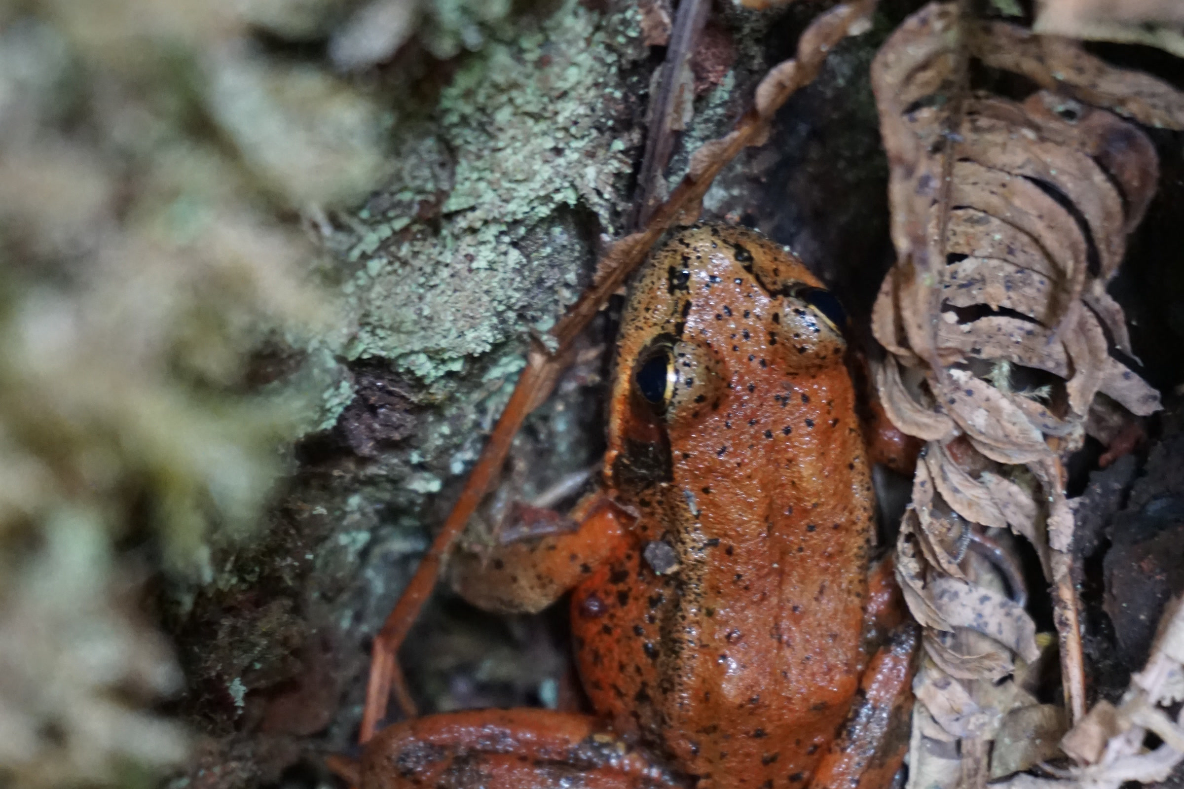
    A reddish orange frog with small black spots tucked between lichen covered bark and dry fern fronds in Olympic National Park
    A frog hiding among bark and ferns in Olympic National Park in September. NPS Photo / D. Archuleta

    Rough-skinned newt

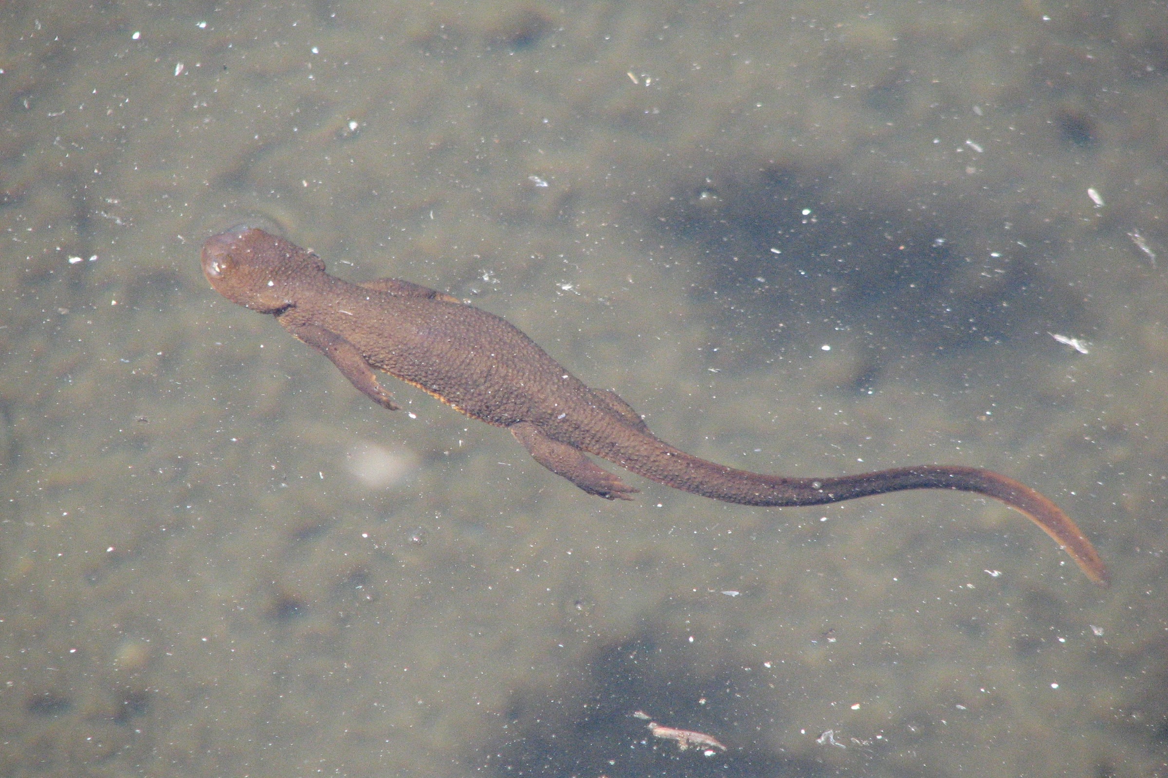
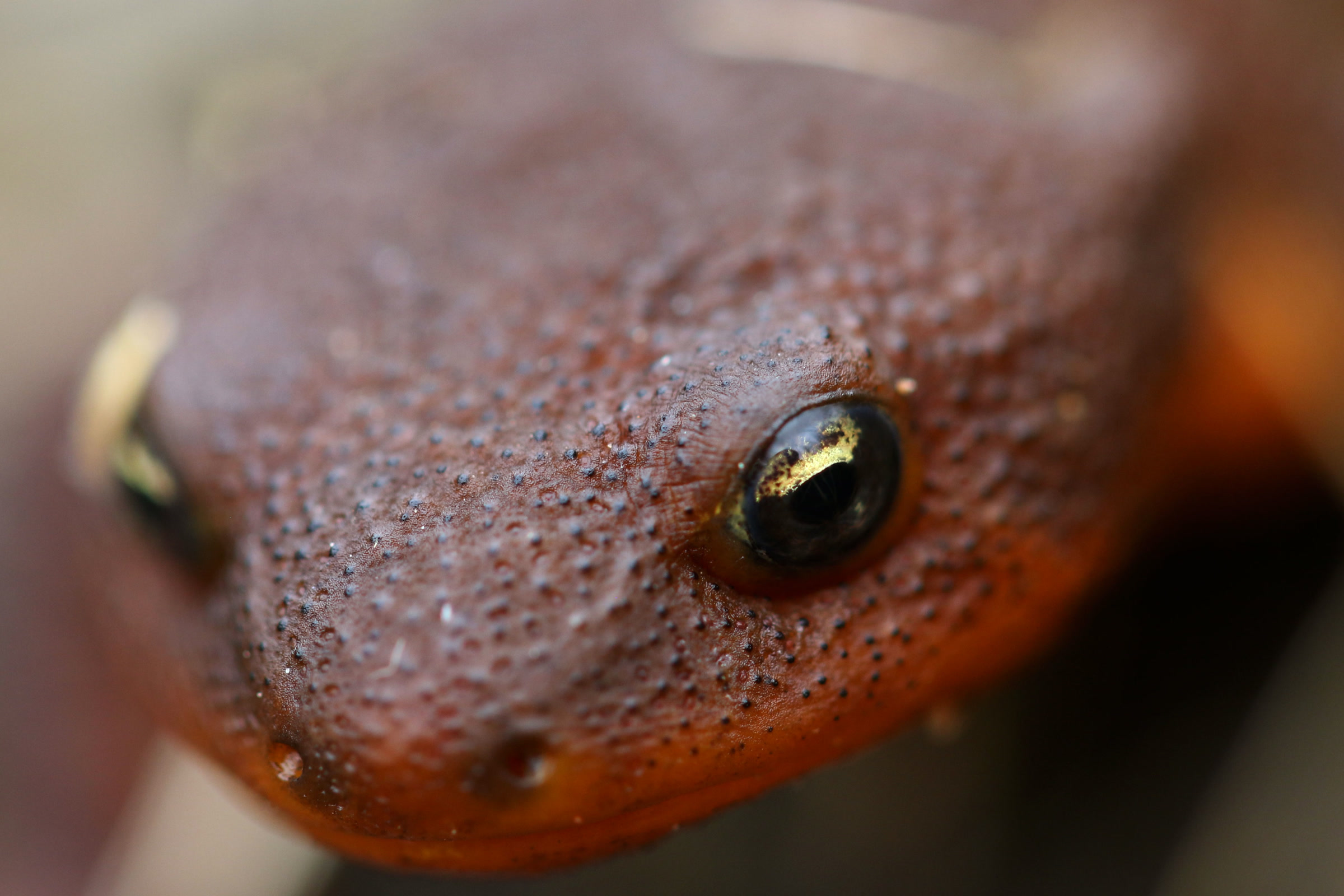
    The rough-skinned newt is common and easy to recognize. The park describes it as common in the lowlands, with bumpy brown skin and a bright orange belly. Newts breed in ponds but usually live in the forest, so you may meet one well away from water.

    Close-up of a rough-skinned newt head showing bumpy brown skin, a dark eye and the bright orange underside along its jaw
    A rough-skinned newt, photographed outside the park. Photo: Peter Pearsall / U.S. Fish and Wildlife Service
    The newt’s toxin and handling

    The park says newts protect themselves with their bright belly and a poison from their skin. The Washington Department of Fish and Wildlife identifies that toxin as tetrodotoxin. When threatened, a newt arches its head back toward its tail to flash its orange underside as a warning, and few predators survive eating one, the common garter snake being the notable exception.

    WDFW says newts can be handled safely, but small children who put things in their mouths need watching. After touching any amphibian, wash your hands before touching your eyes, nose or mouth. Inside the park, though, the rule is simpler: leave them be, because touching or disturbing wildlife is prohibited.

    At low elevations in western Washington, WDFW notes that newts are active all year, and courtship is most visible in March and April. At higher elevations they breed soon after the snow and ice melt.

    Olympic torrent salamander

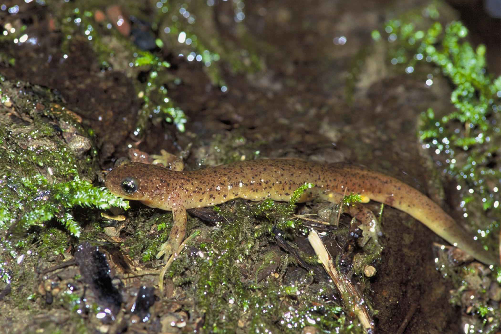
    The Olympic torrent salamander is the park’s own. The park lists it as endemic, and WDFW says about 77 percent of its known occurrences are in Olympic National Park. It is small, under 2.4 inches from snout to vent, brown above and yellow to orange below, with large eyes.

    A small brown Olympic torrent salamander with dark speckles and large eyes on wet, mossy rock
    An Olympic torrent salamander; the exact location is not recorded. Photo: John and Karen Hollingsworth / U.S. Fish and Wildlife Service

    These salamanders need cold, permanent streams, seeps and waterfall splash zones in mature conifer forest. They move only a few meters in their lives, and WDFW notes their eggs have never been found in the wild. WDFW lists warming water and sediment among the threats, so shaded, healthy streams matter.

    Tailed frog

    The park says the tailed frog can live in cold, rushing mountain streams. WDFW describes it as a slender, rough-skinned frog of 1.5 to 2 inches with no documented calls. The male’s “tail” is used for internal fertilization, so sperm is not washed away in the current.

    A mottled brown and green coastal tailed frog sitting half underwater in a clear, rippling stream; the location is not recorded
    A coastal tailed frog in a stream; not known to be from Olympic. Photo: Jeffrey Marsten / Wikimedia Commons (public domain)

    Its tadpoles are just as specialized. WDFW says they are the only tadpoles in Washington able to cling to rocks in fast water, using a large sucker-like mouth, and they stay tadpoles for two to five years.

    Pacific tree frog

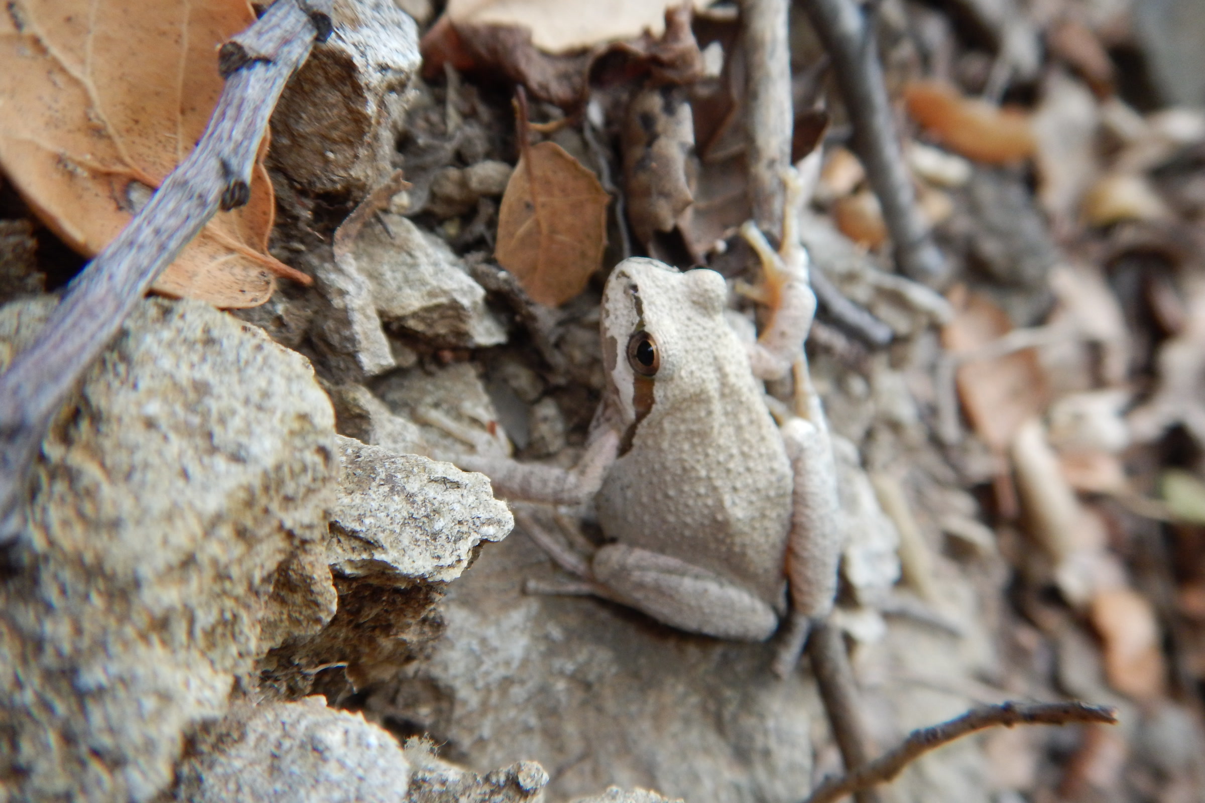
    The Pacific tree frog, also called the Pacific chorus frog, is a small frog with a two-part “rib-it” call; WDFW notes that breeding choruses carry for great distances. WDFW notes it is usually under 2 inches long and the only Washington frog with round toe pads. It can be green, brown, grey, red or copper.

    A pale grey Pacific tree frog blending into dry leaves and rocks in Solstice Canyon, California, not in Olympic National Park
    A grey Pacific tree frog in Solstice Canyon, California, not in Olympic. NPS Photo (Santa Monica Mountains)

    Tree frogs breed in still or slow water, from ponds and lakes to roadside ditches, laying small packets of eggs on plants. Outside the breeding season adults live on land in moist places, including forests.

    Western toad and other species to know

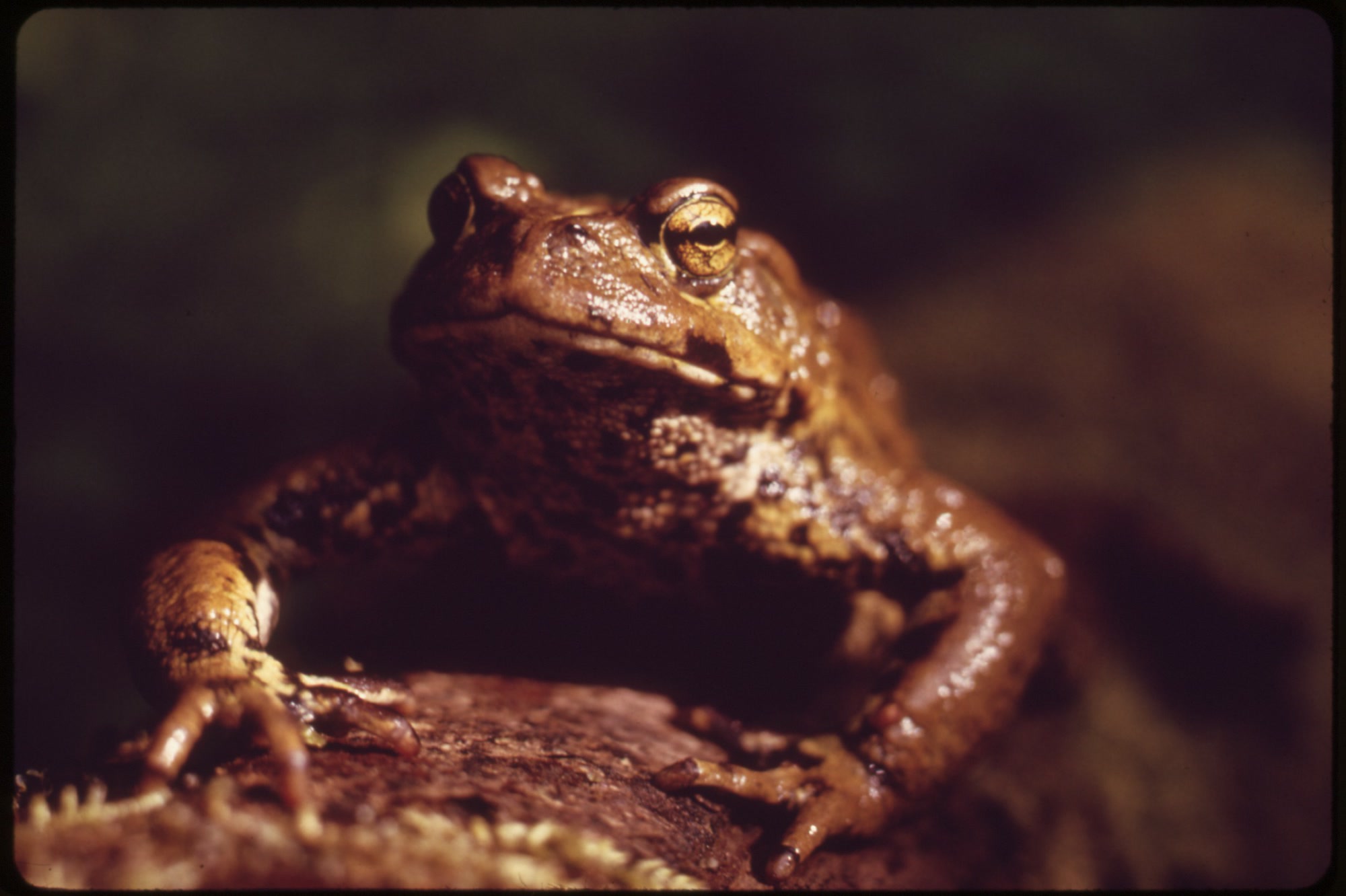
    The western toad is the only toad on the park list, a warty animal of 2 to 5 inches. The park says populations of most amphibians appear fairly stable, but western toads could be declining. WDFW lists the toad as a state candidate species and names road deaths among its main threats.

    Close-up of a warty brown toad resting on wood in the Queets River valley of Olympic National Park, photographed in May 1973
    A toad in the Queets River valley of Olympic National Park, May 1973. Photo: U.S. National Archives

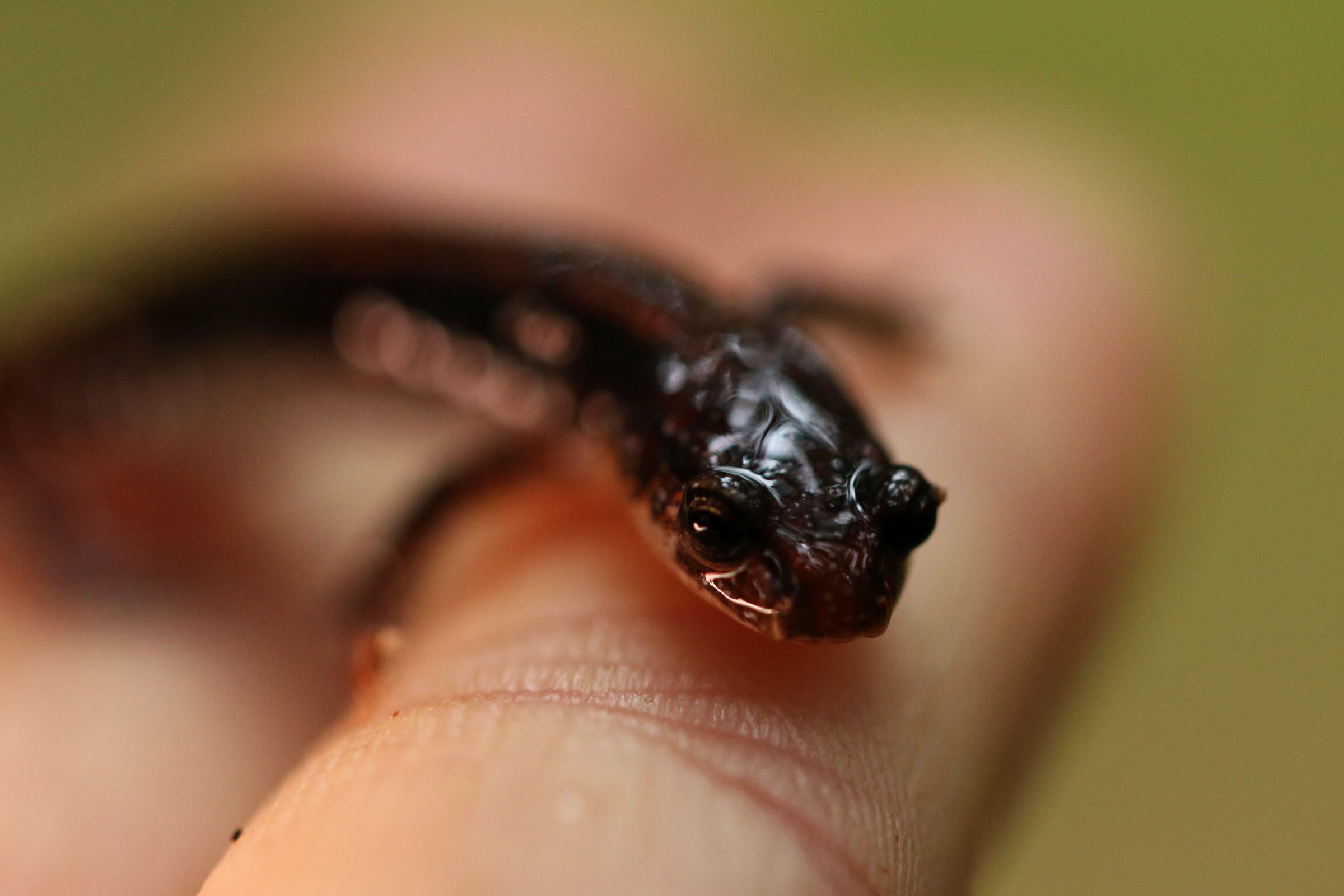
    The list also includes forest salamanders such as the western red-backed salamander and Oregon ensatina. Our guide to temperate rainforests in Olympic National Park and our post on banana slugs explore more of the park’s damp forest life.

    A small dark western red-backed salamander resting on a fingertip, photographed by the U.S. Fish and Wildlife Service, not in Olympic National Park
    A western red-backed salamander on a fingertip, not in Olympic. Photo: Peter Pearsall / U.S. Fish and Wildlife Service

    Threats and how to watch amphibians well

    The park’s amphibians page names pollution and non-native predators, including bullfrogs and eastern brook trout, as threats. You can help in small ways that add up.

    • Watch from a short distance and don’t pick animals up; touching or disturbing park wildlife is prohibited.
    • Stay on trails near ponds and streams, and step around newts on the path.
    • Never move fish, frogs or tadpoles between waters.
    • Report injured or dead animals to a ranger rather than trying a rescue yourself.

    How Friends of Olympic National Park helps

    We are Friends of Olympic National Park (FONP), a volunteer led friends group in Port Angeles. Our guided nature walks and the Children’s Discovery Room help visitors of all ages notice the small lives of the forest. If you’d like to help that work continue, please support Olympic National Park with a gift.

    Frequently asked questions

    How many amphibians are in Olympic National Park?

    The park’s species list, last updated in 2015, names 13 amphibians that have been seen in the park: eight salamanders and newts and five frogs and toads.

    Is the rough-skinned newt poisonous to touch?

    Its skin contains tetrodotoxin. WDFW says newts can be handled safely if you wash your hands before touching your eyes, nose or mouth, and that small children need supervision. In the park, touching wildlife is prohibited, so just watch.

    Where does the Olympic torrent salamander live?

    Only on the Olympic Peninsula. WDFW says about 77 percent of known occurrences are in Olympic National Park, in cold, permanent streams, seeps and waterfall splash zones in mature forest.

    Why is it called a tailed frog?

    The male has a tail-like organ used for internal fertilization, which keeps sperm from washing away in fast mountain streams.

    Are there poisonous snakes in Olympic National Park?

    No. The park says there are no venomous snakes on the Olympic Peninsula.

  • High Divide Loop and Seven Lakes Basin: A Hiking Guide

    High Divide Loop and Seven Lakes Basin: A Hiking Guide

    The High Divide Loop is a classic backpacking route in Olympic National Park. It starts in old growth forest at the Sol Duc trailhead, climbs to a long ridge facing Mount Olympus, and passes above Seven Lakes Basin, a bowl of small subalpine lakes. Here is what the park says about distances, season, camping and safety, so you can plan a trip that suits your group.

    Quick answer

    How long is the High Divide Loop?

    The National Park Service lists the High Divide Loop at 18.2 miles with 3,050 feet of elevation gain, starting and ending at the Sol Duc trailhead. The park calls it a popular 2 to 3 day hike. Its best season is mid July through September, and overnight trips need a wilderness permit and a bear canister.

    • 18.2 mile loop, 3,050 feet of gain (NPS)
    • Snow can linger until early to mid July
    • Seven Lakes Basin sits inside a permit quota area
    • Bear canisters required throughout the loop
    • No campfires above 3,500 feet

    Where the loop goes

    The loop begins at the end of the Sol Duc Road, which the park says is about 40 minutes west of Port Angeles. From the trailhead the first 0.8 mile is the popular walk to Sol Duc Falls, which our Sol Duc Falls and valley guide covers in detail. Beyond the falls, one side of the loop climbs to Deer Lake and the other follows the Sol Duc River up to Sol Duc Park and Heart Lake.

    The two sides meet along the High Divide Trail, high on the ridge south of the basin. The park’s High Divide Loop page names Sol Duc Park, Heart Lake, Lunch Lake and Deer Lake as the main destinations, with Lunch Lake reached by a 0.5 mile spur trail into the basin.

    Heart Lake, a small green lake in the Sol Duc high country of Olympic National Park, ringed by meadow and subalpine firs under a partly cloudy sky
    Heart Lake, where the Sol Duc River trail reaches the High Divide. Photo: Jtmorgan / Wikimedia Commons (CC BY-SA 3.0)

    High Divide Loop distances

    Sources measure this loop differently, so it helps to know whose numbers you are reading. We use the park’s figures first and show the Washington Trails Association’s for comparison.

    NPS and WTA figures compared

    SectionNPSWTA
    Trailhead to Sol Duc Falls0.8 mile one way0.8 mile
    Trailhead to Deer Lake3.8 miles one way, 1,700 feet of gainAbout 3.7 miles (0.8 plus 2.9)
    Lunch Lake spur0.5 mileListed as a side trip
    Full loop18.2 miles, 3,050 feet of gain19 miles, 4,000 feet of gain
    Highest pointNot listed5,120 feet

    The WTA hike description goes up the Deer Lake side first and reaches the Seven Lakes Basin junction about 8 miles from the trailhead. The park rates the loop moderate, on moderate to steep terrain with a few creek crossings. Plan your daily miles around your camps rather than the total.

    The Sol Duc River rushing white over rocks between mossy boulders and forested banks in Olympic National Park
    The Sol Duc River in April. Photo: Adbar / Wikimedia Commons (CC BY-SA 3.0)

    Seven Lakes Basin

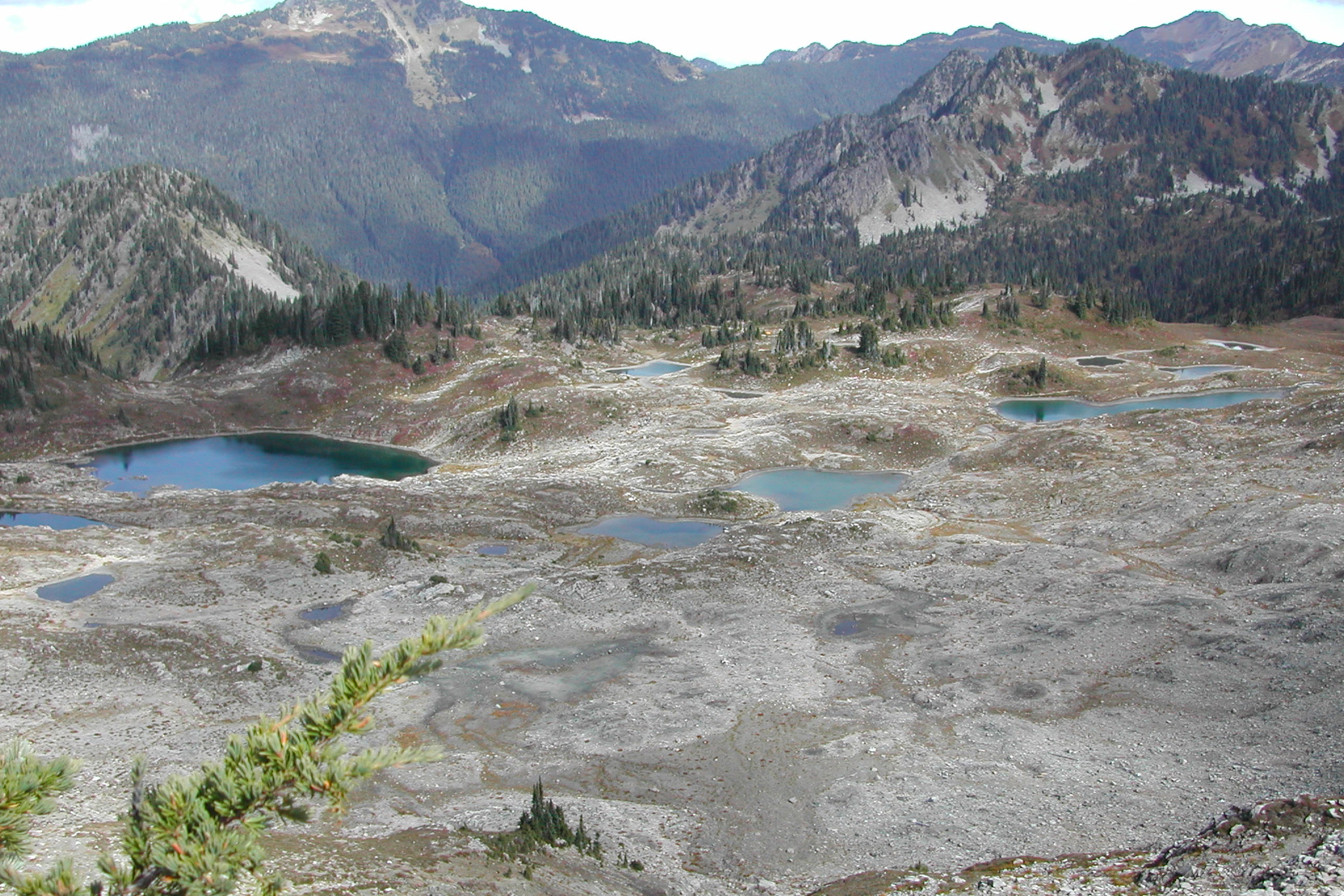
    Seven Lakes Basin lies just north of the High Divide, a rocky bowl dotted with lakes and tarns. The WTA describes eight or more lakes, despite the name. From the ridge you look down into the basin on one side and across the Hoh valley to Mount Olympus on the other.

    Several small blue lakes in the open, rocky floor of Seven Lakes Basin, with green forested mountains and white clouds beyond
    Lakes on the floor of Seven Lakes Basin in August. Photo: Jason Pratt / Wikimedia Commons (CC BY 3.0)

    Lunch Lake, down in the basin, is one of the destinations the park lists, and it has a vault toilet. The park notes that campsites above 3,500 feet are heavily used, so keep to established paths and to the designated sites.

    The High Divide Trail and Mount Olympus

    The park’s Sol Duc valley page says the views of Mount Olympus are astounding on a clear day. Bogachiel Peak, which the WTA lists as a side trip, is another viewpoint along this stretch. Our post on Olympic National Park glaciers and climate change explains what is happening to the ice you see across the valley.

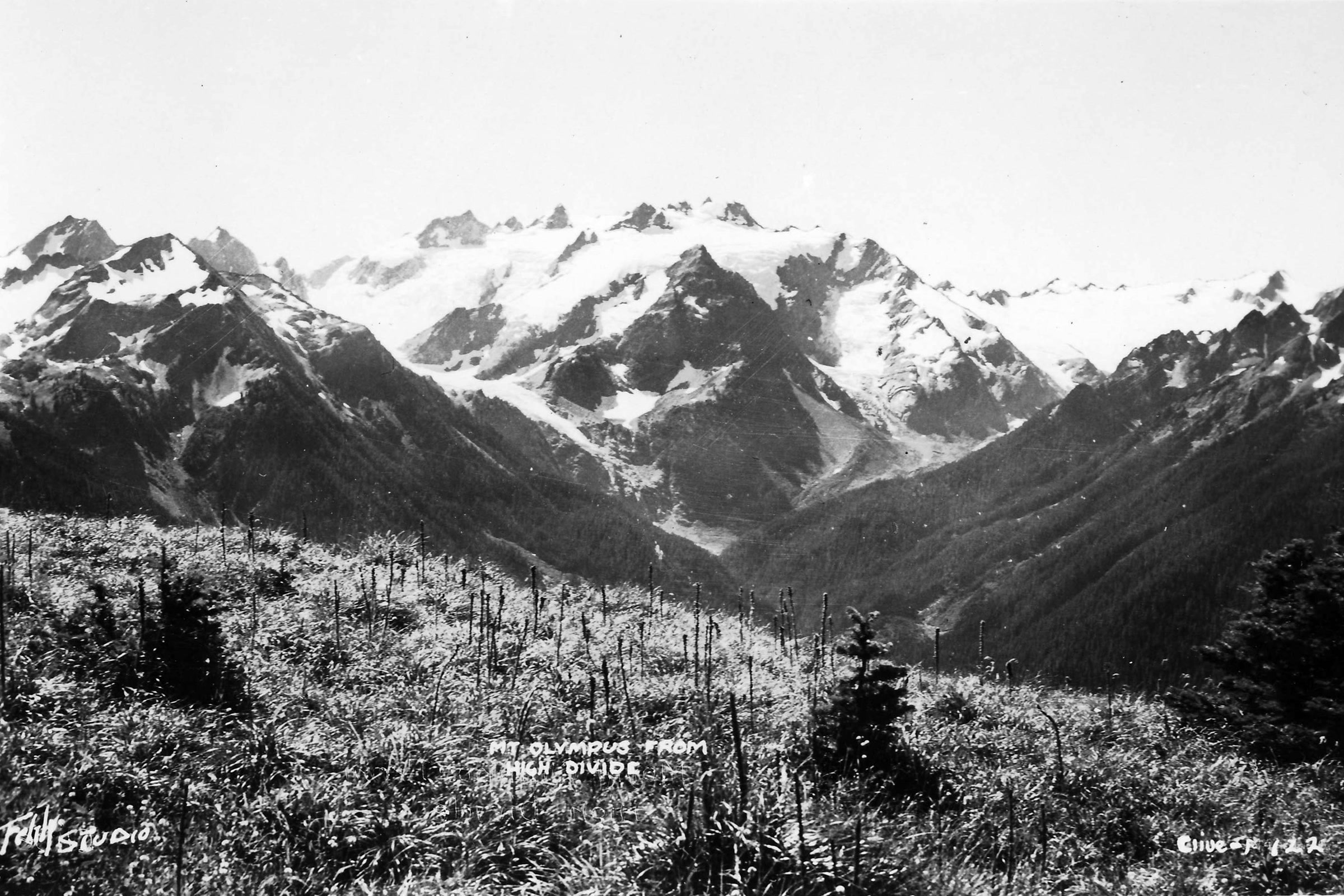
    Historic black and white photograph of glacier covered Mount Olympus seen from a meadow on the High Divide
    Mount Olympus from the High Divide, an undated historic photograph. U.S. Forest Service, Pacific Northwest Region

    The park warns that snow and ice can cover the High Divide slopes, the area around Bogachiel Peak and the way into the basin. It recommends carrying an ice axe and knowing how to self arrest when snow remains. If you are not prepared for that, wait for later summer.

    Rocky ridges around Bogachiel Peak above a deep forested valley in Olympic National Park on a clear summer day
    The Bogachiel Peak area in August. Photo: Jason Pratt / Wikimedia Commons (CC BY 2.0)

    When to hike, as of October 2026

    The park gives mid July through September as the best season. Snow can stay on the trail until early to mid July, and later on steep slopes. As of October 2026 the Sol Duc Road is open all year when weather permits but often closes in winter for snow and ice, so check the NPS page before you go or call the Road and Weather line at 360-565-3131.

    Expect cool, wet weather even in summer. Our what to pack for Olympic National Park list covers the layers and gear that wet trail days call for.

    Permits, camps and bear canisters

    Every overnight trip needs a wilderness permit, and the park lists the “Sol Duc/Seven Lakes Basin/Mink Lake area (including Cat Basin, High Divide, and Little Divide)” as a quota area. Camping is in designated sites only. Our guide to Olympic National Park wilderness permits explains how reservations, fees and quotas work, so we won’t repeat them here.

    Camping along the loop

    StretchWhat the park says
    Sol Duc Falls to Sol Duc ParkMany campsites and water
    Heart Lake to Deer LakeVery few campsites and little water
    Vault toiletsSol Duc Park, Heart Lake, Lunch Lake and Deer Lake
    Group sitesSevenmile Camp, Sol Duc Park and Deer Lake
    A steep forested ridge with a bare rock escarpment seen from near Heart Lake on the High Divide Trail in Olympic National Park
    Cliffs seen from near Heart Lake on the High Divide Trail. Photo: Jtmorgan / Wikimedia Commons (CC BY-SA 3.0)

    Park approved bear canisters are required for all food, garbage and scented items throughout the loop area, and those items must be secured from wildlife 24 hours a day. The park says bears and elk are common here. Our posts on black bears in Olympic National Park and Roosevelt elk explain how to keep a safe distance.

    • Boil, filter or chemically treat all water; the park warns of Giardia.
    • Campfires are prohibited above 3,500 feet, so bring a stove.
    • Use vault toilets for solid waste only; urinate at least 200 feet from campsites and water.
    • Where there is no toilet, bury waste 6 to 8 inches deep, 200 feet from camps and water.
    • Leave dogs at home; the WTA lists this hike as no dogs.

    How Friends of Olympic National Park helps

    We are Friends of Olympic National Park (FONP), a volunteer led friends group based in Port Angeles. Our adopt-a-trail crew cares for the Heart O’ the Forest Trail, and our volunteers help with cleanups across the park. If the High Divide is one of your favourite places, look at our volunteer opportunities and lend a hand on the trails closer to town.
    Frequently asked questions

    How long is the High Divide Loop?

    The National Park Service lists the loop at 18.2 miles with 3,050 feet of elevation gain. The Washington Trails Association lists 19 miles and 4,000 feet.

    Do you need a permit for Seven Lakes Basin?

    Yes, for any overnight stay. The park lists the Sol Duc, Seven Lakes Basin and Mink Lake area, including the High Divide, as a wilderness quota area, and camping is in designated sites only.

    When is the best time to hike the High Divide?

    The park gives mid July through September. Snow can linger until early to mid July, and later on steep slopes, where the park recommends an ice axe and self arrest skills.

    Can you do the High Divide Loop in one day?

    The park describes it as a popular 2 to 3 day hike. Plan for the full distance, the elevation gain and cool, wet mountain weather.

    Do you need a bear canister on the High Divide?

    Yes. The park requires approved bear canisters for all food, garbage and scented items throughout the loop area, secured from wildlife 24 hours a day.

  • Deer Park and Obstruction Point: The High Roads

    Deer Park and Obstruction Point: The High Roads

    Deer Park and Obstruction Point are the two high road ends of the northern Olympics, each reached by a narrow gravel mountain road. Obstruction Point sits about eight miles east of Hurricane Ridge, and Deer Park lies at the far end of the ridge beyond it. A high trail along Grand Ridge links them, and both roads open only for part of the year.

    Quick answer

    Can you drive to Obstruction Point and Deer Park?

    Yes, in season. Obstruction Point Road runs 7.8 miles of narrow gravel from Hurricane Ridge, and Deer Park Road climbs 18 miles, the last 9 gravel. As of October 2026 the park lists both open, neither suitable for RVs or trailers. Snow closes them each year, so check the NPS road conditions page first.

    • No RVs or trailers on either road
    • Obstruction Point Road: mid-June through October 15, weather permitting
    • Deer Park Campground: 14 tent sites at 5,400 feet
    • Grand Ridge trail links the two in 7.4 miles

    Obstruction Point Road and Deer Park Road compared

    Both roads are slow, steep and unpaved where it matters. As of October 2026, the NPS current road conditions page lists both as open. Conditions change quickly up high, so check that page before you go.

    RoadObstruction Point RoadDeer Park Road
    Starts atEntrance to the Hurricane Ridge parking areaHighway 101
    Length7.8 miles from Hurricane Ridge18 miles, the last 9 gravel
    SurfaceGravel, narrow, winding, steep in placesGravel, narrow, windy, numerous blind corners
    VehiclesNot suitable for RVs, trailers or busesNot suitable for RVs or trailers
    SeasonMid-June through October 15, weather and snow permittingClosed at the park boundary from late fall until melt out in late spring

    To reach Obstruction Point you first drive the paved 17 mile Hurricane Ridge Road, which the park says may open or close depending on road conditions and weather. Our Hurricane Hill trail guide covers the ridge itself.

    Driving to Obstruction Point

    Obstruction Point Road branches off right at the entrance to the Hurricane Ridge parking area. The park describes it as its highest elevation road, running from Hurricane Ridge at 5,242 feet to Obstruction Point at 6,150 feet. The NPS trailhead page is blunt: the drive is “not for the faint of heart,” or for large vehicles like RVs and trailers.

    Snowy peaks of the interior Olympic Mountains above forested valleys, seen past subalpine firs from Obstruction Point Road
    The interior Olympics from Obstruction Point Road in July. Photo: brewbooks / Wikimedia Commons (CC BY-SA 2.0)

    The same page adds that the breathtaking views are worth it. From the road end you can hike along the high alpine ridges or drop into Grand Valley. As of October 2026 the alerts page lists the road as open, and on the park’s usual schedule it closes after October 15.

    Visiting Deer Park in Olympic National Park

    Deer Park is reached by its own road from Highway 101. The park calls the 18 mile road narrow and steep with occasional turnoffs, and says its last 9 miles are gravel. From late fall until melt out in late spring, the road is closed at the park boundary, about 9 miles from the highway.

    Snow plastered subalpine firs at Deer Park in winter, with a distant snowy ridge peeking through low cloud
    Deer Park under snow, when the road is closed at the park boundary. NPS Photo / B. Baccus

    The park notes that a ranger station here is staffed intermittently during summer and fall. Pets and bicycles are not permitted on the Deer Park trails.

    Deer Park Campground

    At 5,400 feet, Deer Park Campground offers mountain views and starry skies. As of October 2026 the NPS camping page lists it open, with a season of June to mid-October that depends on road conditions and snow melt.

    • 14 sites, $15 per night, first come, first served; self register at the campground.
    • Tents only; the steep, winding gravel road makes it unsuitable for RVs.
    • Fire pits, picnic tables, accessible pit toilets and animal proof food storage; no potable water.
    • Firewood gathering is prohibited.

    Our guide to Olympic National Park campgrounds compares Deer Park with the park’s other camps.

    Blue Mountain and the Rain Shadow Loop

    Above the campground, the park’s Rain Shadow Loop is a 0.5 mile loop to the top of Blue Mountain, with panoramic views of lowlands and mountains and about 170 feet of elevation gain.

    Evening light on the bare upper slopes of Blue Mountain above Deer Park, with the lower ridges already in shadow
    The west side of Blue Mountain at sunset in September. Photo: Chase N. / Wikimedia Commons (CC BY-SA 2.0)

    The park’s Deer Park brochure explains that during the last ice age, high peaks like Blue Mountain stood above the glaciers as islands in the sky. From the top you look over glacier rounded foothills, and the endemic Olympic bellflower blooms on the summit. Why this side of the range is so dry is the story of our Olympic rain shadow explainer.

    A clump of blue violet Piper's bellflower blooming from a crack in grey rock among loose stones in the Olympic Mountains
    Piper’s bellflower, also known as Olympic bellflower, in the Olympic Mountains. Photo: brewbooks / Wikimedia Commons (CC BY-SA 2.0)

    The brochure also notes that the endemic Olympic marmot, once common here, is now rarely seen, likely because of predation by non-native coyotes. Our post on the Olympic marmot at Hurricane Ridge tells more of its story.

    The Grand Ridge trail from Obstruction Point to Deer Park

    The park calls this route Obstruction Point to Deer Park, and its trail conditions page lists it as the Grand Ridge Trail. It runs 7.4 miles between 6,100 and 5,400 feet, rated moderate, with early July through October as the best season. The park’s brochure describes subalpine forests and mountain meadows along the way.

    A dirt trail along a dry, rocky ridge near Maiden Peak, with deep forested valleys and rows of Olympic peaks to the left
    The trail near Maiden Peak in August. Photo: Peter Abrahamsen / Wikimedia Commons (CC BY-SA 2.0)

    It is high, open and exposed, and the park’s warnings are worth reading in full:

    • There is no water on the trail once the snow fully melts, usually around late August.
    • Storms move quickly and whiteouts are sudden, so watch the weather before and during your hike.
    • Map and compass skills may be necessary, and snow may cover higher reaches in any season.
    • Campfires are prohibited, and so is hanging food or scented items.
    A narrow trail crossing a rocky, red tinged subalpine slope under big white clouds, looking east toward Deer Park
    Looking east toward Deer Park from the ridge trail. Photo: brewbooks / Wikimedia Commons (CC BY-SA 2.0)

    The WTA Grand Ridge hike guide adds that clear days bring views of Mount Olympus, the Strait of Juan de Fuca and the Cascades, with constant wind near Maiden Peak. Its one campsite, Roaring Winds, needs a reservation; our guide to Olympic National Park wilderness permits explains how.

    Other Deer Park trails

    TrailDistanceClimb or drop
    Maiden Peak3.5 miles one way1,545 feet gain
    Elk Mountain5.5 miles one way2,249 feet gain
    Three Forks4.3 miles to the Gray Wolf River Trail3,416 feet loss

    Figures are from the park’s Deer Park brochure, which notes that Maiden Peak and Elk Mountain branch off the trail to Obstruction Point. For when to go, see our guide to the best time to visit Olympic National Park.

    How Friends of Olympic National Park helps

    We are Friends of Olympic National Park (FONP), a volunteer led friends group in Port Angeles. We run guided wildflower walks and other projects that help people know and care for the park. If the high country matters to you, become a member and support our work.
    Frequently asked questions

    Is Obstruction Point Road open?

    As of October 2026 the park lists Obstruction Point Road as open. The park says it opens from mid-June through October 15, weather and snow permitting, so check the NPS road conditions page before you go.

    Can you take an RV to Deer Park or Obstruction Point?

    No. The park says Deer Park Road is not suitable for RVs or trailers, and Obstruction Point Road is not suitable for RVs, trailers or buses. Deer Park Campground is tents only.

    How long is the drive to Obstruction Point?

    Obstruction Point Road runs 7.8 miles of narrow, winding gravel from Hurricane Ridge, which is itself reached by the paved 17 mile Hurricane Ridge Road.

    Do you need a reservation for Deer Park Campground?

    No. Its 14 sites are first come, first served at 15 dollars per night, and you self register at the campground. There is no potable water.

    How long is the hike from Obstruction Point to Deer Park?

    The park lists the Grand Ridge route as 7.4 miles, rated moderate, between 6,100 and 5,400 feet. There is no water once the snow melts, usually around late August.

  • Mount Storm King Trail: What to Know

    Mount Storm King Trail: What to Know

    Mount Storm King is the steep, forested peak that rises straight out of the south shore of Lake Crescent in Olympic National Park. Its trail is short but hard, climbing through forest to viewpoints high above the lake. Here is what the park says about the route, the upper section and the ropes you may see there.

    Quick answer

    How hard is the Mount Storm King trail?

    The Mount Storm King trail is rated difficult by the park. It branches off the Marymere Falls trail near Storm King Ranger Station and climbs about 2,000 feet in roughly 2 miles. The maintained trail ends at a signed point; beyond it the park warns of exposed, steep ground with loose rock and unsafe ropes.
    • Starts at Storm King Ranger Station on Lake Crescent
    • Day use only; camping on the route is prohibited
    • Ropes past the sign are not installed or maintained by the NPS
    • The park lists May through October as the best season

    Where the Storm King trail starts

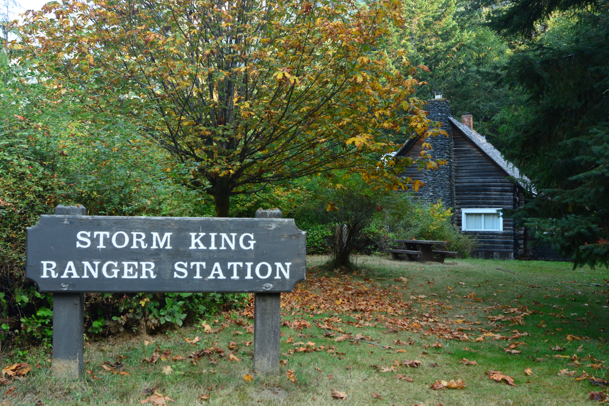
    The hike begins at Storm King Ranger Station, the historic log building on the south shore of Lake Crescent. The park opens the station in summer as staffing allows, and as of October 2026 its alerts page lists it as closed for the season. Please check the NPS page before you go.

    Wooden Storm King Ranger Station sign on a lawn scattered with fallen leaves, with the log ranger station under autumn maples behind
    Storm King Ranger Station, where the hike begins, in October. Photo: Joe Mabel / Wikimedia Commons (CC BY-SA 4.0)

    From the station you follow the Marymere Falls trail, which passes under Highway 101 and heads into old growth forest. Our guide to Lake Crescent in Olympic National Park covers the lake itself, and our Olympic National Park waterfalls guide describes Marymere Falls, so we won’t repeat them here.

    The climb up Mount Storm King

    The NPS trailhead page says the Mount Storm King trail branches off the Marymere Falls trail and switchbacks up 2,000 feet in 2.2 miles, calling it “an intense, steep ascent.” Washington Trails Association’s guide notes a large boulder and a sign at the turnoff, where the path doubles back sharply uphill.

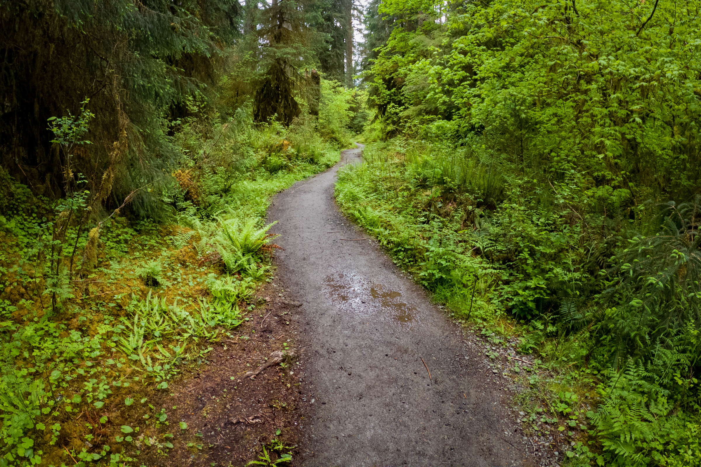
    Tangled tree roots and sword ferns beside the dirt path of the Marymere Falls trail in tall green forest near Lake Crescent
    Old growth forest on the Marymere Falls trail, the first part of the hike. NPS Photo / C. Bubar

    After the turnoff the trail climbs hard through damp forest. The WTA describes it easing a little higher up, where the woods grow drier, madronas appear and the first glimpses of Lake Crescent open through the trees. Expect steady switchbacks all the way.

    Mount Storm King trail numbers, by source

    Published figures differ a little depending on where each source measures from, so here they are side by side.

    SourceDistanceClimb
    NPS trailhead page2.2 miles from the Marymere Falls trail2,000 feet
    NPS trail page1.7 miles600 feet to 2,700 feet elevation
    NPS trail conditionsJunction to end of trail at mile 1.7Not given
    WTA4.0 miles round trip2,065 feet gain

    The park’s own trail page rates the hike difficult, describes the elevation trend as steep, and lists views of Lake Crescent and nearby peaks as its unique feature. It also warns that snow may cover the higher reaches in any season, so know how to navigate without a trail for guidance.

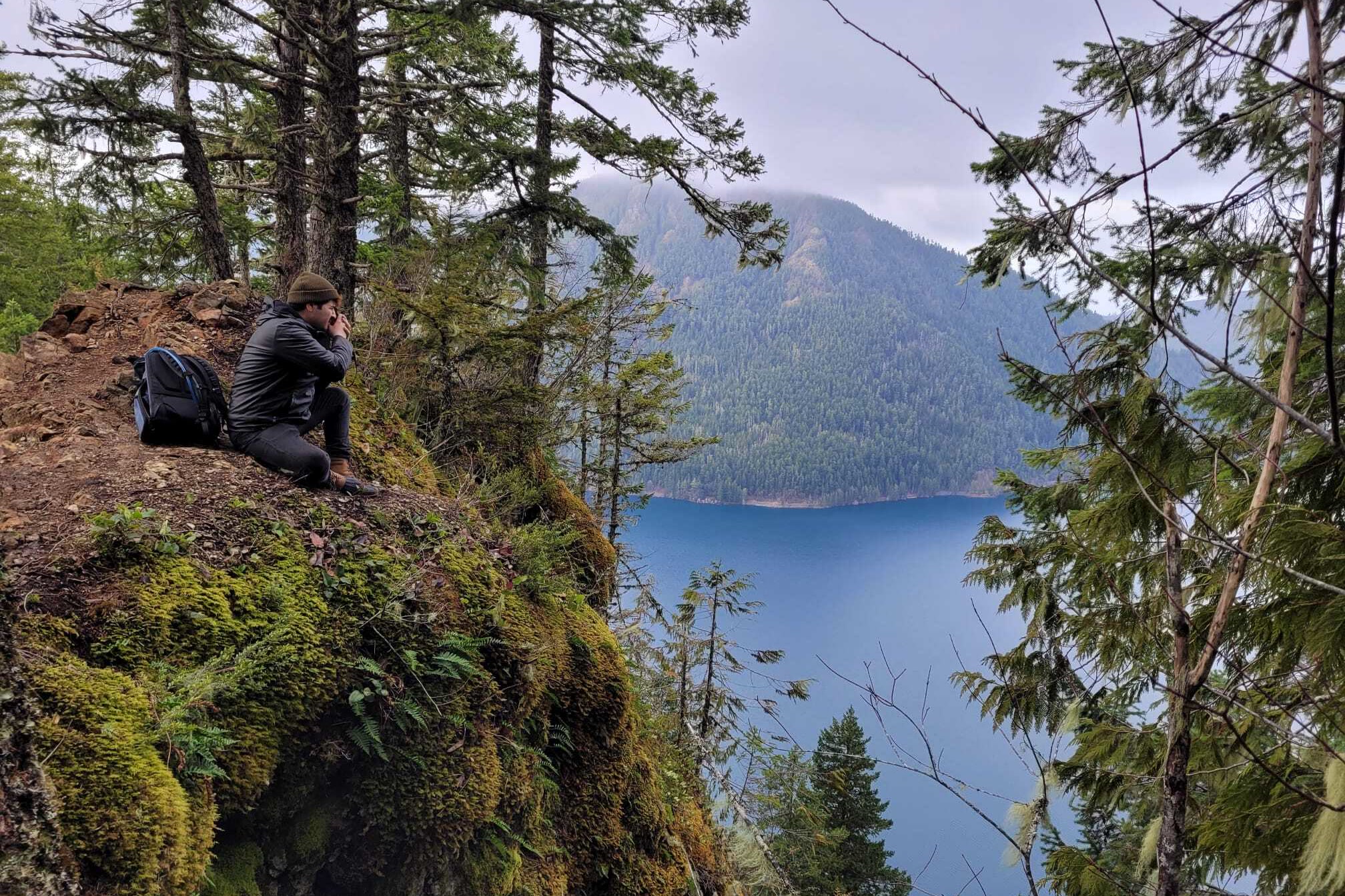
    A hiker sitting on a mossy rock outcrop on Mount Storm King, photographing Lake Crescent far below between forested slopes
    A viewpoint on Mount Storm King above Lake Crescent. NPS Photo

    The End of Maintained Trail sign and the ropes

    This is the part of Mount Storm King that every visitor should know about. The NPS trail conditions page (entry last updated June 4, 2026) tells hikers to note the “End of Maintained Trail” sign. In the park’s words, “Beyond this is exposed & steep with loose rock.”

    The same entry speaks directly about the ropes. “Visitors sometimes put up ropes in this location,” the park says, and “these are not installed or maintained by the NPS and may be unsafe.” The park also notes that this is a day use trail and camping along the route is prohibited.

    • The maintained trail ends at the signed point; the park does not maintain the ground beyond it.
    • Ropes there are put up by visitors, not by the park, and the park warns they may be unsafe.
    • The WTA likewise calls the upper section an unmaintained, exposed climber’s trail and says to know your skill level.

    The viewpoints below the sign already give wide views over Lake Crescent, and the sign is a fine place to turn around. Conditions change, so read the current trail conditions page before you go.

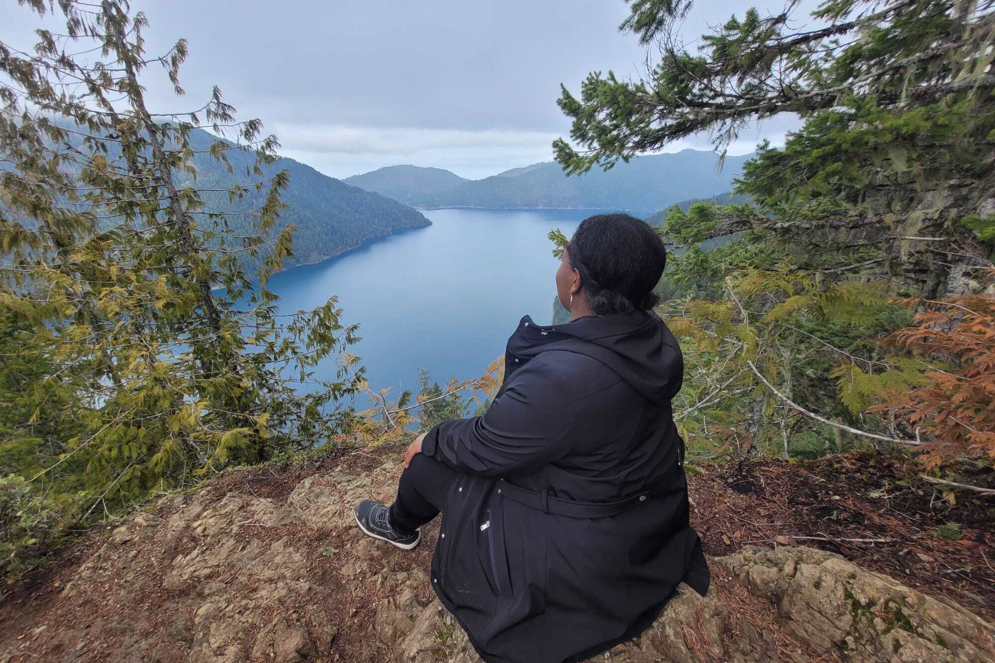
    A hiker in a dark jacket sitting on bare rocky ground on Mount Storm King, looking out over the long blue sweep of Lake Crescent
    Looking west along Lake Crescent from Mount Storm King in February. NPS Photo

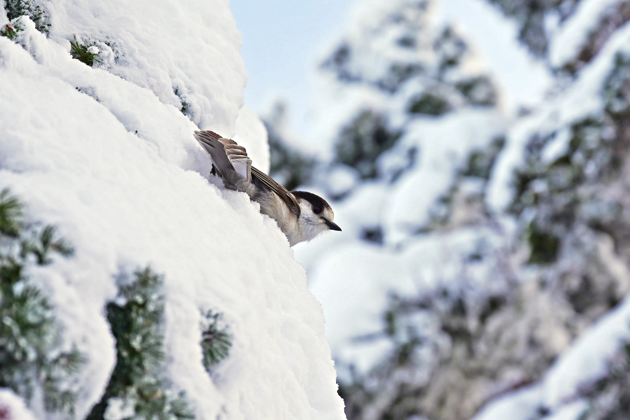
    Don’t feed the Canada jays

    The park has a specific request for Mount Storm King: don’t feed the Canada jays. Its trailhead page explains that some visitors have fed birds here, and birds that grow used to handouts can forget how to be wild and even turn aggressive. Feeding wildlife breaks park rules and can bring a fine.

    A grey and white Canada jay perched among snow covered conifer branches at Hurricane Ridge in Olympic National Park
    A Canada jay, photographed at Hurricane Ridge rather than Mount Storm King. Photo: stevehfung / Wikimedia Commons (CC BY-SA 2.0)

    Our guide to birding in Olympic National Park has more on watching these bold, curious birds without changing how they behave.

    Planning your Mount Storm King hike

    It ranks among the toughest short Lake Crescent hikes, so give it time and plan with the season in mind. These points come from the park and the WTA.

    • Season: the park lists May through October as best, and snow may linger high up in any season.
    • Pass: the WTA lists a park entrance pass; our Olympic National Park entrance fees guide explains the options.
    • Dogs: the WTA lists dogs as not allowed; see dogs in Olympic National Park for places that welcome them.
    • Stock: the park prohibits stock on this trail.

    The WTA Mount Storm King hike guide has recent trip reports from other hikers. On the way down, you can turn at the Marymere junction and add the short walk to the falls before heading back to the ranger station.

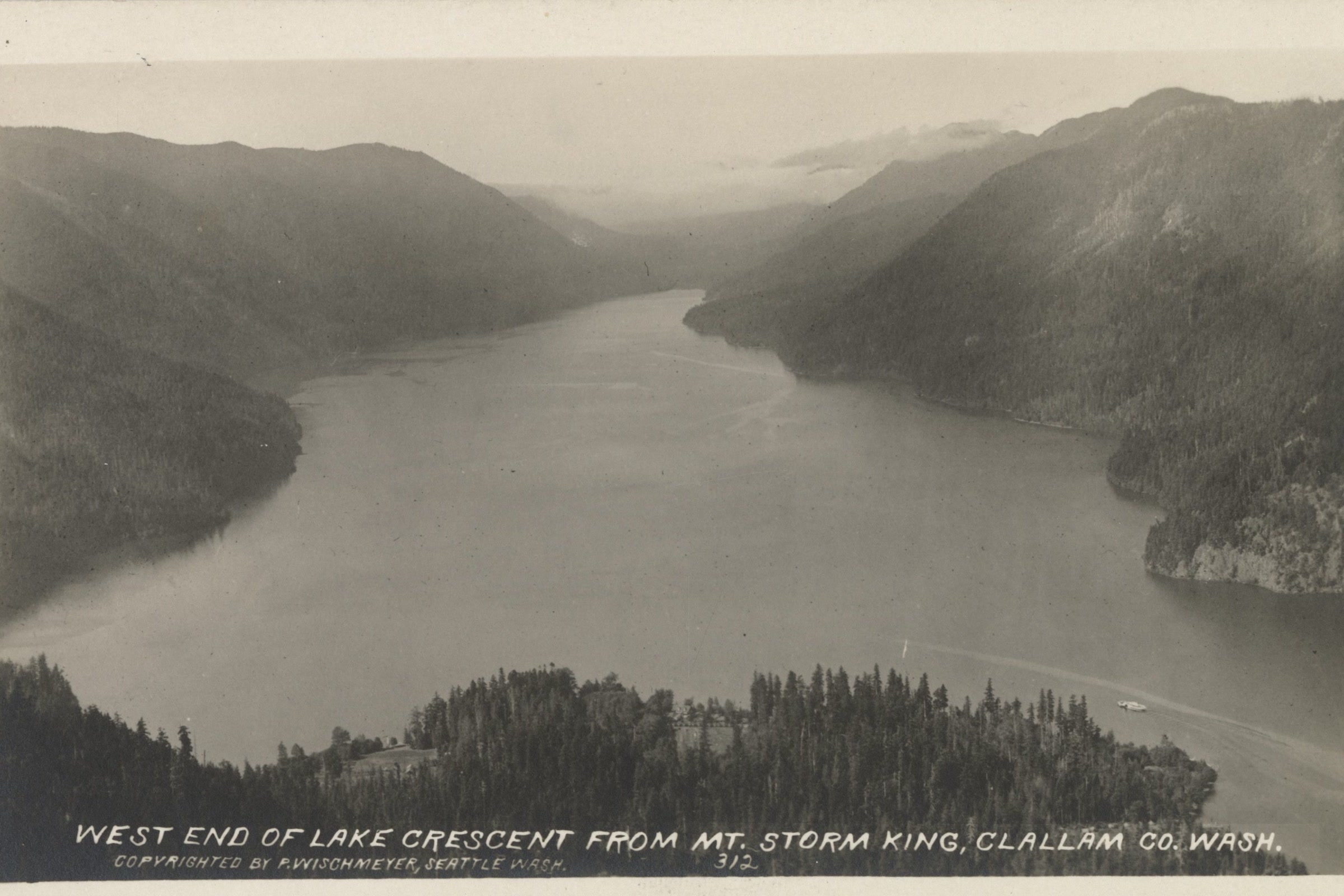
    Black and white postcard view from Mount Storm King down the length of Lake Crescent to its west end, between steep forested ridges
    The west end of Lake Crescent from Mount Storm King, about 1925. Photo: P. Wischmeyer / Wikimedia Commons (public domain)

    People have come up Mount Storm King for this view for a long time. A postcard from about 1925 already showed the lake stretching west between its forested ridges.

    How Friends of Olympic National Park helps

    We are Friends of Olympic National Park (FONP), a volunteer led friends group based in Port Angeles. Our volunteers look after the Heart O’ the Forest Trail through our adopt-a-trail crew, and our members help fund work like it. If trails like Mount Storm King matter to you, become a member and help us care for the park.
    Frequently asked questions

    How long is the Mount Storm King hike?

    The NPS trailhead page says the trail climbs 2,000 feet in 2.2 miles from the Marymere Falls trail. The park’s trail page lists 1.7 miles, and the WTA gives 4.0 miles round trip with 2,065 feet of gain.

    Are there ropes on Mount Storm King?

    Visitors sometimes put up ropes beyond the End of Maintained Trail sign. The park says these are not installed or maintained by the NPS and may be unsafe, and that the ground beyond the sign is exposed and steep with loose rock.

    Where does the Mount Storm King trail start?

    At Storm King Ranger Station on the south shore of Lake Crescent. You follow the Marymere Falls trail under Highway 101, then take the signed Mount Storm King branch uphill.

    Can you camp on Mount Storm King?

    No. The park lists it as a day use trail and says camping along the route is prohibited.

    When is the best time to hike Mount Storm King?

    The park lists May through October as the best season. Snow may cover the higher reaches in any season, so check the NPS trail conditions page before you go.

  • Hoh River Trail: A Hiking Guide to Glacier Meadows

    Hoh River Trail: A Hiking Guide to Glacier Meadows

    The Hoh River Trail starts at the Hoh Rain Forest Visitor Center and follows the river upstream toward Mount Olympus. For most of its length it is nearly flat, so it works as an easy day hike to Five Mile Island or a backpacking trip to Glacier Meadows. Here are the park’s own distances, camps and rules.

    Quick answer

    How long is the Hoh River Trail?

    The Hoh River Trail runs about 17.3 to 17.5 miles one way to Glacier Meadows, depending on the NPS page, and ends at the Blue Glacier moraine at 18.5 miles. Five Mile Island, at 5.0 miles, is the classic day hike. The first 13 miles are generally flat, then the trail climbs steeply.

    • Five Mile Island: 5.0 miles one way
    • Olympus Guard Station: 9.5 miles up the trail
    • Elevation from 600 feet to 4,300 feet at Glacier Meadows
    • Wilderness permit and bear canister for every overnight stay

    Getting to the trailhead

    The trailhead is about 20 miles southeast of Forks, at the end of the Upper Hoh Road, 18 miles in from Highway 101. Three trails begin just outside the visitor center. Our posts on temperate rainforests in Olympic National Park and accessible trails cover the two short loops, so this guide stays on the long one.

    As of October 2026, WSDOT is repairing the US 101 bridge over the Hoh River, with overnight closures from 7 pm to 5:30 am through October 19. The park says the Hoh Rain Forest stays reachable from Forks throughout. Check the WSDOT Hoh River Bridge project page before you drive.

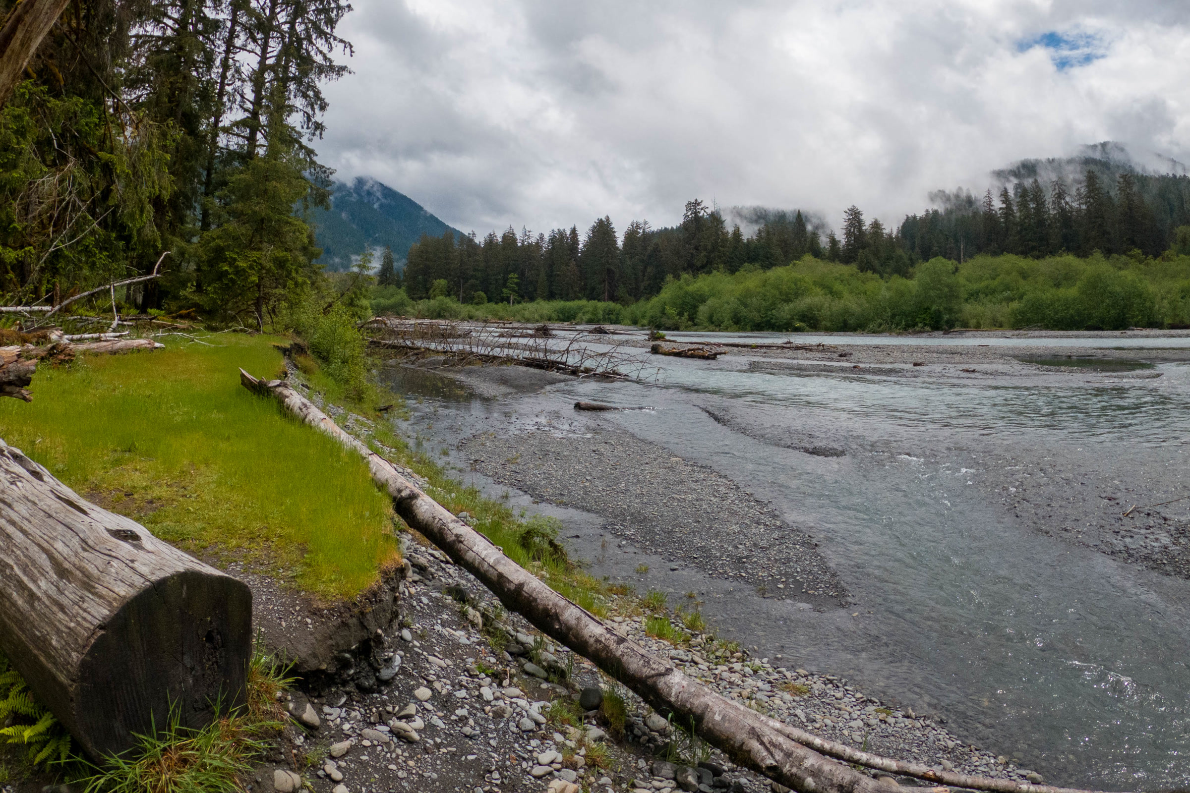
    The grey green Hoh River flowing past a gravel bank with driftwood logs, with forest and clouds beyond, inside Olympic National Park
    The Hoh River inside the park in June 2022. Photo: Sea Cow / Wikimedia Commons (CC BY-SA 4.0)

    Hoh River Trail distances

    The park’s pages don’t quite agree on the total. The trail page gives 17.4 miles to Glacier Meadows, the Hoh visitor page and brochure give 17.3, and the wilderness trail conditions table lists 17.5. The table below uses only NPS figures.

    Distances from the trailhead, one way

    PointMilesNPS source
    First River access0.9Visiting the Hoh
    Mineral Creek Falls2.7Visiting the Hoh
    Cedar Grove4.0Visiting the Hoh
    Five Mile Island5.0Visiting the Hoh
    Olympus Guard Station9.5Hoh River Trail page
    Lewis MeadowNot publishedListed as a camp past the guard station
    Glacier Meadows17.3 to 17.5Varies by page
    Blue Glacier moraine18.5Visiting the Hoh

    We found no NPS mileage for Lewis Meadow, so we haven’t guessed one. Trail guides and trip reports give figures between about 10 and 11 miles.

    Day hike to Five Mile Island

    Five Mile Island is the park’s suggested turnaround for a day hike, 10 miles round trip on a well kept, mostly level tread. Along the way it runs through temperate rain forest and past gravel bars on the river. Shorter turnarounds are First River access, Mineral Creek Falls and Cedar Grove.

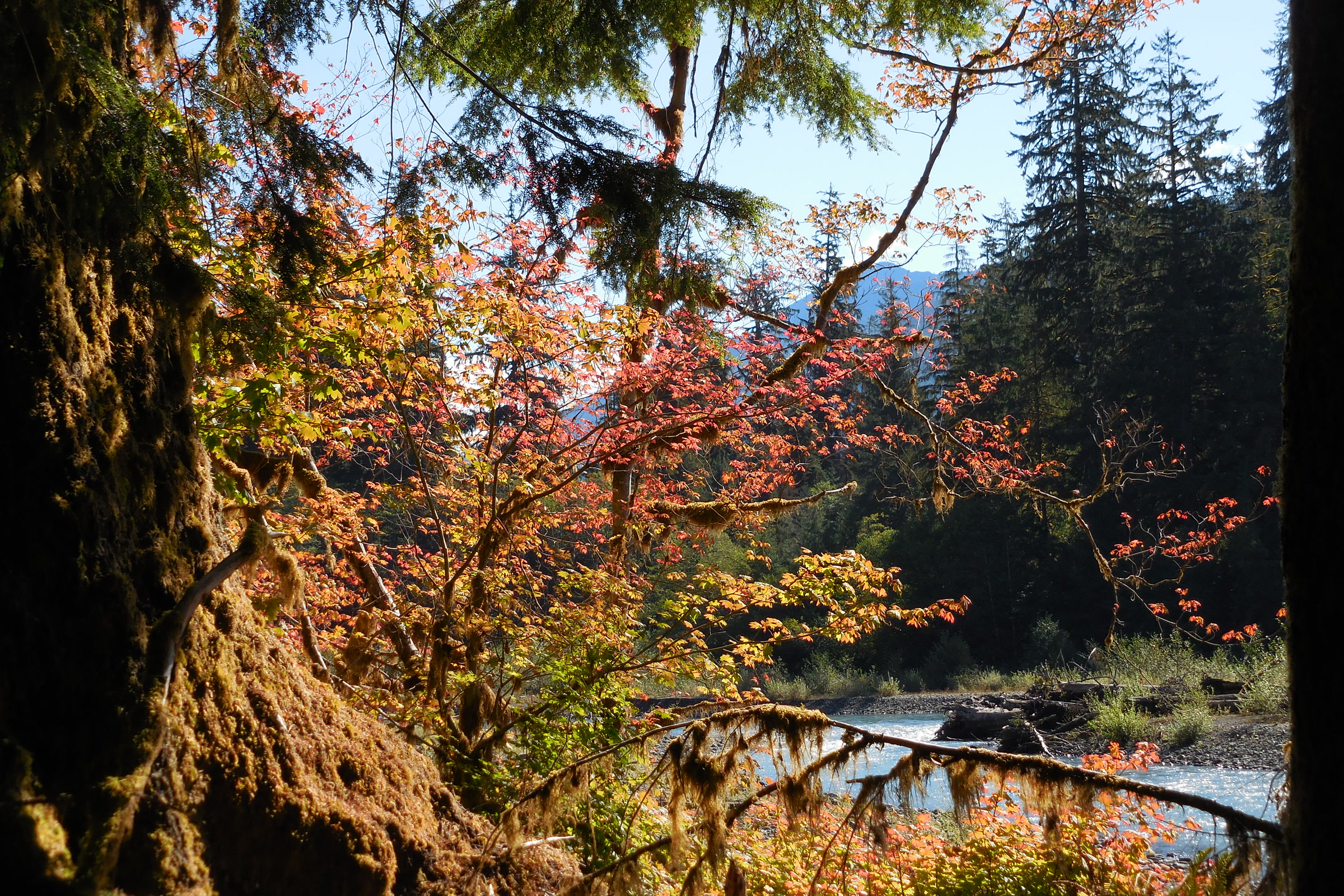
    Orange and red autumn leaves framed by a moss covered trunk, with the Hoh River and a gravel bar below
    Fall color along the Hoh River. NPS Photo / C. Bubar

    Pets are not allowed on any trail in the Hoh Rain Forest. Our post on dogs in Olympic National Park lists places where they are welcome.

    Backpacking to Glacier Meadows

    The park rates the trail easy to moderate, best from late June through September. It climbs from 600 feet to 4,300 feet at Glacier Meadows, and the brochure puts the total gain at 3,700 feet. The steep part comes after about 13 miles.

    Camps along the trail

    CampSitesPit toilet
    Tom Creek3 individual, 1 groupNo
    Five Mile Island3 individual, 2 group, 1 stockYes
    Happy Four2 individualNo
    Olympus Guard Station7 individual, 2 groupYes
    Lewis Meadow2 individual, 1 group, 1 stockYes
    Elk Lake7 individual, 1 group, 1 stockYes
    Glacier Meadows11 individual, 1 groupYes

    The park also says gravel bars on the river make good, low impact campsites. Groups of more than six must use the group camps, and stock parties must use the stock sites.

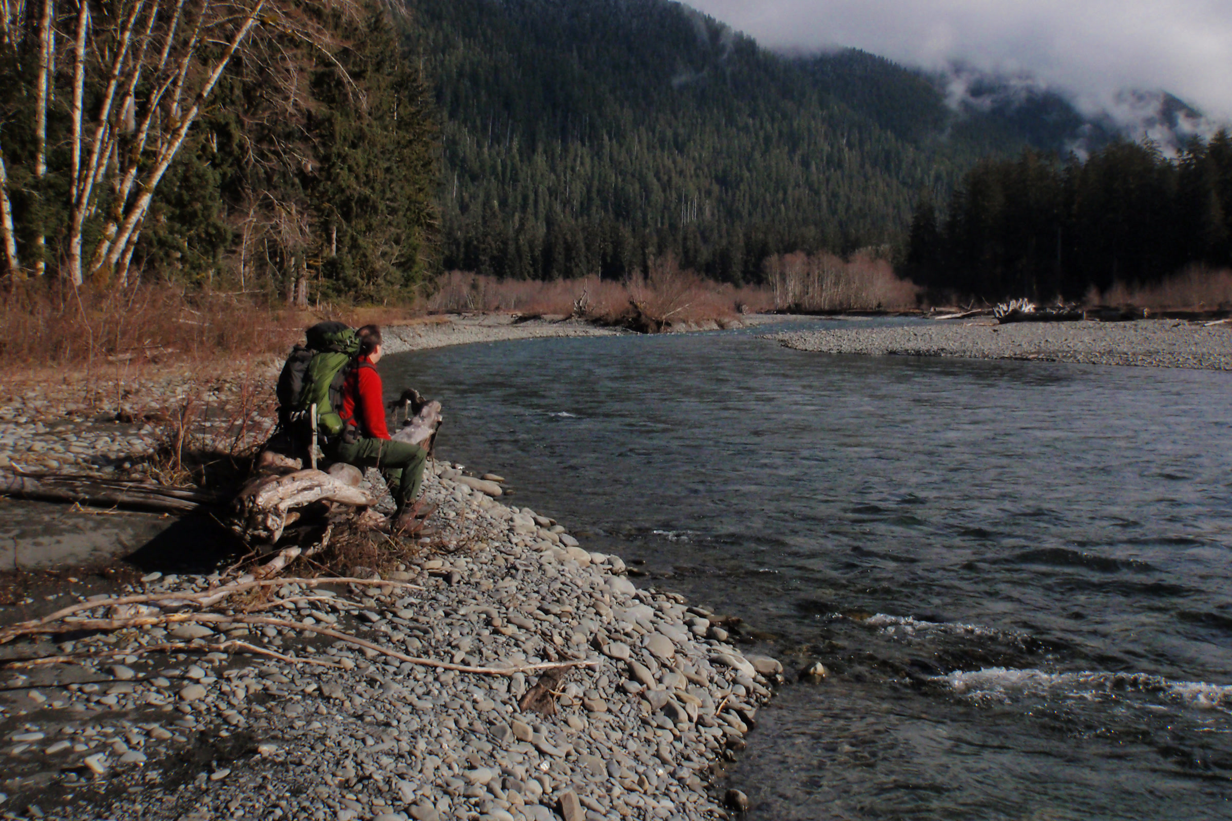
    Two backpackers resting on a driftwood log on a gravel bar beside the Hoh River, with forested hills and low clouds behind
    Backpackers taking a break beside the Hoh River. NPS Photo

    Olympus Guard Station and beyond

    The historic Olympus Guard Station is a wooden ranger station 9.5 miles up the trail. Just past it, the park says, the Hoh Lake Trail branches off and climbs to Bogachiel Peak, a link to the routes in our Seven Lakes Basin and High Divide guide.

    About 0.25 miles before Glacier Meadows, a washed out section crosses an avalanche chute, and hikers climb down a steep, loose slope on a rope ladder. In its June 2026 update the park reported three broken rungs and one missing. Climbing Mount Olympus itself is only for experienced mountaineers with glacier travel and crevasse rescue skills.

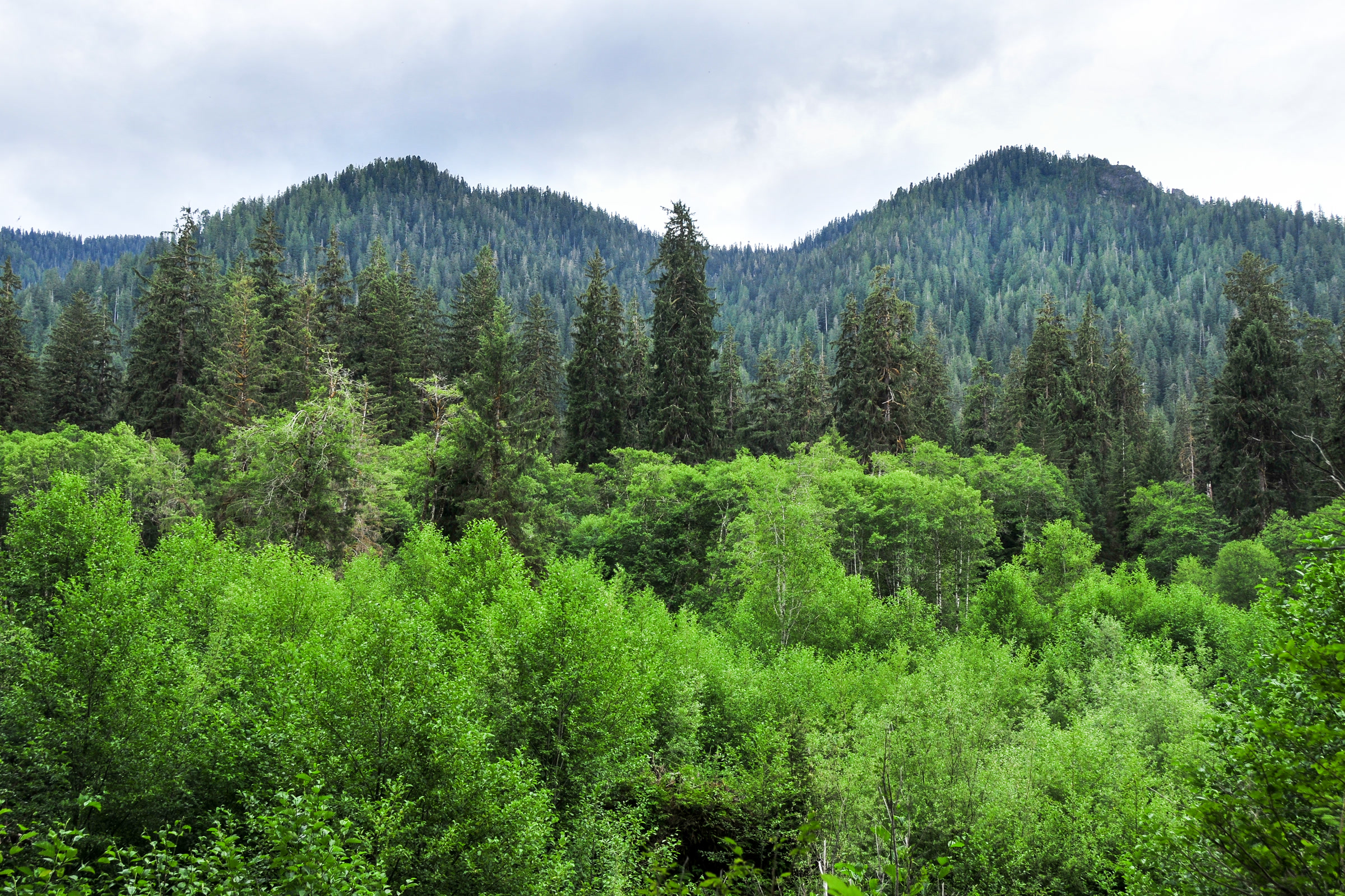
    Layers of alder, conifers and forested hillside rising beyond the Hoh River
    Forest layers across the Hoh River. Photo: John Leszczynski / Wikimedia Commons (CC BY-SA 2.0)

    Permits, fords and other rules

    Every overnight trip needs a wilderness permit, with campsites reserved on Recreation.gov, and all food, trash and scented items must go in a bear canister. The park lists Martin Creek, Elk Lake and Glacier Meadows as quota areas, so reserve early. Our Olympic National Park wilderness permits guide explains how to book.

    • Two streams just before the Olympus Guard Station camps must be forded. The park says they can become impassable in moderate to heavy rain, especially in fall, winter and spring.
    • Campfires are not allowed at or above Elk Lake. Lower down, use dead and down wood only.
    • Boil, filter or chemically treat all water to prevent Giardia.
    • Away from pit toilets, bury waste 6 to 8 inches deep and 200 feet from water and camps.
    • Stock can’t camp above Martin Creek, and the trail is closed to stock beyond it except llamas.

    Early in the season, steep snow slopes may call for an ice axe and map and compass skills. In winter the park does not recommend travel above Elk Lake because of avalanche chutes. Check the NPS Hoh River Trail page and the wilderness trail conditions before you go.

    Young conifers heavy with snow beside a snowy road in the Hoh valley, below a snow dusted forested ridge
    The Hoh valley under snow in January 2011. NPS Photo

    Elk and bears on the Hoh River Trail

    The park says visitors here often spot Roosevelt elk, black bears and river otters. Its Hoh brochure estimates that 400 to 500 of the park’s 3,000 to 4,000 elk live in the Hoh Valley. Stay at least 50 yards from wildlife and never approach elk.

    Our guides to Roosevelt elk in Olympic National Park and black bears in Olympic National Park explain what to do if you meet one on the trail.

    Two old logs topped with grass and moss reflected in a still, green backwater along the Hoh River
    Grassy logs in a quiet backwater of the Hoh River, July 2014. NPS Photo / C. Bubar

    How Friends of Olympic National Park helps

    We are Friends of Olympic National Park (FONP), a volunteer led friends group based in Port Angeles. Our adopt-a-trail crew looks after the Heart O’ the Forest Trail, and our volunteers help with cleanups and guided walks around the park. If long river trails like the Hoh are why you love this place, see our volunteer opportunities.
    Frequently asked questions

    How long is the hike to Five Mile Island?

    The park gives 5.0 miles one way from the Hoh Rain Forest Visitor Center, so about 10 miles round trip on a mostly level trail.

    How far is Glacier Meadows on the Hoh River Trail?

    NPS pages give 17.3 to 17.5 miles one way. The trail ends at the Blue Glacier moraine, which the park puts at 18.5 miles.

    Do you need a permit for the Hoh River Trail?

    Not for a day hike, but every overnight stay needs a wilderness permit, with campsites reserved on Recreation.gov, and a bear canister. Martin Creek, Elk Lake and Glacier Meadows are quota areas.

    How far is the Olympus Guard Station?

    The park describes the historic Olympus Guard Station as 9.5 miles up the Hoh River Trail. It has 7 individual and 2 group campsites and a pit toilet.

    Can you bring a dog on the Hoh River Trail?

    No. Pets are not allowed on any trail in the Hoh Rain Forest.

  • Staircase in Olympic National Park: A Visitor’s Guide

    Staircase in Olympic National Park: A Visitor’s Guide

    Staircase is the southeast corner of Olympic National Park, a forested valley on the North Fork Skokomish River above Lake Cushman. It has a ranger station, a riverside campground and one of the park’s best short walks, the Staircase Rapids Loop. In 2025 the Bear Gulch Fire closed it for a year. Here is what is open now and how to plan a visit.

    Quick answer

    Is Staircase in Olympic National Park open?

    Yes, partly. Staircase and its access road reopened on July 8, 2026, after a year closed by the Bear Gulch Fire. As of October 2026 the campground, ranger station and Staircase Rapids Loop are open, but the wilderness trails beyond the developed area remain closed. Check the NPS fire page before you go.

    • 16 miles from Highway 101 at Hoodsport, part paved, part gravel
    • Staircase Rapids Loop: about 2 miles, 200 feet of gain
    • 49 site campground beside the river
    • Shady Lane, Four Stream and Flapjack Lakes trails still closed

    Where Staircase is and how to get there

    The park describes Staircase as about an hour’s drive from Olympia and two hours south of Port Angeles. From Highway 101 at Hoodsport, the road climbs past Lake Cushman for 16 miles, partly paved and partly gravel. Inside the Olympic National Forest it is road FS-24.

    The unpaved stretch closes from time to time for weather such as snow, and Recreation.gov notes that it is often closed completely from November to May. If you are driving the whole peninsula, our Olympic Peninsula loop road trip puts Staircase on the long Hood Canal leg.

    Lake Cushman stretching between forested ridges far below, seen from subalpine trees on Mount Ellinor in Olympic National Forest
    Lake Cushman from Mount Ellinor, just outside the park, in 2009. Photo: Gregg M. Erickson / Wikimedia Commons (CC BY 3.0)

    The Bear Gulch Fire and the 2026 reopening

    The human caused Bear Gulch Fire started on July 6, 2025, on Mt. Rose above Lake Cushman, in Olympic National Forest. In late July it moved into the park, crossed the North Fork Skokomish River and spread into the wilderness. The park calls it the largest wildland fire on the Olympic Peninsula since 1951, and it was fully contained on November 12, 2025.

    The Staircase developed area and FS-24 reopened on July 8, 2026. Crews spent the summer on trail stabilization, erosion control, culvert repairs and vegetation work, and the park warns that closures may change as recovery continues.

    The wooden Olympic National Park entrance sign at Staircase on a log and stone base, below a hillside of fallen, charred trees and new green plants
    The Staircase entrance in July 2026, a year after the fire began. NPS Photo / E. Goode

    What is open and closed at Staircase, as of October 2026

    PlaceStatus
    Access road FS-24Open since July 8, 2026
    Campground and ranger stationOpen
    Staircase Rapids LoopOpen
    Shady Lane TrailClosed
    North Fork Skokomish Trail beyond the Rapids LoopClosed to Home Sweet Home
    Four Stream, Wagonwheel Lake, Flapjack Lakes, Black and White LakesClosed
    Six Ridge Primitive TrailClosed from Belview Camp to the North Fork

    Wilderness camps along those trails are closed too, from Beaver Flats and Camp Pleasant to Flapjack Lakes and Wagonwheel Lake. The NPS fire conditions page keeps the full list, so check it before you go.

    Walking the Staircase Rapids Loop

    The Staircase Rapids Loop is the walk most visitors come for. The park describes an easy 2 mile loop with about 200 feet of elevation gain, through old growth forest to a bridge over the North Fork Skokomish. The park’s trail conditions table lists it at 2.1 miles and marked it reopened in September 2026.

    The plank deck, metal railings and cables of the Staircase Rapids suspension bridge leading toward a forest of green and scorched conifers
    Staircase Rapids Bridge in July 2026. NPS Photo / E. Goode

    A short spur off the loop leads to the Big Cedar, a fallen western redcedar about 14 feet across. The spur starts just over the Skokomish River bridge from the parking area and runs 0.2 miles on compacted gravel, mostly under 5% grade. Our guide to accessible trails in Olympic National Park has the full measurements.

    Seeing the fire up close

    Walking the loop now, you pass through a mosaic. Some stretches are still green with ferns and maples, while others are black trunks and orange needles, with new plants coming up underneath.

    A Staircase trail where lush ferns and maples give way to trees with dead needles and burn marks at their bases, a mosaic left by the Bear Gulch Fire
    Green forest gives way to burned trees along a Staircase trail. NPS Photo / E. Goode

    The park lists real hazards in burned forest: trees and branches that fall without warning, even on calm days, loose rocks, stump holes, landslides and debris flows. Stay on open trails, leave at once if you hear cracking trees or moving rocks, and avoid burned areas in wind or heavy rain.

    Burned ground is also easy for invasive plants to take over, so the park asks you to clean your boots and gear before you hike. Our post on invasive plants on the Olympic Peninsula explains why that matters.

    Pink spires of fireweed and leafy green plants in front of a large burned log and a burned forest at Staircase
    Fireweed, which often thrives in disturbed ground, at Staircase in July 2026. NPS Photo / E. Goode

    The ranger station and campground

    The Staircase Ranger Station sits at the parking area. The park’s Staircase brochure says it is open in summer when staffing allows, with information, exhibits, wilderness permits, bear canisters, maps and a wheelchair to borrow. A stock corral, an accessible restroom and a picnic area are nearby.

    The campground has 49 sites, many along the river, with picnic tables, fire rings, potable water and animal proof food lockers. From mid fall to May there are only pit toilets, with no water or trash service. Recreation.gov warns that most sites can’t fit large RVs or trailers.

    Book through the Staircase Campground page on Recreation.gov, which also lists the stay limits and food storage rules. Our Olympic National Park campgrounds guide compares Staircase with the park’s other campgrounds.

    Why it is called Staircase

    In 1890, Lt. Joseph O’Neil’s expedition crew built a cedar staircase over the rock bluff across the river from today’s campground. The park says it was the only way over the bluff until the Shady Lane Trail was built in 1911. The staircase is long gone, but the name stayed.

    A wide, rocky stretch of the North Fork Skokomish River lined with green leaves and scorched trunks with orange needles, July 2026
    The North Fork Skokomish River at Staircase. NPS Photo / E. Goode

    Before you go

    • Pets and bicycles are not allowed on park trails. Leashed pets are allowed in the campground; see our post on dogs in Olympic National Park.
    • You need a valid park entrance pass to camp, and a wilderness permit for any overnight hike once trails reopen.
    • Drive slowly, especially in wet or windy weather, and carry extra food and water in case fallen trees or rocks block the road.
    • Store food and scented items in a vehicle or animal resistant locker.

    How Friends of Olympic National Park helps

    We are Friends of Olympic National Park (FONP), a volunteer led friends group based in Port Angeles. The park’s own crews are doing the work at Staircase. Our volunteers pitch in elsewhere, from our adopt-a-trail crew on the Heart O’ the Forest Trail to invasive plant pulls. If places like Staircase matter to you, see our volunteer opportunities.

    Frequently asked questions

    Is Staircase open after the Bear Gulch Fire?

    Partly. The developed area and road FS-24 reopened on July 8, 2026. As of October 2026 the campground, ranger station and Staircase Rapids Loop are open, while the wilderness trails beyond them stay closed. Check the NPS fire conditions page before you go.

    How long is the Staircase Rapids Loop?

    The park describes it as an easy 2 mile loop with about 200 feet of elevation gain, and its trail conditions table lists 2.1 miles. A 0.2 mile spur leads to the fallen Big Cedar.

    How far is Staircase from Hoodsport?

    The road runs 16 miles from Highway 101 at Hoodsport, past Lake Cushman, and is part paved and part gravel. The park puts Staircase about an hour from Olympia and two hours south of Port Angeles.

    Can you camp at Staircase?

    Yes. Staircase Campground has 49 sites and takes reservations on Recreation.gov. Most sites cannot fit large RVs or trailers, and from mid fall to May there is no water or trash service.

    Are dogs allowed at Staircase?

    Leashed pets are allowed in the campground, but pets are not allowed on park trails, including the Staircase Rapids Loop.