

The Ozette Triangle is a roughly nine-mile loop on the wild northern coast of Olympic National Park, starting at Lake Ozette. Two boardwalk trails run through coastal forest to Cape Alava and Sand Point, and a beach walk between them closes the loop. Here is how the route fits together, what to plan for, and the history that deserves our respect along the way.
Quick answer
How long is the Ozette Triangle loop?
The Ozette Triangle is about 9 miles. The NPS lists 3.1 miles on the Cape Alava Trail, 3.1 miles of beach and 2.8 miles on the Sand Point Trail, starting from the Ozette Ranger Station. The trails are mostly boardwalk, but the beach leg depends on tides, so carry a tide chart.
- About 9 miles, from sea level to about 100 feet
- Boardwalks are very slippery when wet or frosty
- Overnight camping needs a wilderness permit, limited year-round
- Bear canisters required; none at Ozette Ranger Station
What is the Ozette Triangle?
The name comes from the shape of the route. From the trailhead at the Ozette Ranger Station, one trail leads to Cape Alava and another leads to Sand Point. The beach between the two capes is the third side.
The park’s Ozette Loop page rates the hike as easy, gives the distance as 9.2 miles and calls April through October the best season. It runs from sea level to about 100 feet, with no river crossings. Hiking groups give slightly different totals, so plan on nine to ten miles.

The three legs of the loop compared
| Leg | Distance (NPS) | What you walk on |
|---|---|---|
| Cape Alava Trail | 3.1 miles | Trail, boardwalk and stairs through prairie and coastal forest |
| Beach between the capes | 3.1 miles | Sand and rocky shore, timed with the tides |
| Sand Point Trail | 2.8 miles | Mostly boardwalk through coastal forest |
The Cape Alava trail
Washington Trails Association describes the start well: cross the Ozette River on an arched bridge, then reach a junction about a quarter mile in. The right fork is the Cape Alava trail, and the left fork leads to Sand Point. Many hikers go out one way and come back the other.
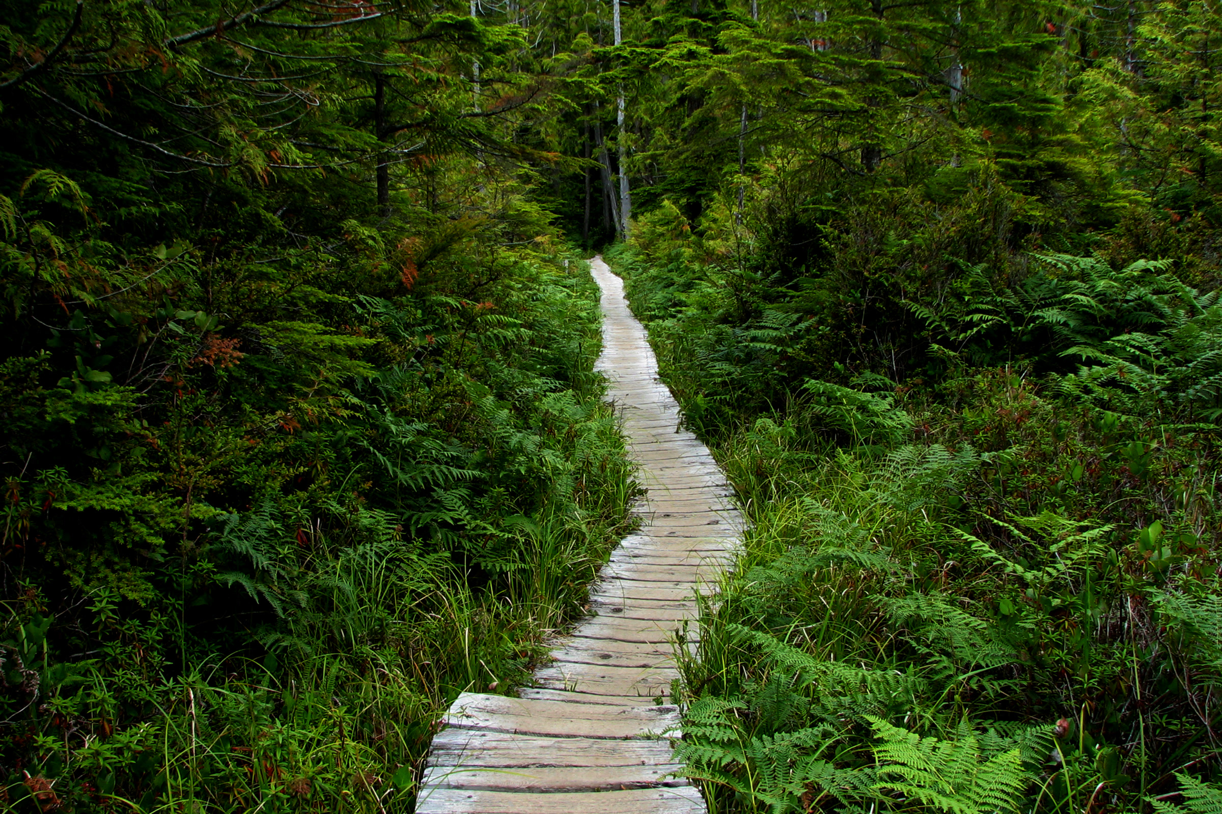
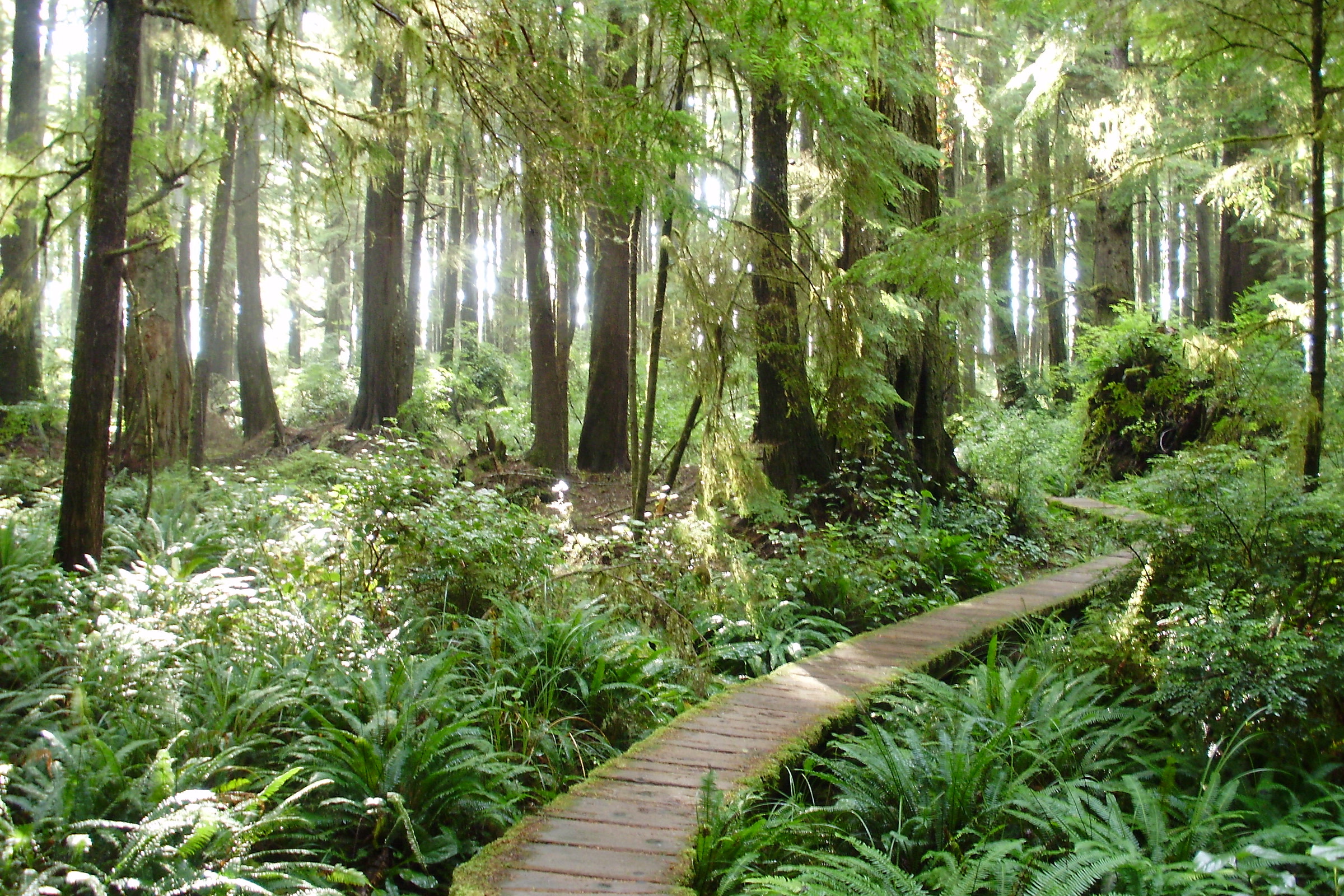
Much of the way follows a cedar boardwalk through coastal forest. The NPS warns that the boardwalks are very slippery when wet or frosty, so take your time.
Partway along, the trail crosses an open, soggy meadow known as Ahlstrom’s Prairie. The park’s Lake Ozette brochure calls it the prairie where Lars Ahlstrom pastured his livestock. As many as 130 homestead families lived around Lake Ozette in the early 1890s, and most left after the area became part of the Olympic Forest Reserve in 1897.
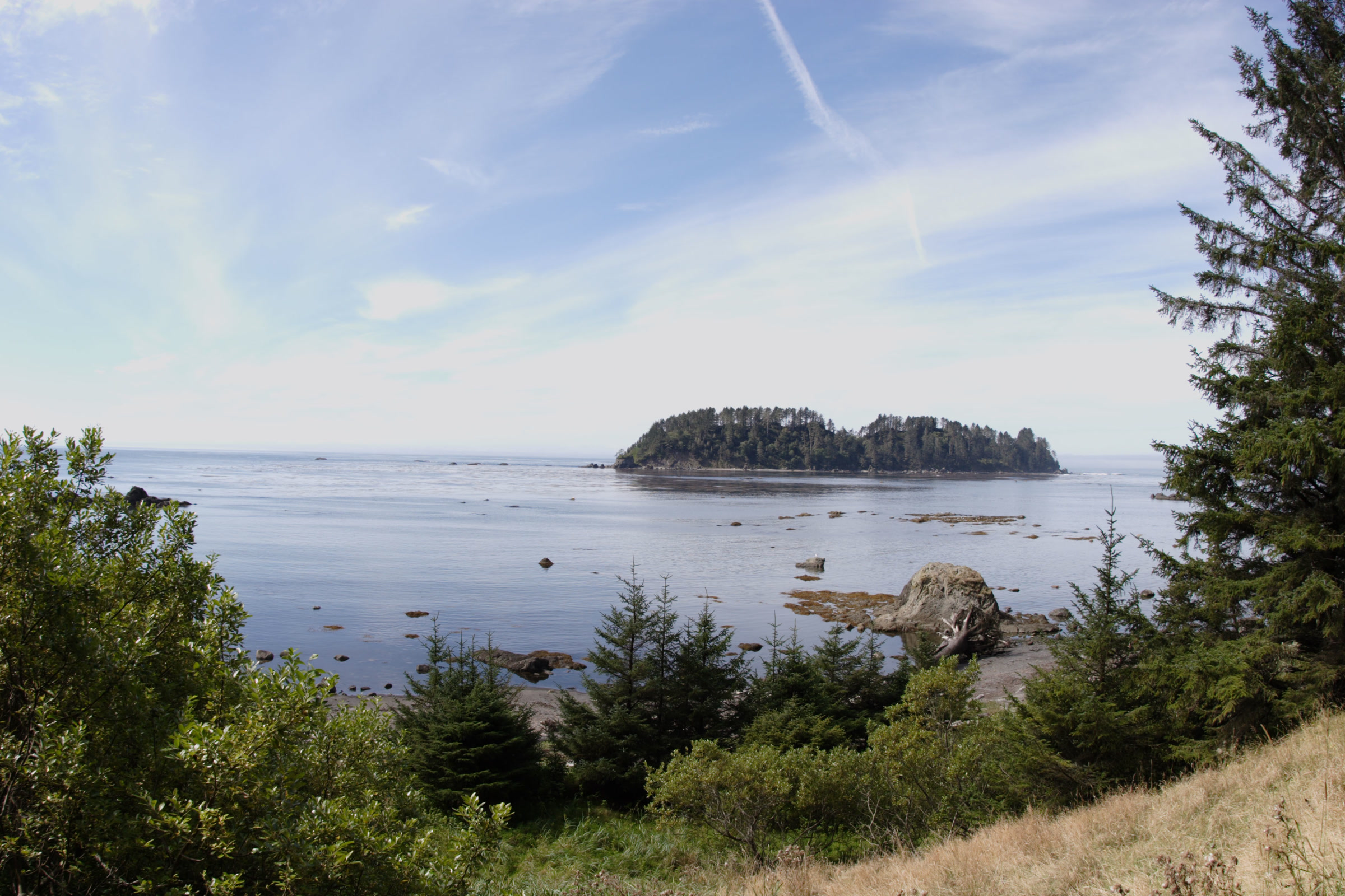
Cape Alava, Wedding Rocks and the Makah village of Ozette
Cape Alava lies within the traditional territory of the Makah people. Offshore sits Cannonball Island (Tskawahyah Island), which the park notes is part of the Ozette Indian Reservation and always closed to the public.
The village of Ozette stood near here, close to the migration routes of whales, fur seals and other sea mammals. The NPS says bone, shell and stone artifacts tell of a sea-mammal hunting culture going back at least 2,000 years. Makah oral history also told of a great slide that buried part of the village long ago.
According to the Makah Cultural and Research Center, a winter storm in 1969 to 1970 made the bank slump and exposed wooden artifacts. A hiker told the Makah Tribe, which called in Washington State University. The 11-year excavation recovered more than 55,000 artifacts, which the Tribe kept on its reservation.
Those artifacts are cared for at the Makah Museum in Neah Bay, not on the beach. Check the museum’s current opening status before you plan a visit. Between the capes you will also pass Wedding Rocks, where Makah petroglyphs are carved into the stone. They are protected by federal law, so look without touching, tracing or chalking.
The Sand Point trail and the beach leg
The Sand Point trail is 2.8 miles of mostly boardwalk ending at a wide, sandy beach. It also makes a pleasant out-and-back walk on its own.
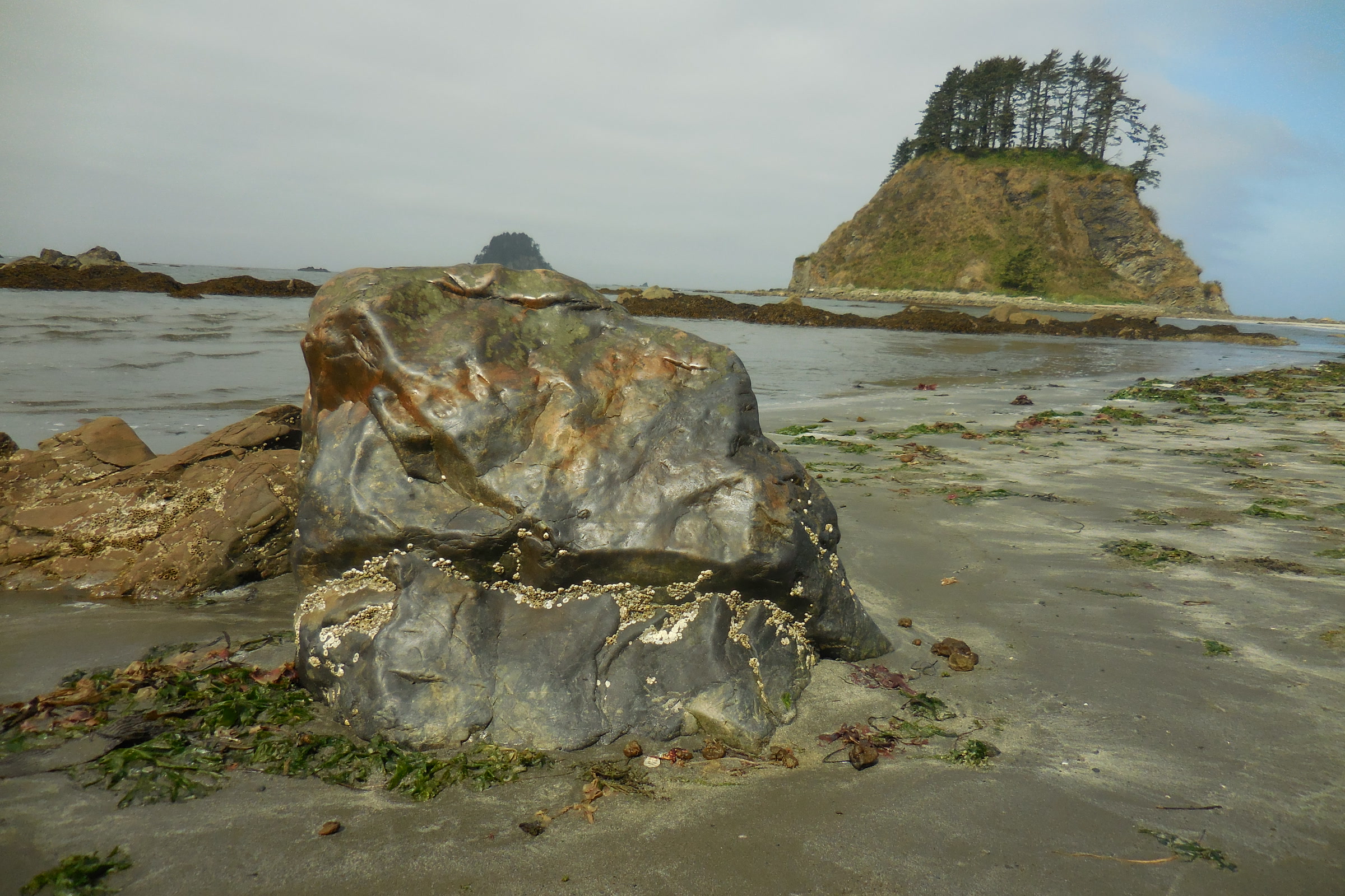
Hikers often find the beach the slowest part of the Ozette loop hike. It mixes sand with rocky stretches, and WTA notes that you cannot hike south at high tide. Plan your beach crossing with a tide chart, whichever way you walk.
- Carry a map and a tide chart, as the park advises.
- Some headlands can only be passed at lower tides; use the overland trails when the water is up.
- Pets, weapons and wheeled devices are not allowed on coastal beaches and trails.
Our Leave No Trace guide to Olympic coast beaches covers tide safety and beach etiquette in more depth. Tide pool fans can also read our guide to Olympic National Park tide pools.

Camping on the Ozette Triangle
Sand Point and Cape Alava are the main overnight spots, and both have pit toilets and creeks. Every overnight stay needs a wilderness permit. As of October 2026 the park limits camping permits on the Ozette coast, from Yellow Banks to Point of the Arches, all year, and suggests booking early for trips from May to the end of September.
Our guide to Olympic National Park wilderness permits explains how to reserve. A few Ozette rules are worth knowing before you pack:
- Food: store all food, garbage and scented items in a park-approved bear canister along the whole Wilderness Coast. Canisters are not available at the Ozette Ranger Station, and raccoons easily raid food hung in trees.
- Fires: campfires are banned from the headland north of Yellow Banks to the headland at Wedding Rocks, including Sand Point. Elsewhere, burn driftwood only.
- Water: creek water is often tea stained. Filter or boil it, and carry extra in late summer when some sources dry up.
- Groups: no more than 12 people, and camp above the high tide line.
Rules change, so check the NPS Ozette page and current trail conditions before you go. For an easier night, the park’s Ozette campground near the trailhead has 15 sites and is open all year, though winter flooding can close it.
How Friends of Olympic National Park helps
We are Friends of Olympic National Park (FONP), a volunteer-led friends group based in Port Angeles. Our beach cleanups in Olympic National Park remove litter and debris from the coast, and anyone who loves places like Cape Alava is welcome to join a crew. You can also become a member to stay in touch.
Frequently asked questions
How long is the Ozette Triangle?
About 9 miles. The NPS lists 3.1 miles on the Cape Alava Trail, 3.1 miles of beach and 2.8 miles on the Sand Point Trail. Its Ozette Loop page gives 9.2 miles in total.
Do I need a permit to hike the Ozette loop?
You need a wilderness permit for any overnight stay, and camping permits on the Ozette coast are limited all year, so book early for May to September trips.
Do I need a bear canister at Ozette?
Yes. All food, garbage and scented items must go in a park-approved bear canister along the whole Wilderness Coast. Canisters are not available at the Ozette Ranger Station, so bring or borrow one first.
Can I visit Cannonball Island at Cape Alava?
No. Cannonball Island, or Tskawahyah Island, is part of the Ozette Indian Reservation and is always closed to the public. Enjoy it from the beach.
Can I have a campfire at Sand Point?
No. Campfires are banned from the headland north of Yellow Banks to the headland at Wedding Rocks, including Sand Point. Where fires are allowed, burn driftwood only.
Want to give back to the coast you love? See our volunteer opportunities at Olympic National Park.
Leave a Reply