
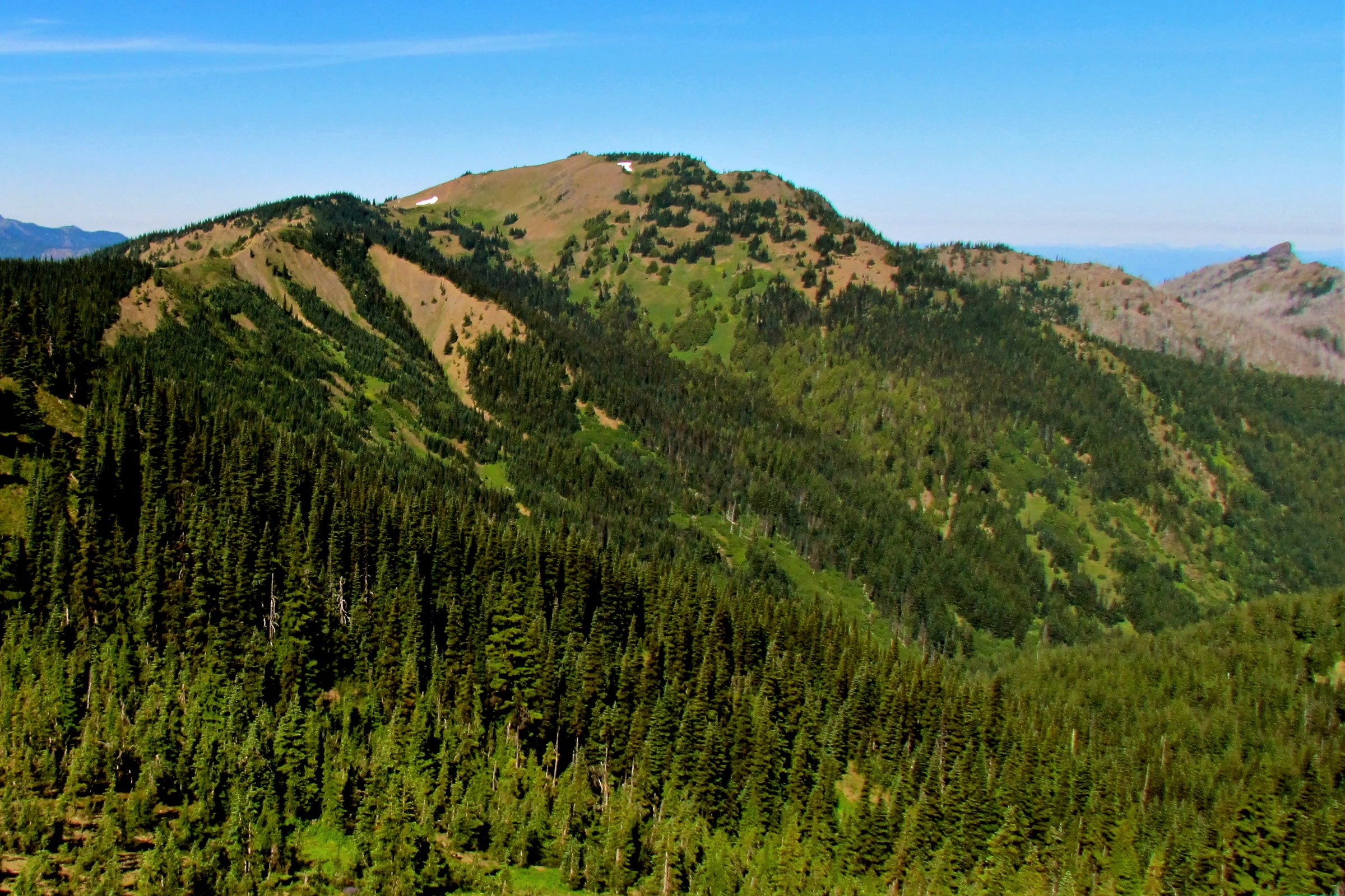
The Hurricane Hill Trail is the paved path that climbs from the end of Hurricane Hill Road, just beyond the Hurricane Ridge parking area, to the top of Hurricane Hill. It is 1.6 miles one way with about 700 feet of climbing, and on a clear day the summit looks over the Olympic Mountains, the Strait of Juan de Fuca and Vancouver Island.
Quick answer
How long is the Hurricane Hill Trail?
The Hurricane Hill Trail is 1.6 miles one way, about 3 miles round trip, and climbs roughly 700 feet on pavement to a summit with 360 degree views. The first half mile is nearly level; after that it gets steep, with many grades of 15 to 20 percent. Dogs are not allowed.
- Trailhead at the end of Hurricane Hill Road
- Paved surface about 8 feet wide
- Summit at 5,757 feet
- No drinking water on Hurricane Ridge as of October 2026
Hurricane Hill Trail at a glance
Figures come from the park’s Hurricane Hill trailhead page and brochure, with the summit height from the Washington Trails Association.
| Detail | Hurricane Hill Trail |
|---|---|
| Distance | 1.6 miles one way, about 3 miles round trip |
| Climb | About 700 feet |
| Summit | 5,757 feet |
| Surface | Asphalt, typically 8 feet wide |
| Steepest grades | Many sections of 15 to 20 percent |
| Pets and bikes | Not allowed on Hurricane Ridge trails |
Getting to the trailhead
Drive 17 miles up Hurricane Ridge Road from Port Angeles, passing the Heart O’ the Hills entrance station, where you pay or show your pass. Our guide to Olympic National Park entrance fees covers the options. At the top, continue past the main parking area onto Hurricane Hill Road, which runs about 1.5 miles to the trailhead and is not suitable for RVs or buses.
Van accessible parking sits right across from the trailhead, and overflow parking is at Picnic Area B. Hikers’ trip reports from summer 2026 put the nearest restrooms by the road about 0.3 mile before the trailhead, with none at the trailhead itself. On busy summer days the park meters cars at the entrance station, so see our best time to visit Olympic National Park guide for the quieter hours.
Road and facilities, as of October 2026
As of October 2026, the park’s conditions page lists Hurricane Ridge Road and Hurricane Hill Road open. A project to replace the aging water system means no drinking water on Hurricane Ridge, and road patching may cause short rolling closures. Fill your bottles in Port Angeles, and check the NPS conditions page or call 360-565-3131 before you go.
The Hurricane Hill hike, step by step
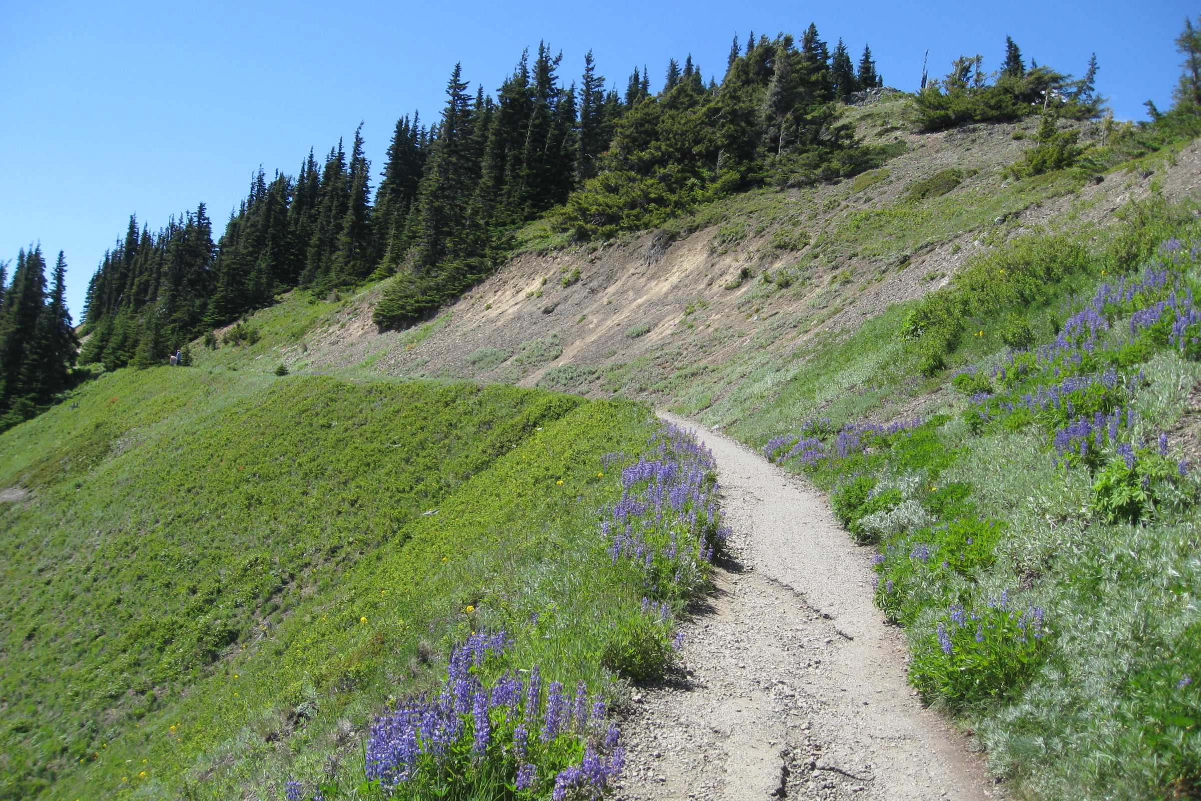
The Hurricane Hill hike starts gently. The park’s accessibility survey says the first 2,700 feet, about half a mile, gain only 10 feet overall. The path follows the south side of the hill with mountain views the whole way.
About 1,400 feet in, the trail curves around a steeply cut bank with a big drop on the outside edge. If heights bother you, keep to the inside. Around 2,450 to 2,700 feet, the park suggests turning back if you want an easy outing, because the trail gets strenuous from there.

The rest of the climb is the real work. Grades run from 10 to 18 percent in long stretches, with many short sections of 15 to 20 percent. The trail traverses the south-facing slope, then makes three generous switchbacks to the top. Trip reporters in July 2026 recommended poles and plenty of water, and took anywhere from 90 minutes to three hours round trip.
The pavement is fairly new: a rebuild that began in 2018 added retaining walls, drainage, benches and an 8 foot paved width, and brought the first 0.4 mile up to federal accessibility standards. Our guide to accessible trails in Olympic National Park compares this path with the easier Hurricane Ridge walks.
At the summit
The trail ends on the open top of Hurricane Hill. In clear weather the park describes a full 360 degree view. To the north you can pick out Griff Peak, the Strait of Juan de Fuca and Vancouver Island, with Port Angeles below and, sometimes, a ferry crossing the water.

Turn south and the Bailey Range fills the skyline, often streaked with snow well into summer, with Mount Olympus beyond. Interpretive signs at the top name the peaks and towns you can see. The Washington Trails Association’s Hurricane Hill hike page and its trip reports are a good way to check recent conditions.

Wildlife and wildflowers on the way
Summer meadows along the trail are famous for their flowers, and our Hurricane Ridge wildflower season guide explains how the bloom follows the melting snow. The hill is also home to the Olympic marmot, found nowhere else on Earth.
Hikers in summer 2026 also reported grouse, a hare, an elk and bears seen at a distance in the meadows. The park asks you not to feed wildlife, to keep a safe distance and to stay on the trail so the meadows can recover.
The Elwha trail: for strong hikers only
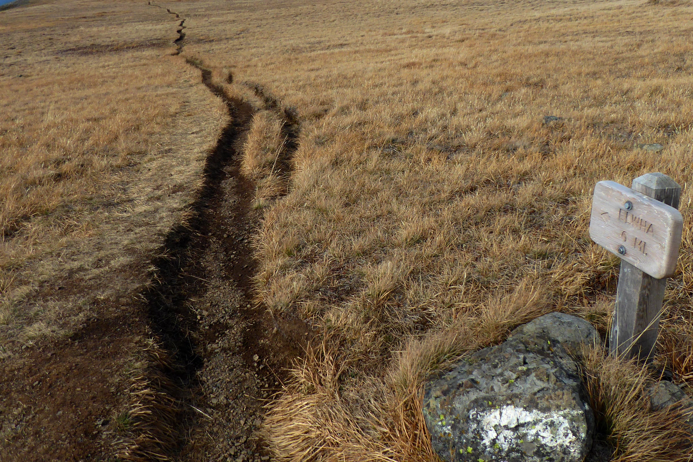
Just before the first switchback, a dirt trail signed for the Elwha branches off. The park’s brochure describes the Hurricane Hill/Elwha trail as 6 miles one way, dropping 5,250 feet to the start of Whiskey Bend Road in the Elwha Valley. The Washington Trails Association calls the out and back a steep, challenging 14 mile day.
If you are looking for other Hurricane Ridge hikes, the brochure lists the paved Big Meadow and Cirque Rim walks, the High Ridge loop and the longer Klahhane Ridge trail. Our guide to mountain goats in Olympic National Park covers the high country beyond.
When to go and what to bring
Hurricane Ridge earned its name: the park says winds gusting over 75 miles an hour buffet the ridge, and 30 to 35 feet of snow falls each year, often lasting into summer. The paved Hurricane Hill Trail is a summer and early fall walk for most people. In winter, Hurricane Hill Road is not plowed, and the snow route to the summit is rated most difficult; see our guide to Hurricane Ridge in winter.

- Water and snacks, because there is no drinking water or food service on the ridge.
- A windbreaker and a warm layer, since weather and wind can change quickly up top.
- Sun protection, as most of the trail is open to the sky.
Our what to pack for Olympic National Park list goes into more detail on layers and rain gear.
How Friends of Olympic National Park helps
We are Friends of Olympic National Park (FONP), a volunteer led friends group based in Port Angeles. Our volunteers lead guided wildflower walks and look after the Heart O’ the Forest Trail through our adopt-a-trail crew. If you love trails like this one, browse our volunteer opportunities and come give a few hours back.
Frequently asked questions
How long does the Hurricane Hill hike take?
The trail is 1.6 miles one way, about 3 miles round trip, with roughly 700 feet of climbing. Hikers in 2026 reported anywhere from about 90 minutes to three hours round trip, depending on pace and stops.
Is the Hurricane Hill Trail paved?
Yes. It is asphalt, typically 8 feet wide. The first half mile is nearly level, but after that the grades are very steep, with many sections of 15 to 20 percent.
Can you bring dogs on the Hurricane Hill Trail?
No. Pets and bicycles are not permitted on paved or dirt trails at Hurricane Ridge, including Hurricane Hill.
Is there water at the Hurricane Hill trailhead?
No. As of October 2026 the park says no drinking water is available on Hurricane Ridge while the water system is replaced. Bring all the water you need from Port Angeles.
Leave a Reply