Author: Nobenaa Ahsan

  • What to Pack for Olympic National Park

    What to Pack for Olympic National Park

    What to pack for Olympic National Park depends on where you are headed, because the park runs from rain forest valleys and wild beaches to snowy peaks. Start with the Ten Essentials, then add layers and gear for each region and season. Here is our Olympic National Park packing list, built on the park’s own safety advice.

    Quick answer

    What should you pack for Olympic National Park?

    Pack the Ten Essentials first: navigation, sun protection, extra clothing, a light, first aid, fire starters, a repair kit, extra food, water with treatment and emergency shelter. Then add rain gear and warm layers in every season, a tide chart and shoes that can get wet for the coast, and tire chains for Hurricane Ridge in winter.

    • The coast gets 100 to 170 inches of rain a year
    • Hurricane Ridge records 30 to 35 feet of snow a year
    • Winter chains are required above Heart O’ the Hills
    • Coastal backpackers must store food in bear canisters

    What to pack for Olympic National Park: start with the Ten Essentials

    The National Park Service’s Ten Essentials are the core of any day pack, even for a short walk. Weather here can turn quickly, and these are the items that get you through a wrong turn, a sprained ankle or an unplanned night out.

    1. Navigation: map, compass and GPS.
    2. Sun protection: sunglasses, sunscreen and a hat.
    3. Extra clothing: jacket, hat, gloves, rain shell and other layers.
    4. Illumination: flashlight or headlamp.
    5. First aid supplies: a first aid kit.
    6. Fire: matches or a lighter and fire starters.
    7. Repair kit and tools: duct tape, knife or multi tool, scissors.
    8. Nutrition: extra food.
    9. Hydration: water and water treatment supplies.
    10. Emergency shelter: tent, space blanket, tarp or bivy.

    Why the weather shapes what you bring

    The park says the coast and west facing valleys get 100 to 170 inches of rain a year, while park headquarters in Port Angeles averages only 25 to 30 inches. Most of it falls from November through April. Even in July and August, rain is always possible, and hikers should be ready for thunderstorms in the high country.

    Summer temperatures can swing 10 to 20 degrees, especially on the coast and at higher elevations, and fog can sit on the beaches on sunny days. Our guide to the best time to visit Olympic National Park covers each season, and the park’s road and weather line is 360-565-3131.

    Olympic National Park packing list by region

    WhereWhat to expectAdd to the Ten Essentials
    Rain forestsHeavy rain, wet trailsRain jacket and pants, waterproof boots
    CoastFog, tides, creek crossings, drift logsTide chart, shoes that can get wet, water filter
    MountainsBig temperature swings, storms, late snowWarm layers, gloves, sun protection
    Hurricane Ridge in winterDeep snow, no indoor warming areaTire chains, waterproof boots, spare dry clothes
    Wilderness overnightBears, raccoons, untreated waterBear canister, water treatment, permit

    Rain forests: rain gear first

    In the Hoh and Quinault valleys, good rain gear matters more than anything else in your pack. Bring a waterproof jacket and pants, waterproof footwear and a spare warm layer.
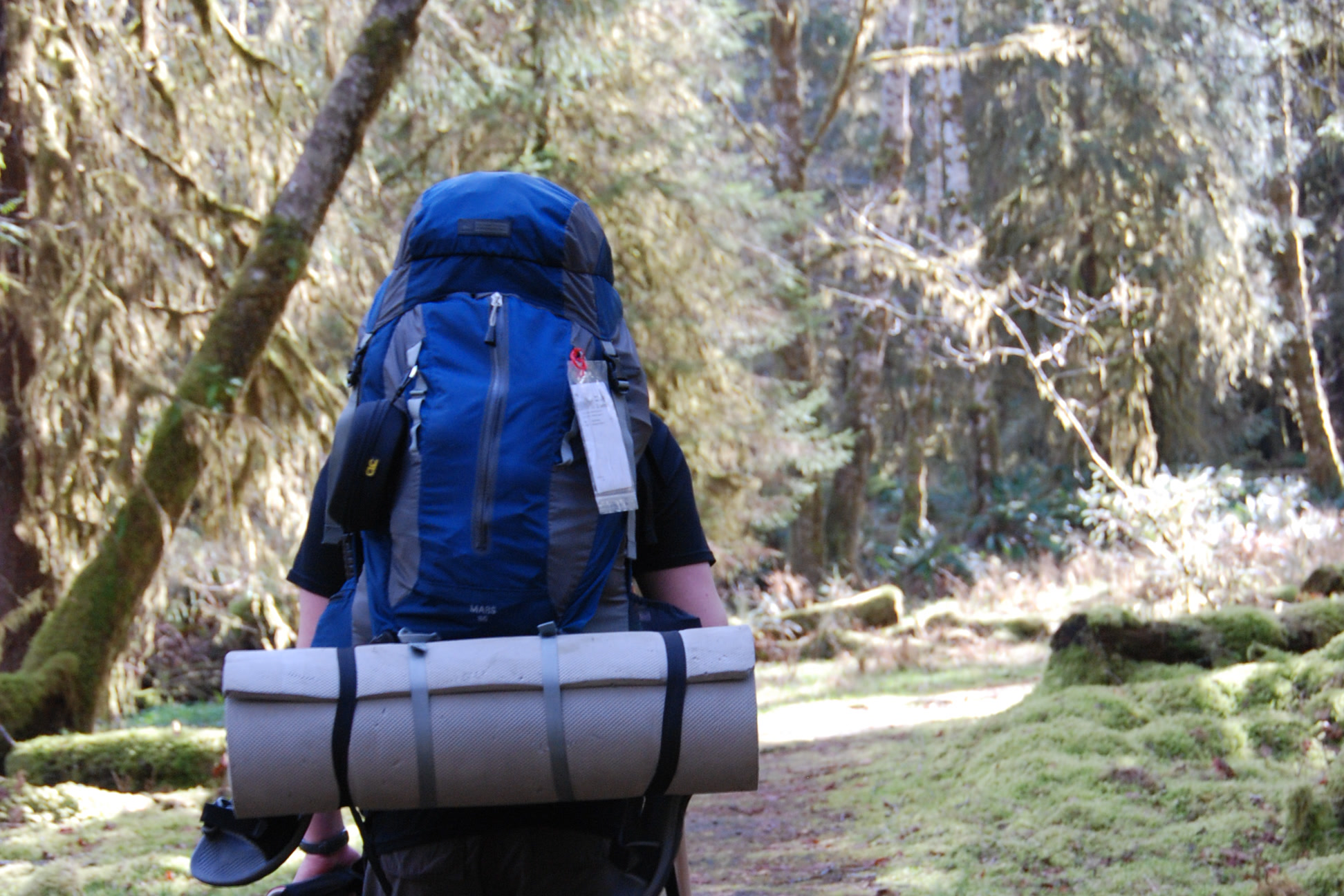
    A backpacker seen from behind with a large blue pack and rolled sleeping pad, walking a mossy trail in the Hoh Rain Forest
    Heading into the Hoh Rain Forest in March. NPS Photo / D. Archuleta

    Coast: tides, wet feet and fog

    On the beaches, the tide sets your schedule. Carry a printed tide chart and, for longer trips, a topographic map, since some headlands can only be rounded at low tide and others not at all. The park recommends sturdy shoes that can get wet for tidepooling, and many beach routes cross creeks.
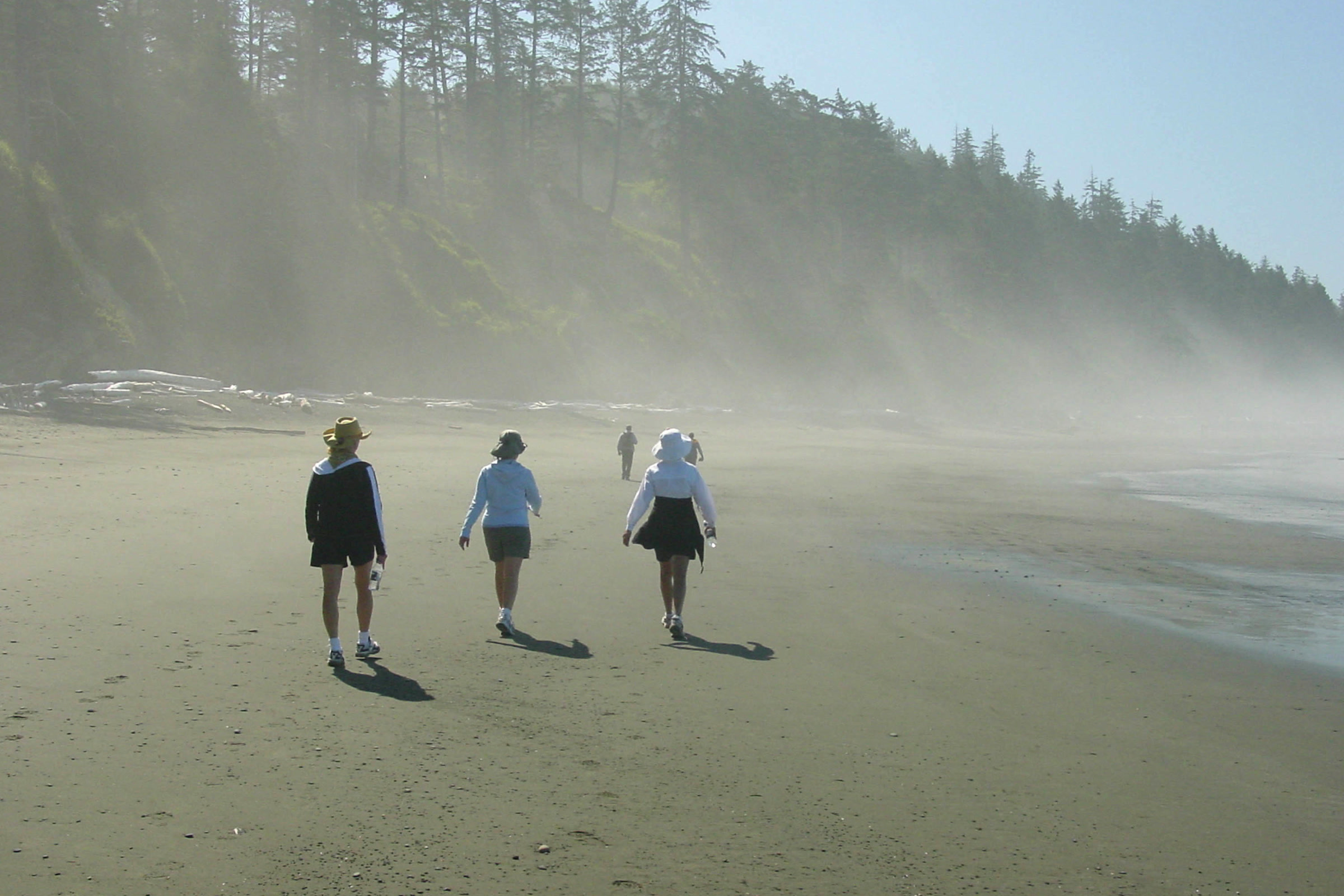
    Three people in jackets and hats walking along a wide sandy beach at Kalaloch as fog drifts through the forest behind them
    Fog on Kalaloch Beach in November. NPS Photo

    Coastal streams are often tea stained, and giardia and cryptosporidium are present, so the park says to filter or boil all water; iodine does not kill cryptosporidium. Check pet rules too: pets are not allowed on wilderness beaches such as Second Beach and Third Beach. Our guides to Second Beach and Third Beach at La Push and Leave No Trace on Olympic coast beaches cover tides and drift log safety.

    Two backpackers with loaded packs walking across rippled wet sand at low tide on the Olympic wilderness coast, with forested bluffs behind
    Backpackers on the wilderness coast at low tide. NPS Photo / Zaidel

    Mountains: layers for fast changes

    Up high, snow and heavy rain can linger into June, and many high elevation trails may be impassable until it melts. Snow can return as early as late September. Pack a warm insulating layer, hat and gloves even on a sunny summer day, plus sunglasses and sunscreen for the open ridges.

    A backpacker in a warm jacket sitting in the doorway of a small tent on a subalpine ridge, with trekking poles, a stove and snowy peaks behind
    A cool morning camp in the high country. NPS Photo

    For a classic day hike up high, our Hurricane Hill Trail guide covers the route and what to expect on the ridge.

    Winter at Hurricane Ridge

    Hurricane Ridge records 30 to 35 feet of snow a year, and its winter season generally runs from late November through the end of March. As of October 2026, the park requires all vehicles, four wheel drive included, to carry tire chains above the Heart O’ the Hills entrance station from November 1 to April 1. Check the NPS page before you go.
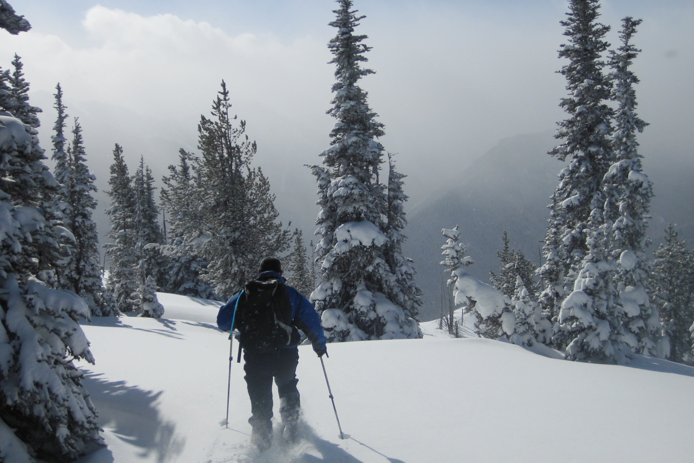
    A snowshoer with a backpack and poles heading down a snowy slope between snow covered firs under a grey winter sky
    Snowshoeing through snowy forest in Olympic National Park in February. NPS Photo / B. Baccus

    There is no indoor warming area, so the park advises dressing in layers with warm, waterproof boots, hats, mittens, sunscreen and sunglasses. Bring extra food, water, dry clothing and blankets or sleeping bags in the car. Last season the park offered no snowshoe or ski rentals, and sledders needed their own tube or sled.
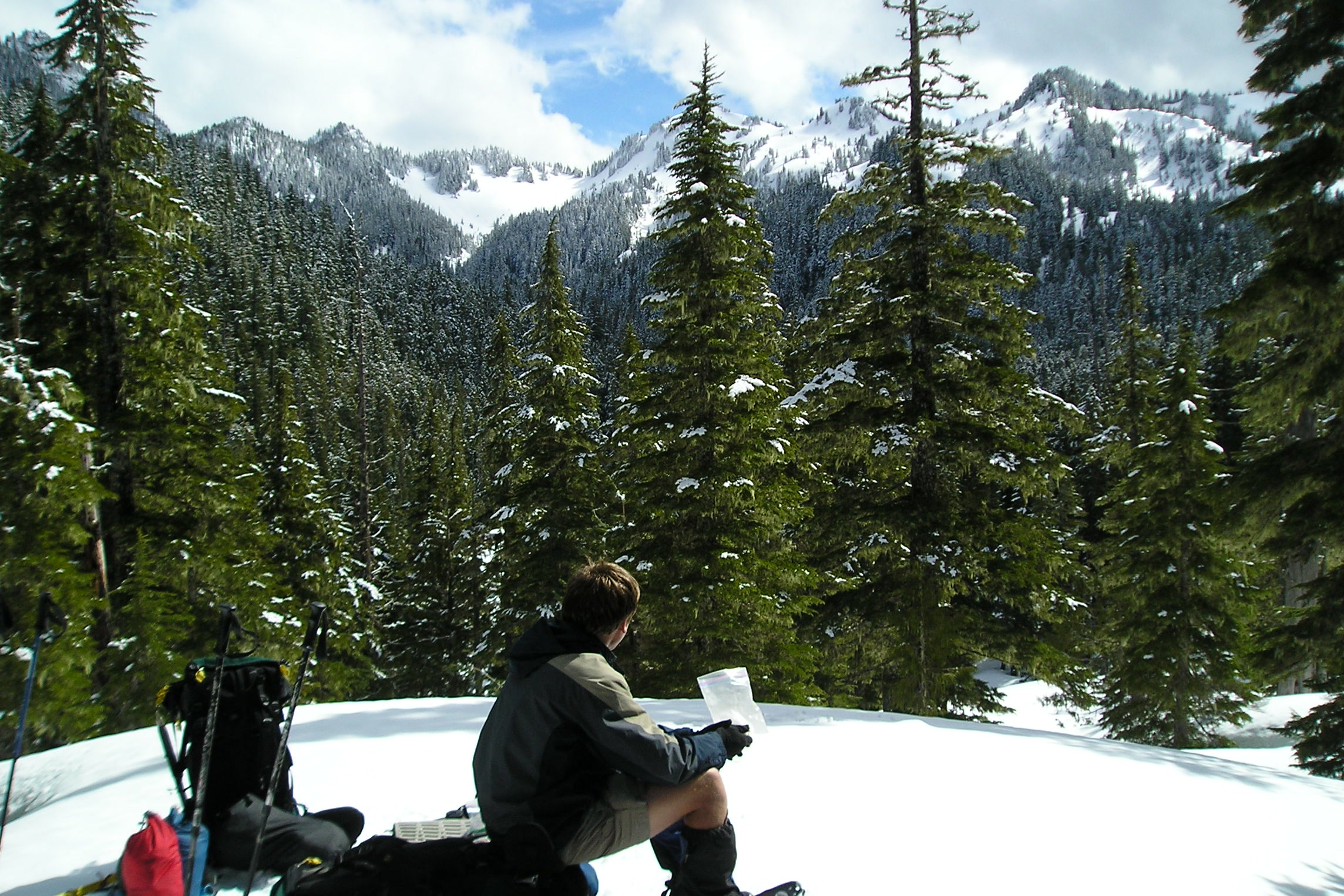
    A snowshoer sitting on a snowbank for lunch beside backpacks, with snowy forested peaks behind
    A lunch stop on a March snowshoe trip. NPS Photo

    Anyone heading off the groomed areas should be ready for steep terrain and avalanches, which the park says can change daily or even hourly. Check the Northwest Avalanche Center forecast before you go. Our guide to Hurricane Ridge in winter covers road hours and activities.

    Overnight trips and wildlife

    Backpackers need a wilderness permit, and along the entire wilderness coast all food, garbage and scented items must go in a park approved bear canister. The park’s Wilderness Information Center lends canisters. Our guide to Olympic National Park wilderness permits explains booking.

    Good food storage protects wildlife as well as your dinner. Read our guides to black bears in Olympic National Park and cougars in Olympic National Park before you go, so you know how to react to an encounter.

    How Friends of Olympic National Park helps

    We are Friends of Olympic National Park (FONP), a volunteer led friends group in Port Angeles. Our volunteers care for the Heart O’ the Forest Trail, clean beaches and host the Winter Perspectives Series. If you love exploring this park well prepared, become a member and help us care for it.

    Frequently asked questions

    Do I need rain gear in summer at Olympic National Park?

    Yes. The park says rain is always a possibility, even in July and August, and hikers should be ready for thunderstorms in the high country. Fog can also linger on the coast on sunny days.

    What are the Ten Essentials?

    The National Park Service lists navigation, sun protection, extra clothing, illumination, first aid supplies, fire, a repair kit and tools, extra food, water with treatment supplies, and emergency shelter.

    Do I need chains to drive to Hurricane Ridge in winter?

    As of October 2026, yes. The park requires all vehicles, including four wheel drive, to carry tire chains above the Heart O’ the Hills entrance station from November 1 to April 1.

    What shoes should I wear on Olympic coast beaches?

    The park recommends sturdy shoes that can get wet. Algae makes rocks slippery, many beach routes cross creeks, and tide pools are best explored with good grip.

    Do I need a bear canister in Olympic National Park?

    For overnight trips on the wilderness coast, yes. All food, garbage and scented items must be stored in a park approved bear canister, and the Wilderness Information Center lends them.
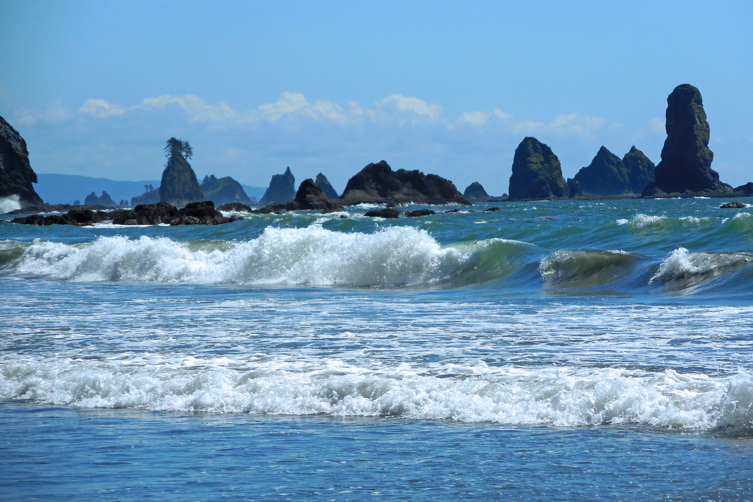
  • Second Beach and Third Beach at La Push

    Second Beach and Third Beach at La Push

    Second Beach and Third Beach are two wild ocean beaches just south of La Push, each reached by a short forest trail off La Push Road. Second Beach is the quicker walk to sea stacks and tide pools. Third Beach is a little longer and is also where backpackers start the South Coast wilderness route.

    Quick answer

    How do you get to Second Beach and Third Beach at La Push?

    Both beaches start from trailheads on La Push Road west of US 101. The Third Beach Trail begins about 12 miles out and runs 1.4 miles to the sand. The Second Beach Trail begins about 14 miles out, on Quileute land, and runs 0.7 mile. Camping on either needs a wilderness permit and a bear canister.

    • Second Beach Trail: 0.7 mile through coastal forest
    • Third Beach Trail: 1.4 miles to a sandy beach
    • Parking on Quileute land costs $10 as of October 2026
    • Pets are not allowed at Second Beach or Third Beach

    Where the beaches are, and whose land you cross

    From US 101 just north of Forks, head west on La Push Road (State Route 110). The park places the Third Beach trailhead about 12 miles west of the highway, and the Second Beach trailhead about 14 miles west, on the Quileute Indian Reservation. Rialto Beach lies across the Quillayute River, reached by a different road.

    La Push is the home of the Quileute Nation, a sovereign tribe with its own government. The tribe says the Quileute have lived and hunted here for thousands of years, in a territory that once reached from these shores to the glaciers of Mount Olympus.

    Quileute etiquette and parking

    The tribe’s Indian Country etiquette guidelines ask visitors to follow posted signs and tribal rules, respect the privacy of residential areas and ask before photographing or recording people or events. Do not take sand, rocks, shells, driftwood, eagle feathers or other objects from the beach. Burial grounds and religious ceremonies are sacred and are not to be entered.

    As of October 2026, Quileute Tribal Enterprises charges $10 per parking session at public access points in La Push, a program that began on May 1, 2026. The park says the fee applies anywhere on Quileute tribal lands, including Second Beach. Pay by the ParkMobile app or at Lonesome Creek Store, which sells multi-day passes for backpackers. Check the NPS and tribal pages before you go.

    Second Beach and Third Beach compared

    DetailSecond BeachThird Beach
    TrailheadAbout 14 miles west of US 101About 12 miles west of US 101
    Trail length0.7 mile one way1.4 miles one way
    Elevation80 ft gain, 100 ft loss going inAbout 240 ft loss going in
    ParkingQuileute land, $10 feeVery limited; carpool if you can
    ToiletPit toilet where the trail meets the beachPit toilet where the trail meets the beach
    Best season (NPS)April through OctoberYear round

    Second Beach: sea stacks and tide pools

    The Second Beach Trail winds through coastal forest before dropping to a sandy beach lined with sea stacks. The park lists bald eagles, seals and seabirds among its highlights, with whales migrating past in March, April and October.

    A forested sea stack and smaller rocks offshore at Second Beach, reflected in a shallow pool on the wet sand at low tide
    Sea stacks at Second Beach on a June evening. Photo: King of Hearts / Wikimedia Commons (CC BY-SA 4.0)

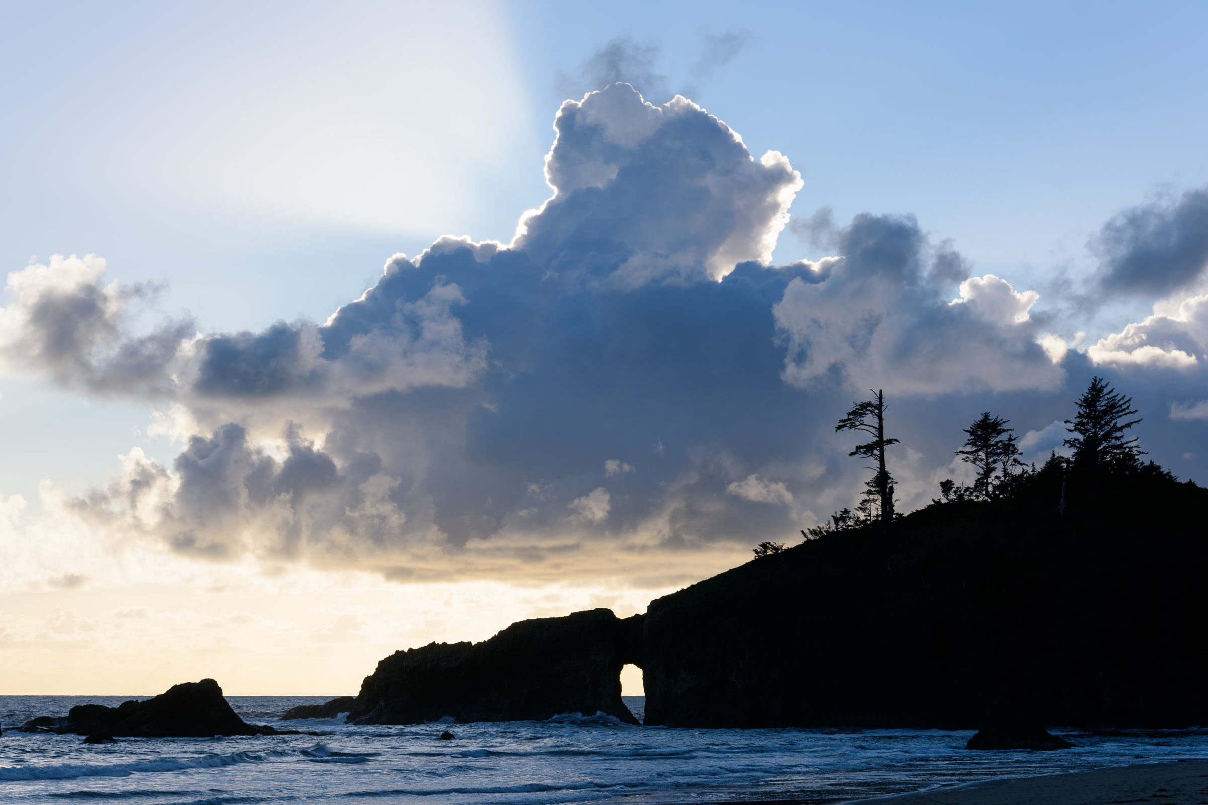
    Second Beach is an out and back walk. The park names Teahwhit Head and Quateata Head as impassable, even at the lowest tide, and asks hikers not to try rounding them. A natural rock arch near the north end is a fine sunset spot.
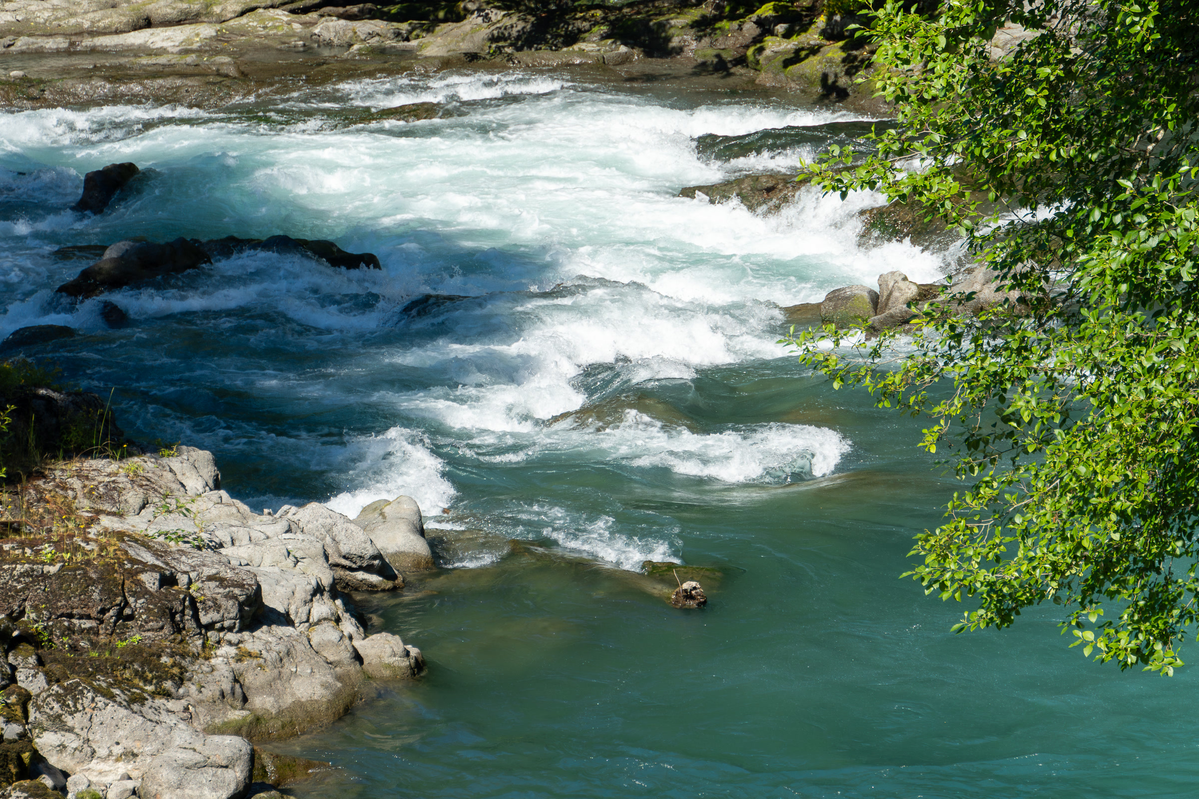
    The dark silhouette of a natural rock arch and forested headland at Second Beach under a towering cloud at sunset
    The natural arch at Second Beach. Photo: King of Hearts / Wikimedia Commons (CC BY-SA 4.0)

    The park counts Second Beach and Third Beach among its excellent tidepooling spots. Our guide to Olympic National Park tide pools covers timing and etiquette.

    A purple sea star resting on wet sand beside rocks covered in green algae in a tide pool at Second Beach
    A sea star at low tide on Second Beach. Photo: Lauren.mta / Wikimedia Commons (CC BY 4.0)

    Third Beach and the start of the South Coast route

    The Third Beach Trail runs 1.4 miles through coastal forest, then drops to a broad sandy beach. Parking at the trailhead is very limited, so the park asks visitors to carpool where they can. At the south end of the beach, a seasonal waterfall pours off the headland near Taylor Point; our guide to waterfalls of Olympic National Park explains when it flows best.

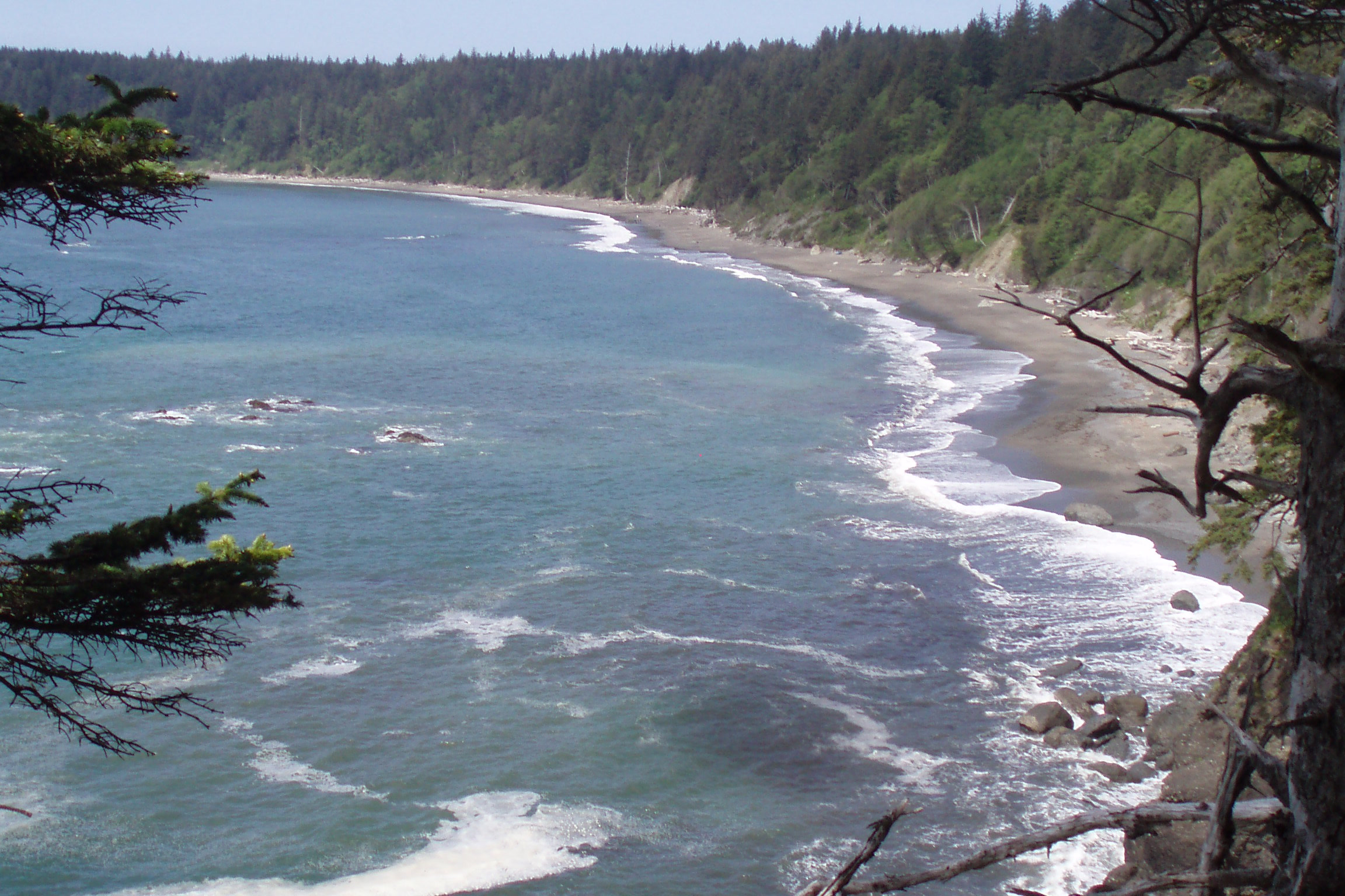
    A long curving wilderness beach on the Olympic South Coast seen from a forested bluff, with surf and offshore rocks
    A beach on the South Coast wilderness route. NPS Photo

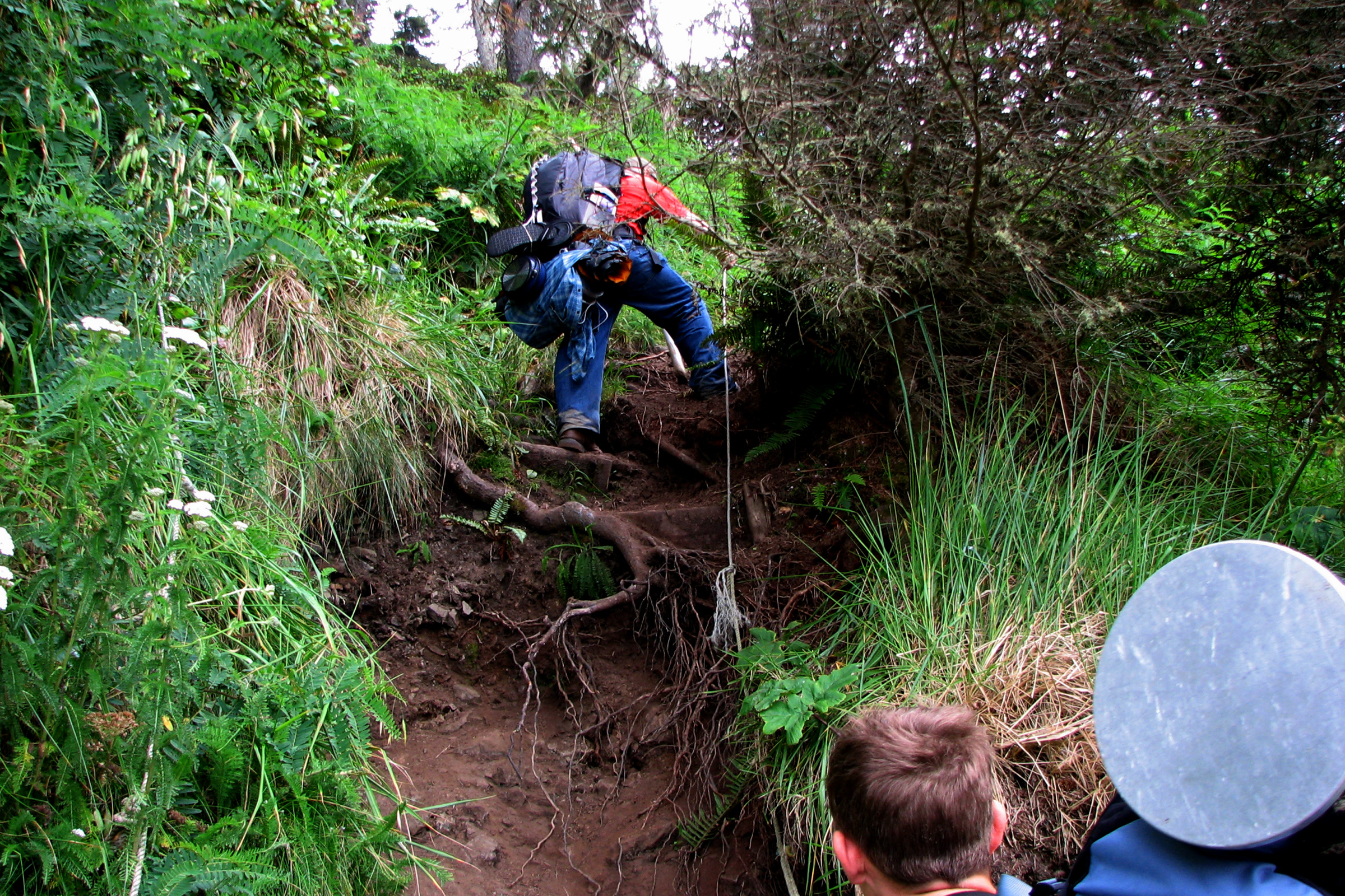
    Third Beach is the first stop on the South Coast route, a 17 mile wilderness trek to the Oil City trailhead that the park rates moderate to difficult, best from May through October. Taylor Point cannot be passed at sea level, so the route climbs an overland trail from the south end of Third Beach, with low angle ladders to help.

    A backpacker hauling up a steep, muddy bank on a fixed rope through coastal brush, with two other hikers waiting below
    A rope assisted overland trail north of Cedar Creek, farther south on the Olympic coast, not at Third Beach. NPS Photo / Shawn Sheltren

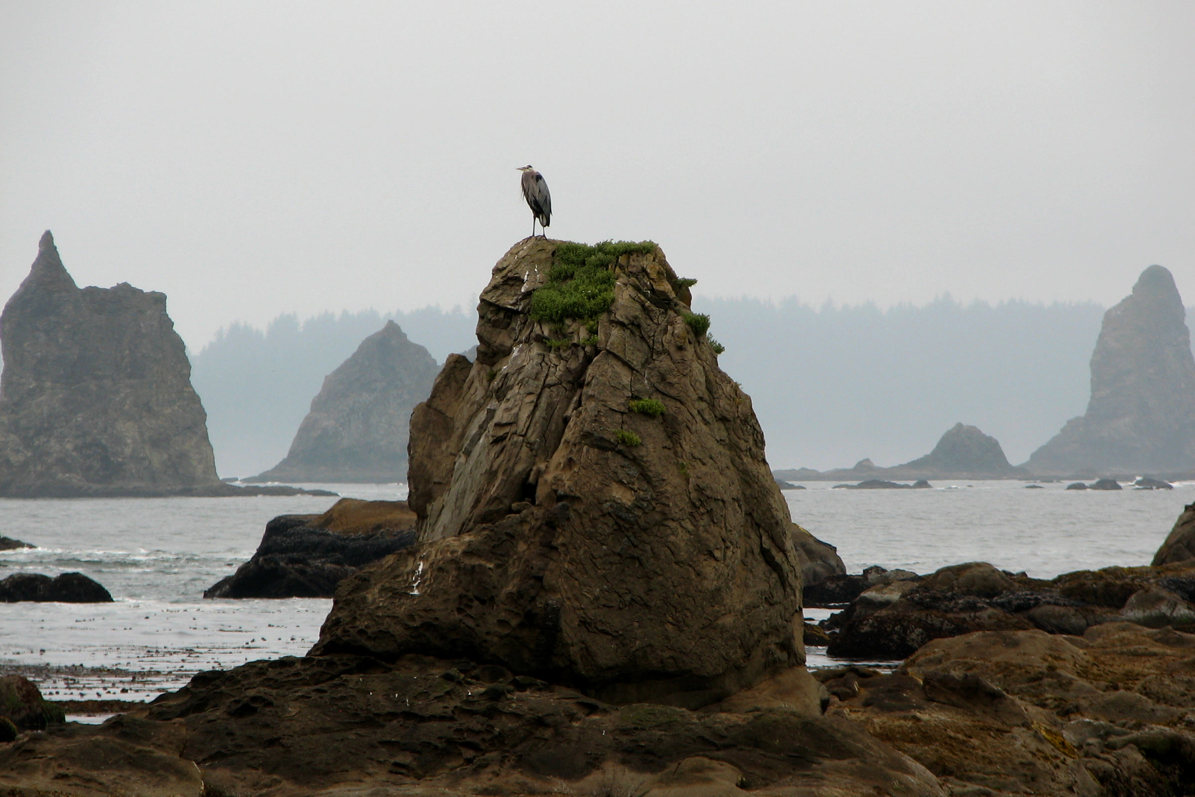
    Beyond the headland, the park gives about 2.6 miles from Third Beach to Scott Creek and another 2.4 miles to Toleak Point. Two stretches have tide limits: about 3 miles from the trailhead (below 4.5 feet) and between Scott Creek and Strawberry Point (below 4 feet).

    A heron standing on top of a rocky sea stack at Toleak Point, with more jagged stacks fading into coastal mist
    Toleak Point, a popular camp farther down the South Coast route. NPS Photo / Shawn Sheltren

    Camping at Second Beach and Third Beach

    Every night on either beach needs a wilderness camping permit, and groups are limited to 12 people. Our guide to Olympic National Park wilderness permits walks through booking and fees.

    • Where to pitch: a few forest sites, but mostly on the sand above the high tide line. On some summer weekends the park says spots are hard to find.
    • Food storage: food, garbage and scented items go in a park approved bear canister. Raccoons and bears raid camps; see our black bear safety guide.
    • Water: coastal streams are often tea stained, and giardia and cryptosporidium are present. Filter or boil it, since iodine does not kill cryptosporidium.
    • Fires: on the beach only, using driftwood only. Check for fire bans first.

    Pets, weapons and wheeled devices are prohibited on these beaches and trails (see dogs in Olympic National Park). For gear, see what to pack for Olympic National Park.

    Tides, drift logs and headland safety

    Carry a tide chart and a topographic map, and never try to round a headland on a rising or high tide. For predictions, use NOAA’s La Push, Quillayute River station. Check the marine forecast for hazardous swells, too.

    A tangled driftwood root wad lying on the sand at Second Beach, with a forested headland and sea stacks behind
    Driftwood on Second Beach. Photo: King of Hearts / Wikimedia Commons (CC BY-SA 4.0)

    The park warns that beach logs may be unstable and that rolling logs can be fatal. Stay off logs in the surf and watch your footing on boulders slick with algae. Our Leave No Trace guide to Olympic coast beaches covers headland trails, camping and fires in more depth.

    How Friends of Olympic National Park helps

    We are Friends of Olympic National Park (FONP), a volunteer led friends group based in Port Angeles. Each spring our volunteers join beach cleanups in Olympic National Park, carrying marine debris off the coast. Browse our volunteer opportunities and come lend a hand.

    Frequently asked questions

    How long is the hike to Second Beach?

    The Second Beach Trail is 0.7 mile each way through coastal forest. It starts on Quileute land on La Push Road, about 14 miles west of US 101.

    How long is the Third Beach trail?

    The Third Beach Trail is 1.4 miles each way through forest, starting on La Push Road about 12 miles west of US 101. Parking is very limited.

    Do you need a permit to camp at Second Beach or Third Beach?

    Yes. Every night needs a wilderness camping permit, groups are limited to 12, and food and scented items go in a park approved bear canister.

    Can you walk from Second Beach to Third Beach?

    Not along the shore. The park lists the Second Beach headlands, Teahwhit Head and Quateata Head, as impassable even at the lowest tide, so each beach is reached by its own trail from La Push Road.

    Is there a fee to park at Second Beach?

    As of October 2026, yes. Quileute Tribal Enterprises charges 10 dollars per parking session on Quileute tribal lands, including Second Beach, paid by app or at Lonesome Creek Store.

  • Shi Shi Beach and Point of the Arches: A Hiking Guide

    Shi Shi Beach and Point of the Arches: A Hiking Guide

    Shi Shi Beach is a long crescent of sand at the far northwest corner of Washington, reached by a trail that starts on the Makah Reservation near Neah Bay and drops into Olympic National Park. At its south end stands Point of the Arches, a line of sea stacks and arches that ranks among the wildest sights on the coast. Here is how to plan the trip.

    Quick answer

    How do you hike to Shi Shi Beach?

    The Shi Shi Beach trail starts on the Makah Reservation near Neah Bay and runs 2 miles to the beach, then 2.5 miles along the sand to Point of the Arches. You need a Makah Recreation Pass for your vehicle, and an Olympic National Park wilderness permit to camp. Carry a tide chart.

    • Makah Recreation Pass: $20 per vehicle, calendar year
    • Day parking at the trailhead; overnight parking about a mile back
    • Pets must turn back at the park boundary
    • Wilderness permit and bear canister for every overnight stay

    Where Shi Shi Beach is

    Shi Shi sits on the south side of Makah Bay. The trail begins on Makah land and continues into the park, so, as the NPS Shi Shi Beach trailhead page explains, you need two different permits. The park describes the hike as an 8 mile round trip and names Shi Shi Beach and Point of Arches among its most popular coastal destinations.

    Aerial view of Point of the Arches, with dozens of rocky islets in blue water and the curve of Shi Shi Beach and forested hills beyond
    Point of the Arches from the air, with Shi Shi Beach curving north. Photo: Sam Beebe / Wikimedia Commons (CC BY 2.0)

    Makah Recreation Pass and parking, as of October 2026

    The Makah Tribe requires a Makah Recreation Pass for recreation on the reservation, including hiking, beach visits and bird watching. As of October 2026, the Makah recreation permits page lists the pass at $20 per vehicle, valid for the calendar year. Check that page and the NPS page before you go.

    Pass and parking at a glance

    ItemWhat the Makah Tribe says
    Recreation Pass$20 per vehicle, good for the calendar year; one per vehicle, shown in the window
    Where to buyOnline (print it), or in Neah Bay at outlets such as the Makah Museum, Makah Marina and Makah Mini Mart
    Day parkingAt the trailhead
    Overnight parkingPrivate paid lot across from Tsoo-Yess Beach, about a mile back toward Neah Bay
    RVsNo RV parking

    The Tribe’s page doesn’t list a parking fee. Washington Trails Association’s guide lists $10 per day, cash, for both the trailhead lot and overnight parking, so bring small bills. If you buy the pass online for a rental car, the Tribe asks you to enter “RENTAL” and write the plate number on the permit before you arrive.

    Getting to the trailhead

    Follow State Route 112 west to Neah Bay, then the Tribe’s turn by turn directions, which end on Fish Hatchery Road past Tsoo-Yess Beach. Save them before you leave, because the WTA notes that phone signal and map apps can be unreliable out here.

    Two backpackers with large packs walking along the sand of Shi Shi Beach on a sunny day, with Point of the Arches sea stacks ahead
    Backpackers heading south on Shi Shi Beach. Photo: NOAA Office of National Marine Sanctuaries

    The trail and the beach walk

    The Tribe describes the trail as well maintained and easy to follow, but warns you to expect mud and slippery bridges and boardwalks. The WTA says the first mile was recently rebuilt, the second is often wet, and the path then drops steeply on an eroded slope to the sand inside the park.

    Shi Shi Beach distances, walking south

    PointDistanceSource
    National park boundary1.7 miles from the trailheadMakah Tribe
    Beach2 miles from the parking areaMakah Tribe
    Petroleum CreekAbout 1.3 miles along the beachWTA
    Point of the Arches2.5 miles along the beachMakah Tribe
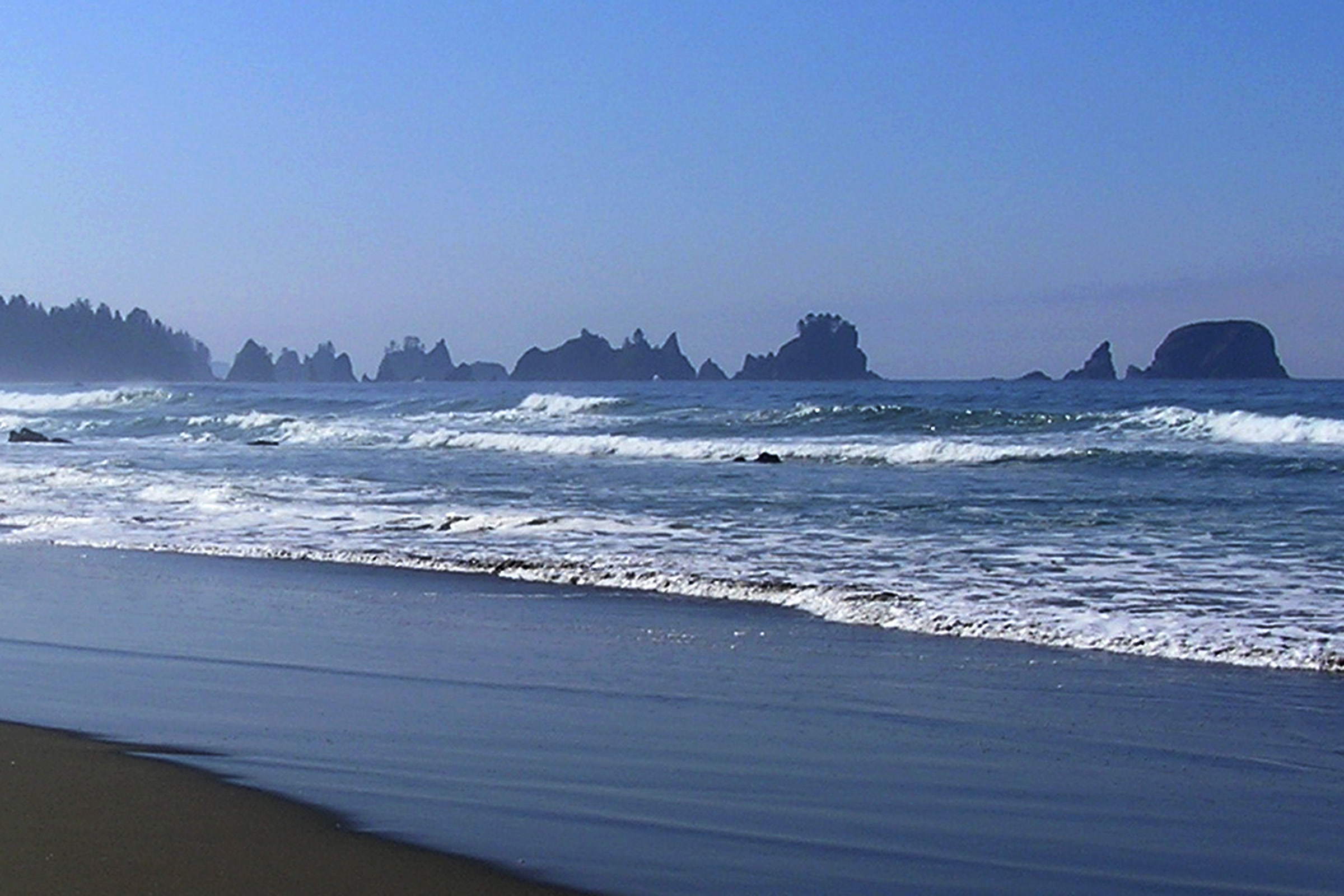
    Wide, empty Shi Shi Beach with dark wet sand, rows of white surf and a line of distant sea stacks under a clear blue sky
    The long beach walk toward Point of the Arches in November. NPS Photo

    Point of the Arches

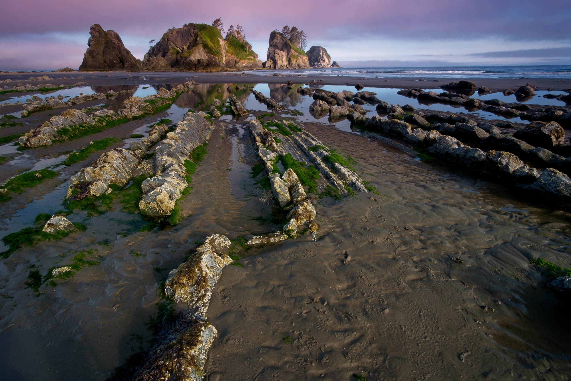
    Point of the Arches (the park and the Tribe call it Point of Arches) is a National Natural Landmark, recognized as an outstanding example of the sea carving a rocky shoreline. At low tide, ridges of rock run out across the sand toward the stacks, and the Olympic Coast National Marine Sanctuary names Shi Shi Beach among its best tide pooling spots. Our guide to Olympic National Park tide pools explains how to explore them gently.

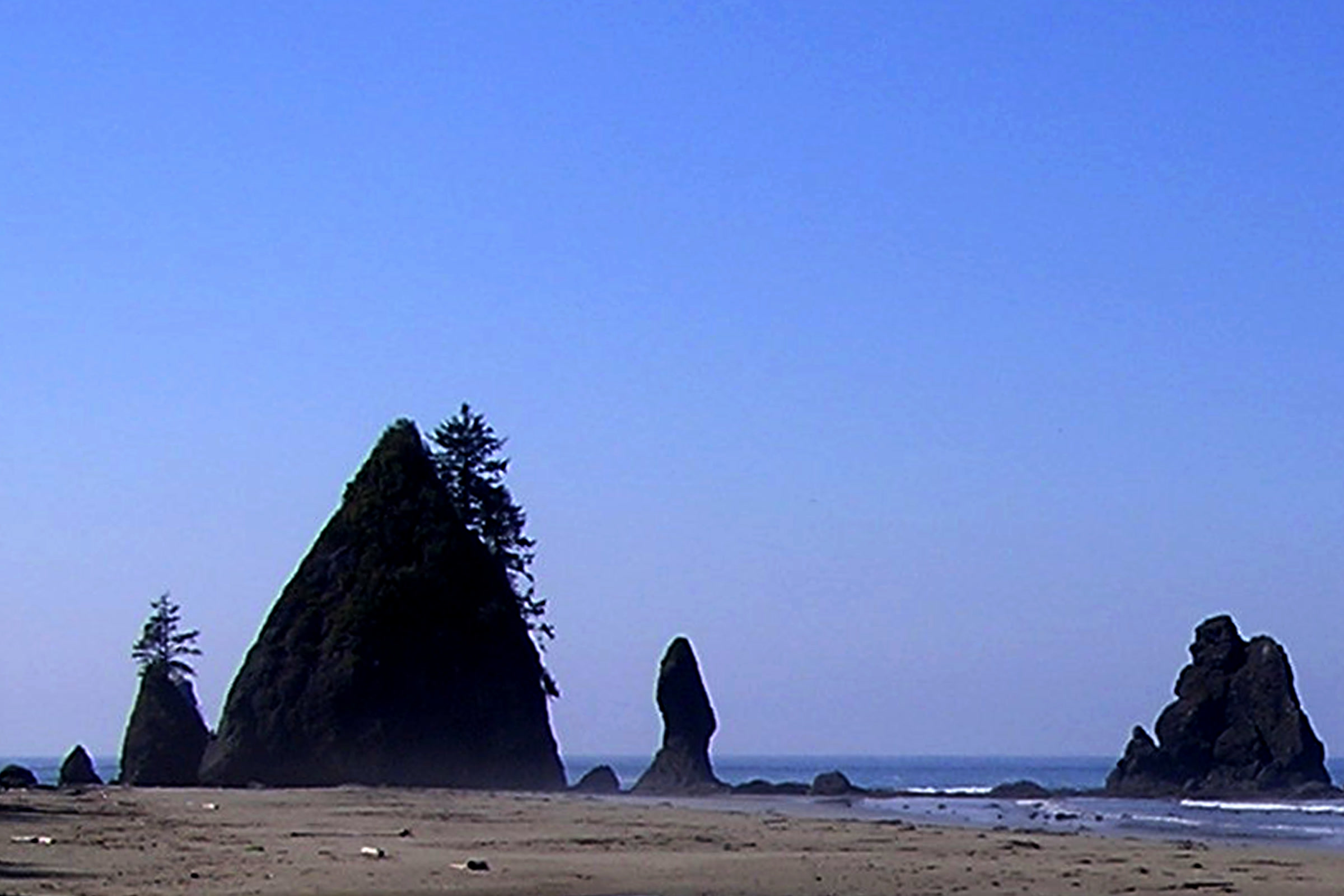
    Dark silhouettes of a tall pointed sea stack topped with trees and smaller rock spires on the sand at Point of the Arches
    Sea stacks at Point of the Arches. NPS Photo

    The U.S. Fish and Wildlife Service names Shi Shi as a good beach for watching seabirds on the offshore refuge rocks, and our guide to birding in Olympic National Park explains what to look for.

    Tides at Shi Shi

    The park warns that some coastal routes become impassable at high tide, so know your route and carry a tide table. The Tribe adds that if you continue south past Point of Arches, a tide chart keeps you from being cut off at the headwalls.

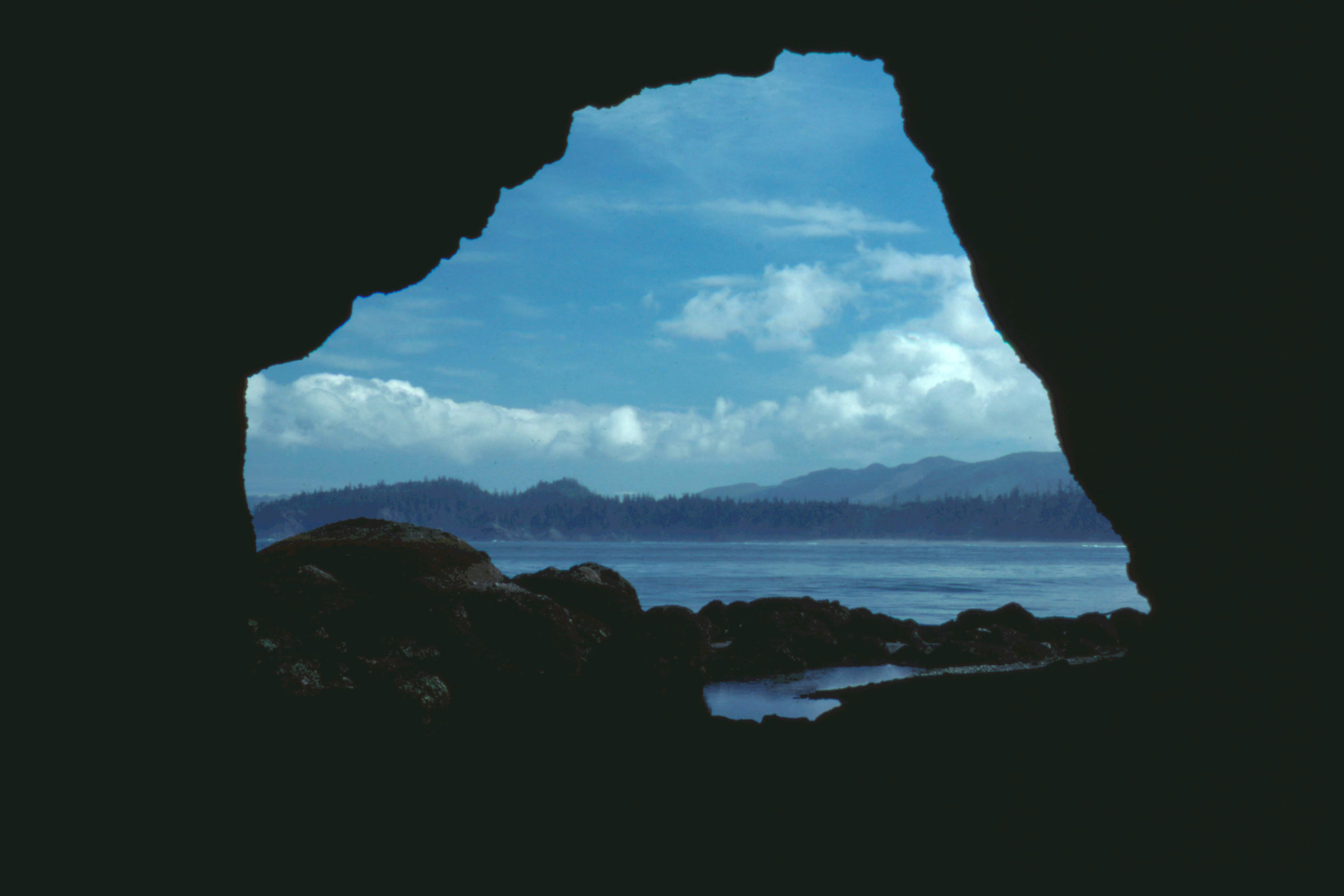
    View out through a dark rock arch at Point of Arches to blue sky, white clouds, calm water and a distant forested shore
    Looking out through one of the arches. NPS Photo / Gurling

    Headland routes, safe timing and beach fires are covered in our Leave No Trace guide to Olympic coast beaches, so we won’t repeat them here.

    Camping at Shi Shi Beach

    Every overnight stay on the wilderness coast needs a park wilderness camping permit, all year, and all food, trash and scented items must go in a bear canister. The park lists the coast from Yellow Banks to Point of the Arches as a quota area. Our guide to Olympic National Park wilderness permits covers booking, fees and canisters.

    • Camp above the high tide line; the WTA notes campsites near the beach and in the forest by Petroleum Creek.
    • The park warns that in peak season you may not find a place for your tent.
    • Treat all water; the park says iodine does not kill cryptosporidium.
    • Use the restrooms the Tribe lists at the trailhead and at designated spots along the beach.
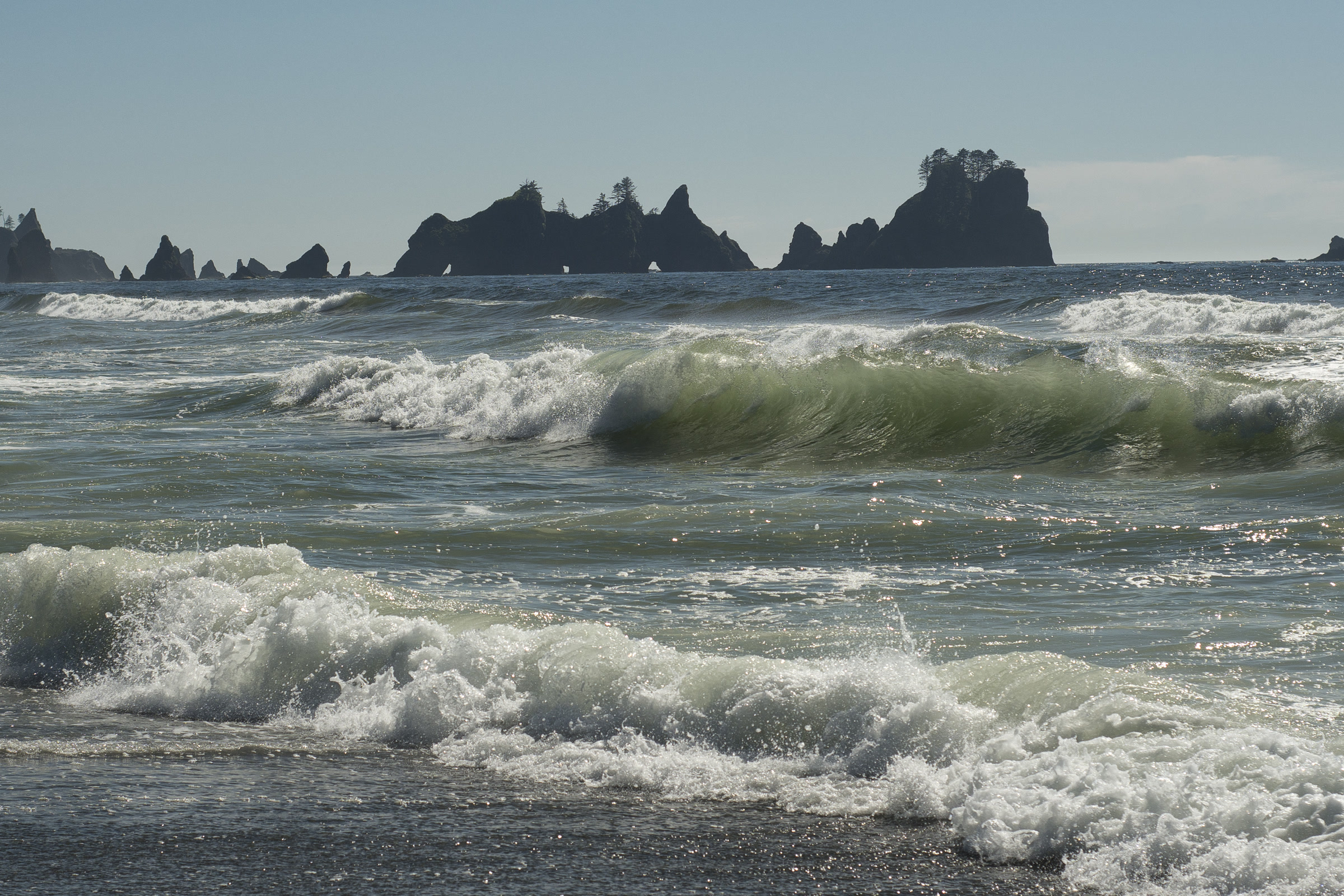
    Green breaking waves rolling toward the shore of Shi Shi Beach, with the jagged sea stacks of Point of the Arches on the horizon
    Surf below Point of the Arches in August. Photo: John Fowler / Wikimedia Commons (CC BY 2.0)

    The Tribe allows pets on the trail but not past the park boundary at 1.7 miles, and the park does not permit pets on its beaches or coastal trails. Our post on dogs in Olympic National Park lists places that welcome them.

    Respecting Makah land

    The first part of this hike crosses the Makah Reservation, the home of the Makah people. The Tribe asks visitors to respect Makah culture and keep to designated visitor facilities. It also prohibits beachcombing and gathering drift material on reservation shores by anyone outside Makah families.

    The Makah Museum at the Makah Cultural and Research Center in Neah Bay is a good place to learn about the Tribe’s history. Our Ozette Triangle and Cape Alava guide tells part of that story.

    How Friends of Olympic National Park helps

    We are Friends of Olympic National Park (FONP), a volunteer led friends group in Port Angeles. Each spring our volunteers join beach cleanups in Olympic National Park, removing marine debris from the coast. If you love wild beaches like Shi Shi, see our volunteer opportunities and come help.

    Frequently asked questions

    How long is the hike to Shi Shi Beach?

    The Makah Tribe gives 2 miles from the parking area to the beach and another 2.5 miles along the sand to Point of the Arches. The park describes the hike as an 8 mile round trip.

    Do you need a pass for Shi Shi Beach?

    Yes. The trail starts on the Makah Reservation, so you need a Makah Recreation Pass, which the Tribe listed at 20 dollars per vehicle for the calendar year as of October 2026. Campers also need a park wilderness permit.

    Where do you park overnight for Shi Shi Beach?

    Not at the trailhead, which is for day use. The Tribe directs overnight visitors to a private paid lot across from Tsoo-Yess Beach, about a mile back toward Neah Bay. There is no RV parking.

    Can you bring dogs to Shi Shi Beach?

    Only on the first part of the trail. The Tribe does not allow pets past the national park boundary at 1.7 miles, and pets are not permitted on park beaches or coastal trails.

    Can you camp at Point of the Arches?

    Yes, with an Olympic National Park wilderness camping permit and a bear canister. The park lists Yellow Banks to Point of the Arches as a quota area, so reserve early.

  • Birding in Olympic National Park: Where and When

    Birding in Olympic National Park: Where and When

    Birding in Olympic National Park means three trips in one: a wild Pacific coast with offshore seabird colonies, mossy rainforest valleys full of small songbirds, and subalpine meadows at Hurricane Ridge where grouse walk beside the trail. The park counts about 300 bird species. Here is where to look, what you might see and when to go.

    Quick answer

    Where is the best birding in Olympic National Park?

    Olympic National Park has about 300 bird species across three main habitats. Scan the offshore islands from coast beaches for puffins, murres and cormorants, walk rainforest trails like the Hoh for wrens, thrushes and dippers, and visit Hurricane Ridge for sooty grouse and summer songbirds. Late spring to early fall is the best season.

    • About 300 bird species, from sea level to the peaks
    • Offshore refuges hold over 72 percent of Washington’s nesting seabirds
    • Seabird islands are closed; watch from the beaches
    • Calling birds with apps counts as harassment in the park

    Why the park is so good for birds

    The park runs from sea level to over 2,000 meters, and the National Park Service says that gradient of habitats supports many resident and migratory birds. Much of the rest of the Olympic Peninsula has been heavily logged, which makes the park’s protected forests especially important. You can read the park’s own overview on the NPS birds of Olympic page.

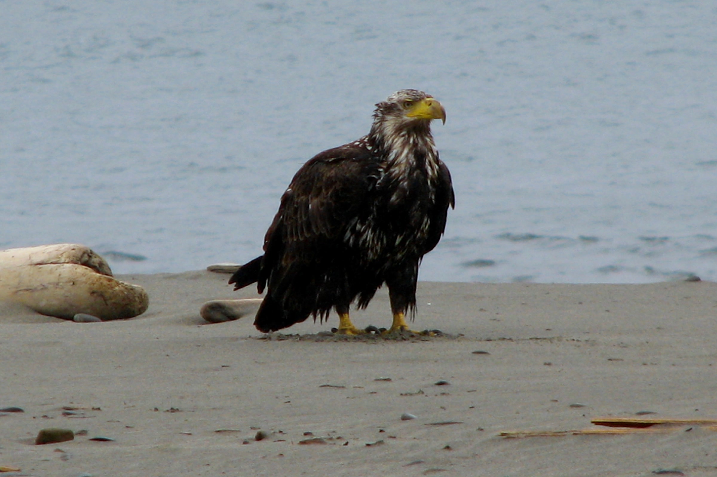
    A young bald eagle with dark brown feathers and a yellow beak standing on wet sand at the edge of the surf
    A young bald eagle on an ocean beach, from the park’s photo collection. NPS Photo / S. Sheltren

    Where to go: three habitats

    The coast and offshore islands

    The rocks and islands off the park’s coast belong to the Washington Islands National Wildlife Refuges. The U.S. Fish and Wildlife Service says they hold over 72 percent of Washington’s nesting seabirds, about 200,000 breeding birds of 13 species. Those include tufted puffins, common murres, rhinoceros and Cassin’s auklets, pigeon guillemots, storm-petrels and three kinds of cormorants.

    The islands are closed to all public access, and boats must stay 200 yards away. That makes the beach your viewing platform. The Flattery Rocks refuge visitor page names Shi Shi, Cape Alava, Rialto, Second Beach, Ruby and Kalaloch as good places to watch. A spotting scope helps, because many seabirds stay well offshore.

    Two common murres in close-up, with dark brown heads, slim pointed bills and white chests, against blue water
    Common murres breed in Washington only on the outer coast islands. Location of photo not recorded. NPS Photo / F. Sharpe

    On the rocks and sand closer in, look for black oystercatchers, and keep an eye out for peregrine falcons hunting shorebirds. Pair a birding walk with a low tide using our guides to Olympic National Park tide pools and Shi Shi Beach and Point of the Arches.

    Rainforest valleys

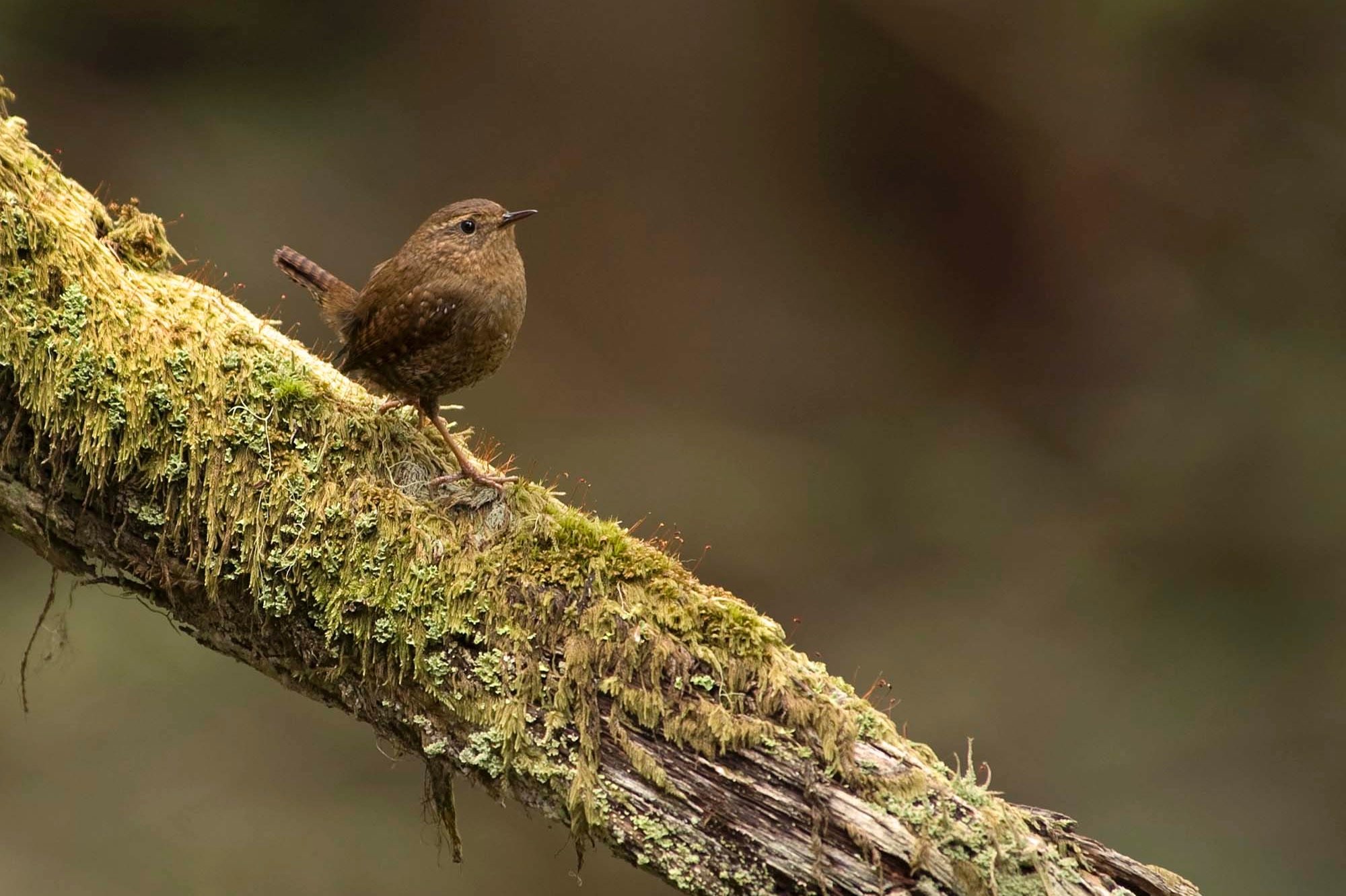
    In the west side valleys, the Hoh is the classic stop. Audubon lists ruffed and sooty grouse, band-tailed pigeons, Pacific wrens and American dippers there. Seattle Audubon’s BirdWeb adds varied thrush, golden-crowned kinglet, Hutton’s vireo and red crossbill as forest residents, with Vaux’s swifts, flycatchers and several warblers arriving to breed.

    A tiny brown Pacific wren with its tail cocked, perched on a moss covered branch at Deer Park in Olympic National Park
    A Pacific wren at Deer Park. The park describes its song as a long, cheerful warble. NPS Photo

    Two threatened birds depend on these old forests. Marbled murrelets are seabirds that feed in shallow water near shore, yet the Fish and Wildlife Service says they lay their single egg on the mossy limbs of big old trees, as far as 53 miles inland in Washington. The northern spotted owl has its own story, told in our post on the northern spotted owl in Olympic National Park. For the forests themselves, see the temperate rainforests of Olympic National Park.

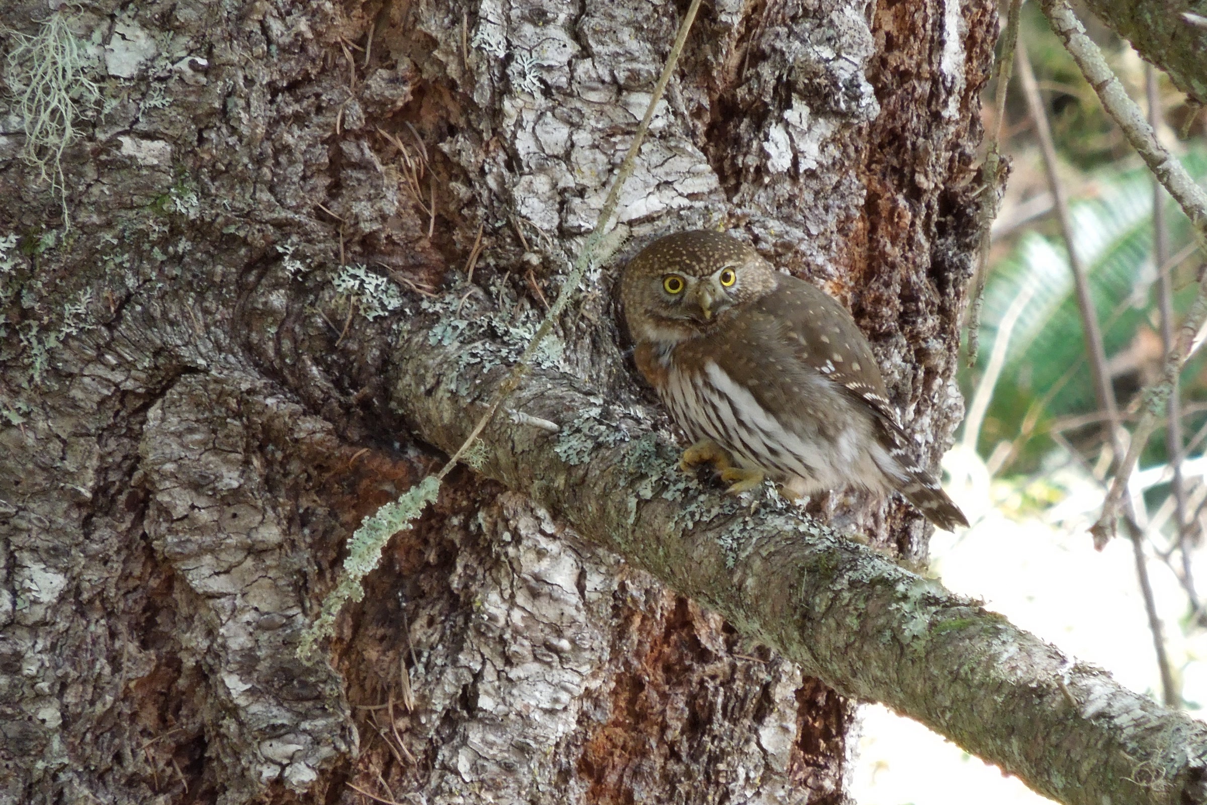
    A small northern pygmy owl perched on a branch beside a rough barked conifer trunk in Olympic National Park
    Northern pygmy owls are uncommon but found at most elevations. NPS Photo

    Subalpine meadows at Hurricane Ridge

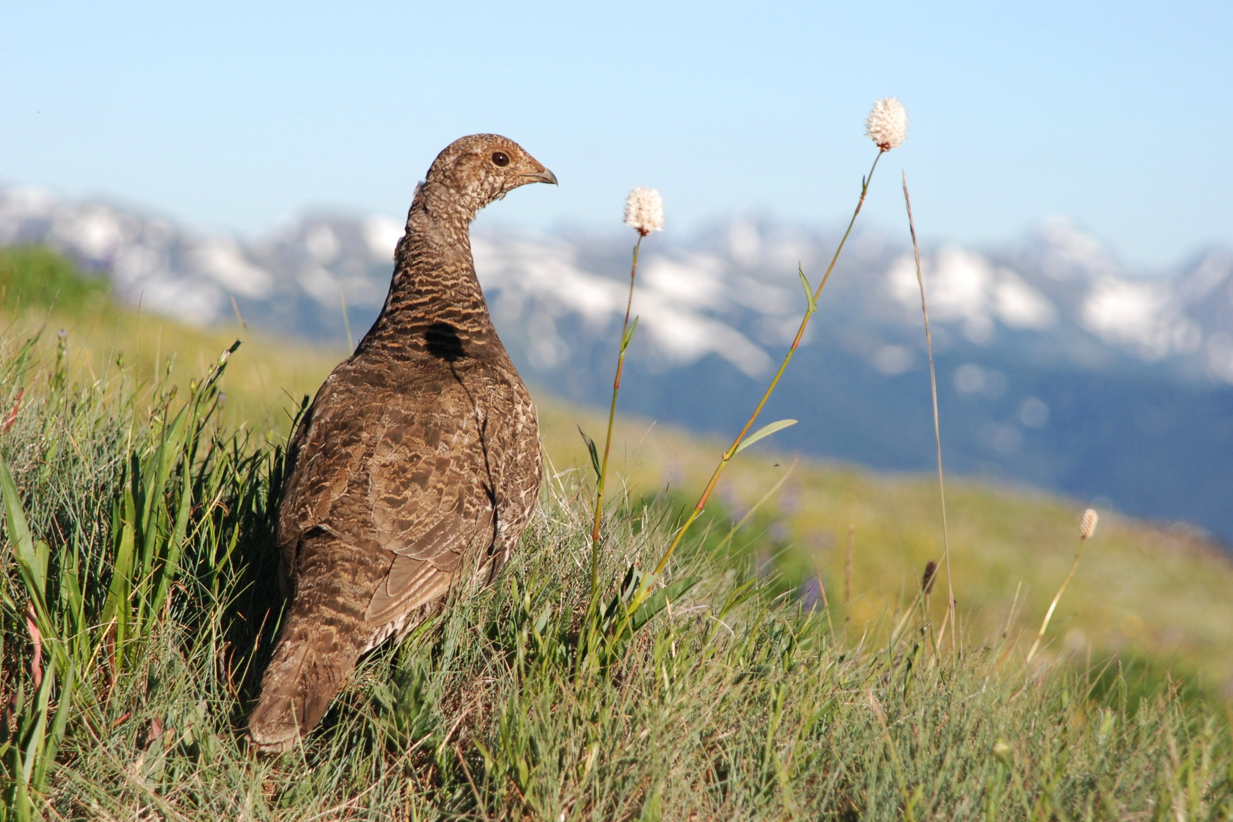
    The 17 mile road from Port Angeles climbs from old growth near Heart O’ the Hills to subalpine parkland above 5,200 feet. BirdWeb lists sooty grouse (once called blue grouse), common ravens, red-breasted nuthatches and chestnut-backed chickadees all year. In summer, Swainson’s and hermit thrushes, western tanagers, Townsend’s warblers and olive-sided flycatchers join them, and American pipits forage near the snow line.

    Audubon lists Canada jays (gray jays in older guides) along the trails here. They can be bold, but the park asks that you never feed them. Our Hurricane Hill Trail guide covers one of the best walks up here.
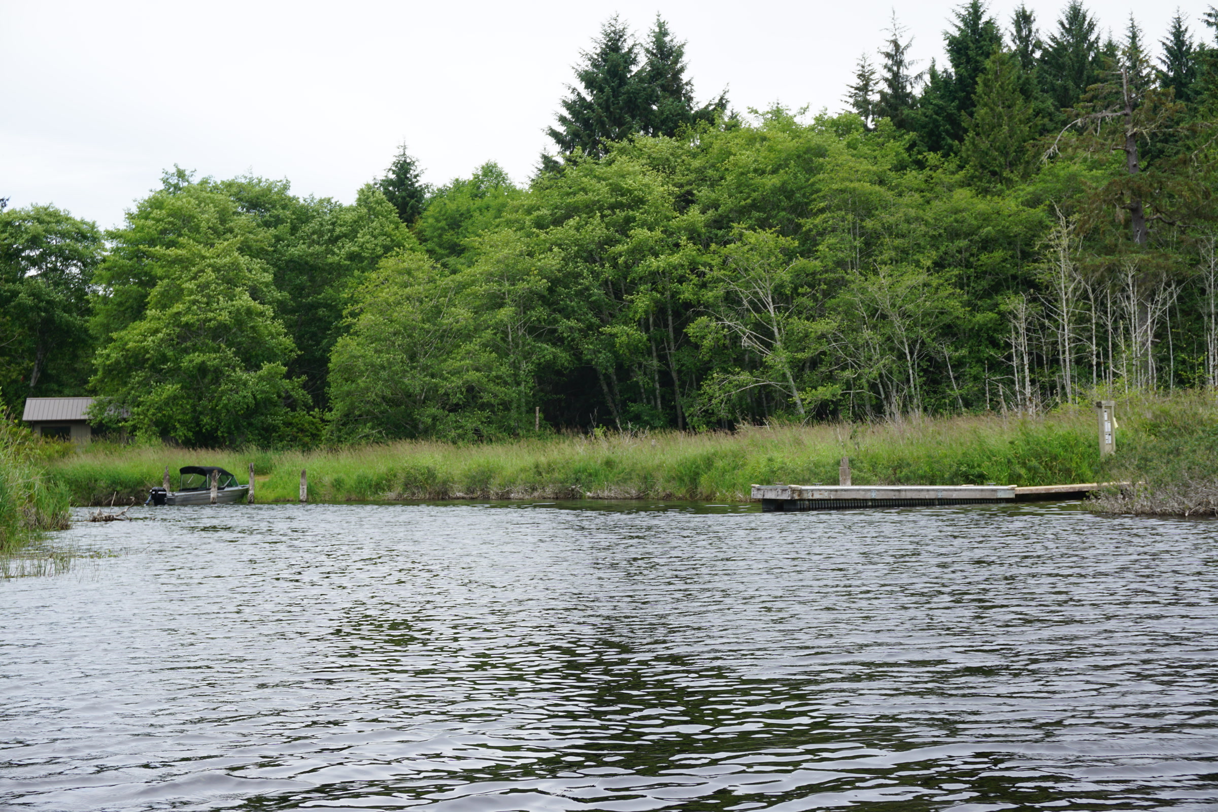
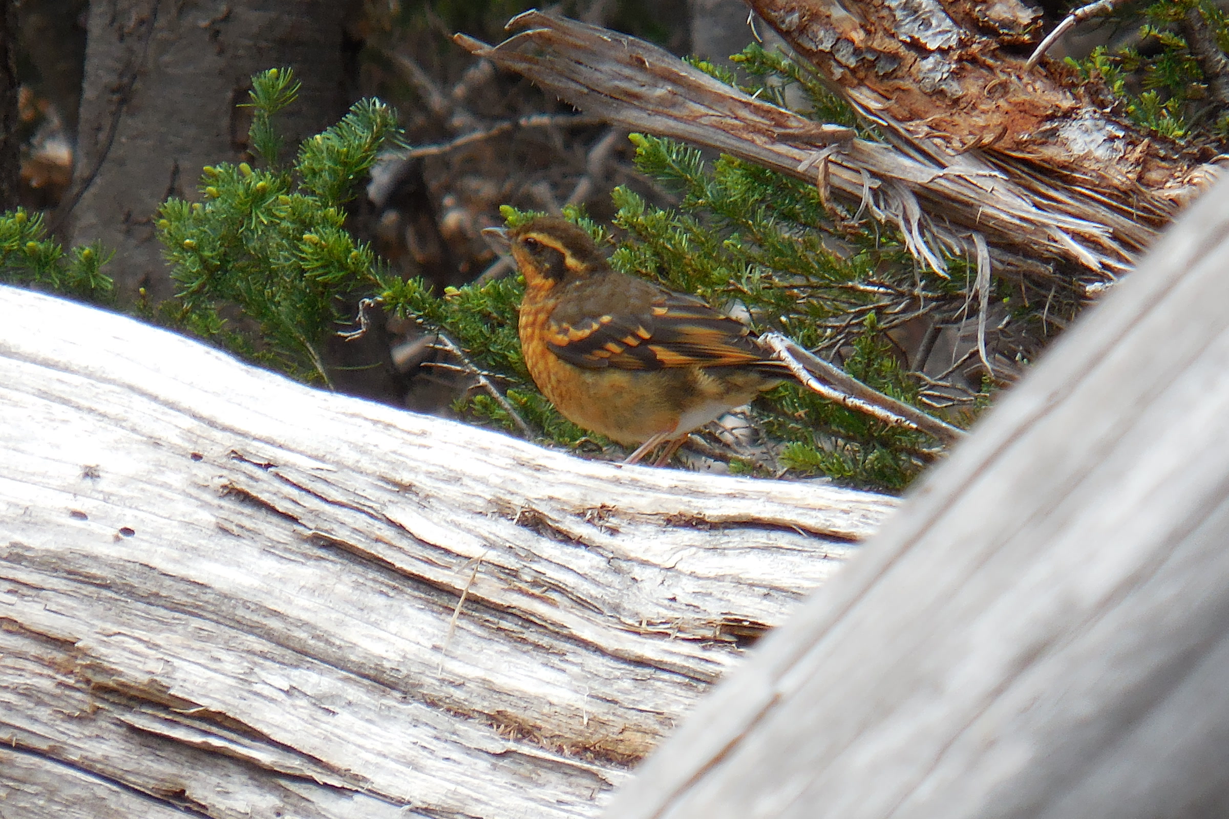
    An orange and grey varied thrush perched among small fir branches behind a weathered silver log at Hurricane Ridge
    A varied thrush at Hurricane Ridge in August. NPS Photo / C. Bubar

    Birds of Olympic National Park by habitat

    HabitatWhere to tryBirds to look for
    Coast and islandsShi Shi, Cape Alava, Rialto, Second Beach, Ruby, KalalochTufted puffin, common murre, cormorants, black oystercatcher
    RainforestHoh and other west side valleysPacific wren, varied thrush, American dipper, sooty grouse
    RiversValley rivers and streamsBald eagle, American dipper, spotted sandpiper
    SubalpineHurricane RidgeSooty grouse, Canada jay, thrushes, American pipit

    Where to see bald eagles

    The park lists bald eagles among the birds visitors can watch for. BirdWeb places them along the peninsula’s rivers, and the park’s photo near the top of this page shows a young eagle on an ocean beach. Scan tall snags above river bars and the shoreline with binoculars, and give any eagle you find plenty of room.

    When to go

    • Late spring to early fall: BirdWeb calls this the best time for both Hurricane Ridge and the coast, when seabirds are nesting offshore.
    • Spring and fall migration: waterfowl, sandhill cranes and shorebirds pass over the west side.
    • September: upper elevation trails can be good for watching migrating hawks.
    • All year: rainforest residents such as wrens, kinglets and varied thrushes, though BirdWeb notes that Forks, on the west side, gets about ten feet of rain a year.
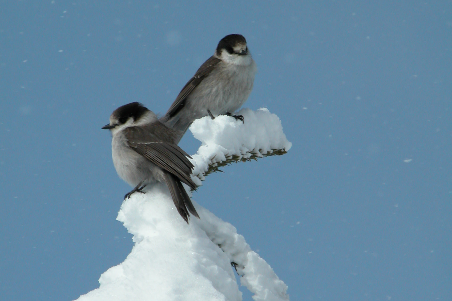
    Two grey and white Canada jays perched on a snow covered treetop against a pale blue sky
    Canada jays in winter, from the park’s photo collection. NPS Photo

    Birding etiquette in the park

    Federal rules protect every bird here. The park says feeding, touching, calling, frightening or disturbing wildlife is prohibited, and it treats using apps to call birds as harassment, especially for threatened species. It also asks you to stay at least 150 feet from wildlife and to back off if an animal moves because of you.

    • Leave the playback at home and let birds come to you.
    • Give nests extra room in spring and summer, when the park says birds are most at risk.
    • Bring binoculars or a scope instead of moving closer.
    • Report injured birds to a ranger rather than trying a rescue.

    Logging your sightings on eBird helps other birders and builds a long record of the park’s birds. Our guide to what to pack for Olympic National Park helps with rain gear for long days of watching.

    How Friends of Olympic National Park helps

    We are Friends of Olympic National Park (FONP), a volunteer led friends group in Port Angeles. Our guided insect, mushroom and wildflower walks help people slow down and notice the life around them, and our volunteers care for trails, beaches and the Visitor Center grounds. If you love the park’s birds, please become a member and help us look after the places they live.

    Frequently asked questions

    How many bird species live in Olympic National Park?

    The National Park Service puts the total at about 300 species, some living in the park all year and others passing through or arriving only to breed.

    Can you see puffins in Olympic National Park?

    Tufted puffins nest on the offshore refuge islands. The islands are closed, so watch from beaches such as Shi Shi, Cape Alava, Rialto or Ruby with a spotting scope, best from late spring to early fall.

    Where can I see bald eagles in Olympic National Park?

    Bald eagles are seen along the peninsula’s rivers and on the coast. Scan tall snags above river bars and beaches.

    What birds live at Hurricane Ridge?

    Sooty grouse, common ravens, chickadees and nuthatches live there all year, and Canada jays are seen along the trails. In summer, thrushes, western tanagers, Townsend’s warblers and American pipits join them.
    Can I use bird call apps in Olympic National Park?

    No. The park treats using apps to call wildlife as harassment, especially for threatened or endangered species. Federal rules prohibit calling, feeding or disturbing birds.

  • Cougars in Olympic National Park and How to Stay Safe

    Cougars in Olympic National Park and How to Stay Safe

    Cougars in Olympic National Park range throughout the Olympics, yet very few visitors ever see one. The park calls them seldom seen and says attacks on people are rare. Knowing a little about these quiet hunters, and exactly what to do if you meet one, lets you hike with confidence.

    Quick answer

    What should you do if you see a cougar in Olympic National Park?

    Don’t approach and don’t run. Stop, stay calm, face the cougar, stand upright and talk to it firmly, leaving it a way to escape, and pick up small children and pets at once. Look larger by opening your jacket and waving your arms. If it turns aggressive, be more aggressive back, and fight back if attacked.

    • The whole park is considered cougar territory
    • Attacks on people are rare
    • Keep children between adults and pets on leash
    • Report every cougar sighting to a ranger

    Meet the cougars in Olympic National Park

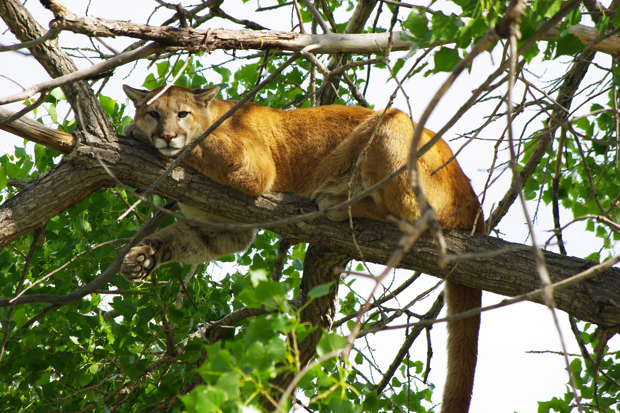
    Cougar, mountain lion, puma and catamount are all names for the same animal, and on the Olympic Peninsula most people say cougar. The park describes a large cat, often over 100 pounds, usually reddish tan to gray brown, with black markings on the face and the tip of a long, rope like tail.

    The Washington Department of Fish and Wildlife (WDFW) says adult males average about 140 pounds and stand about 30 inches at the shoulder, while females rarely exceed 110 pounds.

    A cougar caught on a remote wildlife camera in open forest near Deer Park in Olympic National Park, January 2010
    A cougar on a park wildlife camera near Deer Park, January 2010. NPS Photo

    How many live in the park? The park says the population is uncertain, though there is definite evidence of cougars, and we won’t guess a number. Statewide, WDFW estimates about 2,400 cougars old enough to live on their own.

    Where cougars live and what they eat

    The park says the entirety of Olympic National Park is considered cougar territory. Its cougars tend to live in the mountains and forests, favoring dense underbrush and clear rocky ground for stalking. They are territorial and live at low densities, which is one reason sightings are so rare.

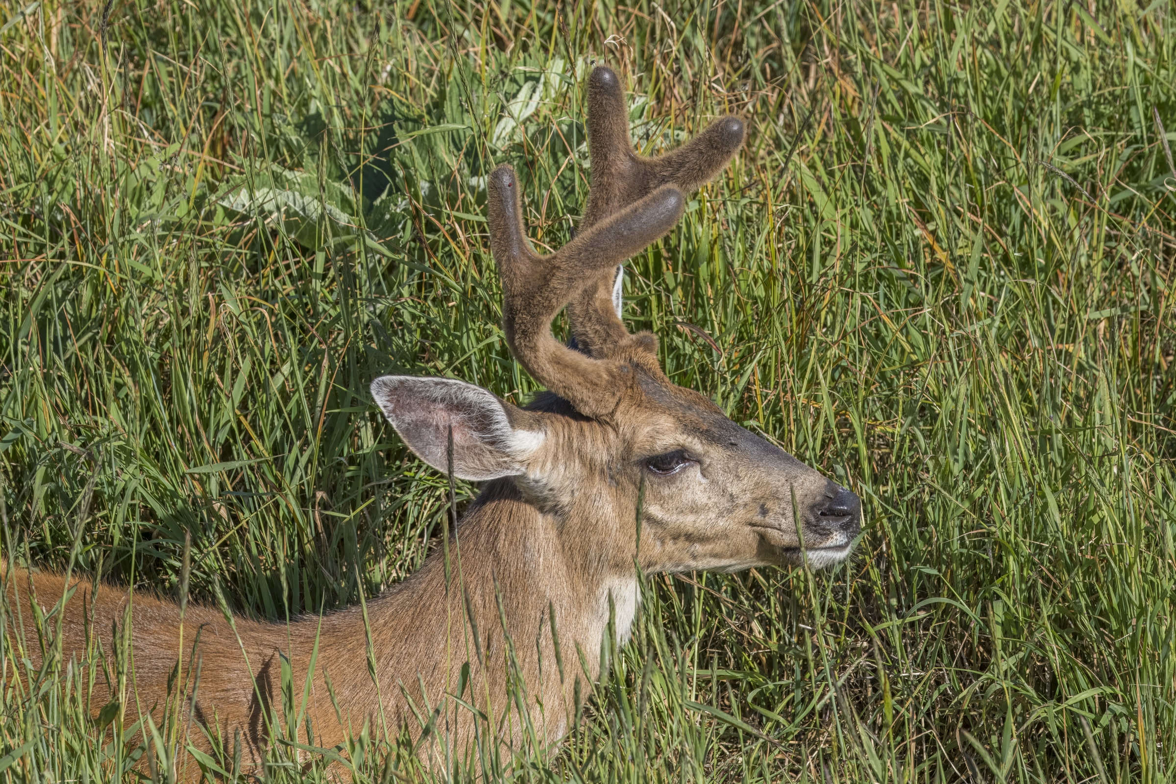
    Deer and Roosevelt elk are the main prey, with smaller mammals, rodents and even fish now and then. As a top predator, the cougar helps keep grazing animals in balance with the plants they eat. WDFW adds that cougars hunt mostly from dusk to dawn and often drag a kill under cover and guard it for days.

    A Columbian black-tailed deer buck with antlers in velvet feeding in tall grass at Hurricane Ridge in Olympic National Park
    Deer are a cougar’s main prey. A black-tailed deer at Hurricane Ridge. Photo: Charles J. Sharp / Wikimedia Commons (CC BY-SA 4.0)

    Signs a cougar has been nearby

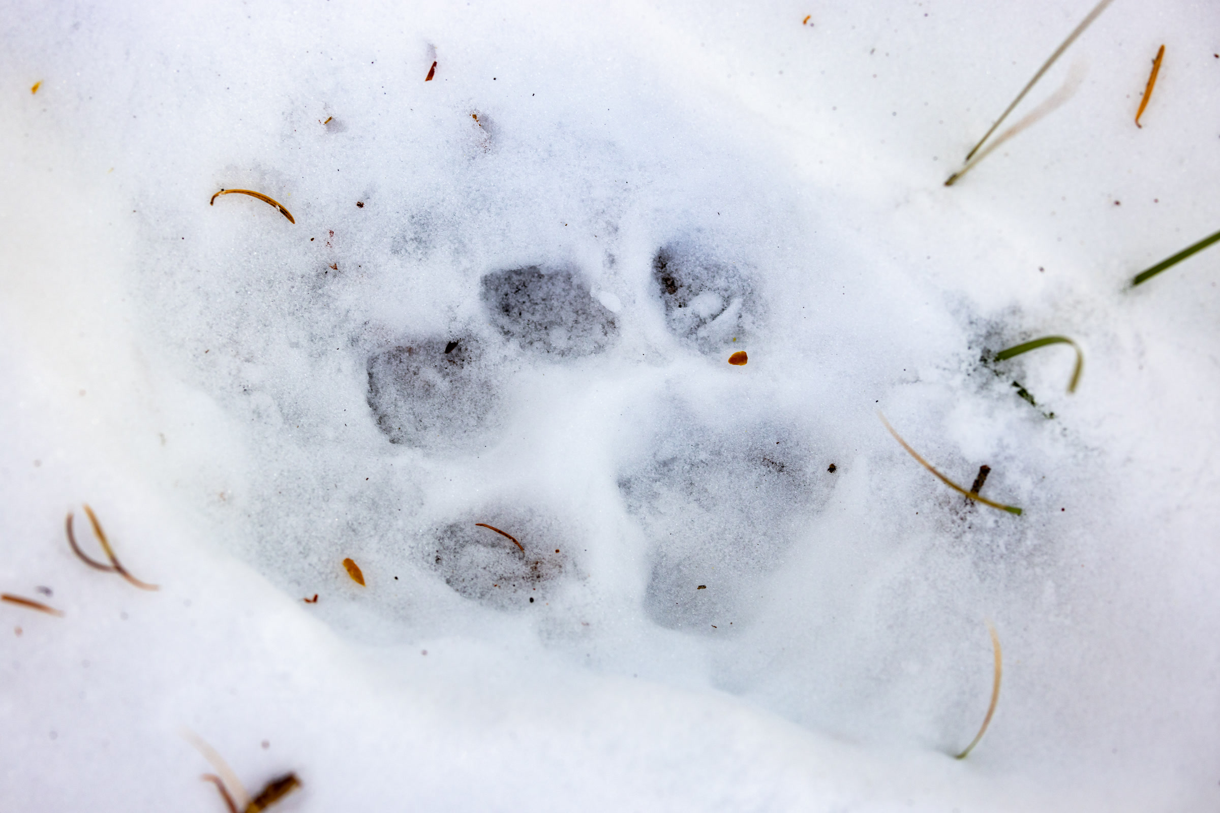
    Signs are easier to find than the cat. The park notes scratch mounds and tracks along backcountry trails, and WDFW lists scratch posts and partially covered droppings.

    A round cougar paw print with four toe pads and no claw marks pressed into snow on the Crevice Creek Trail in Yellowstone National Park
    Cougar tracks in snow, photographed in Yellowstone National Park, not Olympic. NPS / Jacob W. Frank

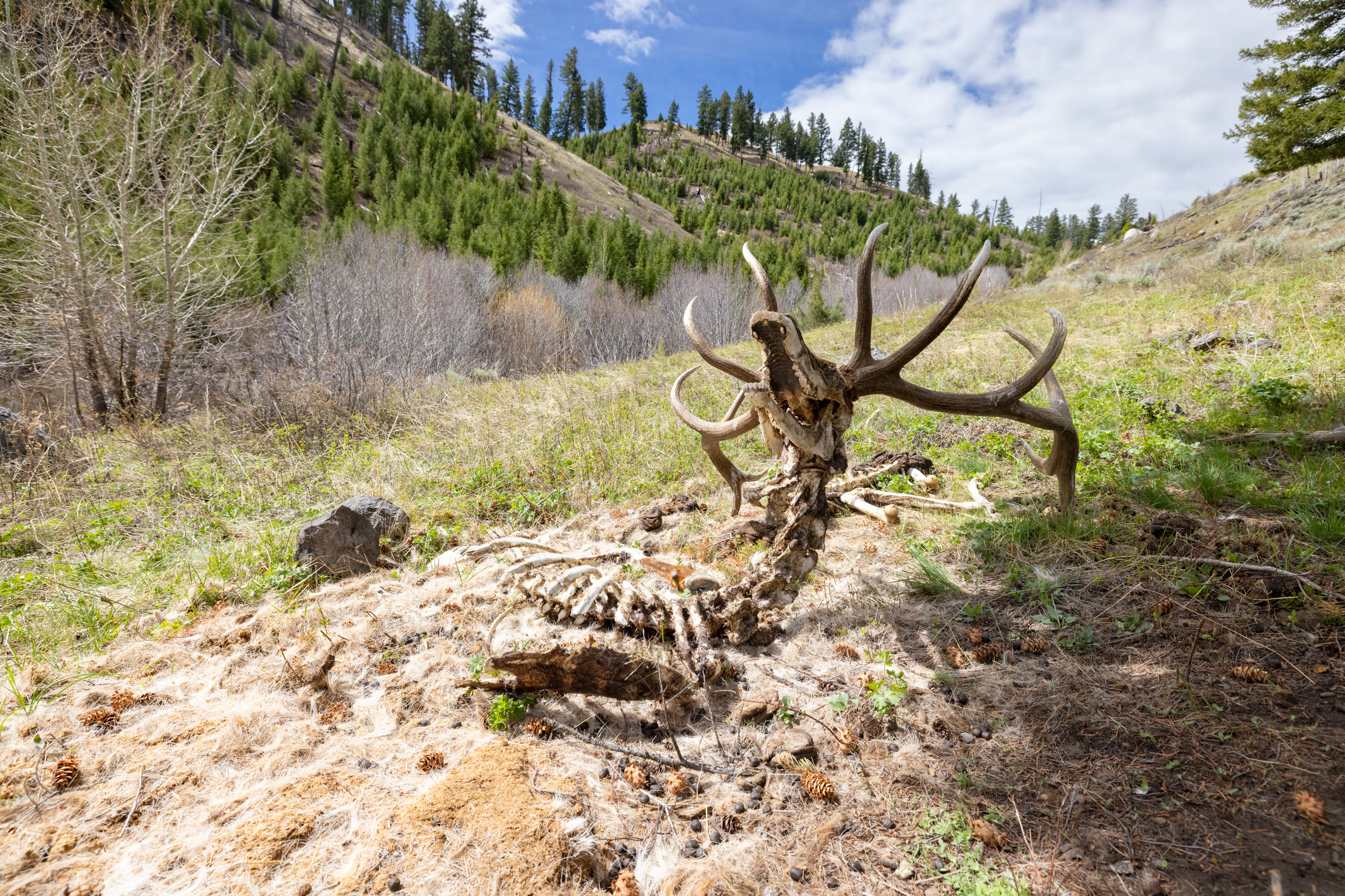
    If you come across a dead deer or elk, especially one partly covered with leaves or soil, WDFW says not to approach it. A cougar may be resting nearby and guarding its meal, so back away and choose another route.

    The bones and antlers of a bull elk at a mountain lion kill site on a grassy slope in Yellowstone National Park
    An old mountain lion kill site, photographed in Yellowstone National Park, not Olympic. NPS / Jacob W. Frank

    Mountain lion safety on the trail

    Good mountain lion safety is mostly about not being mistaken for easy prey. The park asks every visitor to:

    • Keep kids between adults and never let them run ahead.
    • Keep pets on a leash and close. Our guide to dogs in Olympic National Park lists where pets may go.
    • Stay aware of your surroundings.

    WDFW adds a few habits for hikers and campers: hike in groups and make enough noise not to surprise a cougar, avoid hiking after dark, and take extra care in dense cover or when sitting or crouching. Keep a clean camp, because food smells draw raccoons and other prey.

    What to do if you see a cougar

    Here is what to do if you see a cougar, in the order the park’s cougar page lists it:

    1. Do not approach.
    2. Stop, stay calm and do not turn your back. Do not run.
    3. Face the animal, stand upright, talk calmly and firmly to it, and give it a way to escape if you can.
    4. Do all you can to appear larger: open your jacket and raise or wave your arms.
    5. Pick up small children or pets immediately, so they don’t panic, flee or make rapid movements.
    6. If the cougar becomes more aggressive, become more aggressive toward it. Convince it you are not prey, but a danger.
    7. Fight back if attacked.

    Running matters most. WDFW explains that at close range a cougar’s instinct is to chase, so running and rapid movements may trigger an attack.

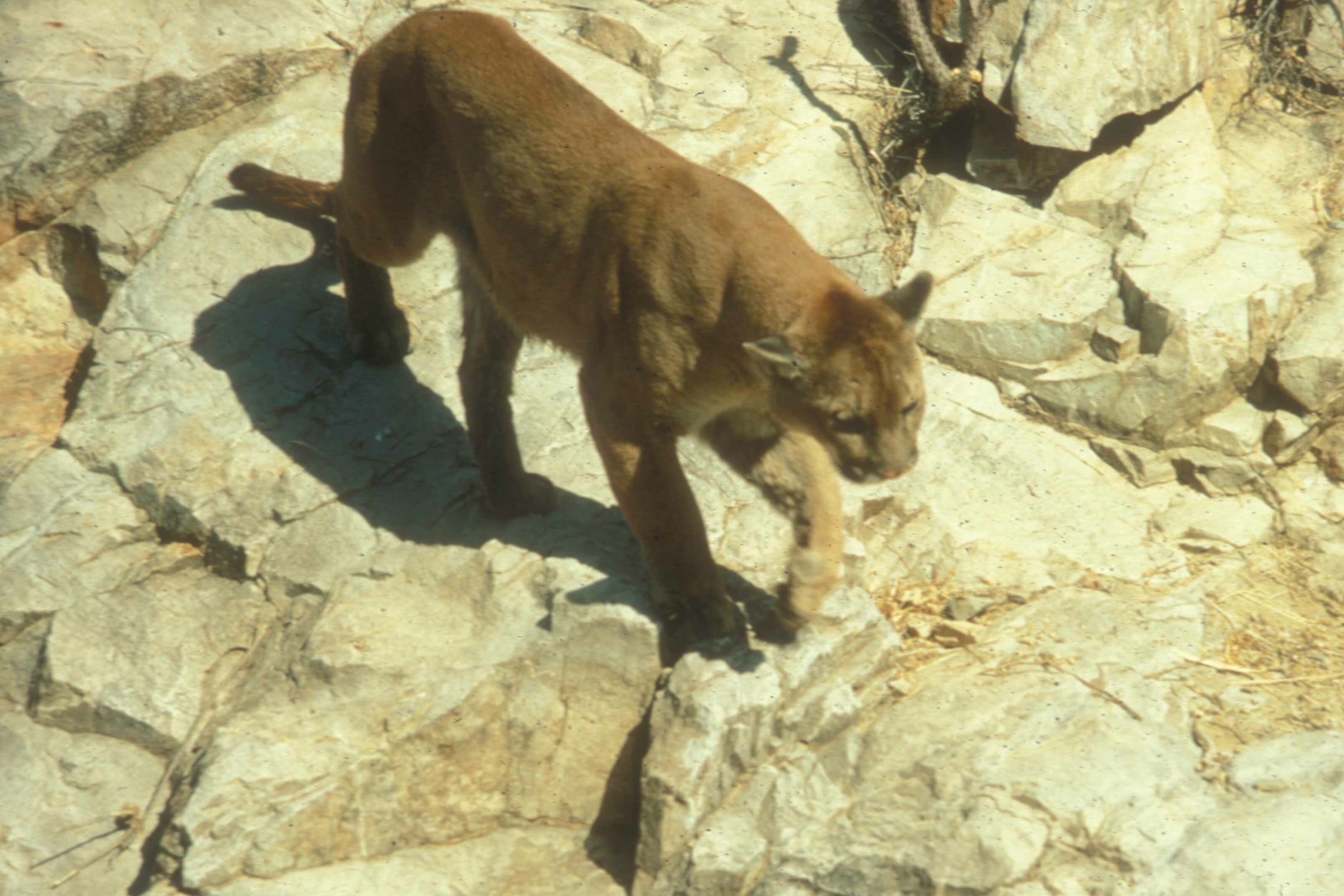
    A mountain lion walking over pale rocks, captured by a wildlife camera in Saguaro National Park, Arizona
    A mountain lion on a wildlife camera in Saguaro National Park, Arizona, not Olympic. NPS Photo

    Cougar encounter: what WDFW adds

    SituationWhat to do
    Cougar in sightBack away slowly while facing it; keep your eyes on it
    Looking biggerStep up onto a rock or stump; groups stand shoulder to shoulder
    Tempted to hideDon’t crouch down or try to hide
    Signs of aggressionShout, wave your arms and throw a water bottle or anything at hand
    AttackFight back, stay on your feet; pepper spray in its face is effective

    WDFW lists the signs of aggression as crouching with ears back, teeth bared, hissing, a twitching tail and hind feet pumping, ready to jump. Never approach a cougar near a kill or with kittens, and never offer it food.

    Cougar encounters in Olympic: what has happened

    Attacks are rare, but they have happened here. On July 29, 2023, a cougar attacked an 8 year old camping at Lake Angeles, the park reported. It gave up when the child’s mother yelled at it, the child had minor injuries, and the park closed the Lake Angeles and Heather Park areas for a time.

    The jagged rock face of Mount Angeles rising above a rocky subalpine meadow and a few firs along the Klahhane Ridge Trail
    Mount Angeles from the Klahhane Ridge Trail, above Lake Angeles. Photo: Dirtsc / Wikimedia Commons (CC BY-SA 3.0)

    On July 20, 2025, according to the park, a collared mountain lion bit a four year old walking with family on a popular trail near Victoria Overlook on Hurricane Ridge. The child was flown to a Seattle hospital, and park staff located the cougar and dispatched it the next morning.

    Both involved young children, so keep kids between adults. For perspective, WDFW records two fatal cougar attacks and about 20 other encounters that injured people across the whole state in the last 100 years.

    Report every cougar sighting

    The park asks visitors to report all cougar sightings to a ranger or through its online wildlife report, with the date, location (GPS is best) and your contact details. If you experience an attack or near attack, call 911.

    How Friends of Olympic National Park helps

    We are Friends of Olympic National Park (FONP), a volunteer led friends group based in Port Angeles. We don’t study or manage wildlife, but we help visitors enjoy the park with care, from our guided nature walks to cleanups. Our black bear safety guide covers the park’s other big predator. If you’d like to give back, volunteer at Olympic National Park with us.

    Frequently asked questions

    Are there mountain lions in Olympic National Park?

    Yes. Cougars, also called mountain lions or pumas, range throughout the Olympics, and the park considers the whole park cougar territory. They are seldom seen.

    Has anyone been attacked by a cougar in Olympic National Park?

    Yes, though attacks are rare. In July 2023 a cougar attacked an 8 year old at Lake Angeles, causing minor injuries, and in July 2025 a mountain lion bit a four year old near Victoria Overlook on Hurricane Ridge.

    Should you run from a cougar?

    No. Running and rapid movements may trigger an attack. Stop, face the cougar, stand tall, talk firmly and back away slowly, leaving it an escape route.

    Does pepper spray work on cougars?

    WDFW says pepper spray in the cougar’s face is effective in the unlikely event of a close encounter.

    Should you play dead if a cougar attacks?

    No. The park says to fight back if attacked, and WDFW says people have driven cougars off with sticks, rocks or bare hands.

  • Where to See Salmon in Olympic National Park

    Where to See Salmon in Olympic National Park

    You can see salmon in Olympic National Park almost any month, if you know which river to visit. Coho leap the Sol Duc in early autumn, Chinook spawn in the Elwha in September, and sockeye turn bright red in the Quinault Valley in early winter. Here is which fish runs where and when, and how to watch them without doing harm.
    Quick answer

    Where can you see salmon in Olympic National Park?

    The easiest place is Salmon Cascades on the Sol Duc River, where coho leap the falls in September and October. Coho also spawn in a small Hoh stream in November and December, Chinook spawn in the Elwha in September, and sockeye spawn in the Quinault Valley in November and December. Watch from the bank and stay out of the water.
    • Salmon Cascades has a short, accessible path to a viewing platform
    • Coho at the Sol Duc: September and October
    • Sockeye in the Quinault Valley: November and December
    • Pink salmon return mostly in odd numbered years

    Why the park is such a good place for salmon

    The park has 10 major rivers and supports some of the most extensive runs of wild salmon, trout and char left in the Pacific Northwest. Five Pacific salmon species use these waters, along with steelhead and bull trout, all hatching in fresh water, growing at sea and coming home to spawn.

    Their return feeds the valley: bears, otters and eagles eat the carcasses, carrying ocean nutrients into the forest. Our guide to black bears in Olympic National Park shows how bears follow the runs.

    The Sol Duc River rushing over mossy bedrock between forested banks near Salmon Cascades in Olympic National Park
    The Sol Duc River near Salmon Cascades. Photo: Sea Cow / Wikimedia Commons (CC BY-SA 4.0)

    Which salmon run where, and when

    Each species keeps its own calendar. These are the places and seasons the park names on its species pages.

    Salmon and steelhead viewing calendar

    FishWhere to lookWhen
    CohoSalmon Cascades, Sol Duc River; a small Hoh stream by the visitor centerSeptember to October (Sol Duc); November to December (Hoh)
    ChinookThe park’s coastal rivers; the Elwha between the former dam sitesMostly fall; September on the Elwha
    SockeyeBig Creek in the Quinault Valley; Lake OzetteNovember to December (Quinault); winter spawning (Ozette)
    PinkGray Wolf River near the trailheadJuly to September, mostly odd numbered years
    ChumLower Queets and Quillayute riversSummer or late fall
    SteelheadSalmon Cascades; near Hoh, Sol Duc and Queets campgroundsLate March to May (Cascades); nests in May and June

    Salmon Cascades on the Sol Duc

    Salmon Cascades is the classic spot. It sits about 5 miles up Sol Duc Road, where a 190 foot path of compacted gravel leads to a platform above the falls, with accessible parking and a toilet nearby. The park says coho are best seen in September and October, and steelhead from late March through May.

    These coho swim more than 50 miles up the Quillayute and Sol Duc to get here. Our Sol Duc Falls and valley guide covers the rest of the valley.

    Coho in the Hoh Rain Forest

    Coho spawn almost everywhere here, from small creeks to main channels. For a quieter late season sighting, the park points to a small tributary of the Hoh River, reached by the nature trail at the Hoh Visitor Center, in November and December.

    A pair of dark red spawning coho salmon over gravel and woody debris in Taft Creek, a small stream in the Hoh Rain Forest
    A spawning coho pair in Taft Creek in the Hoh, December 2010. NPS Photo / Jon Preston

    Our guide to the temperate rainforests of Olympic National Park helps you plan the rest of a Hoh visit.

    Chinook and the Elwha River salmon

    Chinook, or king salmon, are the largest Pacific salmon. Most spawn in the fall in all of the park’s coastal rivers, with small spring and summer runs in the Hoh, Queets, Quinault and Quillayute. Their nests, called redds, can be 10 feet across.

    Close underwater view of an olive brown, heavily spotted Chinook salmon resting over river cobbles in Olympic National Park
    A Chinook, or king salmon, in a park river. NPS Photo

    Since the Elwha dams came down, Chinook have spread above both former dam sites, with redds recorded near Godkin Creek, about 36 miles upriver. In September you can watch Chinook spawn in easily reached stretches between the Elwha and Glines Canyon dam sites. The full story is in our guide to Elwha River restoration.

    As of October 2026, the park’s alerts page says vehicles must stop at Madison Falls because of a washout on Olympic Hot Springs Road, which stays open to walkers and bicycles. Check the NPS alerts page before you go.

    The turquoise Elwha River running through a rocky, forested canyon just below a former dam site in July 2022
    The Elwha River below a former dam site, July 2022. USFWS Photo / Typhanie Shepherd

    Sockeye in the Quinault Valley and Lake Ozette

    Sockeye need a lake in their river system, and the park has two main runs. In the Quinault they spawn in November and December, and the park names Big Creek as a great place to watch. As of October 2026 the park lists North Fork Road as open but narrow gravel, not recommended for RVs; check the NPS alerts page first.

    Bright red spawning sockeye salmon over clean gravel in shallow, clear water in Olympic National Park
    Sockeye in spawning colors over their gravel nests. NPS Photo

    A smaller run enters Lake Ozette in summer and spawns along the lake’s edges and tributaries in winter. NOAA Fisheries listed Lake Ozette sockeye as threatened under the Endangered Species Act in 1999, so these fish deserve extra room. Our Ozette Triangle and Cape Alava guide covers the trails from the lake.

    Calm water at the north end of Lake Ozette with a small dock, a boat and dense green forest along the shore
    Lake Ozette, home of a threatened sockeye run. NPS Photo / D. Archuleta

    Pink, chum and steelhead

    • Pink salmon are the scarcest salmon in park rivers. Most return in odd numbered years, July to September; try the Gray Wolf River near the trailhead.
    • Chum are uncommon, but the lower Queets and Quillayute still have runs in summer or late fall.
    • Steelhead are sea run rainbow trout that can spawn more than once. Look for redds near the Hoh, Sol Duc and Queets campgrounds in May and June.

    Salmon viewing etiquette

    A careless step can wreck a nest. These tips come from the Washington Department of Fish and Wildlife salmon viewing page and the park:

    • Approach slowly and stand quietly at the edge. Don’t wade in: walking in a stream can crush the eggs in a redd.
    • Avoid quick movements, which make salmon think you are a predator.
    • Leave dead and dying salmon where they lie; they feed the river.
    • Keep pets under control so they can’t chase or catch fish. Our guide to dogs in Olympic National Park lists where pets may go.
    • Wear polarized sunglasses, and if you see nothing, try again after rain.

    Salmon runs draw bears and other wildlife too. Park rules require you to stay at least 50 yards from all wildlife.

    Thinking of fishing? Check the rules first

    Fishing rules inside the park differ from the rest of Washington and change every year; park biologists set them with the state and eight treaty tribes. Read the current rules on the park’s Olympic National Park fishing page before you cast, and check WDFW for waters outside the park.

    How Friends of Olympic National Park helps

    We are Friends of Olympic National Park (FONP), a volunteer led friends group based in Port Angeles. We don’t do fisheries work, but we care for the places visitors enjoy through cleanups, trail care and guided nature walks. You can volunteer at Olympic National Park with us, or support Olympic National Park.

    Frequently asked questions

    When is the best time to see salmon jump at Salmon Cascades?

    The park says coho are best seen at Salmon Cascades in September and October. Steelhead can be seen there from late March through May.

    Can you see salmon in the Elwha River?

    Yes. In September Chinook spawn between the former Elwha and Glines Canyon dam sites. As of October 2026 the road is closed to vehicles at Madison Falls, so check the NPS alerts page first.

    Where can you see sockeye salmon on the Olympic Peninsula?

    In the Quinault Valley in November and December; the park names Big Creek as a place to watch. A small threatened run also spawns at Lake Ozette in winter.

    Is the Salmon Cascades trail accessible?

    Yes. The 190 foot compacted gravel path is mostly gentle, with a brief steeper climb to the platform, and accessible parking and a toilet are nearby.

  • Olympic National Park Trees: A Guide to the Giants

    Olympic National Park Trees: A Guide to the Giants

    Olympic National Park trees include some of the largest conifers in the country, and you don’t need to be a botanist to tell the main ones apart. A handful of species, led by Sitka spruce, western hemlock, western red cedar and Douglas fir, make up most of the forest you’ll walk through. Here is how to recognise them, where each grows and where to find the record giants.

    Quick answer

    What trees grow in Olympic National Park?

    The main trees in Olympic National Park are Douglas fir, western hemlock, western red cedar and Sitka spruce in the lowlands, with bigleaf maple and red alder among them. Pacific silver fir joins higher up, and subalpine fir and mountain hemlock grow near treeline, which lies between 5,000 and 6,000 feet.

    • Some park trees are up to 1,000 years old
    • Sitka spruce grows mainly in the west side rain forests
    • Western hemlock is Washington’s state tree
    • Several national champion trees grow in the Quinault area

    A forest of giants

    The park was set up in 1938 partly to protect what its founders called the “finest sample of primeval forests”. The National Park Service says some of its trees are up to 1,000 years old, and the biggest stand 30 stories tall and wider than two parking spaces.

    Mild weather, deep soils and heavy rain in the low valleys grow record sized trees. “Old growth” usually means Douglas fir and western hemlock forest with trees older than about 200 years, fallen logs, snags and a layered canopy. For the moss, nurse logs and rain forest valleys, see our guide to the Olympic National Park rainforest; this guide sticks to the trees themselves.

    The main conifers, and how to tell them apart

    Sitka spruce

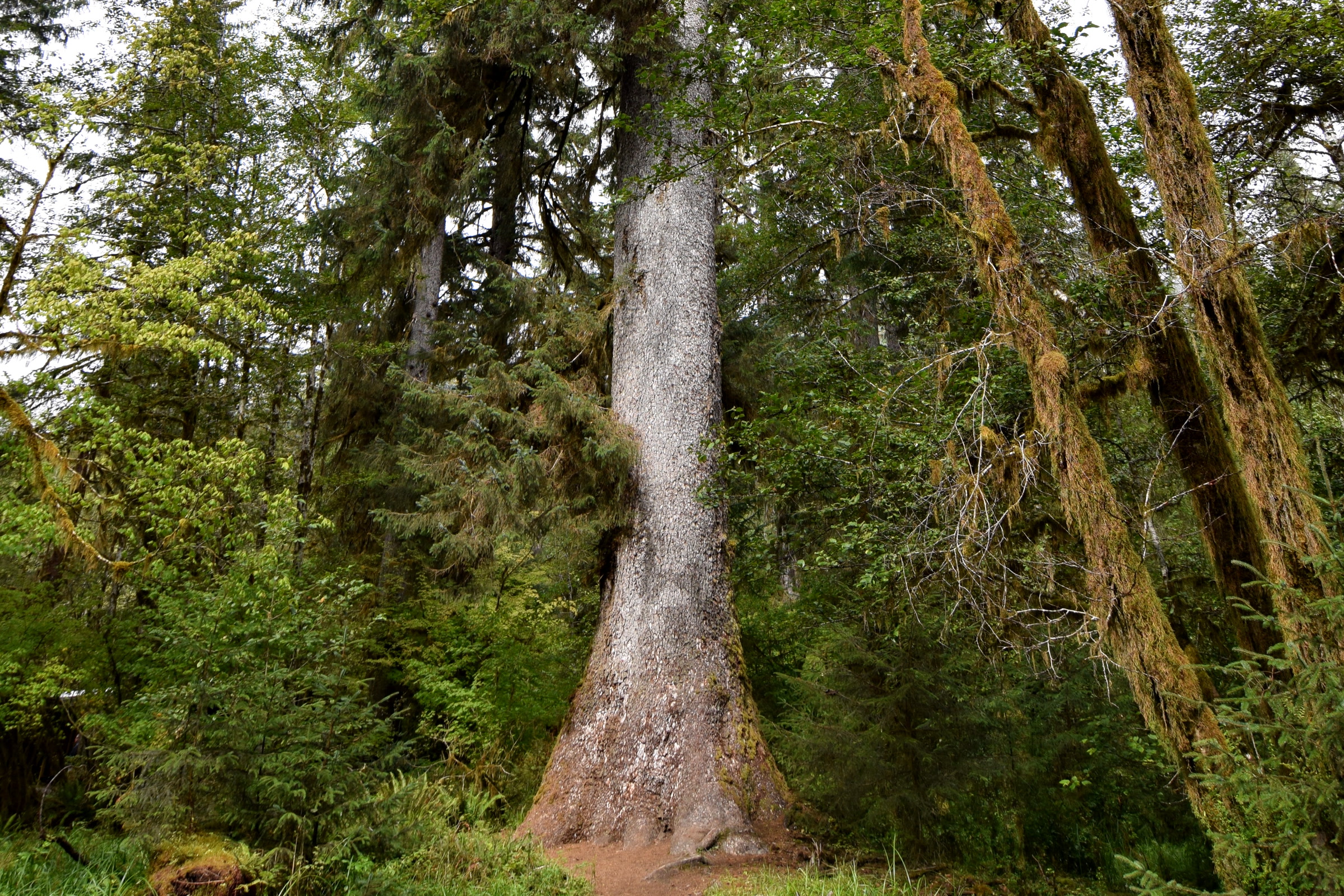
    Sitka spruce grows along the coast from Alaska to California, and in the park it is common mainly in the west side rain forests. Grab a twig gently and you’ll know it: the needles are stiff, very sharp and stick out from all sides. The bark breaks into thin, silvery to purplish grey scales.

    The flared grey trunk of a large Sitka spruce rising beside a trail among moss draped maples in the Hoh Rain Forest
    A Sitka spruce in the Hoh Rain Forest. Photo: Graaf van Vlaanderen / Wikimedia Commons (CC BY-SA 4.0)

    Western hemlock

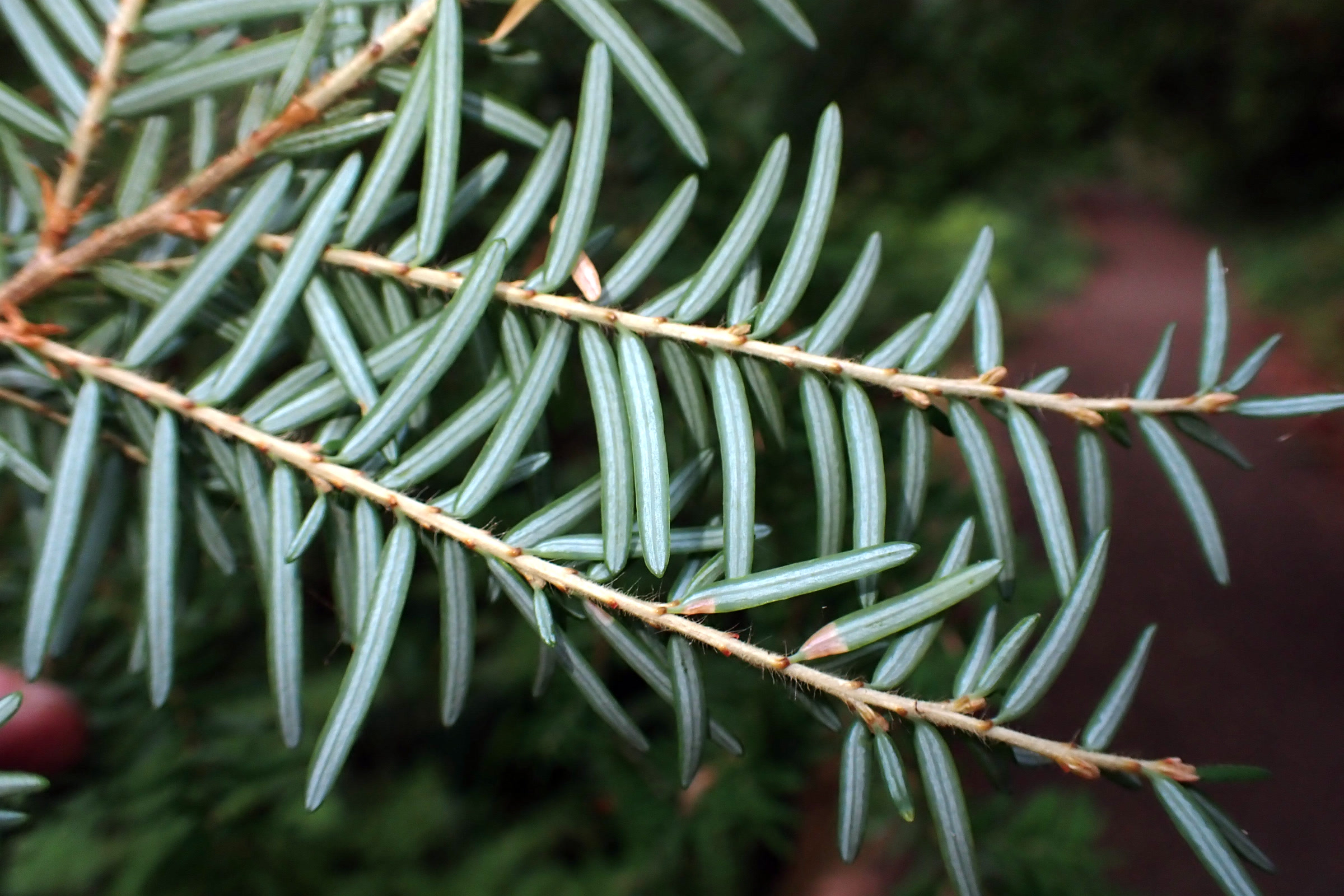
    Western hemlock is common in the park’s forests up to about 3,000 feet. Its needles are short, soft and round tipped, which gives the foliage a lacy look. The best clue is the very top of the tree, which arches over instead of pointing straight up. In 1947 the Legislature made it Washington’s state tree.

    Close view of a western hemlock sprig showing the short, flat, round tipped needles and their pale undersides, on the Olympic Peninsula
    Western hemlock needles, Olympic Peninsula. Photo: Kollibri1969 / Wikimedia Commons (CC0)

    Western red cedar

    Western red cedar likes low valley bottoms and wet ground. Its trunk swells and often flutes at the base, then tapers quickly. The bark is thin and stringy, and instead of needles it has tiny overlapping scales, carried in drooping, lacy sprays.

    The base of a huge western redcedar with stringy, ridged bark patched with moss and sword ferns at its foot in the Hoh Rain Forest
    Stringy cedar bark in the Hoh Rain Forest. NPS Photo / R. McKenna

    Douglas fir

    Douglas fir is the most abundant and widespread tree on the peninsula, growing from sea level to about 5,000 feet. Old trees have thick, reddish brown bark with deep furrows and trunks mostly free of limbs for about 100 feet. Look on the ground for its cones, 2.5 to 3 inches long, with three pointed bracts poking out between the scales.

    A hiker seen from behind, dwarfed by the furrowed trunks of old growth Douglas firs on a mossy forest floor, in a photo from Olympic National Park
    Old growth Douglas firs. NPS Photo

    Broadleaf trees: bigleaf maple and red alder

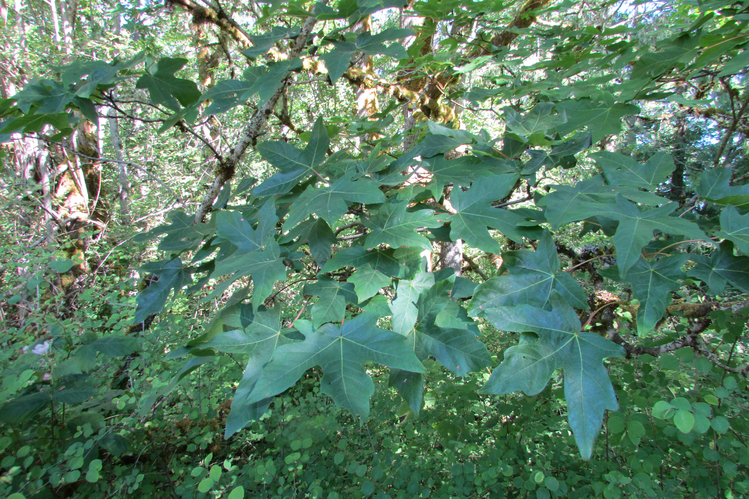
    Bigleaf maples soften the rain forest with limbs draped in mosses, ferns and spikemoss. You can meet one on the Living Forest Nature Trail beside the park visitor center in Port Angeles.

    Broad, deeply lobed bigleaf maple leaves on the Living Forest Nature Trail at the Olympic National Park Visitor Center in Port Angeles
    Bigleaf maple on the Living Forest Nature Trail, Port Angeles. Photo: Chris Light / Wikimedia Commons (CC BY-SA 4.0)

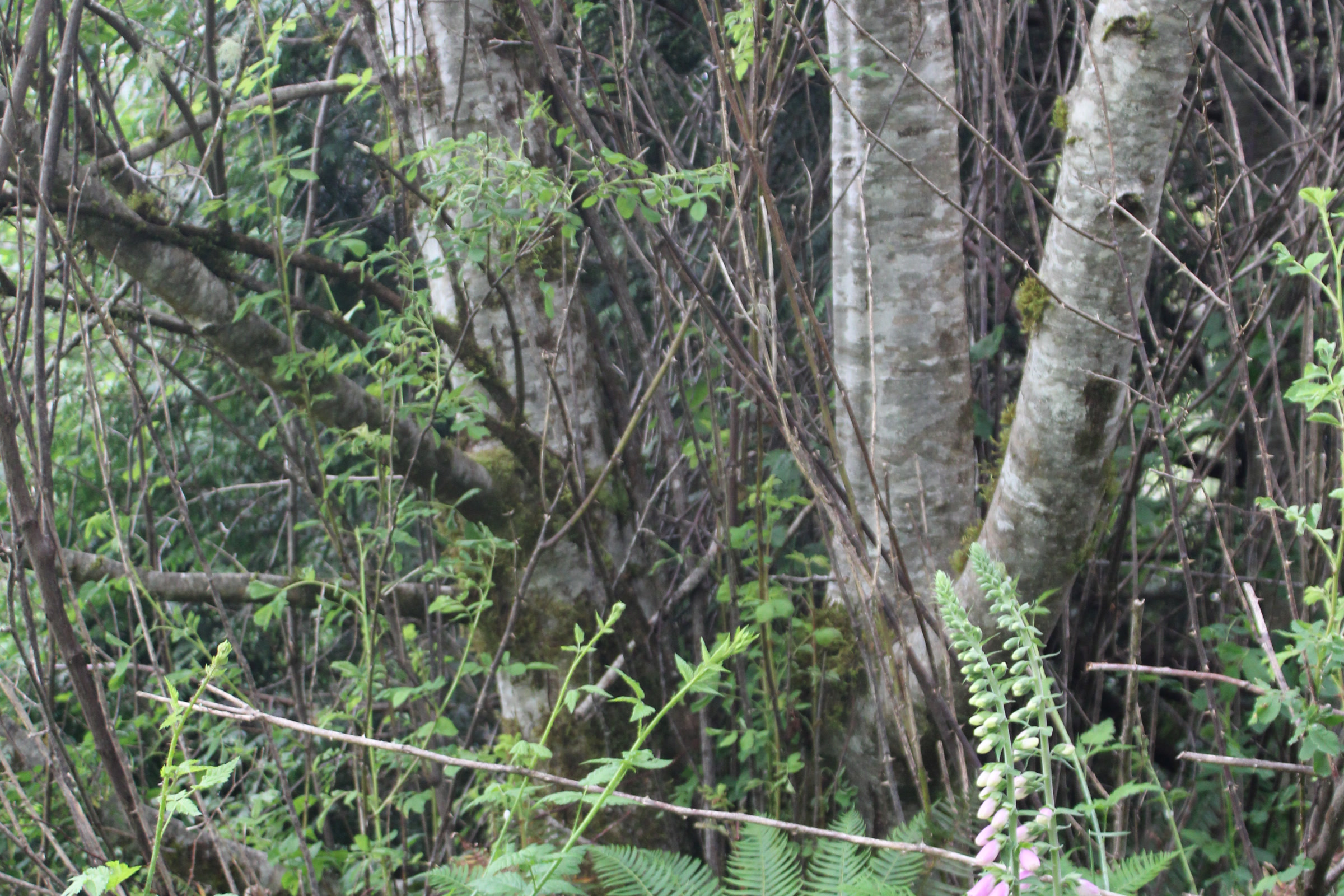
    Red alder, with its smooth, pale bark, is the most common hardwood in the Pacific Northwest, according to the USDA Forest Service. It is a fast growing, fairly short lived pioneer that needs full sun, tends to spread after logging or fire, and can take nitrogen from the air. Look for it along rivers and streams and on disturbed ground.

    Pale, smooth red alder trunks above ferns and foxglove along Cutthroat Creek in Willapa National Wildlife Refuge, Washington
    Red alder at Cutthroat Creek, Willapa National Wildlife Refuge, not in the park. Photo: Chris Light / Wikimedia Commons (CC BY-SA 4.0)

    Higher up: silver fir and subalpine fir

    Montane forest starts around 1,500 to 2,000 feet. Pacific silver fir, with smooth ashy grey bark, chalky patches and resin blisters, grows with western hemlock on the wet west side but only on cool, north facing slopes in the drier east. Hurricane Ridge Road and Deer Park Road both climb through this zone.

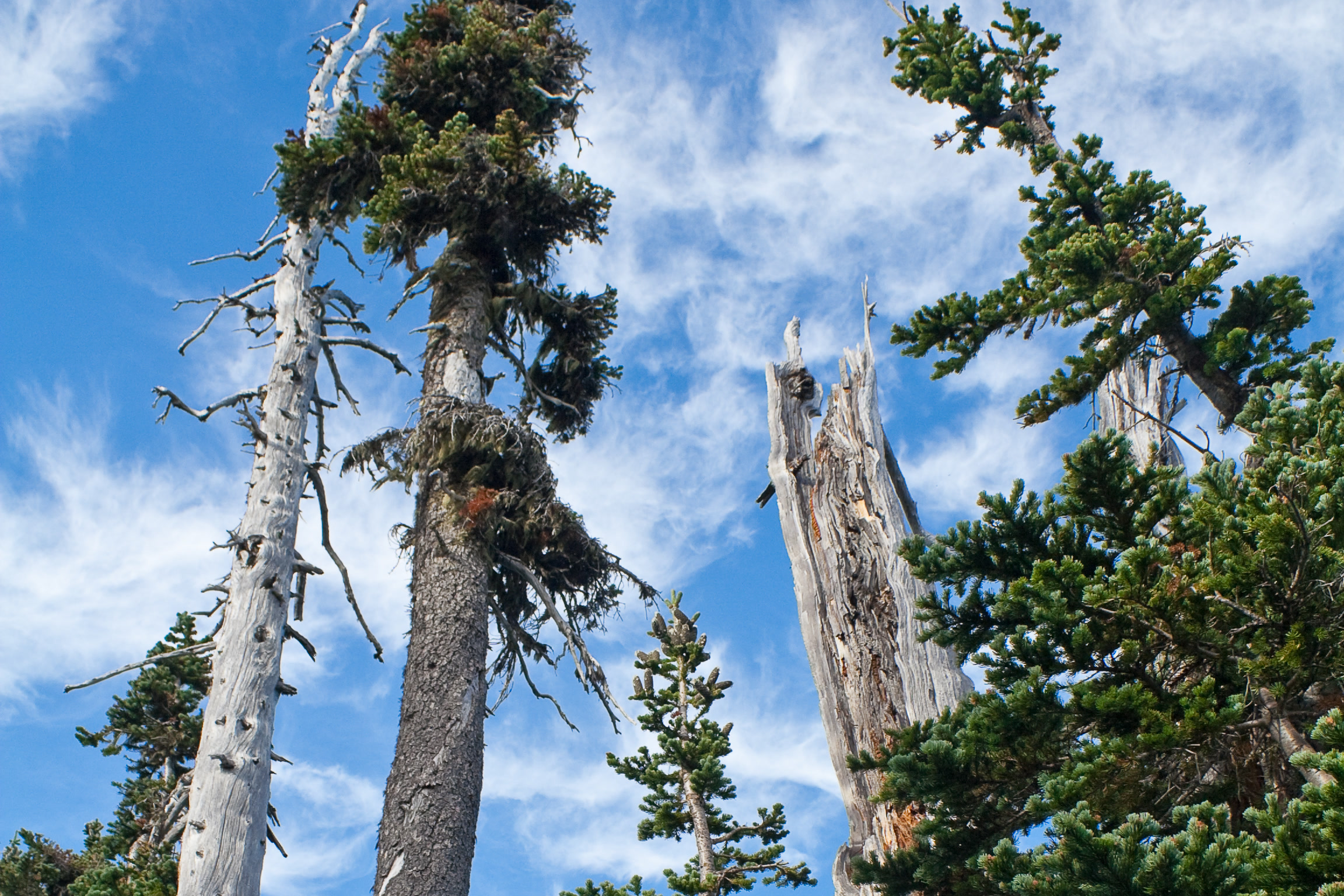
    Above about 4,000 feet comes subalpine forest of subalpine fir, mountain hemlock and Alaska yellow cedar. Subalpine firs are narrow spires that shed snow, with upright purple cones. The photo below shows them at Hurricane Ridge, and our Hurricane Hill Trail guide covers a hike up there.

    Narrow, spire shaped subalpine firs and bleached dead snags against a blue sky with wispy clouds at Hurricane Ridge, Olympic National Park
    Subalpine firs at Hurricane Ridge. Photo: shiladsen / Wikimedia Commons (CC BY 2.0)

    Olympic National Park trees compared

    TreeWhere in the parkQuick clue
    Sitka spruceWest side rain forestsStiff, sharp needles; scaly grey bark
    Western hemlockCommon up to about 3,000 feetDrooping top; short, soft needles
    Western red cedarWet valley bottomsStringy bark; flat, scaly sprays
    Douglas firSea level to about 5,000 feetDeeply furrowed bark; cones with three pointed bracts
    Bigleaf mapleLowland and rain forest valleysBroad, lobed leaves; mossy limbs
    Red alderRivers and disturbed groundSmooth, pale bark
    Subalpine firNear treelineNarrow spire; upright purple cones

    Where to see big trees

    The park points to lowland old growth in the Sol Duc and Elwha valleys, along the trails around Lake Crescent and near Staircase in the southeast corner. On the coast, our post on the Kalaloch Tree of Life covers one famous, clinging Sitka spruce. Close to Port Angeles, our adopt-a-trail crew cares for the Heart O’ the Forest Trail, a gentle walk through big trees.

    Record trees on the park’s list

    The figures below come from the park’s Record Trees handout (revised October 2012), based on American Forests measurements; each year is the latest measurement listed. Titles change as trees are remeasured or fall.

    Tree (status, year)SizeLocation given
    Western red cedar (national champion, 1999)761 in around, 159 ft tallQuinault Big Cedar Trail
    Sitka spruce (national champion, 2007)668 in around, 191 ft tallQuinault, Olympic National Forest
    Douglas fir (co-champion, 1999)505 in around, 281 ft tallQuinault, Olympic National Forest
    Western hemlock (national champion, 2007)273 in around, 237 ft tallOlympic National Park
    Pacific silver fir (national champion, 2011)216 in around, 220 ft tallBogachiel valley

    Two of these stand on national forest land beside the park, not inside it. A 2016 report in The Daily World said the Quinault Big Cedar had died and its trail had closed. Status can change, so as of October 2026 check the park website or ask at a ranger station before you go.

    Be kind to the giants

    The park calls its big trees living museums and asks visitors not to damage the bark or trample the soil at their base. Admire them from the trail.

    How Friends of Olympic National Park helps

    We are Friends of Olympic National Park (FONP), a volunteer led friends group in Port Angeles. Our guided nature walks help people meet the forest up close. To keep that work going, please support Olympic National Park with a gift, or see our volunteer opportunities.

    Frequently asked questions

    What is the most common tree in Olympic National Park?

    The National Park Service calls Douglas fir the most abundant and widespread tree on the Olympic Peninsula. It grows from sea level to about 5,000 feet.

    How old are the trees in Olympic National Park?

    The park says some of its trees are up to 1,000 years old. Old growth forests are usually defined by trees older than about 200 years.

    How can I tell a Sitka spruce from a western hemlock?

    Sitka spruce needles are stiff and very sharp and stick out all round the twig. Western hemlock needles are short, soft and round tipped, and the tip of the tree droops over.

    Where is the largest Sitka spruce near the park?

    The park record trees handout lists a national champion Sitka spruce, measured in 2007 at 191 feet tall, in the Quinault area on Olympic National Forest land beside the park.

  • Banana Slugs of the Olympic Peninsula

    Banana Slugs of the Olympic Peninsula

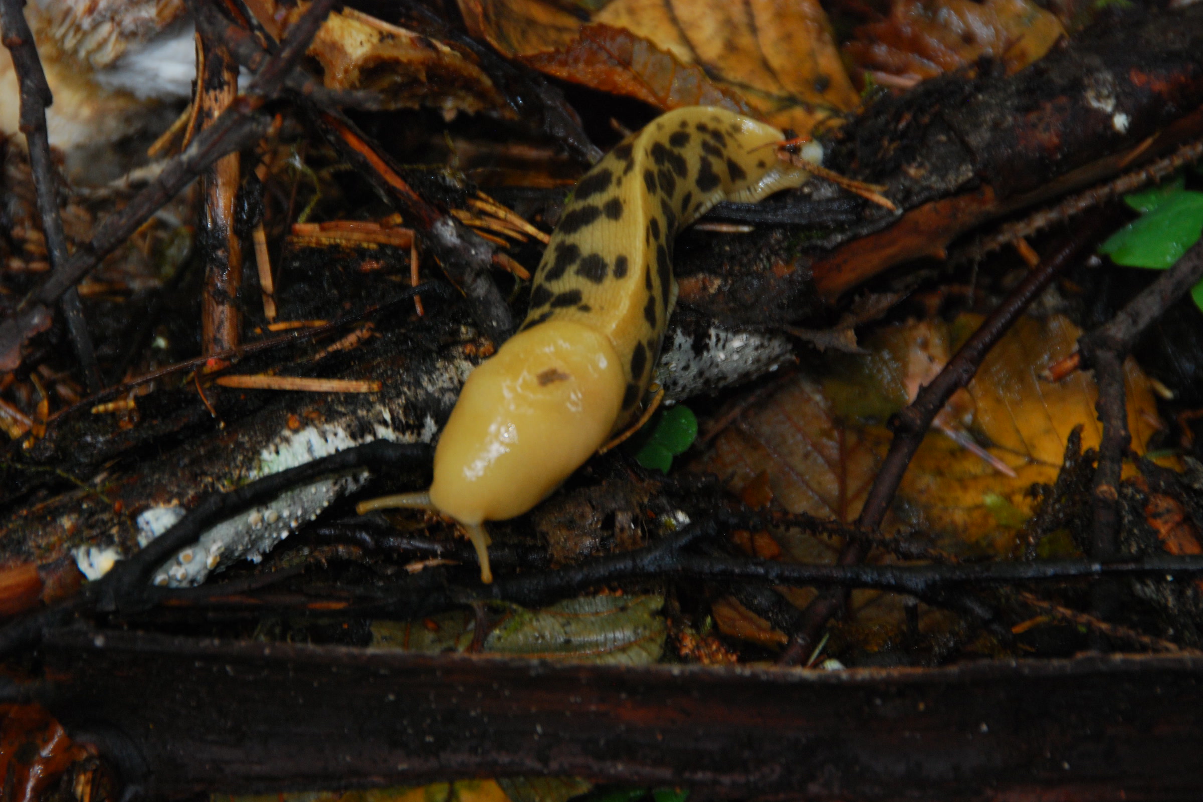
    Banana slugs are the slow, shining stars of Olympic National Park’s wet forests. Walk any damp trail on the west side of the park and you may find one gliding over a mossy log or a fern, especially in the Hoh and Quinault rain forests. Here is how to recognise a Pacific banana slug, what it does for the forest, and how to enjoy one without doing it harm.

    Quick answer

    Where can you see banana slugs in Olympic National Park?

    Banana slugs live year round on forest floors, trails, tree trunks, ferns and stumps in Olympic National Park, and they are especially common in the Hoh and Quinault rain forests. Look on damp mornings, in light rain or after a storm. Stay on the trail, watch your step and leave each slug where you find it.

    • The largest reach about 10 inches long
    • Colours range from yellow and green to brown, black and white
    • They eat leaves and mushrooms and help break down plants
    • An introduced European slug now also lives in the park

    What is a Pacific banana slug?

    The Pacific banana slug, Ariolimax columbianus, is a mollusc, a relative of snails that carries no shell. It lives in coastal rain forests from southeast Alaska to central California, and the Olympic Peninsula sits right in the heart of that range. The University of Puget Sound’s Slater Museum of Natural History calls it the largest slug in North America and perhaps the second largest in the world.

    Muir Woods National Monument puts the biggest at about 10 inches long. Without a shell, a banana slug dries out easily, which is why it does best on the floor of cool, wet forests and is mainly active at night or on cool, damp days.

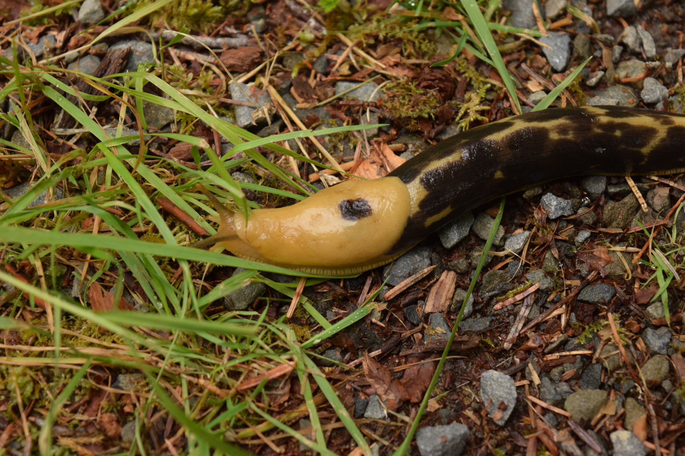
    A banana slug with a yellow head and dark brown blotched body crossing grass and gravel in the Hoh Rain Forest, Olympic National Park
    A heavily blotched banana slug in the Hoh Rain Forest. Photo: Entychologist / Wikimedia Commons (CC0)

    Banana slug facts: colour, body and senses

    Not every banana slug looks like a banana. Olympic National Park describes them as bright to dark yellow, brown, black, white or green, often with dark spots. Their head and body are smooth, and many have a distinct ridge running along the back.

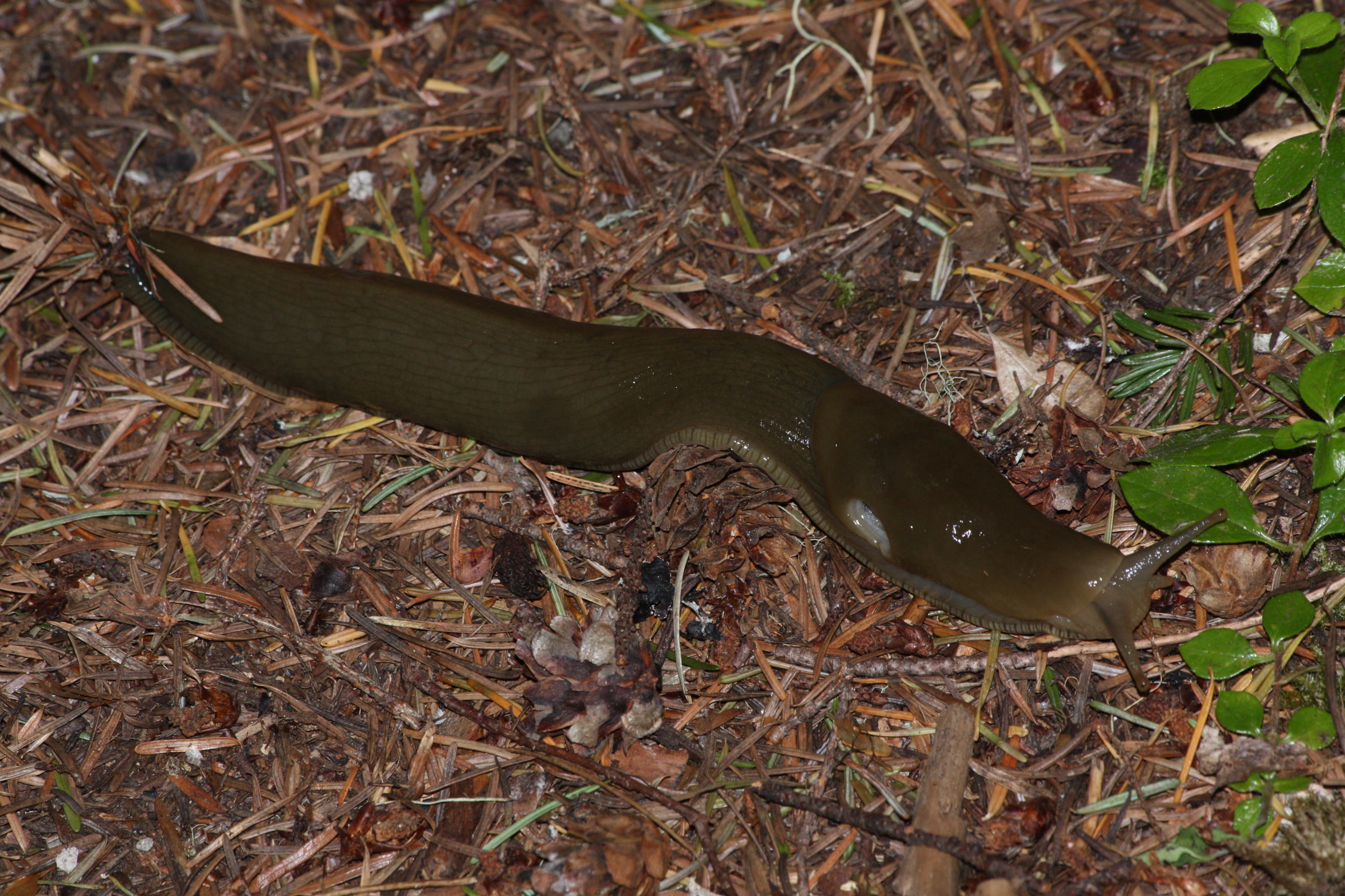
    An olive green banana slug stretched across conifer needles beside the Upper Dungeness Trail in Olympic National Forest
    An olive green banana slug on the Upper Dungeness Trail, Olympic National Forest. Photo: Walter Siegmund / Wikimedia Commons (CC BY-SA 3.0)

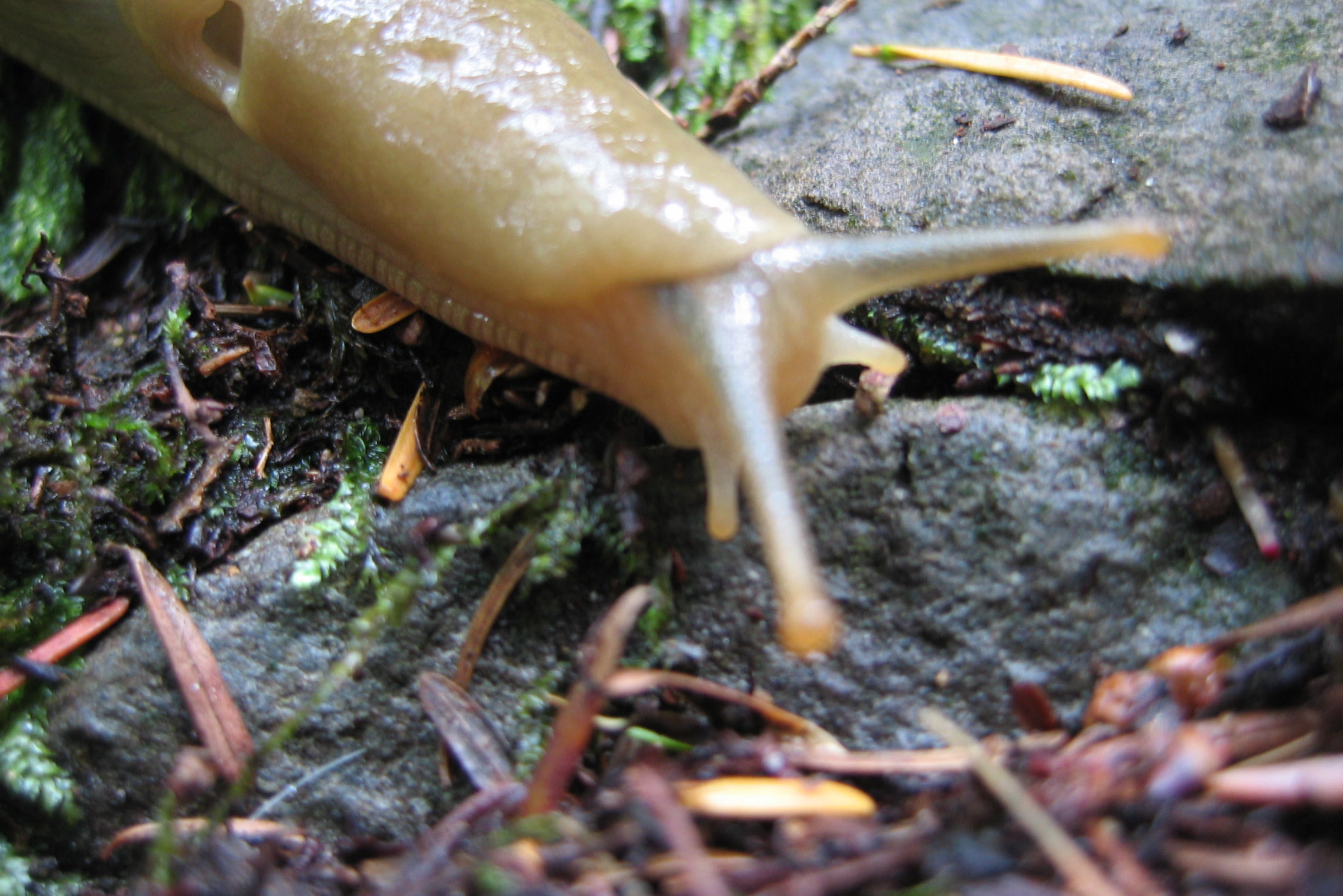
    Look closely at the head and you’ll see four tentacles. The two long upper ones sense light and movement, and the two short lower ones are for touch and smell. On one side of the head there is a small hole, the breathing pore, which leads to a single lung. After rain you may see it open wide.

    Close view of a pale yellow banana slug head showing its long upper tentacles, short lower tentacles and breathing pore, photographed in North Bend, Washington
    Upper and lower tentacles and the breathing pore, seen in North Bend, Washington. Photo: Aronlevin / Wikimedia Commons

    What the slime is for

    Slime is the banana slug’s survival kit. The park says it keeps the slug from drying out, helps it breathe and helps it move: the slug’s single muscular foot glides over a film of mucus, a little like ice skating. Muir Woods clocks that pace at about 6.5 inches per minute.

    The slime is also a defence. It can numb the mouth and tongue of an animal that tries to eat the slug, and the Slater Museum notes that its mucus can make a predator’s mouth stick shut. Even so, Pacific giant salamanders and northwestern garter snakes still eat them.

    What banana slugs eat and why the forest needs them

    Banana slugs are decomposers. They eat leaves and mushrooms, and they help break down dead plant material so its nutrients return to the soil. Redwood National and State Parks adds that they also eat fruit such as raspberries and blackberries, and may spread seeds in their droppings.

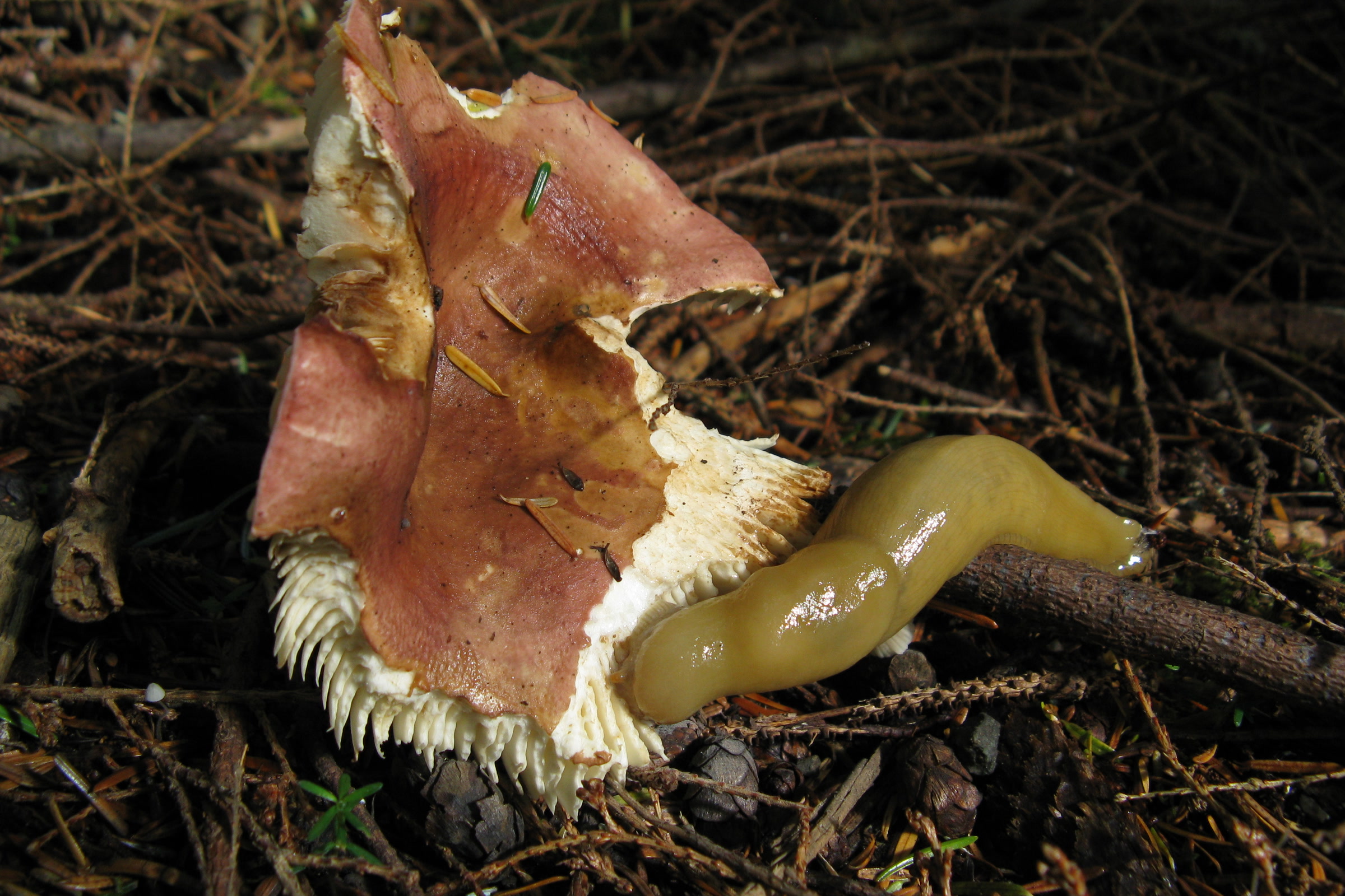
    To scrape up all that food, the park says, a banana slug has up to 27,000 microscopic teeth on its radula, a tongue like ribbon. If you spot a nibbled mushroom on the trail, a slug may be the culprit; our guide to mushroom season in Olympic National Park covers the fungi they love.

    A yellow banana slug feeding at the edge of a half eaten red capped mushroom on the forest floor in Olympic National Park
    Lunch on the forest floor. NPS Photo

    How banana slugs reproduce

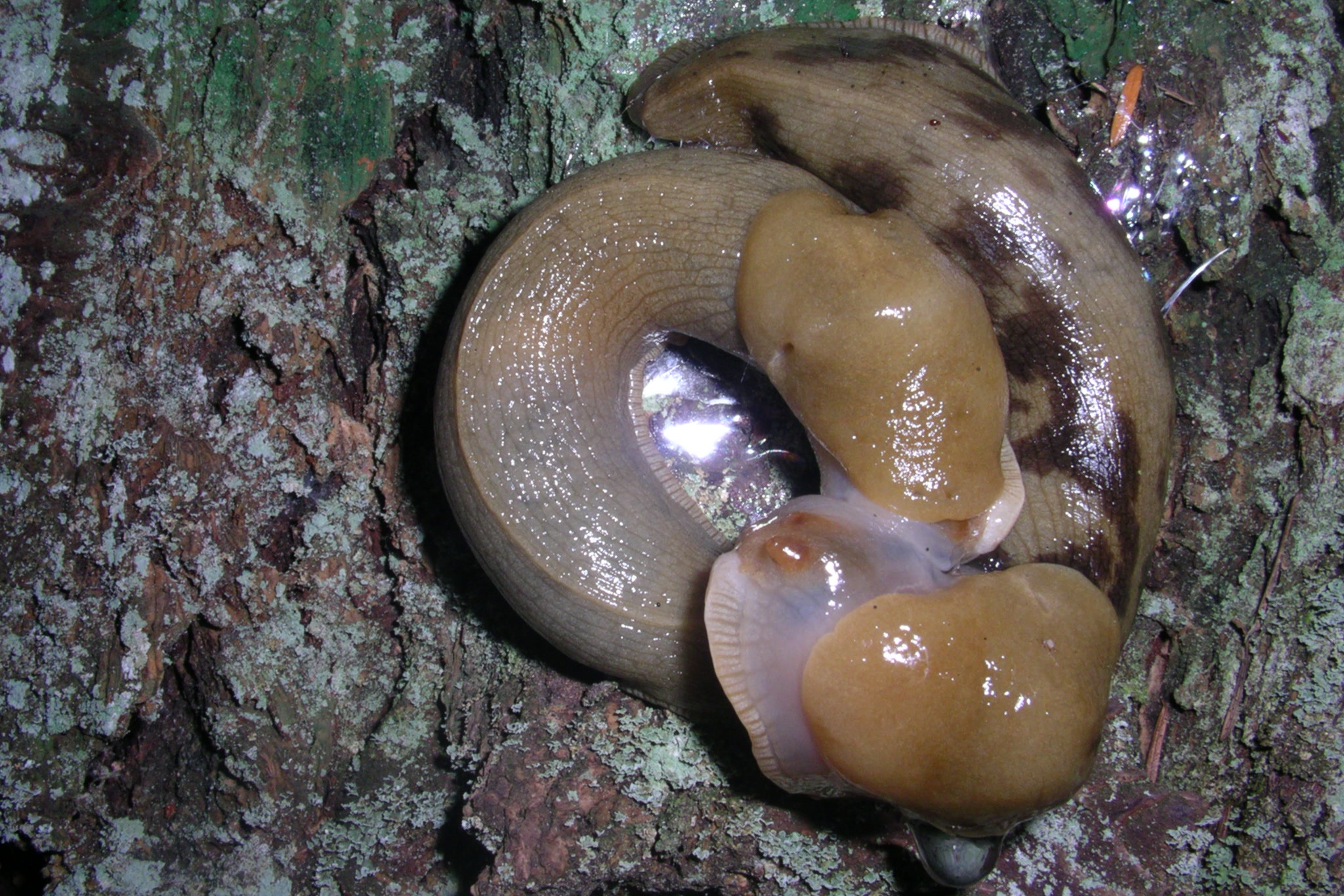
    Every banana slug is both male and female, so both partners in a pair can produce eggs. They rarely fertilise themselves and usually court another slug, a slow ritual of circling, nipping and tail swiping. Afterwards a slug lays 3 to 50 eggs in a hidden spot such as under a log or in leaves. The young hatch in one to two months and mature within a few months.

    Two banana slugs coiled together in a mating circle on a lichen covered log in the Puget Sound area of Washington
    A mating pair in the Puget Sound area, not in the park. Photo: Great Basin Sky / Wikimedia Commons (CC BY 4.0)

    Banana slug or European slug?

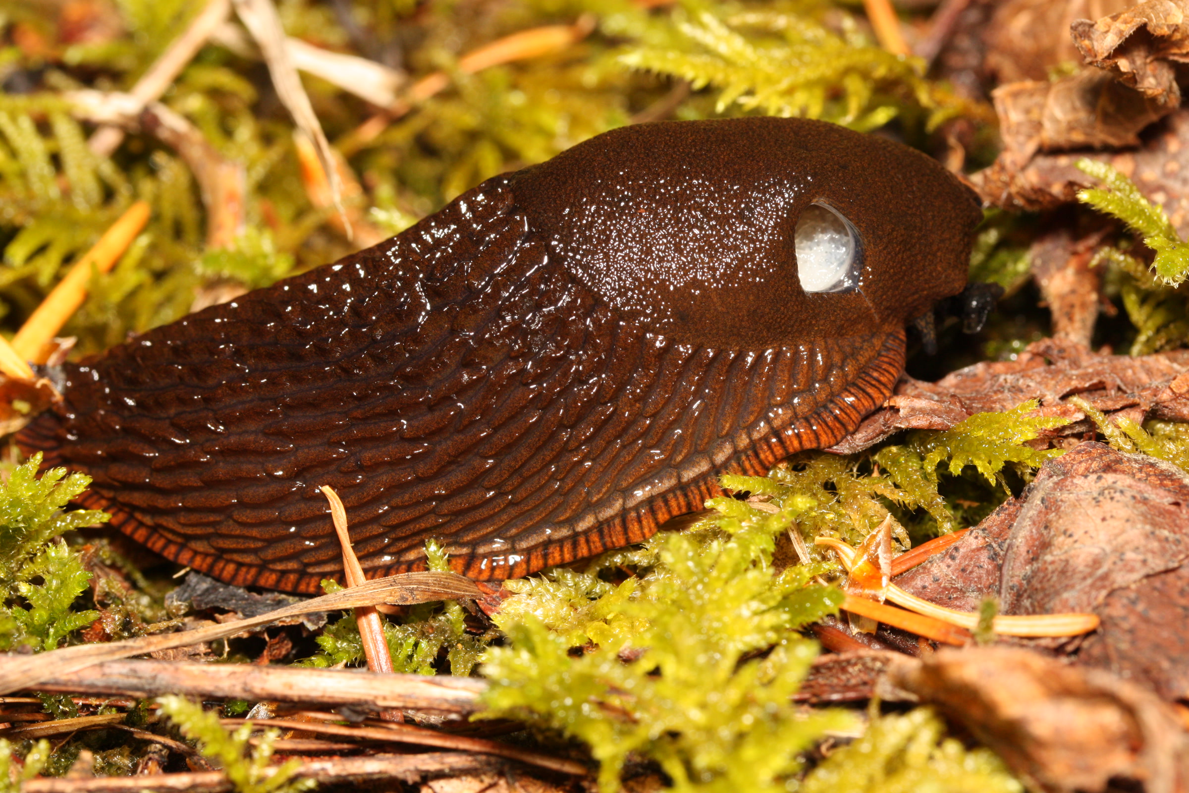
    Not every big slug in the park is a native. A European slug, Arion rufus, arrived in the Pacific Northwest within the last century and is now common in Olympic’s forests. Park Service research on San Juan Island found the newcomer becoming much more common than the banana slug in some places, possibly helped by drought.

    Native banana slug and introduced European slug compared

    FeaturePacific banana slugEuropean slug (Arion rufus)
    OriginNative to the Pacific coastIntroduced from Europe
    ColourYellow, green, brown, black or white, often spottedBlack, brown or red
    SkinSmooth; many have one ridge along the backRidged along the back
    In the parkForest floors, trails, trunks, ferns and stumpsNow common in park forests
    A glossy chocolate brown European slug, Arion rufus, with an orange edged foot on moss in Mount Baker Snoqualmie National Forest, Washington
    The introduced Arion rufus, photographed in Mount Baker Snoqualmie National Forest. Photo: Walter Siegmund / Wikimedia Commons (CC BY-SA 3.0)

    How to watch banana slugs without harming them

    Banana slugs turn up all year, but the park says you’ll see the most on damp mornings, in light rain or after storms. A short loop in the Olympic National Park rainforest is a fine place to start. Then follow the park’s simple advice from its Slugs of Olympic page:

    • Watch your step. Slugs often sit right on the tread.
    • Stay on the trail so you don’t crush the ones you can’t see.
    • If you turn over a rock or log, put it back exactly as it was, because it shelters animals.

    We’d add one more: look, photograph, but don’t pick them up. Their moist skin and slime are how they breathe and stay alive, so the kindest thing is to crouch down, enjoy the tentacles at work and let the slug carry on.

    Want to help science? The Burke Museum’s SLIME Pacific Northwest project maps native and introduced slugs and snails through iNaturalist, and your trail photos can count.

    How Friends of Olympic National Park helps

    We are Friends of Olympic National Park (FONP), a volunteer led friends group in Port Angeles. Our guided insect, mushroom and wildflower walks help neighbours and visitors notice small forest life like this. Members keep that work going, so please become a member or browse our volunteer opportunities.

    Frequently asked questions

    How big do banana slugs get?

    The largest Pacific banana slugs reach about 10 inches long, according to the National Park Service. The Slater Museum at the University of Puget Sound calls it the largest slug in North America.

    Why are banana slugs slimy?

    Slime keeps a banana slug from drying out, helps it breathe and lets its single foot glide along. It also defends the slug by numbing the mouth of a predator.

    Are banana slugs only yellow?

    No. In Olympic National Park they can be bright or dark yellow, brown, black, white or green, and many have dark spots.

    What do banana slugs eat?

    Leaves, mushrooms and decaying plant material, which they help break down. They also eat fruit such as raspberries and blackberries.

    Is it okay to pick up a banana slug?

    We suggest you watch without handling. Their moist skin and slime are how they breathe and stay alive. The park asks visitors to stay on trails, watch their step and put back any rocks or logs they move.

  • Hurricane Ridge in Winter: What to Know

    Hurricane Ridge in Winter: What to Know

    Hurricane Ridge in winter is the snowy heart of Olympic National Park, 17 miles above Port Angeles at the end of Hurricane Ridge Road. On open days you can snowshoe with a ranger, ski or tube at a small lift-served area, or let the kids sled in their own snow play area. It takes more planning than a summer visit, so here is what the park and the ski area say, as of October 2026.

    Quick answer

    Is Hurricane Ridge open in winter?

    Yes, on a limited schedule. In the winter season, generally late November through March, Hurricane Ridge Road typically opens to uphill traffic from 9 am to 4 pm, Friday through Sunday and some holidays, weather permitting. Every vehicle must carry tire chains, and storms can close the road at any time.

    • Chains required from November 1 to April 1
    • Be below Heart O’ the Hills by 5 pm
    • No food, warming area or drinking water
    • Road report line: 360-565-3131

    The winter season, as of October 2026

    The park’s Hurricane Ridge in Winter page says the season generally runs from late November through the end of March. As of mid-October 2026, that page still describes the 2025-26 season, and the park had not yet posted dates for this winter. Treat the details below as last season’s pattern and check the NPS page before you go.

    From March 31 through April 30, the park says the road may open or close depending on snow and weather. Our best time to visit Olympic National Park guide covers the rest of the park in winter.

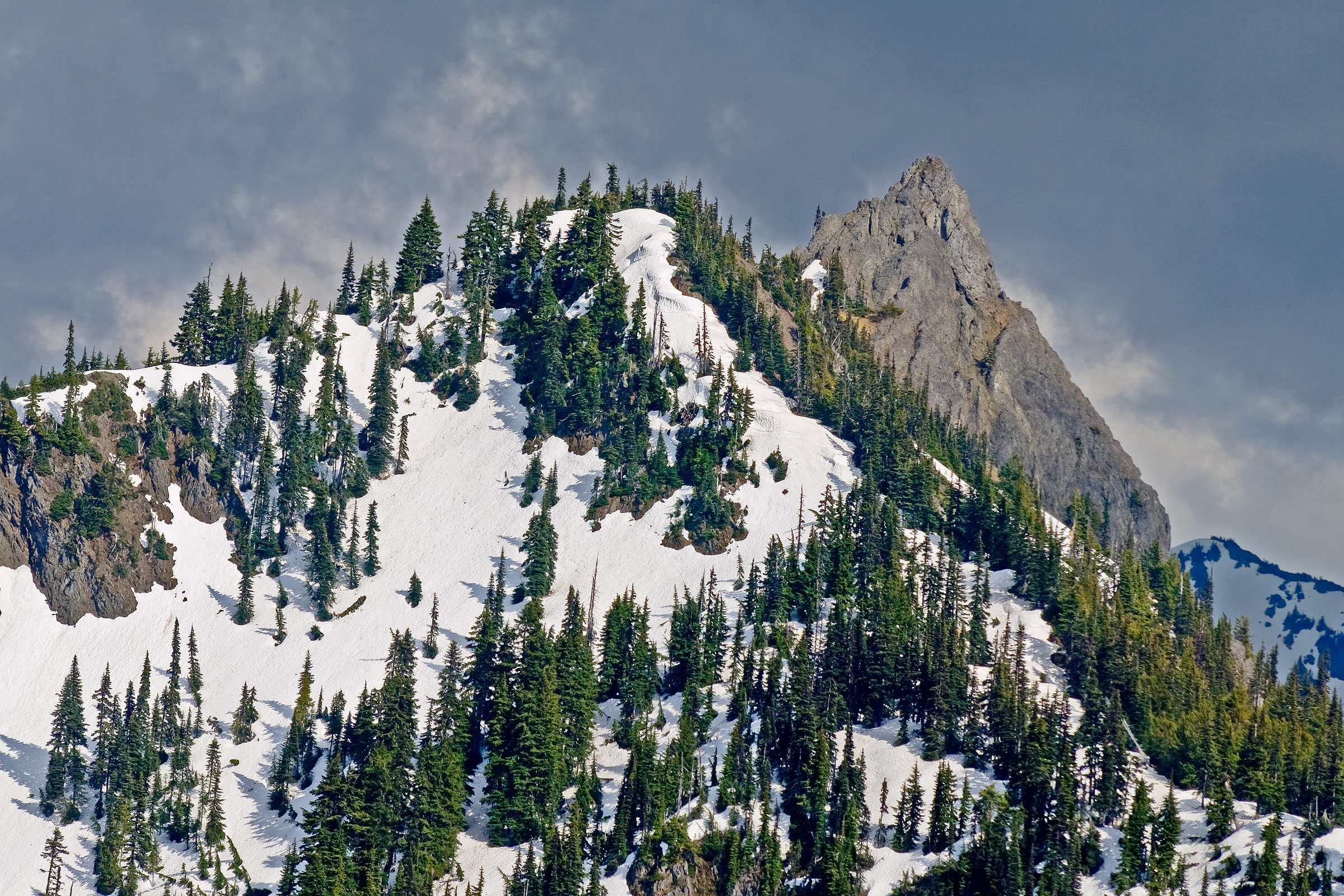
    A rocky peak and fir dotted slopes still deep in snow at Hurricane Ridge at the end of May
    Snow can linger at Hurricane Ridge into late May. Photo: Eric Frommer / Wikimedia Commons (CC BY-SA 2.0)

    Driving Hurricane Ridge Road in winter

    Hurricane Ridge Road is the only way up, and winter rules are strict. All vehicles, four wheel drive included, must carry tire chains or alternate traction devices as defined by the Washington State Patrol. That applies above the Heart O’ the Hills entrance station from November 1 through April 1, whatever your tires or the weather.

    Hurricane Ridge Road winter rules compared

    RuleWhat the park says
    Open daysFriday to Sunday and some holidays, weather permitting
    Uphill hoursTypically 9 am to 4 pm; can open as late as noon
    Leave byAll vehicles below Heart O’ the Hills by 5 pm
    ChainsCarried by every vehicle, November 1 to April 1
    ClosedThanksgiving and Christmas, and any day storms make it unsafe

    High winds and blizzards are common. Call the recorded road and weather line at 360-565-3131 or check the park’s alerts before you leave town. Entrance fees are collected at Heart O’ the Hills; our Olympic National Park entrance fees guide lists the passes.

    Parking at the top is limited. The ski area says cars may be held at the entrance station when the upper lot is full, and suggests reaching the gate by 8:45 am on busy powder days.

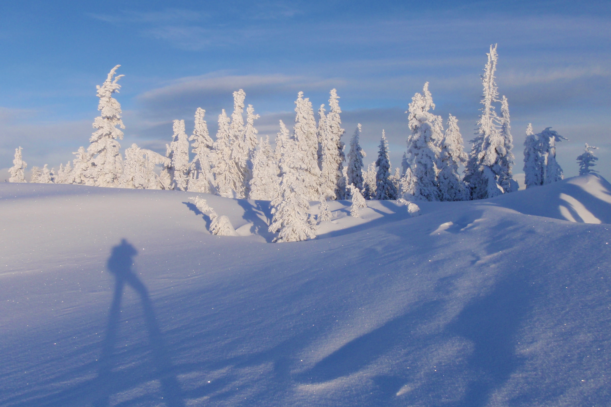
    Rime frosted subalpine firs on a wind sculpted snowfield at Hurricane Ridge, with a photographer's long shadow across the snow
    Rime ice on the firs, February 2011. NPS Photo

    Facilities since the Day Lodge fire

    The Hurricane Ridge Day Lodge, built in 1952, burned in May 2023. Today temporary trailers hold restrooms and a visitor contact station, staffed on and off from Friday to Sunday. There is no indoor warming area, no food service, no drinking water, and the park says snowshoe and ski rentals are not available. It suggests using your car as the warming area and bringing extra food, water, dry clothes and blankets or sleeping bags.

    A new lodge is coming, but not soon. The park’s project page, updated in August 2026, says construction could start in 2028 at the earliest and take two to three years.

    Ranger-led snowshoe walks

    Ranger snowshoe walks are the easiest way to try the sport. Last season they began on December 26, 2025, at 1:30 pm on Saturdays and Sundays. Each walk lasted about 1.5 hours, covered less than a mile and climbed about 130 feet, with snowshoes and instruction provided.

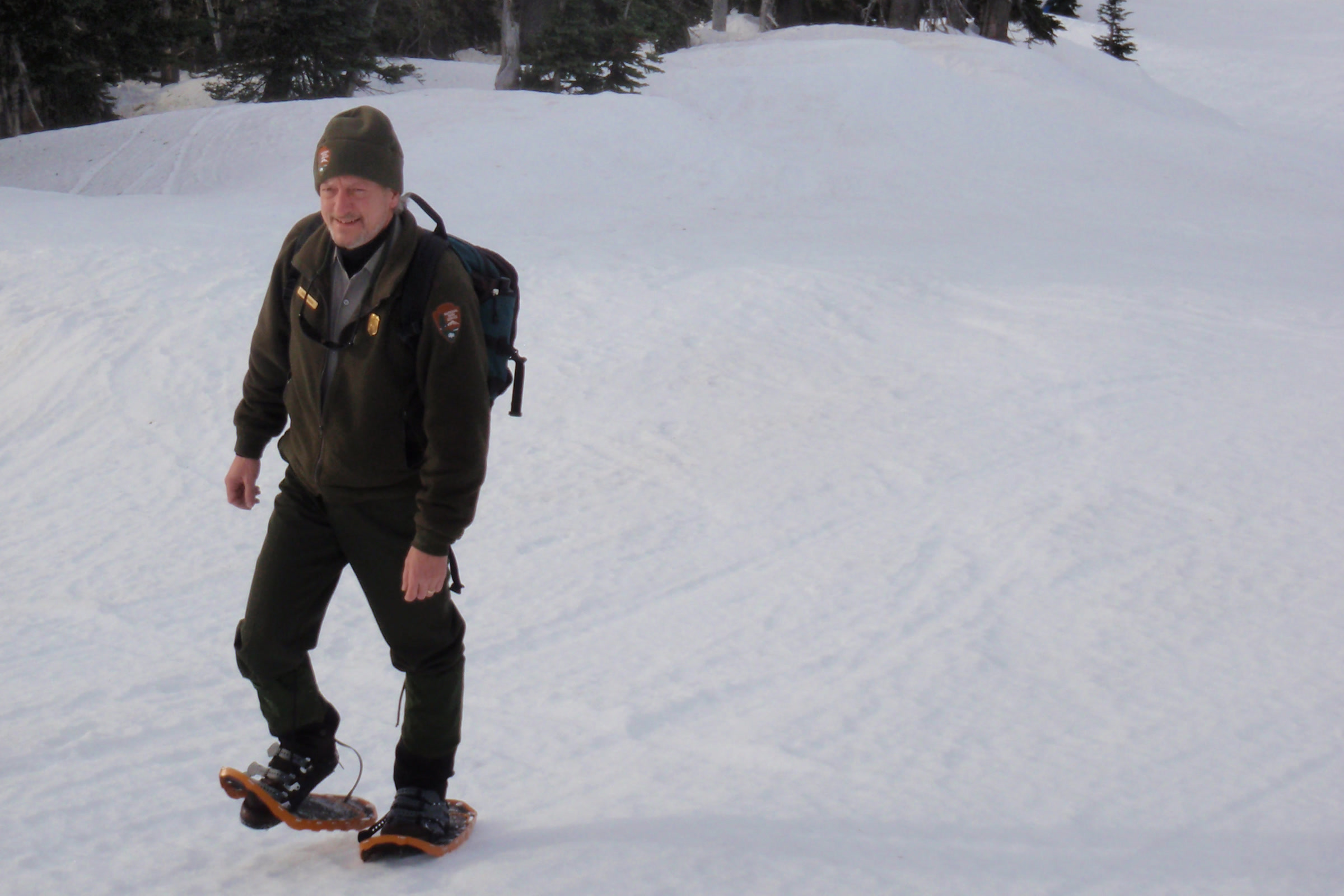
    A park ranger in uniform and wool hat walking across deep snow on snowshoes at Hurricane Ridge
    A ranger on snowshoes at Hurricane Ridge. NPS Photo
    • Sign up at the visitor contact station in the parking area at 1 pm on the day; places are first come, first served.
    • Groups are limited to 20 people, and beginners are welcome.
    • Dress in layers with warm, waterproof boots, a hat, mittens, sunscreen and sunglasses.
    • Walks can be cancelled at any time, and are always cancelled when the road is closed.

    For this winter’s schedule or to ask about accommodations, call the visitor center at 360-565-3130.

    The Hurricane Ridge Ski and Snowboard Area

    The Hurricane Ridge Ski and Snowboard Area is a small, local area run by a nonprofit, the Hurricane Ridge Education Foundation. Weather permitting, it runs two rope tows and a Poma lift, and the park’s winter newspaper calls it one of only three ski lifts in national parks in the country.

    Last season it opened Saturdays, Sundays and holiday Mondays through March, 10 am to 4 pm. The ski area’s website says its dates are tentative and depend on enough snow and fair weather, so check there for lessons, rentals and opening day.

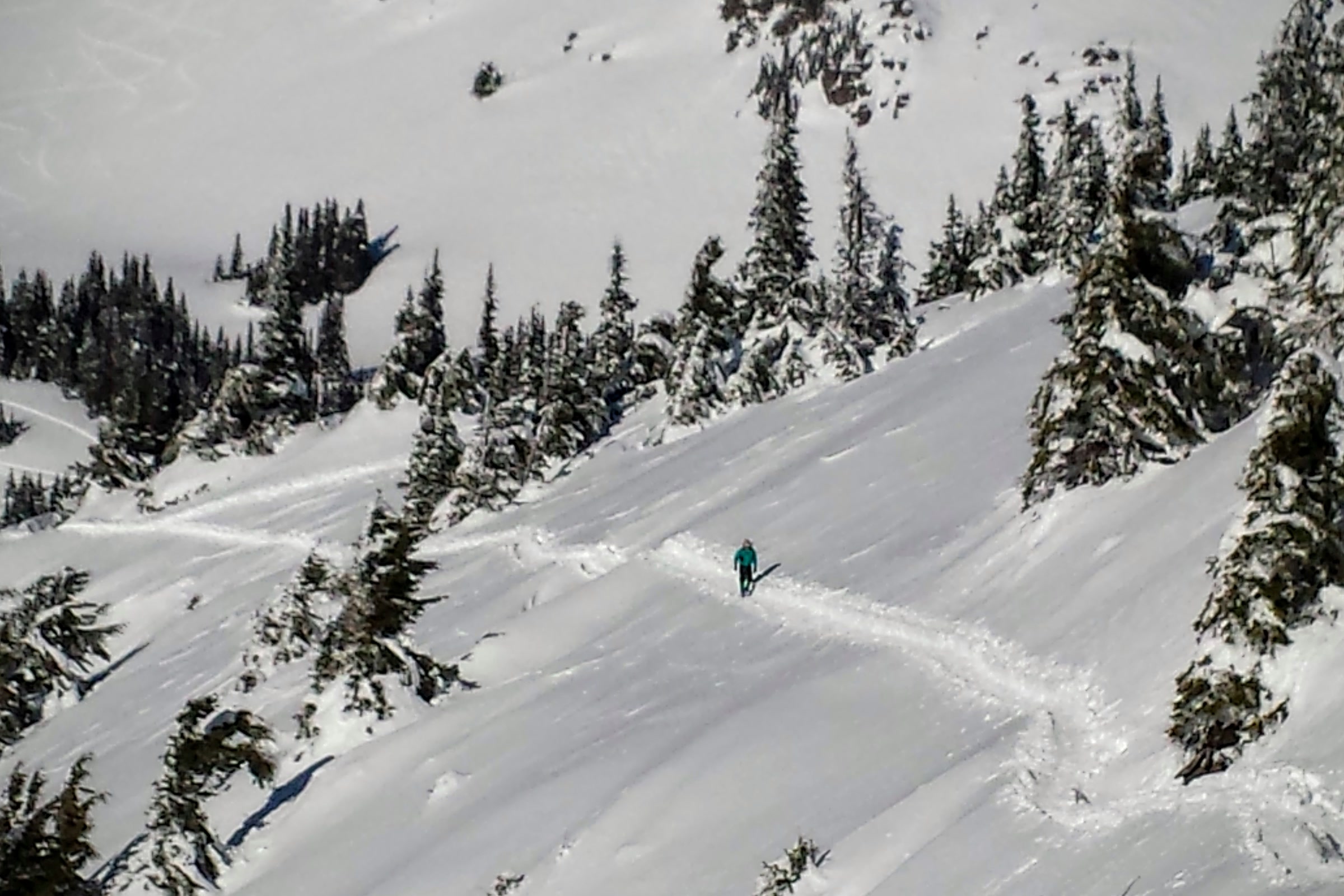
    A snowshoer far off on a packed track descending a steep snowy slope between firs at Hurricane Ridge on December 31, 2015
    A snowshoe track on the last day of 2015. Photo: brewbooks / Wikimedia Commons (CC BY-SA 2.0)

    Sledding and tubing

    Sledding is allowed in only two places. The Children’s Snowplay Area, west of the parking lot, is free for children aged eight and under; bring your own tube or sled, but no sleds with runners or wooden toboggans. Tubing for all ages is at the ski area’s tubing park, with tickets from the ski area trailer in the lot and tubes supplied.

    Snowshoe and cross-country routes

    The park counts 15 to 20 miles of snowshoe and ski routes from the parking area. None are groomed or marked, and gentle beginner terrain is limited to the meadows above the lot. Snowshoers and walkers should keep to one side of ski tracks and stay out of the downhill ski area.

    Hurricane Ridge winter routes by difficulty

    RouteOne wayPark rating
    The MeadowsShort loopsEasiest
    Hurricane Hill Road1.3 milesMore difficult
    Obstruction Point Road to Waterhole3.4 milesMore difficult
    Hurricane Hill Route1.6 milesMost difficult
    Sunrise Ridge2.1 milesMost difficult
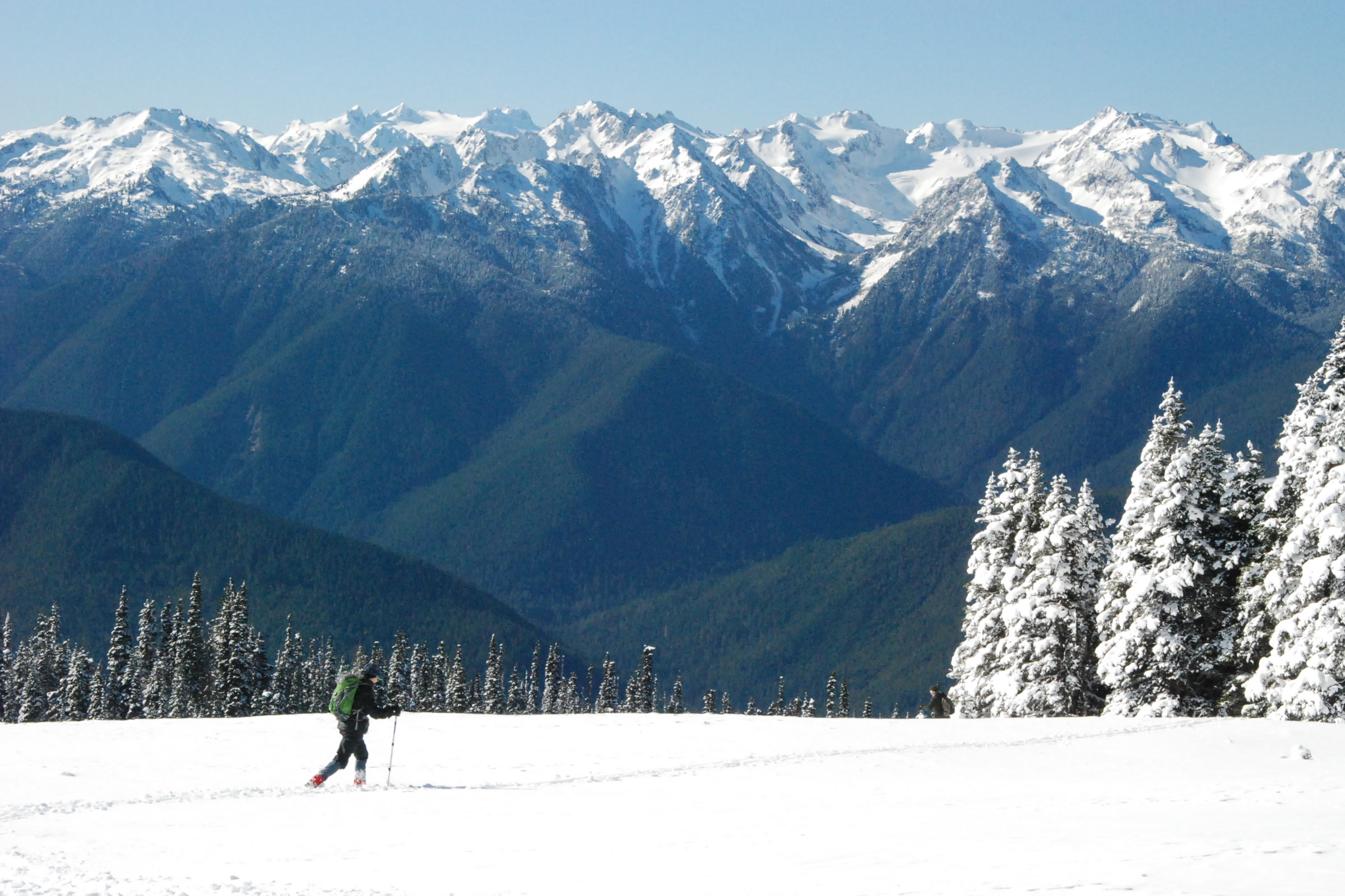
    A lone skier crossing the snowy meadow at Hurricane Ridge beneath a wall of snow covered Olympic Mountains
    Skiing the meadows above the parking area, February 2015. NPS Photo

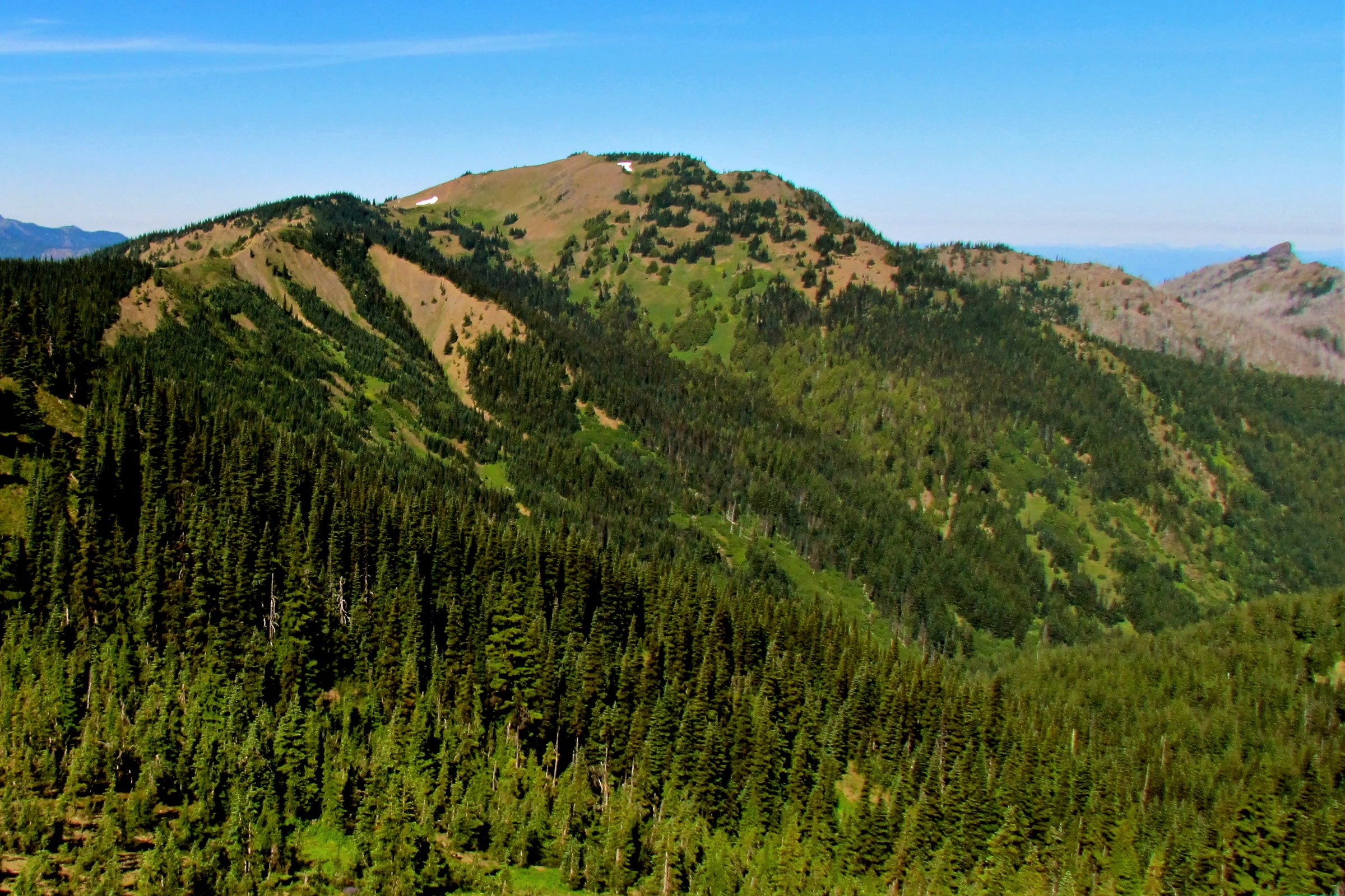
    The unplowed Hurricane Hill Road is sheltered by forest, which makes it a good choice in wind. The summer path to the summit becomes a demanding snow route; our Hurricane Hill Trail guide describes it in summer. Sunrise Ridge and the far end of Obstruction Point Road cross avalanche-prone slopes.

    A cross-country skier with poles moving past snow covered firs at Hurricane Ridge, with white Olympic peaks behind
    A clear February day at Hurricane Ridge. NPS Photo

    Before any trip beyond the meadows, check the Northwest Avalanche Center forecast, be ready for steep terrain and stay off cornices on the downwind side of ridges.

    How Friends of Olympic National Park helps

    We are Friends of Olympic National Park (FONP), a volunteer led friends group based in Port Angeles. When snow closes the high country most of the week, we help bring the park to town through our Winter Perspectives lecture series, free evening talks with the people who study and care for the park.

    Membership starts at $15 for students. Become a member and spend the winter with us.

    Frequently asked questions

    Do you need chains to drive to Hurricane Ridge in winter?

    Yes. From November 1 through April 1, every vehicle above the Heart O’ the Hills entrance station must carry tire chains or approved traction devices, including four wheel drive vehicles, whatever the weather.

    What days is Hurricane Ridge Road open in winter?

    In past seasons the road was scheduled to open Friday through Sunday and some holidays, typically 9 am to 4 pm for uphill traffic, weather permitting. It closes on Thanksgiving and Christmas. Check the NPS page or call 360-565-3131 before you go.

    Are there ranger-led snowshoe walks at Hurricane Ridge?

    Yes, in past seasons. Last winter they ran at 1:30 pm on Saturdays and Sundays, lasted about 1.5 hours and covered less than a mile, with snowshoes provided. Sign up at the visitor contact station at 1 pm; groups are limited to 20.

    Is there food or a warming hut at Hurricane Ridge?

    No. Since the Day Lodge burned in 2023, there is no indoor warming area, food service or drinking water. Temporary trailers hold restrooms and a visitor contact station, so bring food, water and warm layers.

  • Hurricane Hill Trail: A Hiking Guide

    Hurricane Hill Trail: A Hiking Guide

    The Hurricane Hill Trail is the paved path that climbs from the end of Hurricane Hill Road, just beyond the Hurricane Ridge parking area, to the top of Hurricane Hill. It is 1.6 miles one way with about 700 feet of climbing, and on a clear day the summit looks over the Olympic Mountains, the Strait of Juan de Fuca and Vancouver Island.

    Quick answer

    How long is the Hurricane Hill Trail?

    The Hurricane Hill Trail is 1.6 miles one way, about 3 miles round trip, and climbs roughly 700 feet on pavement to a summit with 360 degree views. The first half mile is nearly level; after that it gets steep, with many grades of 15 to 20 percent. Dogs are not allowed.

    • Trailhead at the end of Hurricane Hill Road
    • Paved surface about 8 feet wide
    • Summit at 5,757 feet
    • No drinking water on Hurricane Ridge as of October 2026

    Hurricane Hill Trail at a glance

    Figures come from the park’s Hurricane Hill trailhead page and brochure, with the summit height from the Washington Trails Association.

    DetailHurricane Hill Trail
    Distance1.6 miles one way, about 3 miles round trip
    ClimbAbout 700 feet
    Summit5,757 feet
    SurfaceAsphalt, typically 8 feet wide
    Steepest gradesMany sections of 15 to 20 percent
    Pets and bikesNot allowed on Hurricane Ridge trails
    The Hurricane Hill trail curving along a green slope lined with purple lupine and subalpine firs in July 2010
    Lupine beside the trail in July 2010, before the path was rebuilt. Photo: brewbooks / Wikimedia Commons (CC BY-SA 2.0)

    Getting to the trailhead

    Drive 17 miles up Hurricane Ridge Road from Port Angeles, passing the Heart O’ the Hills entrance station, where you pay or show your pass. Our guide to Olympic National Park entrance fees covers the options. At the top, continue past the main parking area onto Hurricane Hill Road, which runs about 1.5 miles to the trailhead and is not suitable for RVs or buses.

    Van accessible parking sits right across from the trailhead, and overflow parking is at Picnic Area B. Hikers’ trip reports from summer 2026 put the nearest restrooms by the road about 0.3 mile before the trailhead, with none at the trailhead itself. On busy summer days the park meters cars at the entrance station, so see our best time to visit Olympic National Park guide for the quieter hours.

    Road and facilities, as of October 2026

    As of October 2026, the park’s conditions page lists Hurricane Ridge Road and Hurricane Hill Road open. A project to replace the aging water system means no drinking water on Hurricane Ridge, and road patching may cause short rolling closures. Fill your bottles in Port Angeles, and check the NPS conditions page or call 360-565-3131 before you go.

    The Hurricane Hill hike, step by step

    The Hurricane Hill hike starts gently. The park’s accessibility survey says the first 2,700 feet, about half a mile, gain only 10 feet overall. The path follows the south side of the hill with mountain views the whole way.

    About 1,400 feet in, the trail curves around a steeply cut bank with a big drop on the outside edge. If heights bother you, keep to the inside. Around 2,450 to 2,700 feet, the park suggests turning back if you want an easy outing, because the trail gets strenuous from there.

    Three hikers silhouetted on a grassy Hurricane Hill slope against hazy blue mountain ridges in autumn
    Hikers on Hurricane Hill in autumn. NPS Photo / C. Bubar

    The rest of the climb is the real work. Grades run from 10 to 18 percent in long stretches, with many short sections of 15 to 20 percent. The trail traverses the south-facing slope, then makes three generous switchbacks to the top. Trip reporters in July 2026 recommended poles and plenty of water, and took anywhere from 90 minutes to three hours round trip.

    The pavement is fairly new: a rebuild that began in 2018 added retaining walls, drainage, benches and an 8 foot paved width, and brought the first 0.4 mile up to federal accessibility standards. Our guide to accessible trails in Olympic National Park compares this path with the easier Hurricane Ridge walks.

    At the summit

    The trail ends on the open top of Hurricane Hill. In clear weather the park describes a full 360 degree view. To the north you can pick out Griff Peak, the Strait of Juan de Fuca and Vancouver Island, with Port Angeles below and, sometimes, a ferry crossing the water.

    Looking north from Hurricane Hill over a rocky forested ridge and a patch of snow to the Strait of Juan de Fuca
    Looking north toward the Strait of Juan de Fuca. Photo: brewbooks / Wikimedia Commons (CC BY-SA 2.0)

    Turn south and the Bailey Range fills the skyline, often streaked with snow well into summer, with Mount Olympus beyond. Interpretive signs at the top name the peaks and towns you can see. The Washington Trails Association’s Hurricane Hill hike page and its trip reports are a good way to check recent conditions.

    Snow covered peaks of the interior Olympic Mountains above forested ridges and green meadows, seen from Hurricane Hill in July
    The interior Olympic Mountains from Hurricane Hill. NPS Photo

    Wildlife and wildflowers on the way

    Summer meadows along the trail are famous for their flowers, and our Hurricane Ridge wildflower season guide explains how the bloom follows the melting snow. The hill is also home to the Olympic marmot, found nowhere else on Earth.

    Hikers in summer 2026 also reported grouse, a hare, an elk and bears seen at a distance in the meadows. The park asks you not to feed wildlife, to keep a safe distance and to stay on the trail so the meadows can recover.

    The Elwha trail: for strong hikers only

    Just before the first switchback, a dirt trail signed for the Elwha branches off. The park’s brochure describes the Hurricane Hill/Elwha trail as 6 miles one way, dropping 5,250 feet to the start of Whiskey Bend Road in the Elwha Valley. The Washington Trails Association calls the out and back a steep, challenging 14 mile day.

    A narrow dirt path winding through golden autumn grass on Hurricane Hill beside a wooden sign for the Elwha trail
    The dirt trail toward the Elwha leaves the paved route. NPS Photo / C. Bubar

    If you are looking for other Hurricane Ridge hikes, the brochure lists the paved Big Meadow and Cirque Rim walks, the High Ridge loop and the longer Klahhane Ridge trail. Our guide to mountain goats in Olympic National Park covers the high country beyond.

    When to go and what to bring

    Hurricane Ridge earned its name: the park says winds gusting over 75 miles an hour buffet the ridge, and 30 to 35 feet of snow falls each year, often lasting into summer. The paved Hurricane Hill Trail is a summer and early fall walk for most people. In winter, Hurricane Hill Road is not plowed, and the snow route to the summit is rated most difficult; see our guide to Hurricane Ridge in winter.

    A small island of subalpine firs on the open, golden grass of Hurricane Hill in autumn, with distant mountains under streaky clouds
    Golden autumn grass near the top of Hurricane Hill. NPS Photo / C. Bubar
    • Water and snacks, because there is no drinking water or food service on the ridge.
    • A windbreaker and a warm layer, since weather and wind can change quickly up top.
    • Sun protection, as most of the trail is open to the sky.

    Our what to pack for Olympic National Park list goes into more detail on layers and rain gear.

    How Friends of Olympic National Park helps

    We are Friends of Olympic National Park (FONP), a volunteer led friends group based in Port Angeles. Our volunteers lead guided wildflower walks and look after the Heart O’ the Forest Trail through our adopt-a-trail crew. If you love trails like this one, browse our volunteer opportunities and come give a few hours back.

    Frequently asked questions

    How long does the Hurricane Hill hike take?

    The trail is 1.6 miles one way, about 3 miles round trip, with roughly 700 feet of climbing. Hikers in 2026 reported anywhere from about 90 minutes to three hours round trip, depending on pace and stops.

    Is the Hurricane Hill Trail paved?

    Yes. It is asphalt, typically 8 feet wide. The first half mile is nearly level, but after that the grades are very steep, with many sections of 15 to 20 percent.

    Can you bring dogs on the Hurricane Hill Trail?

    No. Pets and bicycles are not permitted on paved or dirt trails at Hurricane Ridge, including Hurricane Hill.

    Is there water at the Hurricane Hill trailhead?

    No. As of October 2026 the park says no drinking water is available on Hurricane Ridge while the water system is replaced. Bring all the water you need from Port Angeles.