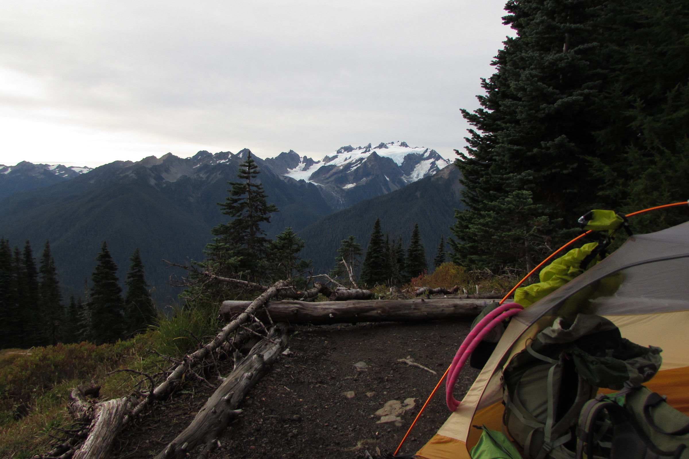
Author: Nobenaa Ahsan

  • Olympic National Park Wilderness Permit: How to Get One

    Olympic National Park Wilderness Permit: How to Get One

    If you plan to sleep anywhere in the backcountry, you need an Olympic National Park wilderness permit, in every season. Most permits are reserved online through Recreation.gov, and the busiest camps fill early. This guide walks through how to book, what it costs and the rules to know, as the park lists them as of October 2026.

    Quick answer

    How do you get a wilderness permit for Olympic National Park?

    Olympic National Park requires a wilderness permit for every overnight backcountry trip, all year. Reserve it on Recreation.gov, by phone or at a Wilderness Information Center. As of October 2026, summer dates open April 15 at 7:00 AM Pacific, adults pay $8 per night, and each permit has a $6 reservation fee.

    • Summer season runs May 15 to October 15
    • Youth 15 and under camp free
    • No self-registration permits at trailheads
    • Bear canisters required in all wilderness areas

    Who needs an Olympic National Park wilderness permit?

    Anyone camping overnight in the backcountry does. The park says backpacking permits are required year-round, and a wilderness camping permit covers every overnight stay in undeveloped areas. Day hikers do not need one.

    That covers a lot of ground. About 95 percent of the park was designated Wilderness in 1988, and the park says nearly 50,000 campers enjoy it every year.
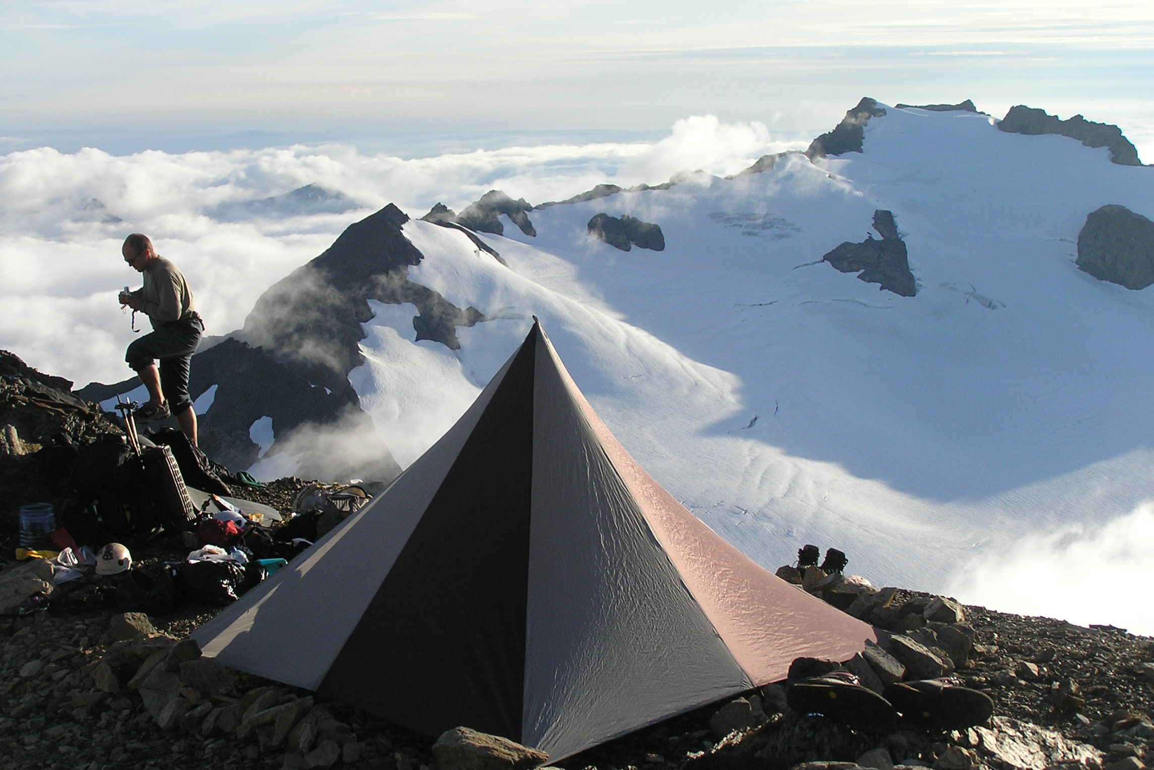
    A backpacker climbing rocks beside a pyramid tent on a high ridge above a sea of clouds and a snowy peak
    A high camp above the clouds. NPS Photo

    How wilderness camping reservations work

    The park moved its permit reservations to Recreation.gov on March 18, 2019. Today you can book online, by phone at (360) 565-3100, or in person at a Wilderness Information Center. There are no longer paper self-registration permits at trailheads, and no sites are held for same-day walk-ups.

    1. Pick your route and camps on the park’s Wilderness Trip Planner map.
    2. Watch the release date. Summer season permits, for May 15 to October 15, open on April 15 at 7:00 AM Pacific Time.
    3. Reserve on Recreation.gov, or call or visit a Wilderness Information Center.
    4. Print your permit once the Wilderness Information Center issues it, about three days before your trip.

    High country camps have a shorter season because of snow, generally from about mid-July to mid-October. The full details sit on the park’s wilderness reservations page, which you should check before you book.

    Wilderness permit costs compared

    ItemCost (as of October 2026)Notes
    Adults 16 and older$8 per person per nightCharged for each night out
    Youth 15 and underFreeNo nightly fee
    Reservation fee$6 per permitNon-refundable
    Annual Wilderness Pass$45 per personCovers nightly fees for 12 months, not the $6 fee

    The park gives an example: two adults out for four nights pay $70, which is $64 in camping fees plus the $6 reservation fee. The annual pass is sold through pay.gov or by phoning a Wilderness Information Center, and you still need a permit for every trip.
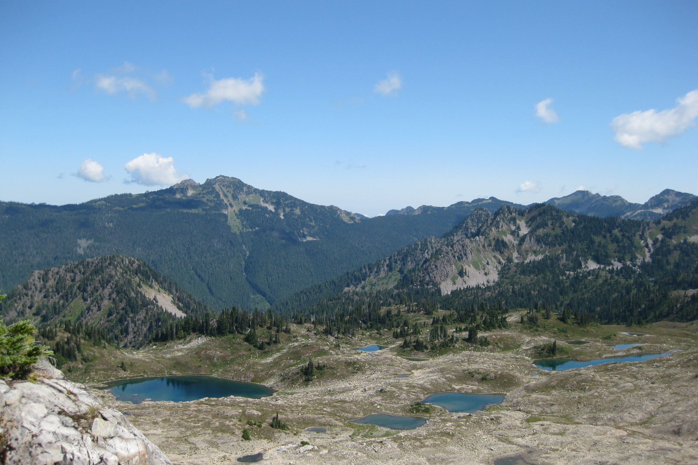
    Small blue lakes scattered across the rocky Seven Lakes Basin, seen from the High Divide Trail with mountains behind
    Seven Lakes Basin is one of the park’s quota areas. Photo: Jtmorgan / Wikimedia Commons (CC BY-SA 3.0)

    Quota areas: where to book early

    Some popular places limit how many campers can stay each night. The park says no extra space opens in these quota areas later, so plan ahead. They show in red or yellow on the Trip Planner map.

    Olympic quota areas by region

    RegionQuota areas
    CoastOzette Coast, Yellow Banks to Point of the Arches
    NortheastRoyal Basin and Royal Lake, Grand and Badger Valleys
    East and southeastLake Constance, Upper Lena Lake, Flapjack Lakes including Gladys Divide
    SouthwestEast Fork of the Quinault River
    North and westSol Duc, Seven Lakes Basin and Mink Lake area; Hoh Lake and C.B. Flats; Hoh River Trail

    The Enchanted Valley has an extra limit. In a trial of up to three years that began in 2024, the East Fork Quinault allows at most 208 users or 30 permits per night, whichever comes first. Our story on the Enchanted Valley Chalet move tells more about this valley.
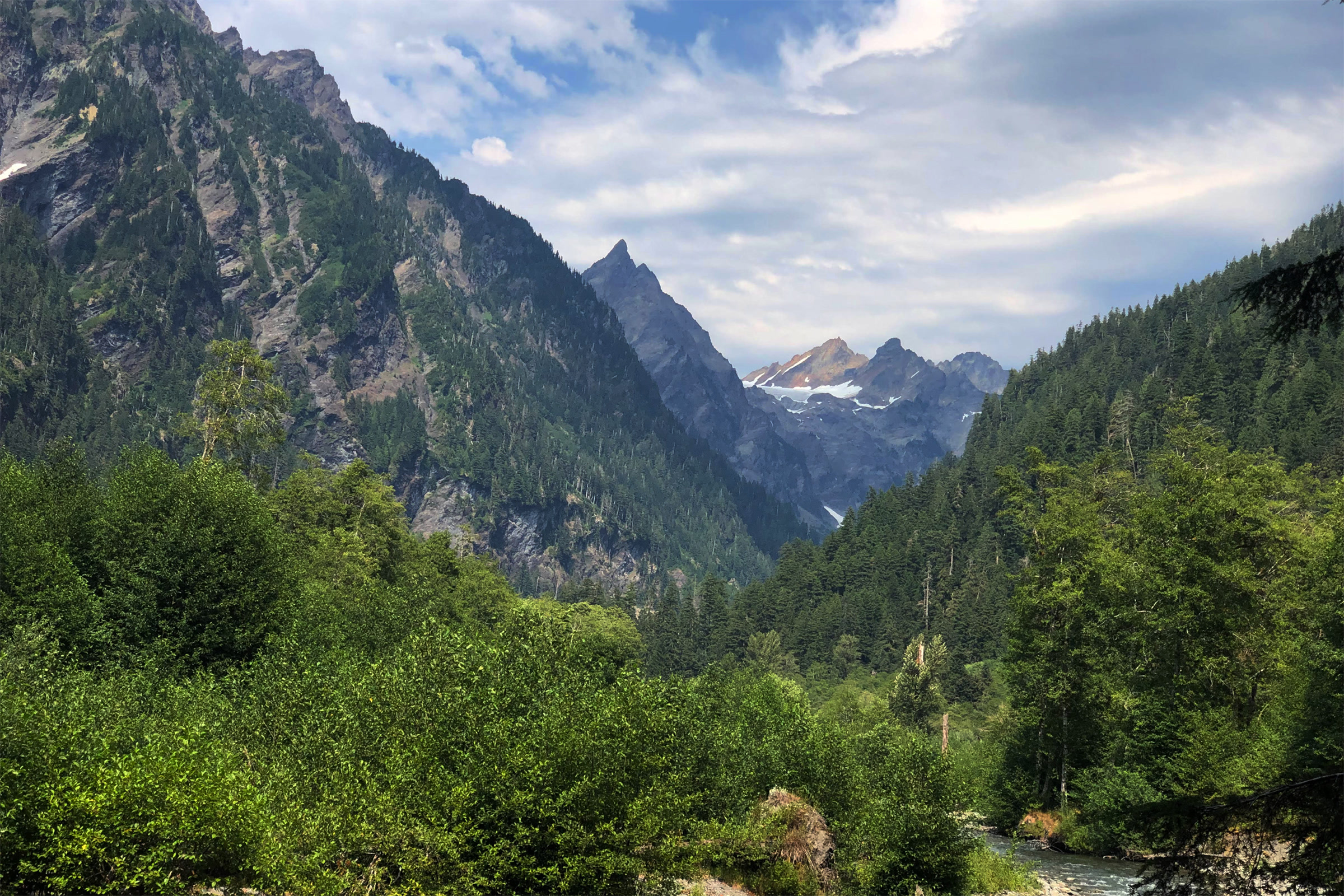
    Steep forested walls and jagged peaks rising above the green floor of Enchanted Valley
    Enchanted Valley, August 2021. Photo: Fduchossois / Wikimedia Commons (CC BY-SA 4.0)

    Olympic National Park backcountry camping rules

    A permit comes with a few rules that apply across the wilderness. These are the ones the park’s regulations page spells out:

    • Group size: no more than 12 people and 8 stock. Groups of 7 to 12 must use designated group sites, and affiliated groups must stay at least a mile apart.
    • Campfires: allowed below 3,500 feet only, and banned on the coast between Wedding Rocks and the headland north of Yellow Banks.
    • Pets: not allowed in designated Wilderness or on overnight trips.
    • Drones: launching, landing or flying one is prohibited in the park.
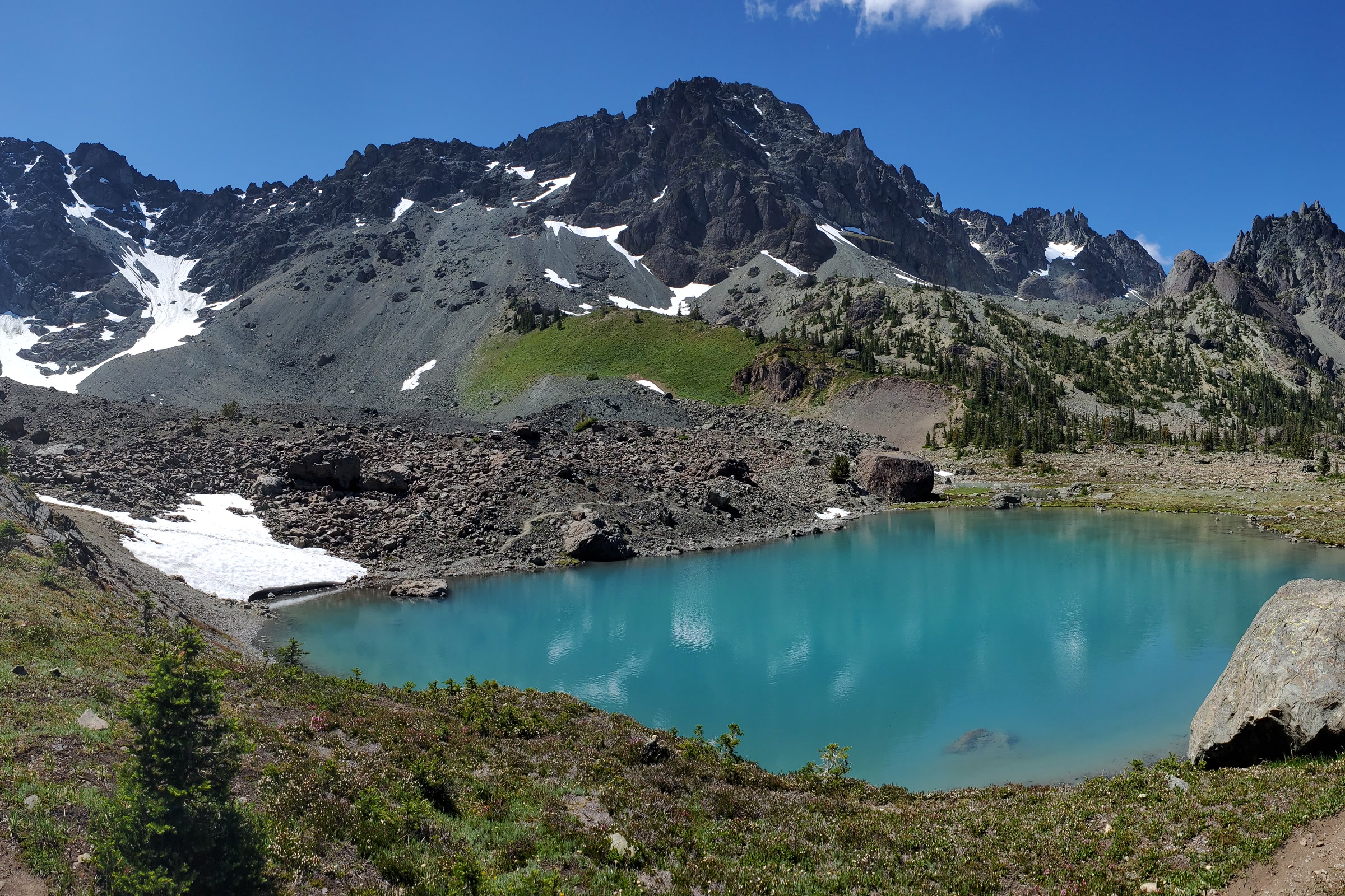
    Turquoise Royal Lake in Royal Basin beneath the rocky ridges of Mount Deception and Martin Peak
    Royal Lake, in the Royal Basin quota area. Photo: Dan Nevill / Wikimedia Commons (CC BY 2.0)

    Bear canister rules in Olympic National Park

    The park’s wilderness food storage page says approved animal resistant food containers are required in all wilderness areas. Everything with a scent goes inside: food, trash and toiletries such as toothpaste, sunscreen, hand sanitizer and lip balm.

    Only models on the park’s approved list count, and that list was last updated in June 2026. It includes several BearVault, Bearikade and Garcia canisters. Wilderness Information Centers lend canisters during business hours, but they cannot be reserved and can run out on busy weekends.
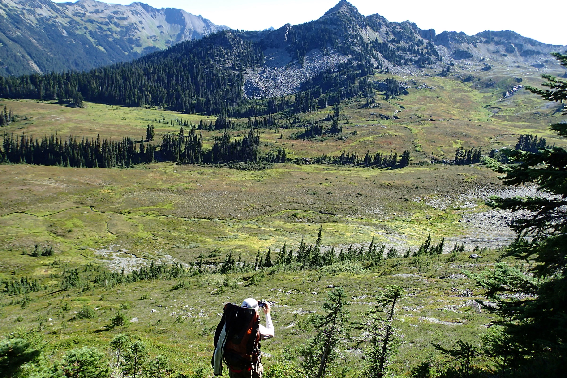
    A backpacker with a large pack crossing a green subalpine meadow below a forested ridge, a backcountry trip that needs an Olympic National Park wilderness permit
    Backpacking through subalpine meadows. NPS Photo

    Headed for the coast? Our Leave No Trace guide to Olympic coast beaches covers tides and camping on the sand, and our Ozette Triangle and Cape Alava guide covers one of the most popular coast trips.

    Picking up, changing and cancelling

    The Port Angeles Wilderness Information Center is inside the Olympic National Park Visitor Center at 3002 Mount Angeles Road. It is open all year, daily from 9 AM to 5 PM, closed Thanksgiving and Christmas. Our Olympic National Park Visitor Center guide explains what else is there.
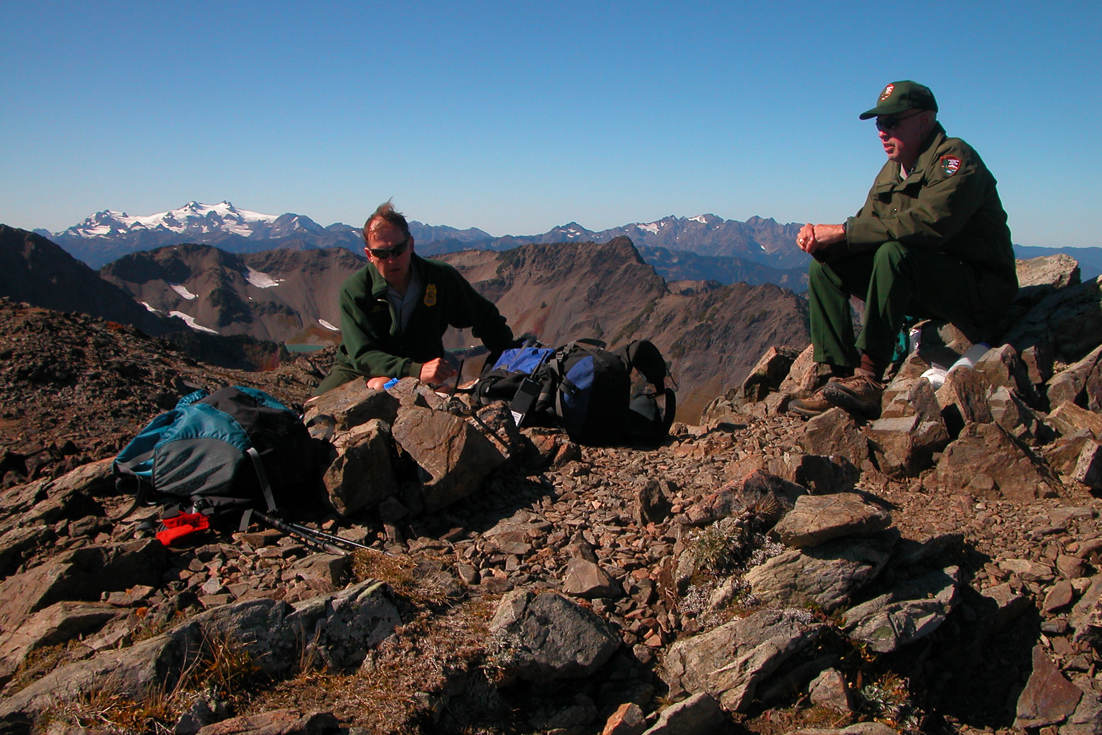
    Two park rangers with backpacks resting on a rocky ridge with snowy Olympic peaks in the distance
    Park rangers on a backcountry ridge. NPS Photo

    On the south side, the Quinault Rainforest Ranger Station in Amanda Park is open from Memorial Day weekend through the end of September. It keeps a bear canister return bin open all year.

    If your plans change, cancel three or more full days before your start date to get the camping fee back. The $6 reservation fee is never refunded. Cancel within three days and there is no refund, and no-shows lose all fees.

    How Friends of Olympic National Park helps

    We are Friends of Olympic National Park (FONP), a volunteer-led friends group in Port Angeles. Our adopt-a-trail crew on the Heart O’ the Forest Trail helps care for one of the park’s trails, and our volunteers join cleanups through the year. To lend a hand, see our volunteer opportunities at Olympic National Park.

    Frequently asked questions

    Do I need a permit to backpack in Olympic National Park?

    Yes. A wilderness camping permit is required for every overnight stay in the backcountry, year-round. Day hikes do not need one.

    How much does an Olympic wilderness permit cost?

    As of October 2026, adults 16 and older pay 8 dollars per person per night, youth 15 and under are free, and each permit has a 6 dollar non-refundable reservation fee.

    When do Olympic National Park permits open?

    Summer season permits, for May 15 to October 15, are released on April 15 at 7:00 AM Pacific Time on Recreation.gov.

    Can I get a walk-up wilderness permit?

    No sites are held for same-day walk-ups, and trailhead self-registration has ended. Get your permit in advance online, by phone or at a Wilderness Information Center.

    Do I need a bear canister in Olympic National Park?

    Yes. Approved animal resistant food containers are required in all wilderness areas of the park. Wilderness Information Centers lend them when available.

    Rules, fees and dates change, so check the NPS pages before every trip. Then come help us care for the park you love.

  • Ozette Triangle and Cape Alava: A Coastal Loop Guide

    Ozette Triangle and Cape Alava: A Coastal Loop Guide

    The Ozette Triangle is a roughly nine-mile loop on the wild northern coast of Olympic National Park, starting at Lake Ozette. Two boardwalk trails run through coastal forest to Cape Alava and Sand Point, and a beach walk between them closes the loop. Here is how the route fits together, what to plan for, and the history that deserves our respect along the way.

    Quick answer

    How long is the Ozette Triangle loop?

    The Ozette Triangle is about 9 miles. The NPS lists 3.1 miles on the Cape Alava Trail, 3.1 miles of beach and 2.8 miles on the Sand Point Trail, starting from the Ozette Ranger Station. The trails are mostly boardwalk, but the beach leg depends on tides, so carry a tide chart.

    • About 9 miles, from sea level to about 100 feet
    • Boardwalks are very slippery when wet or frosty
    • Overnight camping needs a wilderness permit, limited year-round
    • Bear canisters required; none at Ozette Ranger Station

    What is the Ozette Triangle?

    The name comes from the shape of the route. From the trailhead at the Ozette Ranger Station, one trail leads to Cape Alava and another leads to Sand Point. The beach between the two capes is the third side.

    The park’s Ozette Loop page rates the hike as easy, gives the distance as 9.2 miles and calls April through October the best season. It runs from sea level to about 100 feet, with no river crossings. Hiking groups give slightly different totals, so plan on nine to ten miles.

    The calm Ozette River winding between green banks toward Lake Ozette, with forested hills beyond
    The loop starts by crossing the Ozette River near the lake. Photo: Peter Abrahamsen / Wikimedia Commons (CC BY-SA 2.0)

    The three legs of the loop compared

    LegDistance (NPS)What you walk on
    Cape Alava Trail3.1 milesTrail, boardwalk and stairs through prairie and coastal forest
    Beach between the capes3.1 milesSand and rocky shore, timed with the tides
    Sand Point Trail2.8 milesMostly boardwalk through coastal forest

    The Cape Alava trail

    Washington Trails Association describes the start well: cross the Ozette River on an arched bridge, then reach a junction about a quarter mile in. The right fork is the Cape Alava trail, and the left fork leads to Sand Point. Many hikers go out one way and come back the other.

    A narrow wooden boardwalk on the Ozette Triangle winding through dense ferns and coastal forest
    Boardwalk on the Ozette Triangle. NPS Photo

    Much of the way follows a cedar boardwalk through coastal forest. The NPS warns that the boardwalks are very slippery when wet or frosty, so take your time.

    Partway along, the trail crosses an open, soggy meadow known as Ahlstrom’s Prairie. The park’s Lake Ozette brochure calls it the prairie where Lars Ahlstrom pastured his livestock. As many as 130 homestead families lived around Lake Ozette in the early 1890s, and most left after the area became part of the Olympic Forest Reserve in 1897.

    A weathered plank boardwalk curving through sword ferns and tall trees on the trail from Lake Ozette to the coast
    Ferns crowd the planks on the way to the coast. Photo: nick hoke / Wikimedia Commons (CC BY 3.0)

    Cape Alava, Wedding Rocks and the Makah village of Ozette

    Cape Alava lies within the traditional territory of the Makah people. Offshore sits Cannonball Island (Tskawahyah Island), which the park notes is part of the Ozette Indian Reservation and always closed to the public.

    The village of Ozette stood near here, close to the migration routes of whales, fur seals and other sea mammals. The NPS says bone, shell and stone artifacts tell of a sea-mammal hunting culture going back at least 2,000 years. Makah oral history also told of a great slide that buried part of the village long ago.

    A wooded island sitting in calm ocean water, seen past spruce trees and dry grass at the end of the Lake Ozette trail
    The first view of the ocean from the trail. Photo: panacheart / Wikimedia Commons (CC BY 3.0)

    According to the Makah Cultural and Research Center, a winter storm in 1969 to 1970 made the bank slump and exposed wooden artifacts. A hiker told the Makah Tribe, which called in Washington State University. The 11-year excavation recovered more than 55,000 artifacts, which the Tribe kept on its reservation.

    Those artifacts are cared for at the Makah Museum in Neah Bay, not on the beach. Check the museum’s current opening status before you plan a visit. Between the capes you will also pass Wedding Rocks, where Makah petroglyphs are carved into the stone. They are protected by federal law, so look without touching, tracing or chalking.

    The Sand Point trail and the beach leg

    The Sand Point trail is 2.8 miles of mostly boardwalk ending at a wide, sandy beach. It also makes a pleasant out-and-back walk on its own.

    Dark boulders on a sandy beach at low tide with a tree covered island offshore near Cape Alava
    Low tide on the wilderness coast near Cape Alava. NPS Photo / C. Bubar

    Hikers often find the beach the slowest part of the Ozette loop hike. It mixes sand with rocky stretches, and WTA notes that you cannot hike south at high tide. Plan your beach crossing with a tide chart, whichever way you walk.

    • Carry a map and a tide chart, as the park advises.
    • Some headlands can only be passed at lower tides; use the overland trails when the water is up.
    • Pets, weapons and wheeled devices are not allowed on coastal beaches and trails.

    Our Leave No Trace guide to Olympic coast beaches covers tide safety and beach etiquette in more depth. Tide pool fans can also read our guide to Olympic National Park tide pools.

    Tall marsh grass along the shore of Lake Ozette under a blue sky with forested hills across the water
    Lake Ozette, where the loop begins and ends. NPS Photo / R.W. Kaune

    Camping on the Ozette Triangle

    Sand Point and Cape Alava are the main overnight spots, and both have pit toilets and creeks. Every overnight stay needs a wilderness permit. As of October 2026 the park limits camping permits on the Ozette coast, from Yellow Banks to Point of the Arches, all year, and suggests booking early for trips from May to the end of September.

    Our guide to Olympic National Park wilderness permits explains how to reserve. A few Ozette rules are worth knowing before you pack:

    • Food: store all food, garbage and scented items in a park-approved bear canister along the whole Wilderness Coast. Canisters are not available at the Ozette Ranger Station, and raccoons easily raid food hung in trees.
    • Fires: campfires are banned from the headland north of Yellow Banks to the headland at Wedding Rocks, including Sand Point. Elsewhere, burn driftwood only.
    • Water: creek water is often tea stained. Filter or boil it, and carry extra in late summer when some sources dry up.
    • Groups: no more than 12 people, and camp above the high tide line.

    Rules change, so check the NPS Ozette page and current trail conditions before you go. For an easier night, the park’s Ozette campground near the trailhead has 15 sites and is open all year, though winter flooding can close it.

    How Friends of Olympic National Park helps

    We are Friends of Olympic National Park (FONP), a volunteer-led friends group based in Port Angeles. Our beach cleanups in Olympic National Park remove litter and debris from the coast, and anyone who loves places like Cape Alava is welcome to join a crew. You can also become a member to stay in touch.

    Frequently asked questions

    How long is the Ozette Triangle?

    About 9 miles. The NPS lists 3.1 miles on the Cape Alava Trail, 3.1 miles of beach and 2.8 miles on the Sand Point Trail. Its Ozette Loop page gives 9.2 miles in total.

    Do I need a permit to hike the Ozette loop?

    You need a wilderness permit for any overnight stay, and camping permits on the Ozette coast are limited all year, so book early for May to September trips.

    Do I need a bear canister at Ozette?

    Yes. All food, garbage and scented items must go in a park-approved bear canister along the whole Wilderness Coast. Canisters are not available at the Ozette Ranger Station, so bring or borrow one first.

    Can I visit Cannonball Island at Cape Alava?

    No. Cannonball Island, or Tskawahyah Island, is part of the Ozette Indian Reservation and is always closed to the public. Enjoy it from the beach.

    Can I have a campfire at Sand Point?

    No. Campfires are banned from the headland north of Yellow Banks to the headland at Wedding Rocks, including Sand Point. Where fires are allowed, burn driftwood only.

    Want to give back to the coast you love? See our volunteer opportunities at Olympic National Park.

  • Olympic National Park Entrance Fees and Passes Explained

    Olympic National Park Entrance Fees and Passes Explained

    Olympic National Park entrance fees are simple once you see them side by side: a weekly pass for your car, motorcycle or yourself on foot, a park annual pass, or one of the national America the Beautiful passes. This guide lists the prices as of October 2026, straight from the National Park Service. Fees change, so check the park’s official fees page before you go.

    Quick answer

    How much does it cost to enter Olympic National Park?

    As of October 2026, Olympic National Park charges $30 per private vehicle, $25 per motorcycle and $15 per person on foot or bike, each valid for seven days. Visitors 15 and under enter free. A park annual pass costs $55, and the America the Beautiful pass for US residents costs $80.

    • Private vehicle: $30 for seven consecutive days
    • Olympic National Park Annual Pass: $55
    • The park does not accept cash
    • Ten fee-free days in 2026 for US citizens and residents

    Olympic National Park entrance fees at a glance

    Every standard entrance pass is good for seven consecutive days, so one payment covers a long weekend or a full week of exploring. The vehicle pass covers everyone inside a private vehicle with a capacity of 15 passengers or fewer.

    Seven day entrance passes compared

    PassPriceWho it covers
    Private vehicle$30All occupants of a vehicle seating 15 or fewer
    Motorcycle$25Up to 2 motorcycles with up to 4 riders in all
    Per person$15Hikers, cyclists and walkers without a vehicle
    Ages 15 and underFreeChildren and young teens

    Commercial groups pay separate rates: $75 for a van with 7 to 15 seats, $100 for a mini bus with 16 to 25 seats and $200 for a motor coach with 26 or more.

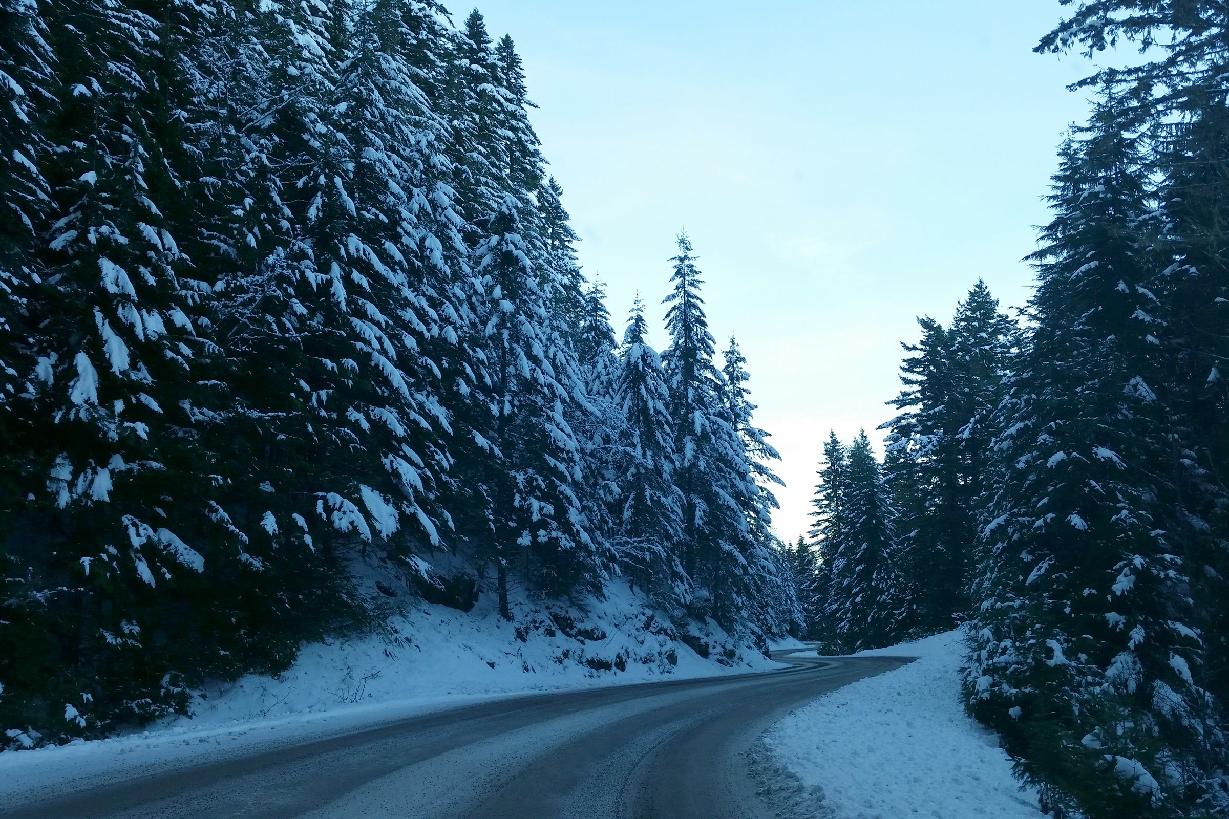
    The paved road to Hurricane Ridge curving through snow covered conifers under a clear blue sky
    One vehicle pass covers the whole carload for a week. Photo: KJRSeattle / Wikimedia Commons (CC BY-SA 4.0)

    Olympic National Park pass or America the Beautiful pass?

    If you visit more than once a year, an annual pass quickly pays for itself. The Olympic National Park Annual Pass costs $55 and is good for one year from the month you buy it, for US citizens and residents. It covers this park only.

    The America the Beautiful pass covers entrance at national parks and other federal recreation lands across the country. The resident annual pass costs $80, so it makes sense if you plan to visit another national park or federal fee area during the year.

    Red paintbrush flowers in a Hurricane Ridge meadow with forested ridges and distant mountains in Olympic National Park
    Regular visitors to Hurricane Ridge often choose an annual pass. NPS Photo

    Annual and lifetime passes compared

    PassPriceWho can get it
    Olympic National Park Annual$55US citizens and residents
    America the Beautiful Resident Annual$80US citizens and residents
    America the Beautiful Non-Resident Annual$250Visitors who are not US residents
    Senior Annual$20US citizens and residents 62 and over
    Senior Lifetime$80US citizens and residents 62 and over
    Military AnnualFreeCurrent US military and dependents
    Military LifetimeFreeGold Star Family members and veterans
    Access PassFreeUS citizens and residents with a permanent disability
    4th Grade PassFreeUS fourth graders
    Volunteer PassFreeFederal volunteers with 250 service hours

    All of these passes are non-refundable and non-transferable, and they cannot be replaced if lost or stolen. Bring photo ID, because staff may ask to see it with your pass.

    Earning a pass as a volunteer

    The free Volunteer Pass goes to people who log 250 hours of service at federal recreation sites. We have written a full guide to the America the Beautiful Volunteer Pass at Olympic National Park, including how hours are recorded and what the pass covers.

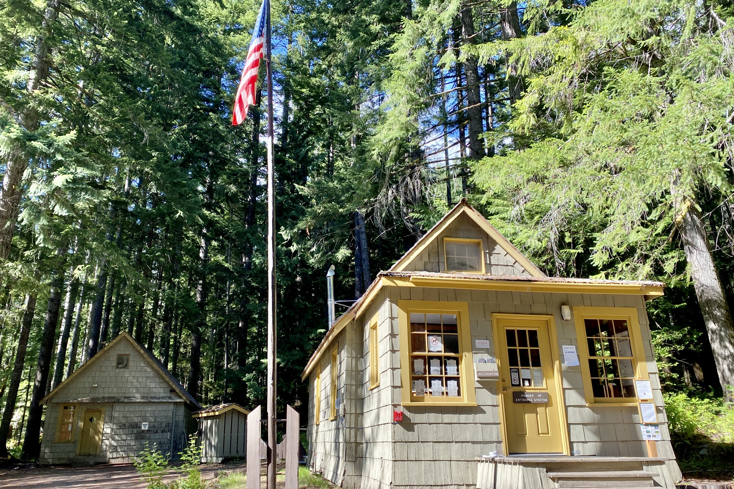
    The small wooden Staircase Ranger Station with yellow trim and a flagpole among tall trees in Olympic National Park
    Staircase Ranger Station, Olympic National Park. Photo: w_lemay / Wikimedia Commons (CC BY-SA 2.0)

    Free entrance days in 2026

    On fee-free days, national parks that charge entrance fees waive them. For 2026 the National Park Service fee-free days page says free entrance applies to US citizens and residents only. Other fees, such as reservation fees, may still apply.

    • February 16 (Presidents Day)
    • May 25 (Memorial Day) and June 14 (Flag Day)
    • July 3 to 5 (Independence Day weekend)
    • August 25 (the National Park Service’s 110th birthday)
    • September 17 (Constitution Day), October 27 (Theodore Roosevelt’s birthday) and November 11 (Veterans Day)

    Free days can be busy, so arrive early. Our season by season guide to the best time to visit Olympic National Park can help you pick quieter dates.

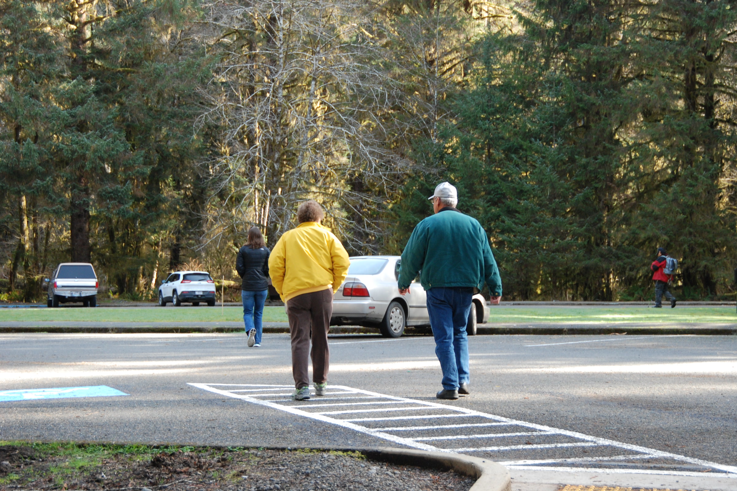
    Three visitors seen from behind walking across the Hoh Rain Forest Visitor Center parking lot; park visitor centers sell passes for Olympic National Park entrance fees
    Visitors at the Hoh Rain Forest Visitor Center, March 2015. NPS Photo / D. Archuleta

    Visiting from outside the United States

    Since 2026, nonresident visitors age 16 and older pay an extra $100 per person at 11 national parks. Olympic is not on that list, so visitors from abroad pay the same seven day fees shown above. If you plan to tour several parks, the $250 Non-Resident Annual Pass covers entrance fees and those extra charges.
    Where and how to pay

    Olympic National Park does not accept cash, so bring a card. You can buy a seven day or park annual pass at park visitor centers and entrance stations, or pay online at Recreation.gov before you arrive.
    The grey Kalaloch Ranger Station building and an information board beside an empty parking lot
    Kalaloch Ranger Station on the park’s coast. Photo: Chris Light / Wikimedia Commons (CC BY-SA 4.0)

    America the Beautiful passes have three routes. Buying in person at one of more than 1,000 federal sites is the park’s recommended option. You can also order by mail from the USGS Online Store, allowing up to three weeks, or get a digital pass through Recreation.gov.

    Quinault River Ranger Station sign for Olympic National Park on a green lawn, pointing to the visitor center and nature trail
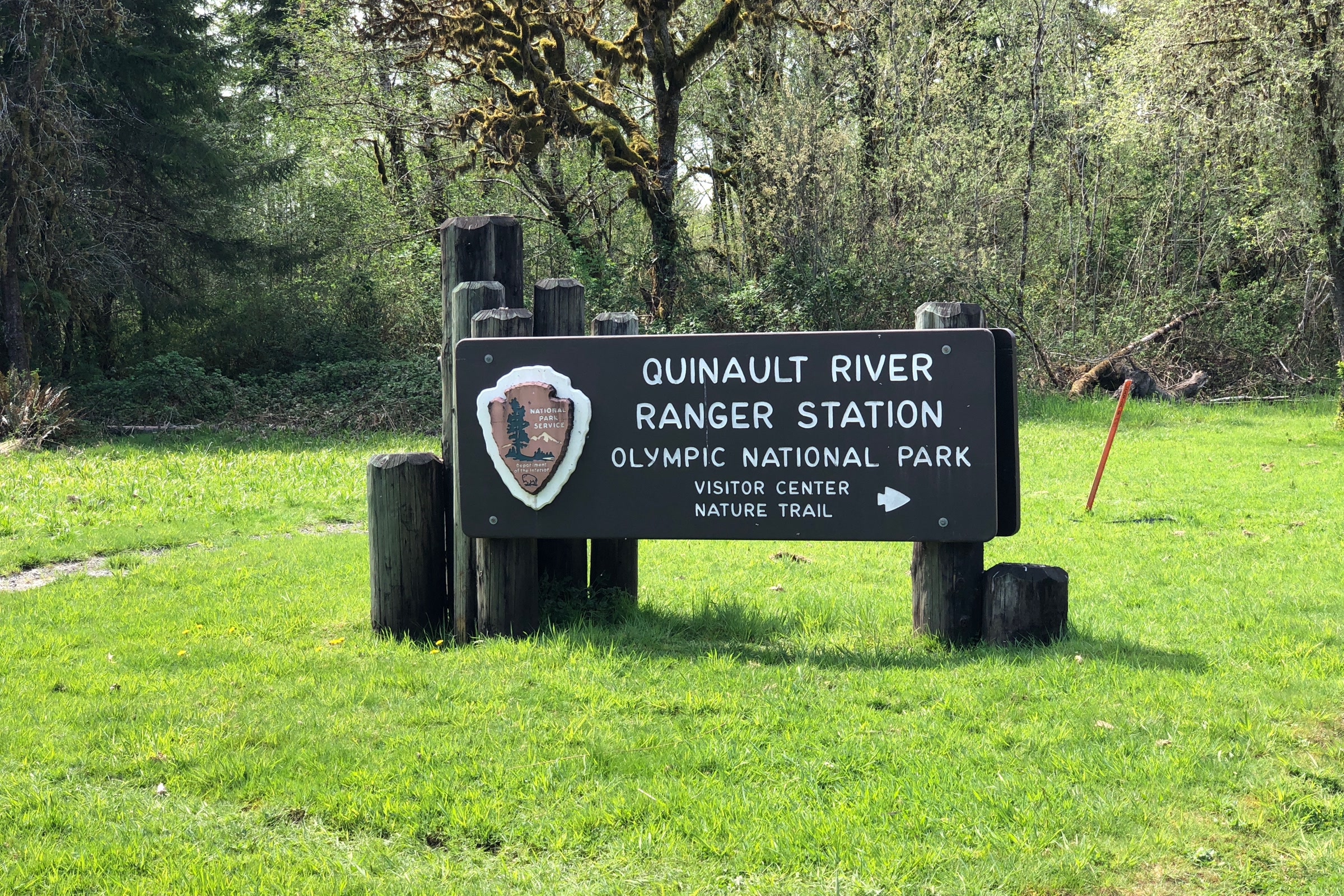
    Ranger stations are a good place to ask about passes and conditions. Photo: Steven Pavlov / Wikimedia Commons (CC BY-SA 4.0)

    Fees your entrance pass does not cover

    An entrance pass gets you into the park, but some services cost extra. Campground fees run $15 to $24 per night depending on the site and season. Overnight wilderness trips cost $8 per person per night plus a $6 permit fee, and our guide to Olympic National Park wilderness permits explains how that works. The RV dump stations at Fairholme, Kalaloch, Mora and Sol Duc charge $10 per use.
    Schools and educational groups can apply for an academic fee waiver at least two weeks before their trip.
    How Friends of Olympic National Park helps

    We are Friends of Olympic National Park (FONP), a volunteer-led friends group based in Port Angeles. We do not set or collect park fees, but we help in other ways: beach cleanups in Olympic National Park, trail work and visitor center cleanups. Start your trip at the Port Angeles visitor center with our Olympic National Park visitor center guide.

    Frequently asked questions

    How much is the entrance fee for Olympic National Park?

    As of October 2026, a private vehicle pass costs $30, a motorcycle pass $25 and a per person pass $15. Each is valid for seven consecutive days, and visitors 15 and under are free.

    Does Olympic National Park accept cash?

    No. The park does not accept cash, so pay by card at a visitor center or entrance station, or pay online at Recreation.gov before you arrive.

    Is the America the Beautiful pass accepted at Olympic National Park?

    Yes. America the Beautiful passes cover entrance at Olympic National Park and other federal recreation lands. The resident annual pass costs $80 as of October 2026.

    What are the free entrance days for national parks in 2026?

    February 16, May 25, June 14, July 3 to 5, August 25, September 17, October 27 and November 11. Free entrance applies to US citizens and residents only.

    Do international visitors pay more at Olympic National Park?

    Not at Olympic. The extra $100 nonresident fee applies at 11 other national parks. Olympic is not one of them, though the America the Beautiful Non-Resident Annual Pass costs $250.

    Love the park? Become a member of Friends of Olympic National Park and help us care for it, or browse our volunteer opportunities.

  • Fisher Reintroduction in Olympic National Park

    Fisher Reintroduction in Olympic National Park

    The fisher reintroduction in Olympic National Park returned a native forest carnivore to Washington after it had been gone for most of a century. Starting in the winter of 2008, biologists carried fishers from British Columbia into the park’s remote forests and let them go. Here is the story of the animal, the project and what we know about how it is going.

    Quick answer

    How were fishers reintroduced to Olympic National Park?

    Fishers vanished from Washington by the early 20th century because of over-trapping. On January 27, 2008, twelve fishers from British Columbia were released in Olympic National Park, and 90 were released in all over three trapping seasons. Cameras and DNA later showed founders surviving and several generations of young born on the peninsula.

    • First release: twelve fishers on January 27, 2008
    • 90 fishers from British Columbia released in total
    • Listed as endangered in Washington since 1998
    • 19 more fishers from Alberta joined them in 2021

    What is a fisher?

    A fisher (Pekania pennanti) is a member of the weasel family, about the size of a large house cat, with thick dark fur and a long bushy tail. In Washington it is sometimes called the Pacific fisher. The Washington Department of Fish and Wildlife gives adults a weight of 4.4 to 13 pounds and a length of about 3 to 3.5 feet, with males larger than females.

    Despite the name, fishers do not eat much fish. The park explains that early European settlers named them after the European polecat, which they resemble. Their real menu is snowshoe hares, mountain beavers, squirrels, mice, voles, birds, carrion and fruit, and they are one of the few animals that hunt porcupines.

    A fisher with a brown head and nearly black legs crouching on a wet mossy log
    A fisher photographed by the U.S. Fish and Wildlife Service Pacific Southwest Region, not in Olympic. USFWS Photo

    Fishers are mesopredators: hunters in the middle of the food web that also become food for larger carnivores. WDFW says they favour low and mid elevation conifer forests with closed canopies, big trees, snags and hollow logs, and they avoid clearcuts and busy places. That is exactly the kind of old forest the park protects.

    Why fishers disappeared from Washington

    That dense, glossy coat was the problem. Decades of over-trapping for fur drove the fisher out of Washington by the early 20th century. The state listed it as endangered in 1998 and wrote a fisher recovery plan in 2006.

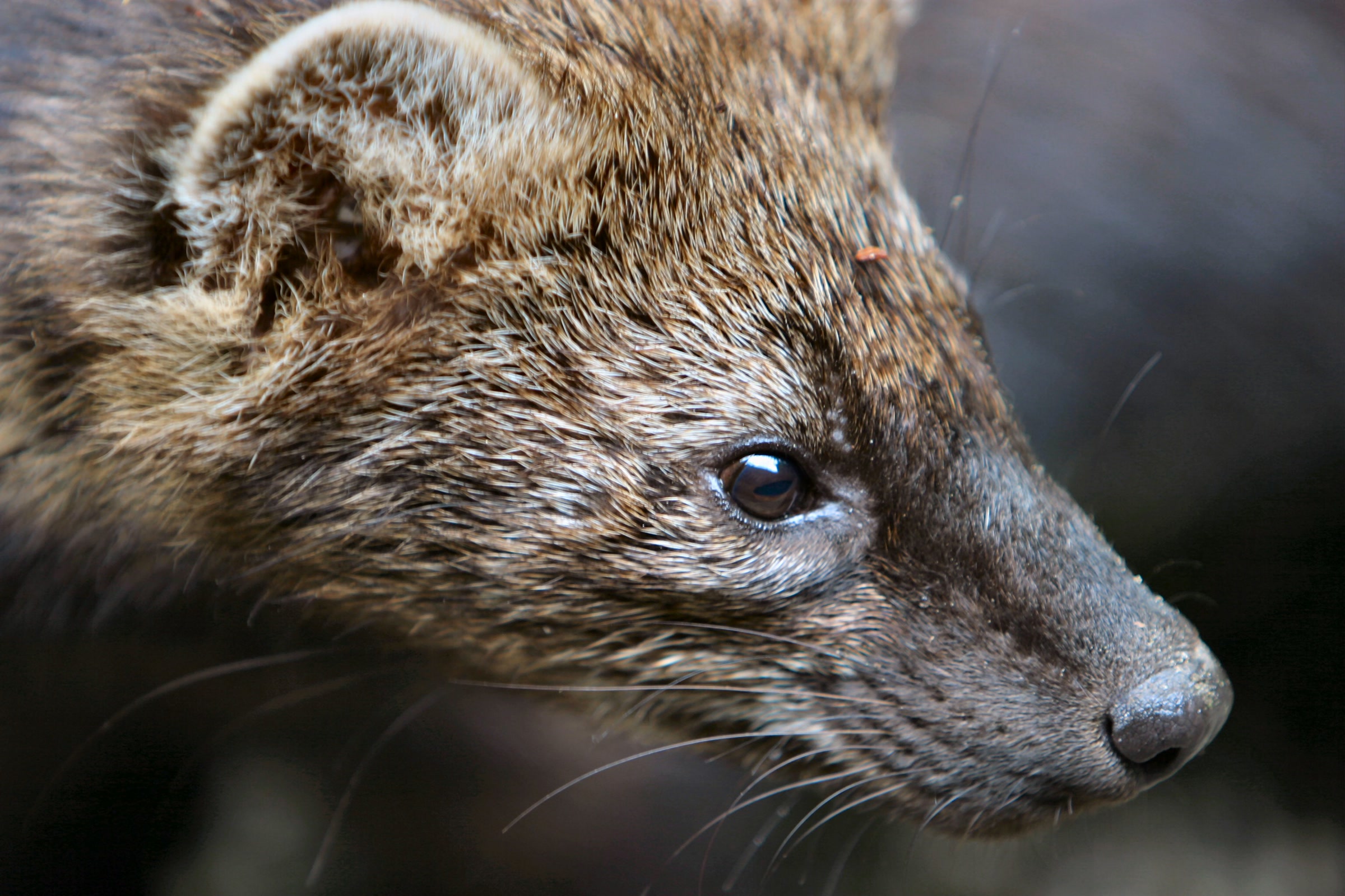
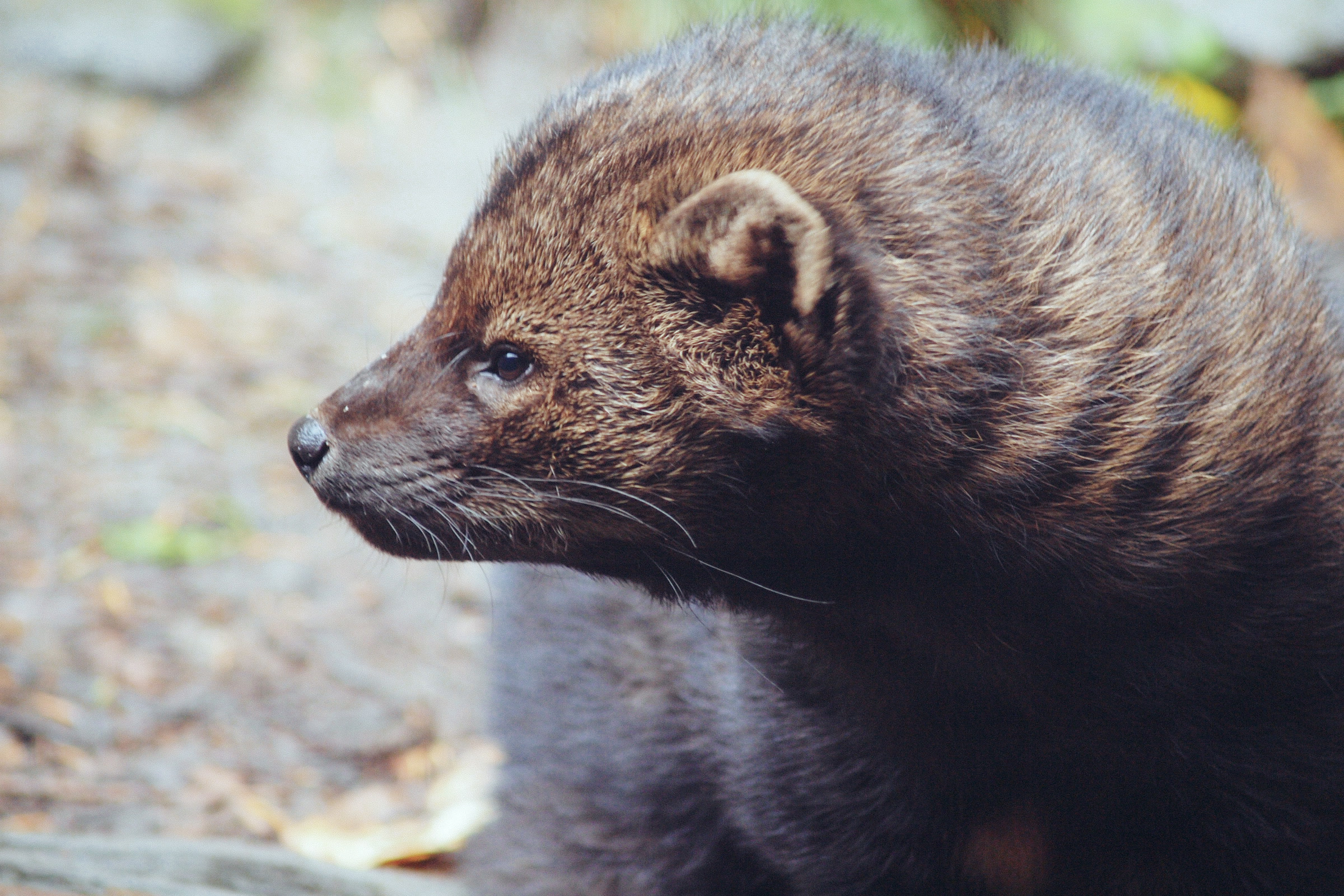
    Close portrait of a fisher showing its brown grizzled fur, small rounded ears and long whiskers
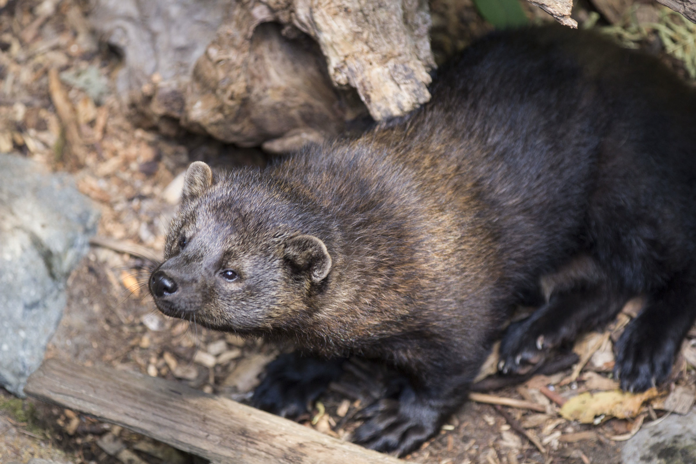
    The thick coat that once made fishers a trapper’s target. Location not recorded. Photo: Matthew Zalewski / Wikimedia Commons (CC BY-SA 4.0)

    How the fisher reintroduction in Olympic National Park worked

    After years of study, biologists chose Olympic National Park as an ideal place to bring fishers back. The park and WDFW managed the project together, working with the British Columbia Ministry of Environment and Canadian trappers to obtain the animals. Nineteen trappers caught fishers over the 2008, 2009 and 2010 seasons, and a ministry veterinarian checked each one before it travelled to Port Angeles.

    The first twelve were released at remote sites on January 27, 2008. Another 78 followed over the next three years, for 90 in all. Many partners backed the work, including the U.S. Fish and Wildlife Service, Olympic National Forest, Washington DNR, Jefferson Land Trust, the Lower Elwha Klallam, Makah, Quileute, Skokomish and Quinault Nation, and the Point-no-Point Treaty Council.

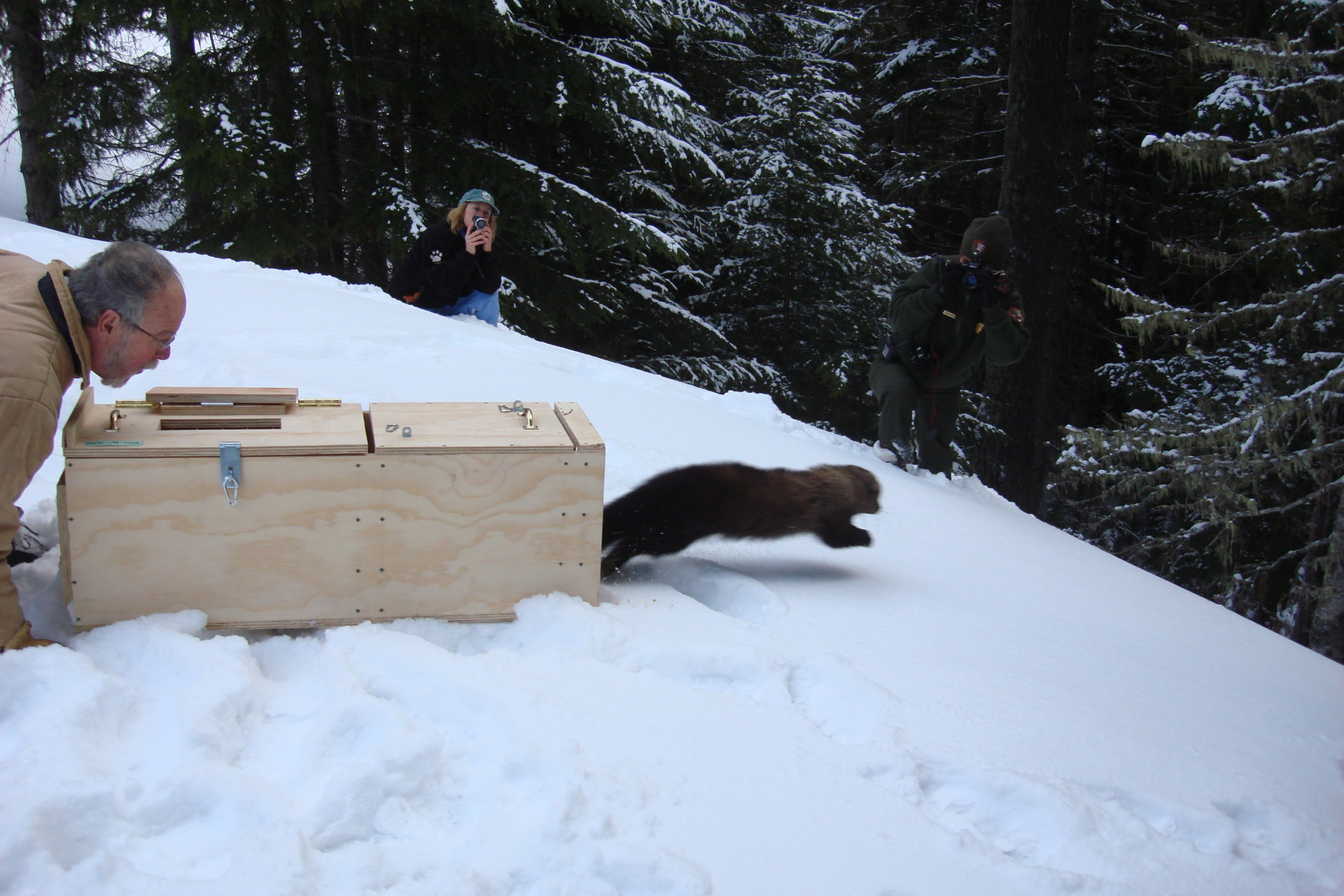
    A fisher bounds out of an open wooden crate across deep snow while two people watch beside a snowy forest
    A fisher leaves its crate during a winter release in the park. NPS Photo

    Fisher recovery timeline compared

    WhenWhat happened
    Early 1900sFishers gone from Washington after over-trapping
    1998Listed as endangered in Washington
    2006Washington State Fisher Recovery Plan
    January 27, 2008First twelve fishers released in the park
    2008 to 2010 seasons90 fishers from British Columbia released in all
    2013 to 2016Camera and hair snare surveys find founders and descendants
    November and December 202119 fishers from Alberta added on the Olympic Peninsula

    Following fishers through the forest

    At first every fisher wore a radio collar. Many collars slipped off, ran out of battery or broke, and by the end of 2011 only two fishers were still known to be alive and tracked. So biologists changed tactics.

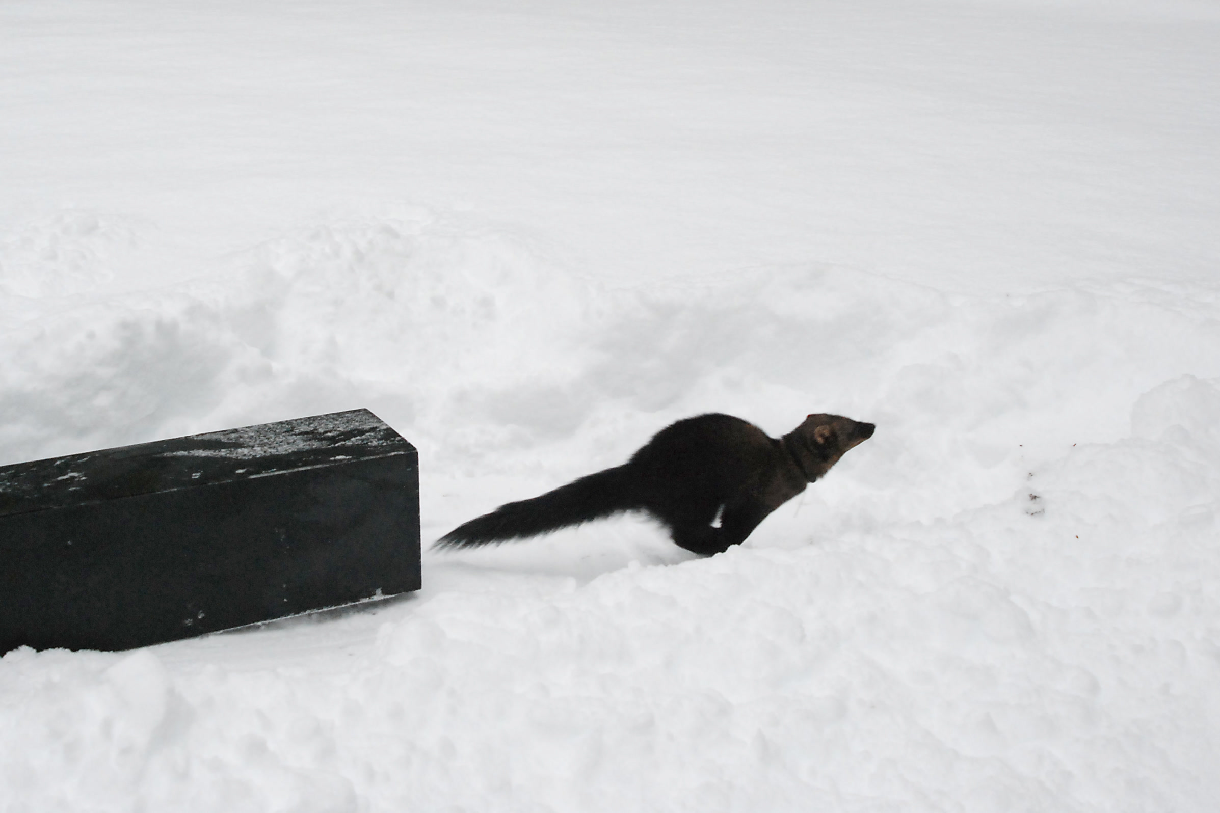
    A dark female fisher runs across snow away from a black release crate in the Sol Duc Valley
    A female fisher leaves her crate in the Sol Duc Valley, December 2008. NPS Photo

    They set out baited wildlife cameras and hair snares. A snare pulls a few hairs as a fisher passes, and the DNA in them identifies the individual, its sex and its family line. The cameras also caught more than 40 other species, cougars among them.

    A U.S. Geological Survey study of the 2013 to 2016 surveys covered 263 sampling units. Fishers turned up most often along the edge between wilderness and more intensively managed forest. The authors found that the population had not yet settled into its final range, and genetics showed at least two generations born on the peninsula.

    How the Pacific fisher is doing now

    The news is hopeful. Park studies found ten of the original founders still alive, along with several generations of their offspring. Fishers have spread widely across the Olympic Peninsula and set up home ranges in both managed and wilderness forests.

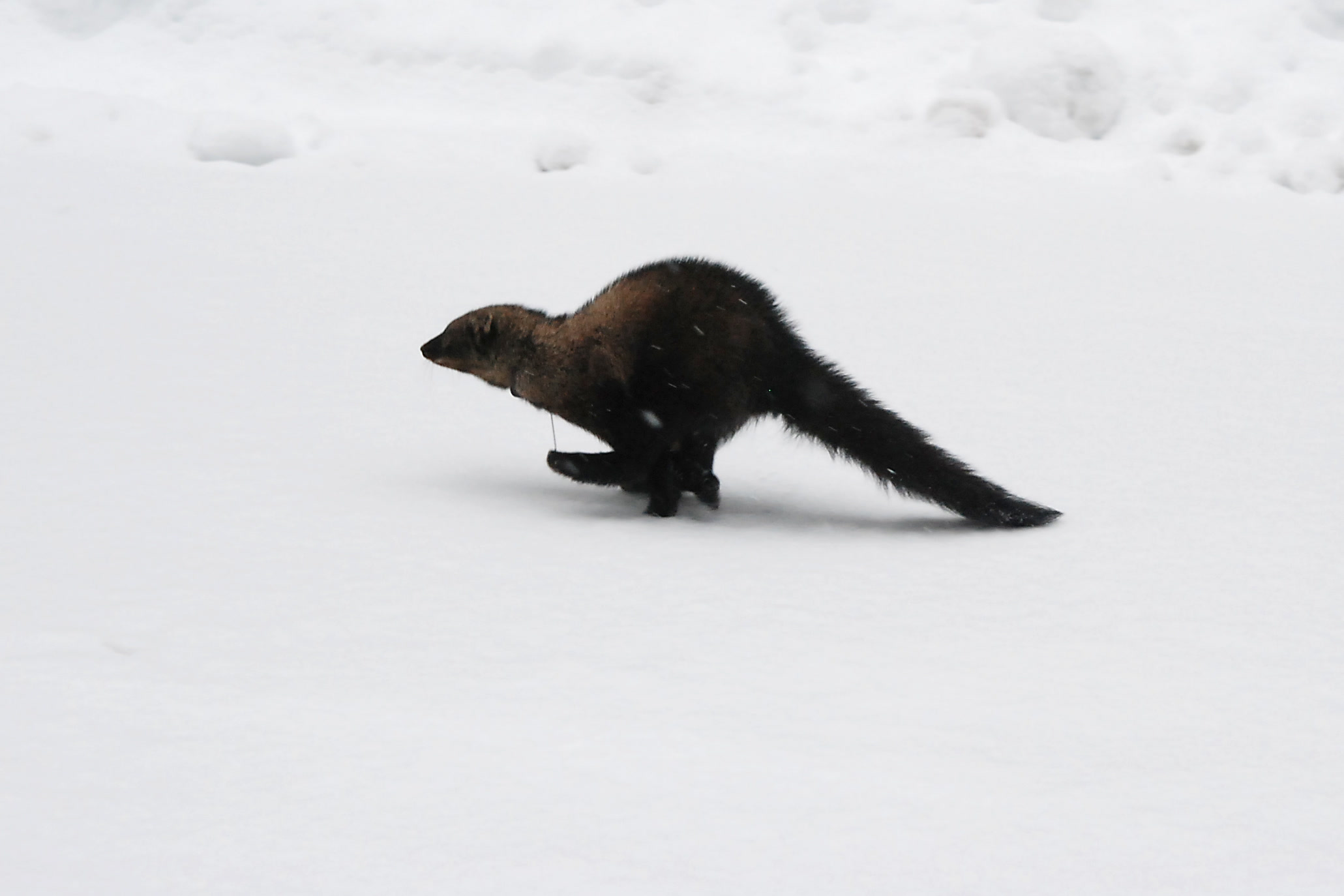
    A female fisher runs over fresh snow in the Sol Duc Valley moments after its release, part of the fisher reintroduction in Olympic National Park
    Free in the Sol Duc Valley, December 2008. NPS Photo

    The work is not finished. The park is still monitoring to learn whether the population reproduces well enough to sustain itself. In late 2021, 19 fishers from Alberta were released on the peninsula to add to it, and WDFW counts 279 fishers reintroduced across Washington from 2008 through 2021, including releases in the Cascades.

    A dark brown fisher with a long bushy tail resting beside a log on bare forest ground at Northwest Trek Wildlife Park
    A captive fisher at Northwest Trek Wildlife Park, photographed by Mount Rainier National Park staff. NPS Photo / Emily Brouwer

    Threats and how you can help fishers

    Fishers still face risks outside the park’s quiet valleys. One fisher found dead along Highway 101 carried high levels of brodifacoum, a rodent poison. Cars are a danger too, especially at night.

    • Slow down on peninsula roads after dark.
    • Skip harmful rodenticides and other pesticides around your home.
    • Keep forest corridors on your land so wildlife can move through.
    • Report a sighting to WDFW, ideally with a photo and exact coordinates.

    The park’s fisher reintroduction page has more on the project and its partners. Fishers are shy and mostly unseen, so a sighting is a real gift to the researchers.

    How Friends of Olympic National Park helps

    We are Friends of Olympic National Park (FONP), a volunteer-led friends group in Port Angeles. We did not run the fisher project, but we share the goal of healthy, connected forests. Our guided nature walks help people enjoy wild places gently, and our stories on Roosevelt elk in Olympic National Park and the mountain goat relocation cover other chapters in the park’s wildlife history. Our guide to the temperate rainforests of Olympic National Park shows the old forest that fishers call home.

    Frequently asked questions

    What is a fisher animal?

    A fisher is a member of the weasel family about the size of a large house cat, with thick dark fur and a long bushy tail. It lives in older conifer forests and hunts hares, rodents, birds and even porcupines.

    Do fishers eat fish?

    Not much. According to the park, early European settlers named them after the European polecat, which they resemble. Fishers mostly eat small and mid-sized mammals, birds, carrion and fruit.

    When were fishers reintroduced to Olympic National Park?

    The first twelve fishers were released on January 27, 2008. In all, 90 fishers from British Columbia were released over the 2008, 2009 and 2010 trapping seasons.

    Is the fisher endangered in Washington?

    Yes. The fisher has been listed as endangered by Washington State since 1998, and the state has a fisher recovery plan from 2006.

    Can I see a fisher in Olympic National Park?

    It is rare. Fishers are shy forest animals that most visitors never see. If you do spot one, report it to the Washington Department of Fish and Wildlife with a photo and exact location if you can.

    Want to help protect the forests where fishers hunt? You can support Olympic National Park with a gift, or explore our volunteer opportunities.

  • Mountain Goats in Olympic National Park: The Full Story

    Mountain Goats in Olympic National Park: The Full Story

    For nearly a century, mountain goats in Olympic National Park were a familiar sight on high ridges above Port Angeles. They were never meant to be here. Between 2018 and 2022 the park and its partners moved hundreds of goats to the Cascades, where the species belongs, and removed the rest. Here is the story in the park.s own figures, and what it means for hikers.

    Quick answer

    Are there still mountain goats in Olympic National Park?

    Very few, if any. Mountain goats are not native to the Olympics; about 12 were released near Lake Crescent in the 1920s. A 2018 plan removed 548 goats by 2022, and over 59 percent were moved to the Cascades. The park is now in a maintenance phase and asks hikers to report any sighting.

    • About 12 goats released near Lake Crescent, 1925 to 1929
    • About 725 goats on the peninsula by 2018
    • 325 goats translocated to the Cascades, 2018 to 2020
    • 548 removed in all; active work ended in 2022

    Are mountain goats native to the Olympics?

    No. The Olympic Mountains have long been cut off from the Cascades, and several mountain species found there never reached the peninsula on their own, including pika, bighorn sheep, ptarmigan and mountain goats. Historical records describe the release of about 12 goats near Lake Crescent between 1925 and 1929, before the park was established in 1938.

    An independent review by the Conservation Biology Institute concluded that the evidence supports the view that the mountain goat has never been native to the Olympic Peninsula. The small herd grew to more than 1,000 animals by a 1983 estimate and spread across the whole range.

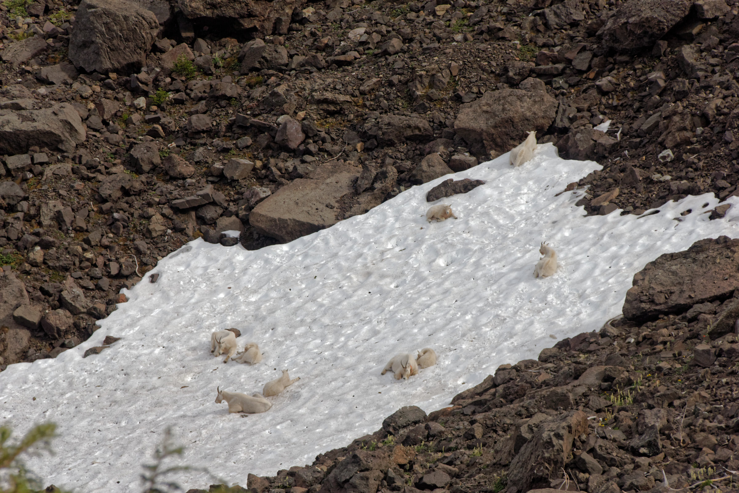
    A group of mountain goats in Olympic National Park resting on a snowfield among dark rocks, seen from the Lake Angeles and Klahhane Ridge trail in 2017
    Goats on a snowfield seen from the Klahhane Ridge trail, August 2017. Photo: Dirtsc / Wikimedia Commons (CC BY-SA 3.0)

    Why the park decided to act

    The goats damaged soils, threatened rare plants and changed alpine plant communities. That matters in a range whose meadows also shelter animals found nowhere else, like the Olympic marmot of Hurricane Ridge.

    Alpine plants are low in minerals, so the goats seek salt wherever they can find it. On the Olympics that meant human urine, sweaty packs and clothing, and they would paw and dig where hikers had relieved themselves. Some became a nuisance along trails and around wilderness campsites, approaching visitors.

    A mountain goat with its head down at the trail edge near Heart Lake, eating salty gravel, with the small lake behind
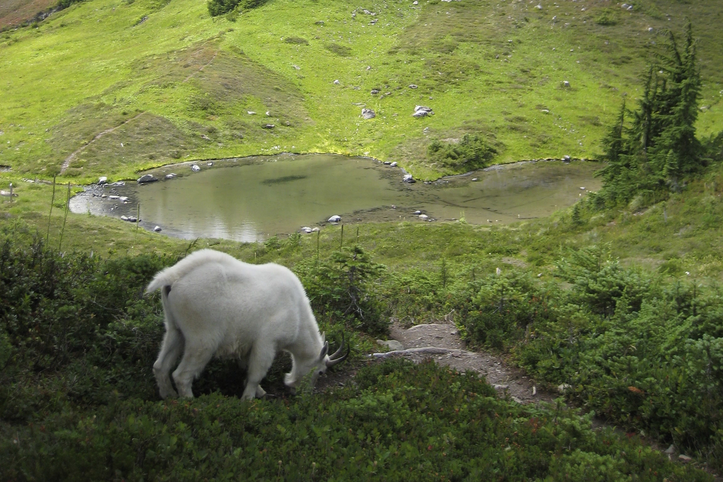
    A goat eating salty trail gravel near Heart Lake, 2009. Photo: Jtmorgan / Wikimedia Commons (CC BY-SA 3.0)

    In October 2010, a Port Angeles hiker was fatally injured by a mountain goat near Klahhane Ridge, close to Hurricane Ridge. Park staff reached him quickly, and rangers later found and killed the goat. The park.s later plan names public safety, alongside the damage to plants and soils, as a reason to act.

    A 2011 action plan dealt with goat behaviour in busy visitor areas. It did not address the damage to plants and soils, and the herd kept growing.

    The Olympic mountain goat relocation

    The park had tried before: from 1981 to 1989 it removed over 400 goats, 88 percent of them by translocation. The population rebounded to about 725 by 2018. That year the park, the U.S. Forest Service and the Washington Department of Fish and Wildlife finalized a management plan with consulting Tribes, after about 2,300 public comments on the draft.

    The goal was to remove every goat from the Olympic Peninsula: a five-year active phase, then a 15-year maintenance phase. Capture and relocation came first, because goats are native to the Cascades, where many populations had stayed low. Fertility control was ruled out because no contraceptive is approved for mountain goats, and public hunting is illegal in the park.

    How the goats were moved

    Crews darted or net-gunned each goat from a helicopter, placed it in a custom sling and flew it to a staging area at Hurricane Ridge, and later also the Hamma Hamma area. Veterinarians checked each animal before state wildlife staff drove it in a temperature-controlled truck to the Cascades for release the next day. Sixteen kids went to permanent homes in zoos.

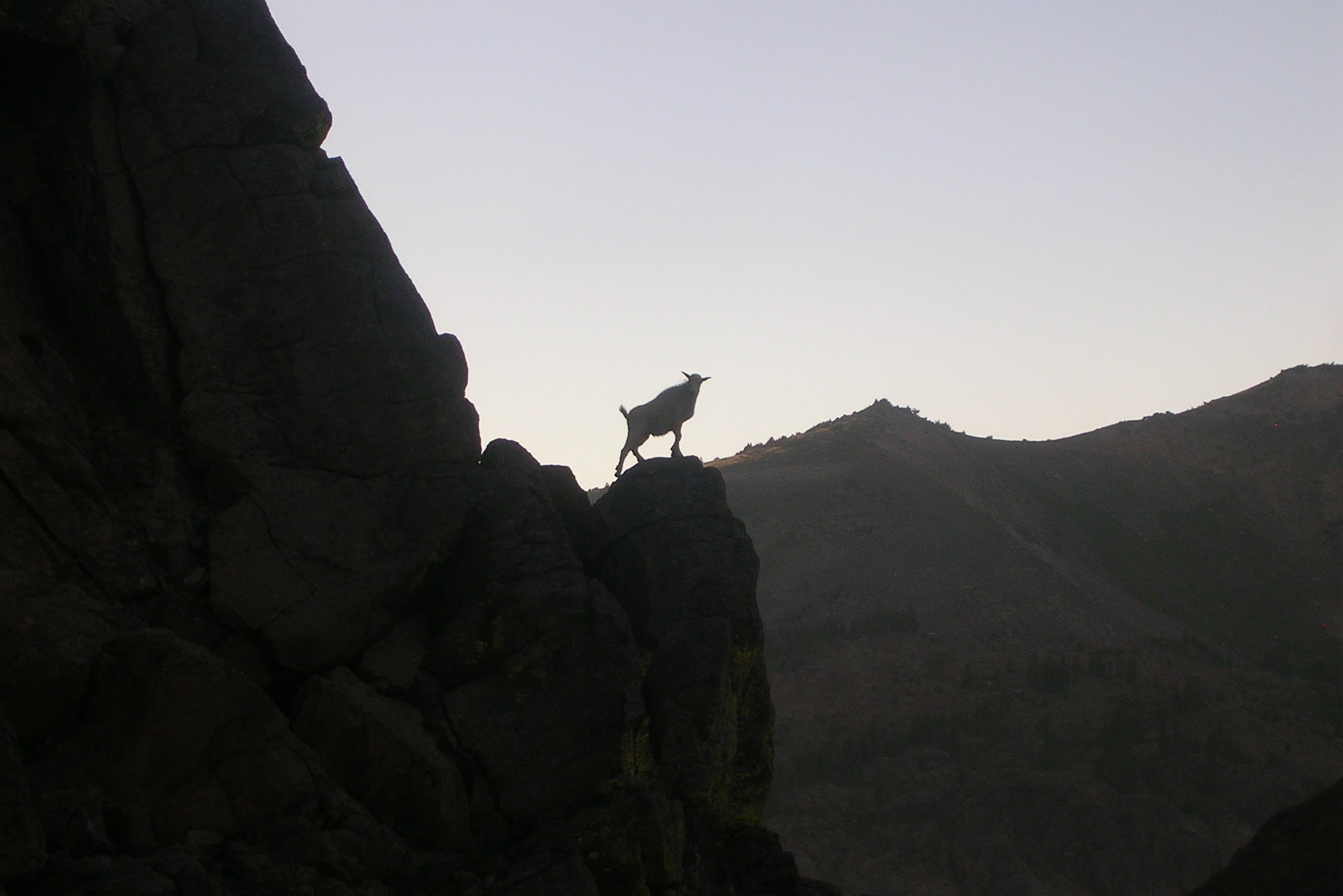
    The silhouette of a young mountain goat standing on a rock pinnacle against a pale sky in the Alpine Lakes Wilderness of the Cascades
    A native mountain goat in the Cascades, where the Olympic goats were released. Photo: Askewchan / Wikimedia Commons (CC BY-SA 3.0)

    From capture to lethal removal

    Each round got harder: by the last capture round, crews needed more than twice the helicopter time per live capture as at the start. In the fall of 2020, 98 volunteers on 20 teams removed 31 goats under park supervision, using authority Congress granted in 2019. Four aerial operations in 2021 and 2022 removed 192 more, and the last, in August 2022, removed just three goats over two weeks.

    Mountain goat removal by the numbers

    PhaseYearsResult
    Introduction1925 to 1929About 12 goats released near Lake Crescent
    Early control1981 to 1989Over 400 removed, 88% translocated
    Capture and translocation2018 to 2020325 goats moved to the Cascades
    Ground removal by volunteers202031 goats
    Aerial removal2021 to 2022192 goats
    Maintenance2023 onward5 sightings reported, 1 confirmed (2023 to 2025)
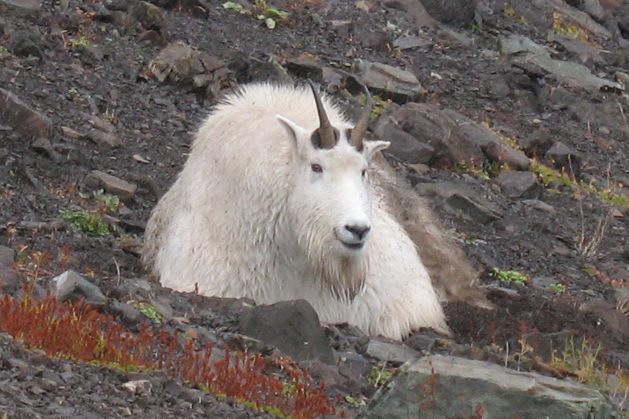
    A shaggy male mountain goat lying among dark rocks and red autumn plants on Klahhane Ridge
    A billy on Klahhane Ridge in 2009, years before the removal. NPS Photo

    Mountain goats in Olympic National Park today

    Active management ended in 2022 with 548 goats removed, over 59 percent of them translocated. The park says some goats may remain at very low numbers and be hard to detect. From 2023 to 2025, five sightings were reported and one was confirmed.

    If you see a goat, note the place and date and tell park staff by email or through the online form on the NPS mountain goat page. Heading into the high country? Our wilderness permits guide covers overnight trips.

    A lone mountain goat on a pale rocky basin below a jagged ridgeline in the Olympic Mountains near Hurricane Ridge
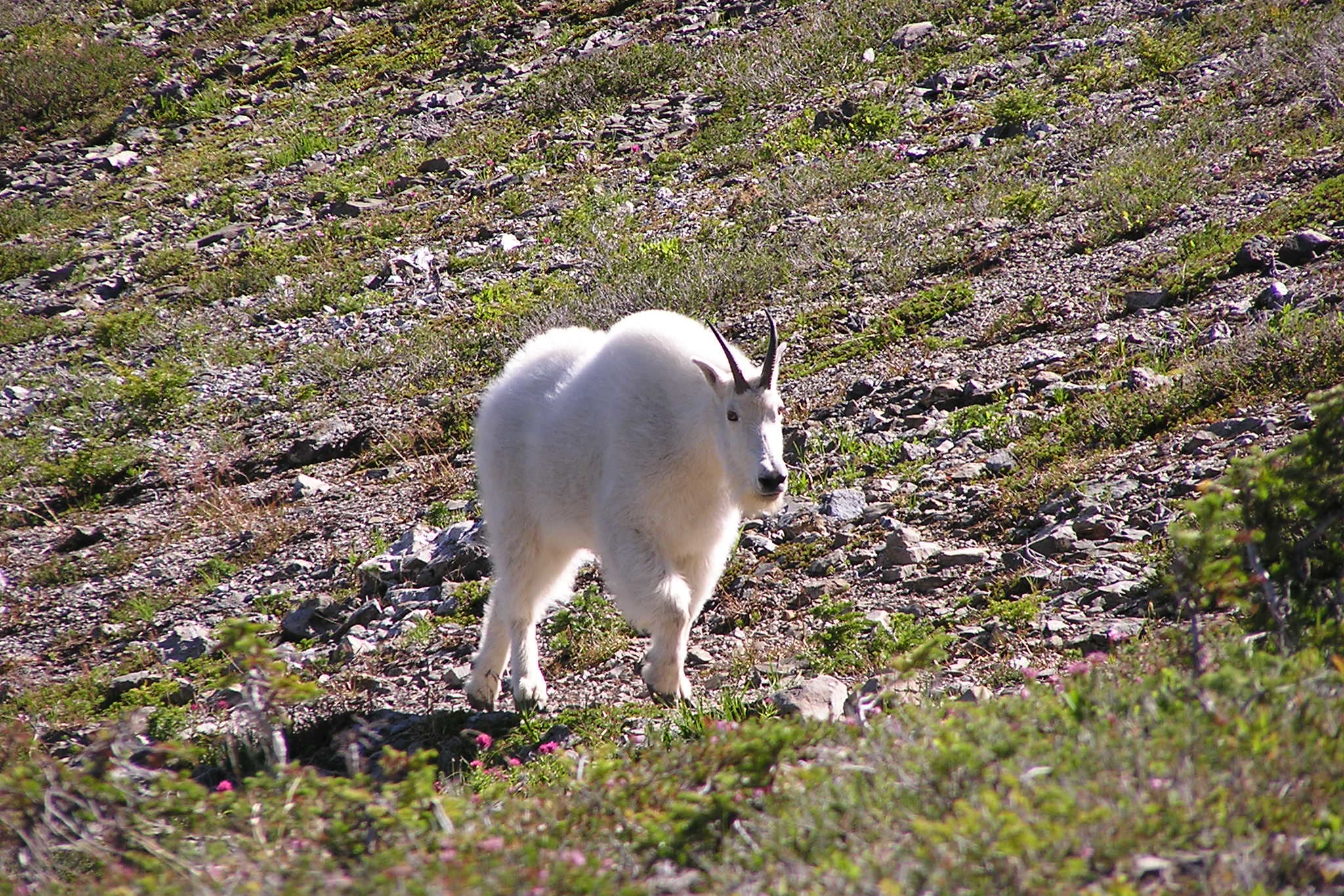
    A goat in the high country near Hurricane Ridge, 2015. Photo: John Leszczynski / Wikimedia Commons (CC BY-SA 2.0)

    The goats did not vanish from Washington. The Washington Department of Fish and Wildlife estimates fewer than 3,000 live in the state, mostly in the Cascades.

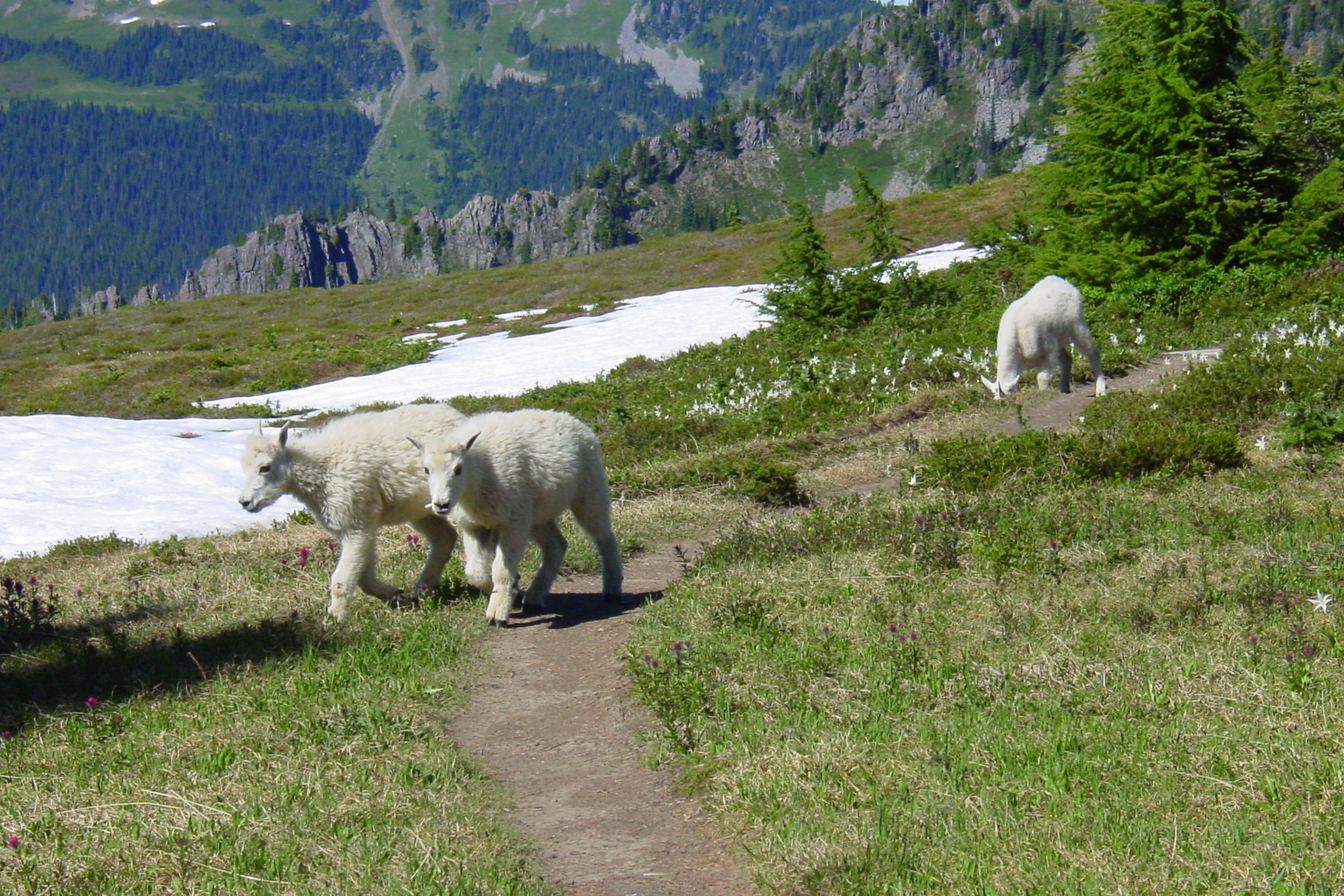
    A mountain goat nanny and kid walking on a narrow trail through a subalpine meadow with snow patches, with another goat beyond
    Goats on a trail in Olympic National Park, 2006. If a goat wants the trail, give it the trail. NPS Photo

    Mountain goat safety on the trail

    You are now far more likely to meet goats in the Cascades than here. Washington Trails Association offers this advice for goat country:

    • Stay at least 50 yards (about 150 feet) away at all times.
    • Urinate at least 50 feet off the trail, on rock if you can.
    • Never feed a goat or let it lick your skin or gear.
    • If a goat is on the trail, back off and go the other way.
    • If one keeps coming, make noise, wave a jacket and, if needed, throw a rock. Report the encounter to the land manager.

    In Olympic National Park, the general rule for all wildlife still applies: stay at least 150 feet away, and never feed or approach animals. The same care keeps our Roosevelt elk wild, too.

    How Friends of Olympic National Park helps

    We are Friends of Olympic National Park (FONP), a volunteer-led friends group. We don’t manage wildlife; the park and its partners do. What we can do is help people understand stories like this one, and you can read about another restoration effort in our post on fisher reintroduction in Olympic National Park. To lend a hand on the ground, see our volunteer opportunities.

    Frequently asked questions

    Are mountain goats native to Olympic National Park?

    No. About 12 goats were released near Lake Crescent between 1925 and 1929, before the park was established. The Olympics were isolated from the Cascades, so goats never reached the peninsula on their own.

    How many mountain goats were relocated from the Olympics?

    Four capture operations from 2018 to 2020 moved 325 goats to the Cascades. In all, 548 goats were removed by 2022, and over 59 percent of them were translocated.

    Why were the goats removed?

    They damaged soils and rare plants, and their hunger for salt drew them to hikers. In October 2010 a hiker was fatally injured by a goat near Klahhane Ridge.

    What should I do if a mountain goat approaches me?

    Back away and give it the trail. If it keeps coming, make noise, wave a jacket and, if needed, throw a rock. Never feed a goat or let it lick you.

    If this story matters to you, please support Olympic National Park with a gift to our volunteer work.

  • Olympic National Park Waterfalls: The Best Falls to Visit

    Olympic National Park Waterfalls: The Best Falls to Visit

    Olympic National Park waterfalls are fed by some of the wettest country in the lower 48, so you never have to walk far to find falling water. Some of the best are short, family-friendly walks from the road, from a paved path in the Elwha Valley to an old-growth trail near Lake Crescent. Here are the falls our volunteers send friends to first, with honest notes on trail length, access and the best time to go.

    Quick answer

    What are the best waterfalls in Olympic National Park?

    The easiest favourites are Marymere Falls near Lake Crescent, a 90-foot falls reached by a 0.9 mile trail, and Madison Falls in the Elwha Valley, a 60-foot falls at the end of a 0.1 mile paved path. Sol Duc Falls and the waterfall at Third Beach on the coast are also short, rewarding walks.

    • Marymere Falls: 90 feet, 0.9 mile one way from Storm King Ranger Station
    • Madison Falls: about 60 feet, 0.1 mile paved trail
    • Sol Duc Falls: 0.8 mile from the end of Sol Duc Road
    • Third Beach Trail: 1.4 miles one way to the beach

    Marymere Falls: the classic Lake Crescent walk

    The park calls Marymere Falls the most popular day hike at Lake Crescent. According to the NPS Marymere Falls trailhead page, the trail runs 0.9 mile one way through old-growth forest to a 90-foot waterfall. It starts at the Storm King Ranger Station, and you can also reach it from Lake Crescent Lodge.

    The lower stretch of Marymere Falls dropping as a thin white stream down a dark mossy cliff, with the wooden viewpoint railing in front
    The base of Marymere Falls from the lower viewpoint, October 2022. Photo: Joe Mabel / Wikimedia Commons (CC BY-SA 4.0)

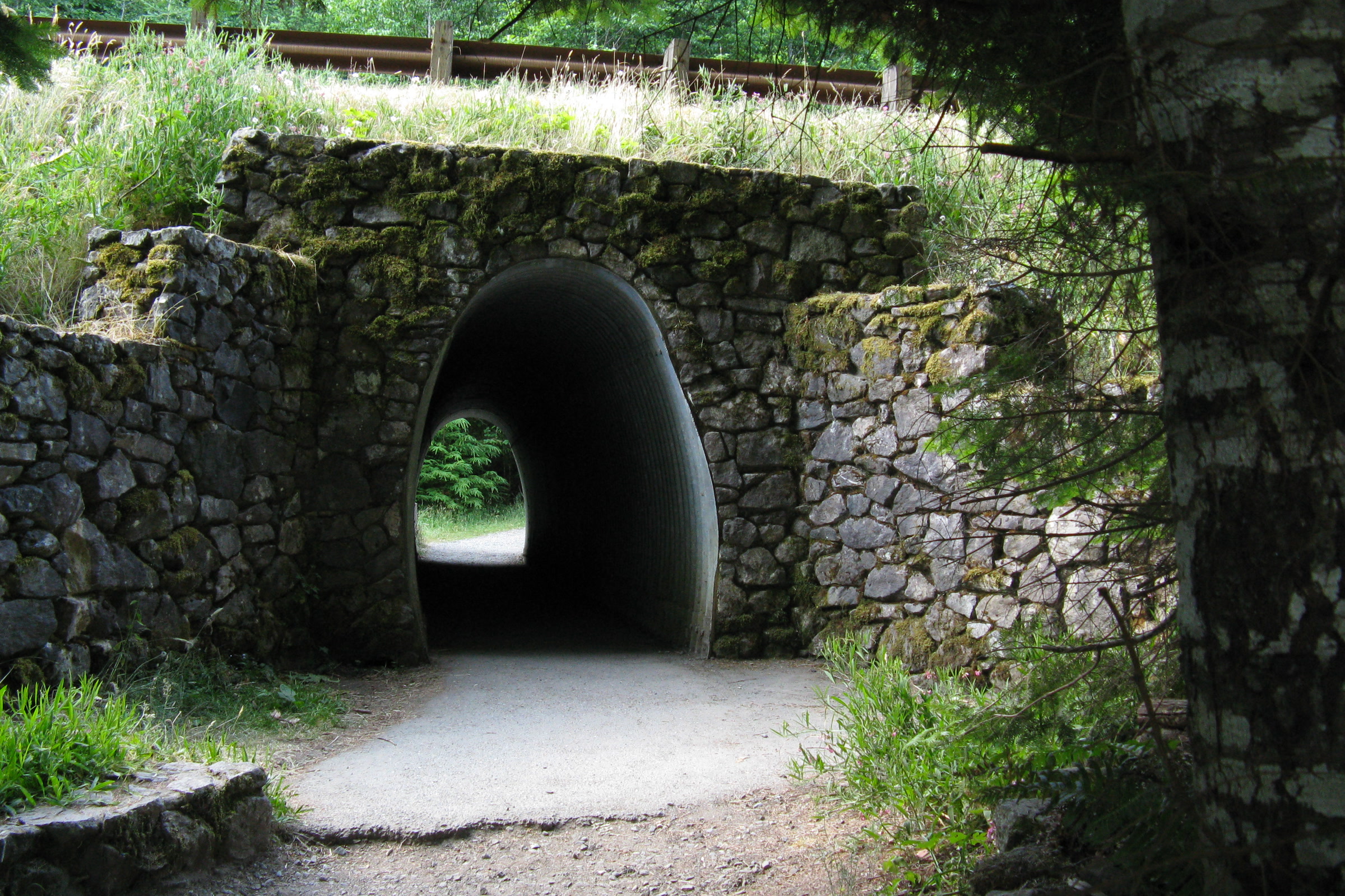
    The walk begins with a fun surprise: a stone tunnel that carries the trail under Highway 101. Beyond it, the path follows the forest toward Barnes Creek, which the park describes as the route to the falls. Near the end, the trail crosses Barnes Creek and then Falls Creek before climbing into a ravine.

    A stone arched tunnel carrying the Marymere Falls trail under Highway 101, with a gravel path leading into it
    The Marymere Falls trail passes under Highway 101. NPS Photo

    Washington Trails Association lists the hike at 1.8 miles round trip with about 500 feet of gain. The last stretch is a short loop with stairs and two viewpoints, one on the hillside looking down on the falls and a lower platform facing its base. WTA notes that dogs are not allowed, so leave pets at home for this one.

    Barnes Creek running shallow over cobbles between mossy forest banks, seen from the bridge on the Marymere Falls trail
    Barnes Creek from the trail bridge. Photo: Joe Mabel / Wikimedia Commons (CC BY-SA 4.0)

    Make a day of it with our guide to visiting Lake Crescent for more to see and do around the lake.

    Madison Falls: the most accessible waterfall

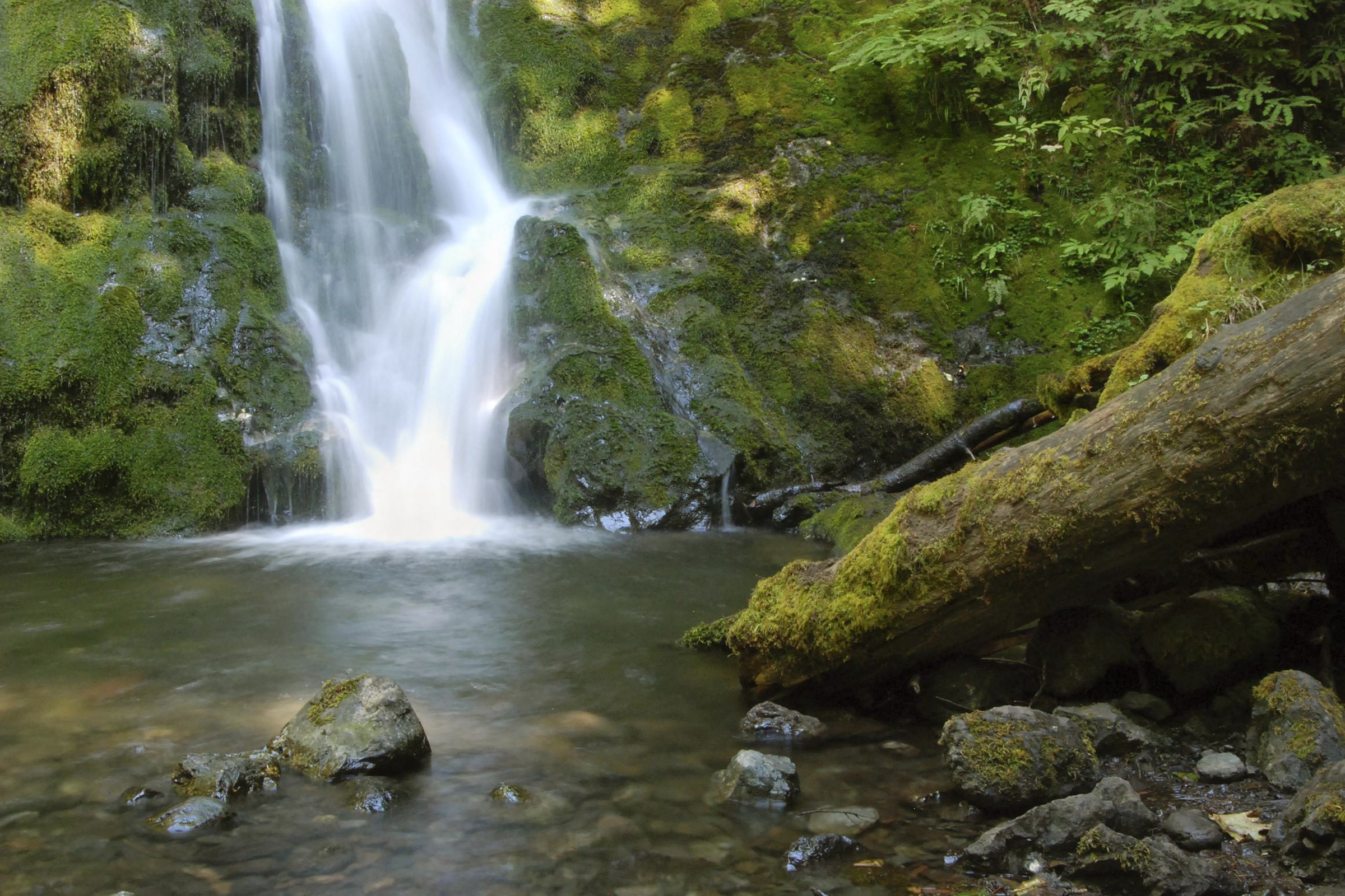
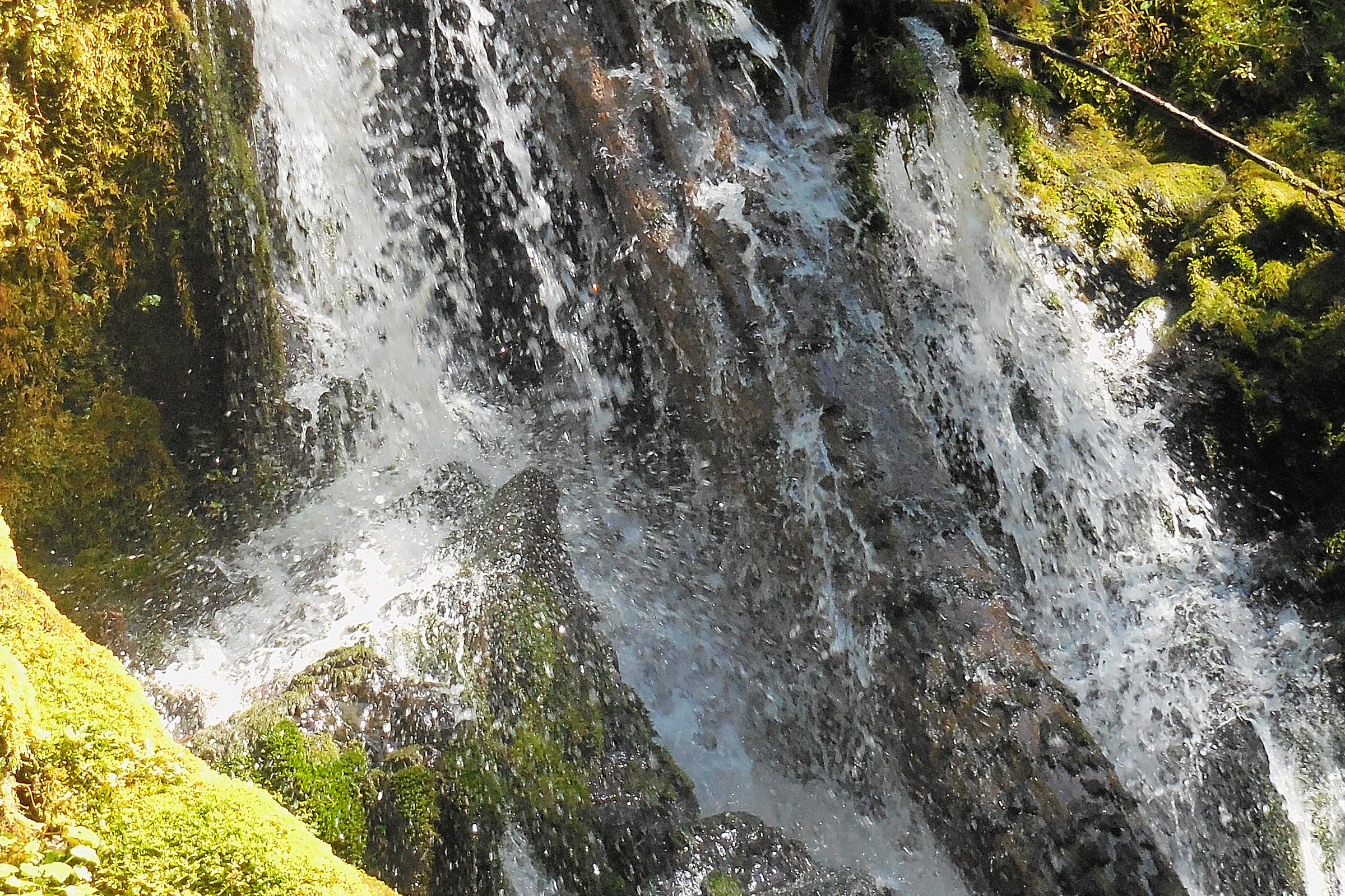
    Madison Falls is the gentlest waterfall visit in the park. The trail is 0.1 mile one way, paved and gently sloping, and it ends at a waterfall about 60 feet tall with a bench for resting. There is an accessible vault toilet at the trailhead, and the park says a visit takes about 5 to 15 minutes.

    Pets are allowed on this short trail as long as you follow the park’s BARK Rules. The falls sit near the Elwha River in the Elwha Valley, 11 miles west of Port Angeles. Stop at the gravel parking lot for a view of the river at the heart of the Elwha River dam removal and restoration story.

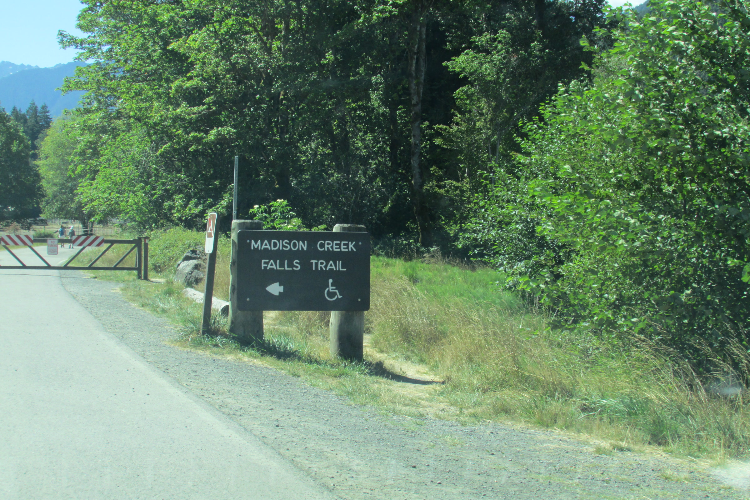
    A Madison Creek Falls Trail sign with a wheelchair symbol beside the paved road and a closed gate in the Elwha Valley
    The Madison Falls trailhead, August 2023. Photo: Chris Light / Wikimedia Commons (CC BY-SA 4.0)

    Elwha road status

    Madison Falls is also where driving ends in the Elwha. The park closed Olympic Hot Springs Road to vehicles beyond the Madison Falls parking lot because of flood damage and a road washout. The road beyond stays open to bikes and walkers, but there are no visitor facilities past the gate, so check the NPS Elwha Valley page before you go.

    Sol Duc Falls in the Sol Duc Valley

    Sol Duc Falls is one of the best-known falls in the park. The park says the walk from the parking lot at the end of the road is 0.8 mile and relatively level. For more on the trail and the valley around it, read our Sol Duc Falls and Sol Duc Valley guide.

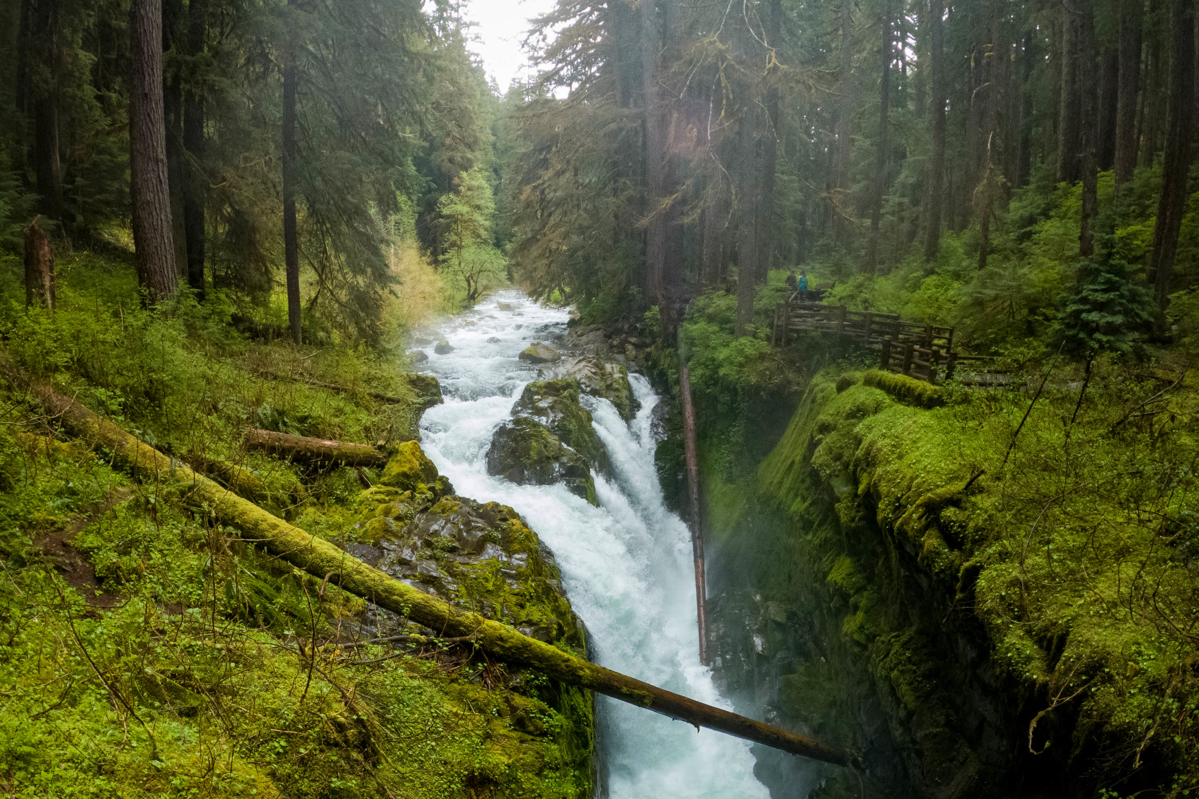
    One of the small Olympic National Park waterfalls: water streaming down a dark rock face edged with bright green moss in the Hoh Rain Forest
    Small, nameless falls like this one in the Hoh are everywhere after rain. NPS Photo / C. Bubar

    After a wet spell, small unnamed cascades spill off mossy banks all through the temperate rainforests of Olympic National Park.

    A waterfall on the beach at Third Beach

    On the coast near La Push, the Third Beach Trail drops through forest to a wide, wild beach. The park rates it easy, at 1.4 miles one way with about 240 feet of elevation loss. Toward Taylor Point at the south end of the beach, a waterfall pours off the headland onto the sand, a sight that surprises many visitors.

    This falls is fed by rain, so it runs best in the wet months and can fade to a trickle in late summer. Parking is very limited, and pets are not allowed on coastal beaches or trails. Taylor Point cannot be rounded at shore level, and the park warns never to try rounding headlands at high tide, so carry a tide chart and see our guide to tide pools in Olympic National Park for low tide tips.

    Merriman Falls near Lake Quinault

    In the Quinault Valley, Merriman Falls sits right beside the South Shore Road on Lake Quinault. It is on Olympic National Forest land rather than inside the park, but it makes an easy stop on a Quinault rain forest drive. Its creek is small, so like the Third Beach falls it looks best after winter and spring rain.

    Merriman Falls spilling in thin streams past moss covered boulders and fallen logs near Lake Quinault
    Merriman Falls in June 2018. Photo: King of Hearts / Wikimedia Commons (CC BY-SA 4.0)

    Olympic National Park waterfalls compared

    WaterfallAreaWalkGood to know
    Marymere FallsLake Crescent0.9 mile one way90 feet; stairs at the end; no dogs
    Madison FallsElwha Valley0.1 mile, pavedAbout 60 feet; accessible; pets allowed
    Sol Duc FallsSol Duc Valley0.8 mile one wayRelatively level forest walk
    Third Beach fallsCoast near La Push1.4 miles to the beachBest in wet months; no pets
    Merriman FallsLake QuinaultRoadsideOlympic National Forest land

    Tips for waterfall hikes on the Olympic Peninsula

    How Friends of Olympic National Park helps

    We are Friends of Olympic National Park (FONP), a volunteer-led friends group based in Port Angeles. Busy trails stay welcoming when people care for them, and our adopt-a-trail crew on the Heart O’ the Forest Trail and our beach cleanups are two ways neighbours pitch in. To join a crew, see our volunteer opportunities at Olympic National Park.

    Frequently asked questions

    What is the easiest waterfall to see in Olympic National Park?

    Madison Falls in the Elwha Valley. The trail is 0.1 mile one way, paved and gently sloping, with an accessible vault toilet at the trailhead and a bench at the falls.

    How long is the hike to Marymere Falls?

    The park lists 0.9 mile one way from the Storm King Ranger Station, or about 1.8 miles round trip. The final loop to the viewpoints has stairs.

    Can I bring my dog to see the waterfalls?

    Pets are allowed on the short Madison Falls trail if you follow the park BARK Rules. Dogs are not allowed on the Marymere Falls trail, and pets are prohibited on coastal beaches and trails such as Third Beach.

    Is there a waterfall on the beach in Olympic National Park?

    Yes. At Third Beach near La Push, a waterfall pours off the headland toward Taylor Point at the south end of the beach. It flows best in the wet months.

    Love these trails as much as we do? Become a member of Friends of Olympic National Park and help us look after them.

  • Sol Duc Falls and the Sol Duc Valley: A Visitor Guide

    Sol Duc Falls and the Sol Duc Valley: A Visitor Guide

    Sol Duc Falls is the payoff at the end of one of the gentlest walks in Olympic National Park. The trail starts at the end of Sol Duc Road, deep in a valley of old growth forest, and ends where the Sol Duc River drops into a narrow, mossy canyon. Here is how to plan the walk, what else the valley offers, and what to check before you drive in.

    Quick answer

    How do you get to Sol Duc Falls, and how long is the hike?

    Sol Duc Falls is reached by a relatively level trail of about 0.8 mile one way, with roughly 200 feet of gain, from the parking area at the end of Sol Duc Road. The paved road runs 14 miles from Highway 101 and is often closed by winter snow and ice, so check NPS road conditions first.

    • About 0.8 mile one way through old growth forest
    • Sol Duc Road: paved, 14 miles from Highway 101
    • No pets or bicycles on any Sol Duc trail
    • Coho leap at Salmon Cascades in autumn

    The Sol Duc Falls trail

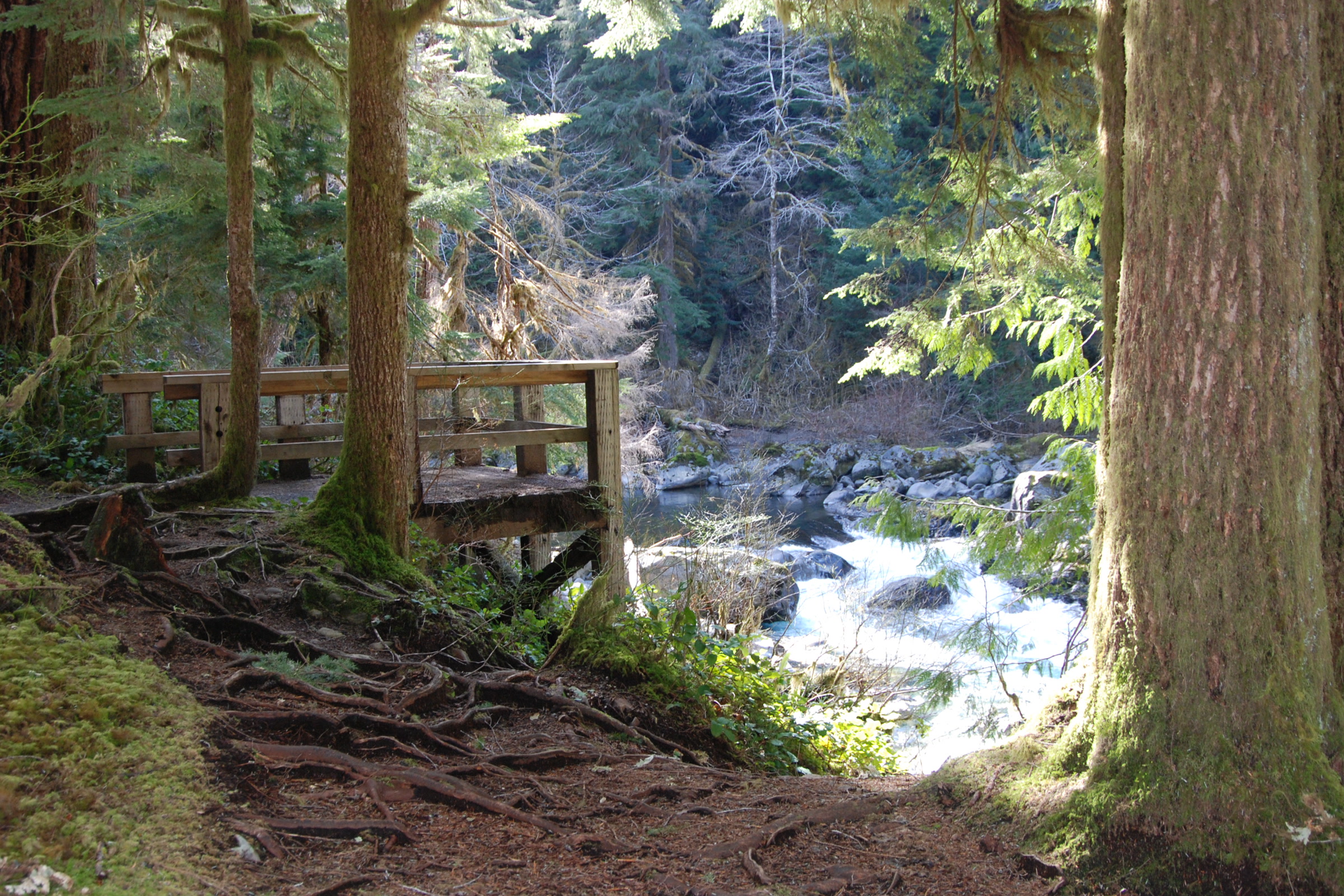
    The park’s page for the Sol Duc Falls trail calls this “perhaps the most picturesque waterfall in Olympic,” and the walk to it is an easy one. From the trailhead it is about 0.8 mile (1.3 km) one way on a relatively level path through big old trees. The park’s Sol Duc brochure puts the elevation gain at about 200 feet.

    Near the falls you pass Canyon Creek Shelter, one of the historic trail shelters featured in our guide to historical structures in Olympic National Park. A footbridge crosses the river at the falls and is one of several viewpoints, upstream and downstream.

    A wooden footbridge on the Sol Duc Falls trail crossing through old growth forest lit by beams of sunlight
    The footbridge near the falls. NPS Photo / C. Bubar

    Sol Duc valley walks compared

    The falls are only the start. These distances come from the park’s Sol Duc area brochure and are one way unless noted.

    TrailDistance and gainHighlights
    Ancient Groves0.6 mile loop, flatSelf guided nature trail
    Sol Duc Falls0.8 mile, 200 feetOld growth forest to the falls
    Lover’s Lane6.0 mile loop, 200 feetLinks the resort and the falls
    Mink Lake2.6 miles, 1,500 feetClimb through dense forest
    Deer Lake3.8 miles, 1,700 feetClimb through dense forest

    Seeing Sol Duc Falls safely

    The Washington Trails Association describes the falls splitting into as many as four channels, depending on how much water is flowing, before dropping 48 feet into a narrow, rocky canyon. The park asks visitors to watch from the designated viewing areas and to keep children under close supervision, because the falls can be dangerous.

    Sol Duc Falls splitting into separate channels around a dark rock as the river drops into the canyon
    The river divides around rock before it plunges. Photo: Kimon Berlin / Wikimedia Commons (CC BY-SA 2.0)
    • Stay on the trail and in the viewing areas, even for a photo.
    • Leave dogs at home: pets and bicycles are not permitted on any Sol Duc trail.
    • Expect spray near the falls; WTA suggests bringing a towel.

    The Sol Duc valley forest

    The Sol Duc valley is a world of tall conifers and moss. The 0.6 mile Ancient Groves loop is the easiest way to stand among them, and Sol Duc Campground sits right in the forest. The campground has 82 sites, including one group site and one accessible site, and is run by the resort, with summer sites reserved through recreation.gov.

    Tall straight conifer trunks rising above an open, mossy forest floor near Sol Duc Campground
    Old growth forest beside Sol Duc Campground. NPS Photo / R. McKenna

    Strong hikers use the valley as a gateway to Seven Lakes Basin and the High Divide, with views of Mount Olympus. Snow can linger there into late summer, and it is a quota area, so overnight trips need a permit; our guide to Olympic National Park wilderness permits explains how.

    Salmon at Salmon Cascades

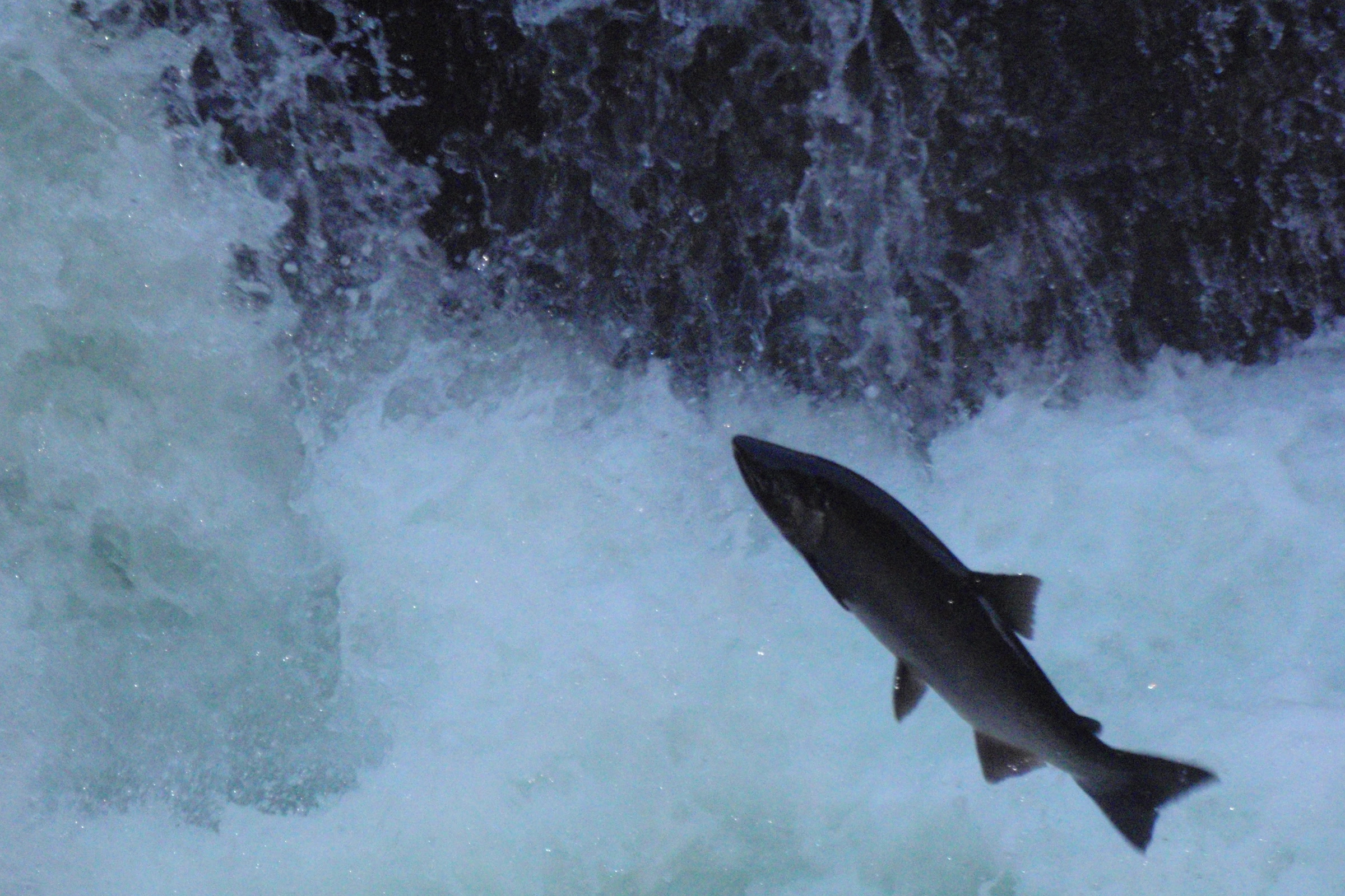
    On the drive up Sol Duc Road, stop at Salmon Cascades, where coho leap the rapids in autumn. According to the park, Chinook and coho climb the river in late summer and spawn in late fall, while cutthroat trout and steelhead run in fall and winter. The Sol Duc is one of the few places where salmon run in every season.

    A coho salmon leaping clear of the white water at Salmon Cascades on the Sol Duc River
    A coho in mid leap, September 2009. NPS Photo

    These fish hatch in the Sol Duc, spend most of their lives in the Pacific Ocean, then return to spawn. Watch quietly from the overlook and give the fish room.

    A wooden viewing platform among big trees above the rushing Sol Duc River at Salmon Cascades
    The Salmon Cascades overlook. NPS Photo / C. Bubar

    Sol Duc Hot Springs, then and now

    The Quileute and other peoples of the peninsula knew these springs long before settlers arrived. HistoryLink’s history of Sol Duc Hot Springs tells how timber baron Michael Earles bought them after homesteader Theodore Moritz died in 1909. Earles opened a grand resort on May 15, 1912, with a 165 room hotel and a 100 bed sanatorium.

    On May 26, 1916, a fire from a defective chimney flue destroyed nearly all of it within three hours, and the main buildings were never rebuilt. The National Park Service bought the site in 1966, and the resort was rebuilt in the 1980s.

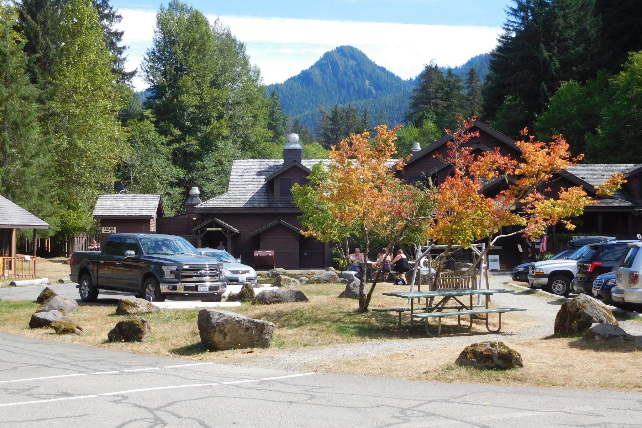
    The lodge buildings and parking area of Sol Duc Hot Springs Resort framed by autumn leaves and a forested peak
    Sol Duc Hot Springs Resort in September. Photo: Robert Ashworth / Wikimedia Commons (CC BY 2.0)

    Today the resort offers cabins, an RV park, a restaurant and seasonal day use of three mineral pools and one freshwater pool, which the park says are tested daily. The pools are open only while the resort is open, and it closes in winter. Hours, rates and season dates change, so check the NPS hot springs page and the resort’s website before you go.

    Planning your Sol Duc day

    Sol Duc Road is open year round, weather permitting, but snow and ice often close it in winter. Call the road and weather line at 360-565-3131 or check the park’s current road conditions page on the morning you go. You will need a park pass; see our guide to Olympic National Park entrance fees.

    Lake Crescent is less than half an hour away, so it pairs well with the falls. Our Lake Crescent history and visitor guide covers the hikes, paddling and places to stay there.

    How Friends of Olympic National Park helps

    We are Friends of Olympic National Park (FONP), a volunteer led friends group based in Port Angeles. Our adopt-a-trail crew cares for the Heart O’ the Forest Trail, and our volunteers help with cleanups and guided walks. If trails like the one to Sol Duc Falls matter to you, explore our volunteer opportunities.

    Frequently asked questions

    How long is the hike to Sol Duc Falls?

    About 0.8 mile one way on a relatively level trail through old growth forest, with roughly 200 feet of elevation gain, so around 1.6 miles round trip.

    Can I bring my dog to Sol Duc Falls?

    No. Pets and bicycles are not permitted on any trails in the Sol Duc area, including the Sol Duc Falls trail.

    Is Sol Duc Road open in winter?

    It is open year round, weather permitting, but snow and ice often close it in winter. Check the NPS current road conditions page or call 360-565-3131 before you go.

    Are Sol Duc Hot Springs open all year?

    No. The pools are open only while the resort is open, and the resort closes in winter. Check the NPS hot springs page and the resort website for this year’s dates.

    When can you see salmon jump at Salmon Cascades?

    The park says coho leap at Salmon Cascades in autumn. Chinook and coho climb the Sol Duc in late summer and spawn in late fall.

  • Lake Crescent: History, Hikes and How to Visit

    Lake Crescent: History, Hikes and How to Visit

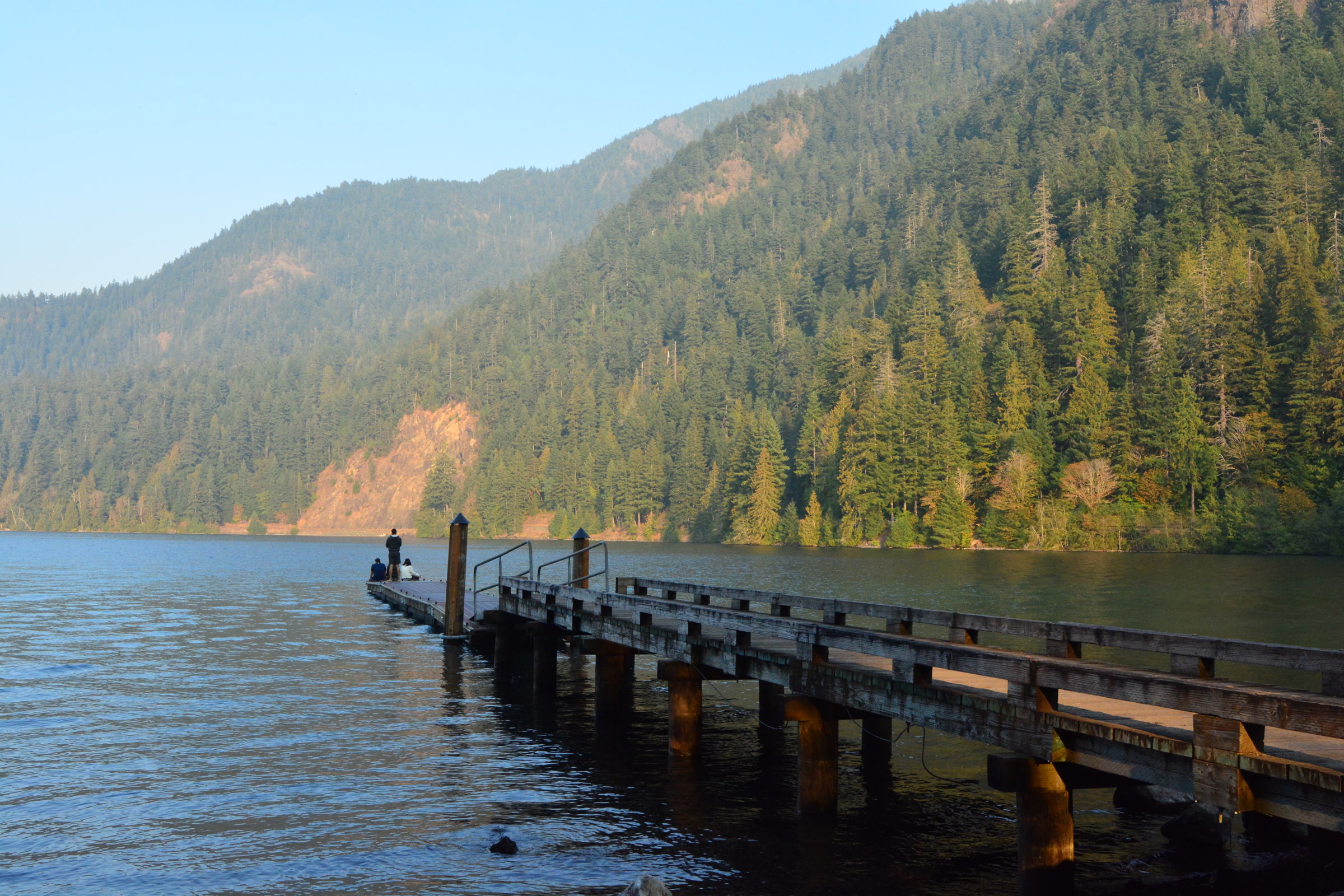
    Lake Crescent sits in the northern foothills of the Olympic Mountains, about 18 miles west of Port Angeles inside Olympic National Park. Its deep, glacier carved basin holds some of the clearest, bluest water on the peninsula. Here is how the lake formed, what happened along its shores, and how to spend a good day there.

    Quick answer

    What is Lake Crescent, and what can you do there?

    Lake Crescent is a deep, glacially carved lake in Olympic National Park, about 18 miles west of Port Angeles. The park gives its depth as 624 feet, and low nitrogen keeps the water clear. Visitors hike the Spruce Railroad Trail and Mount Storm King, paddle from launches at both ends, and stay at seasonal lodges or Fairholme Campground.

    • About 18 miles west of Port Angeles on Highway 101
    • Home to Beardslee and Crescenti trout, found nowhere else
    • Spruce Railroad Trail: paved, 4.0 miles one way, two historic tunnels
    • Lodges are generally open late spring to early fall

    How Lake Crescent formed, and why it is so clear

    Ice sheets carved this steep valley thousands of years ago, and it filled with water as the ice pulled back. Later, landslides from the surrounding mountains split one larger lake in two. The park dates the slide that isolated Lake Crescent from neighbouring Lake Sutherland to roughly 7,000 years ago.

    The famous colour has a simple cause. According to the park’s Lake Crescent area brochure, the water holds very little nitrogen, which limits the tiny floating plants that cloud most lakes. In some places you can see 60 feet down, and that clarity plus reflected light gives the lake its blue green glow.

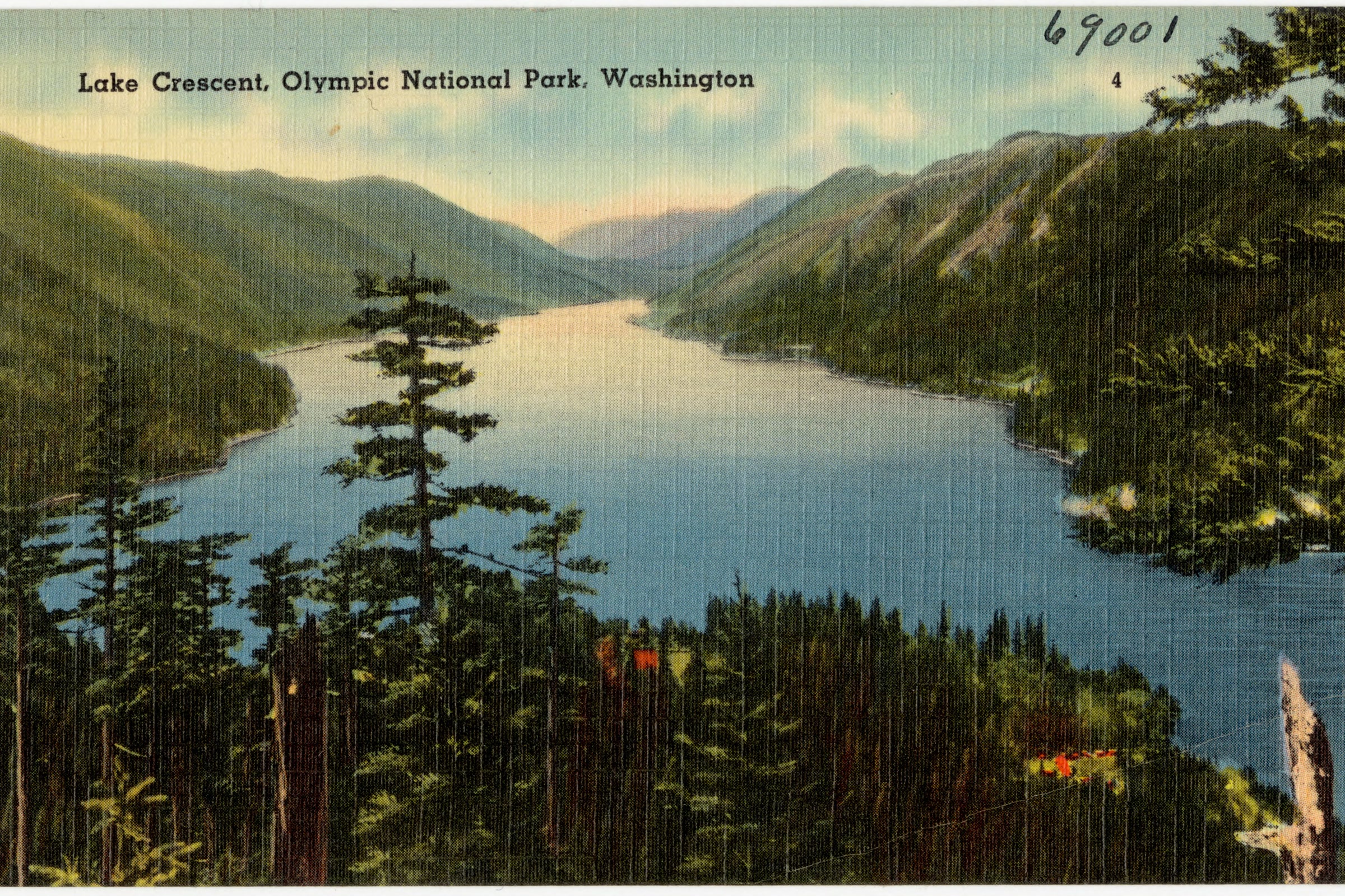
    A colourful mid twentieth century postcard of Lake Crescent seen from above, winding between steep forested ridges
    The lake has drawn visitors for more than a century. Tichnor Bros. postcard, Boston Public Library / Wikimedia Commons (public domain)

    Trout found nowhere else

    Cut off for thousands of years, the lake’s fish went their own way. The Beardslee trout and the Crescenti trout live here and nowhere else in the world. The U.S. Geological Survey notes that because the lake is so low in nutrients, even small increases could trigger algal blooms, and that the Beardslee trout is at particular risk because its spawning habitat is limited.

    Close view of the silvery, speckled head of a Beardslee trout from Lake Crescent
    A Beardslee trout, one of the lake’s two endemic trout. NPS Photo

    Lake Crescent history: resorts, ferries and a wartime railroad

    Lake Crescent history as a destination starts with fish. A historic structure report for the park records that Admiral Leslie Beardslee visited in 1895 and publicised the trout that now carries his name, which helped make the lake a sport fishing spot. Small resorts followed, from log cabins at East Beach in the 1890s to Ovington’s on the north shore in 1905 and Marymere on Barnes Point in 1906.

    Getting there was half the adventure. A county road from Port Angeles reached the lake in 1911, and in 1914 the county commissioners authorised a ferry, the Marjory, to carry travellers across. A larger ferry, the Storm King, followed in 1915 and could carry thirty vehicles.

    The best known survivor is Lake Crescent Lodge at Barnes Point. Its story, along with Rosemary Inn and Storm King Ranger Station, is told in our guide to historical structures in Olympic National Park, so we won’t repeat it here.

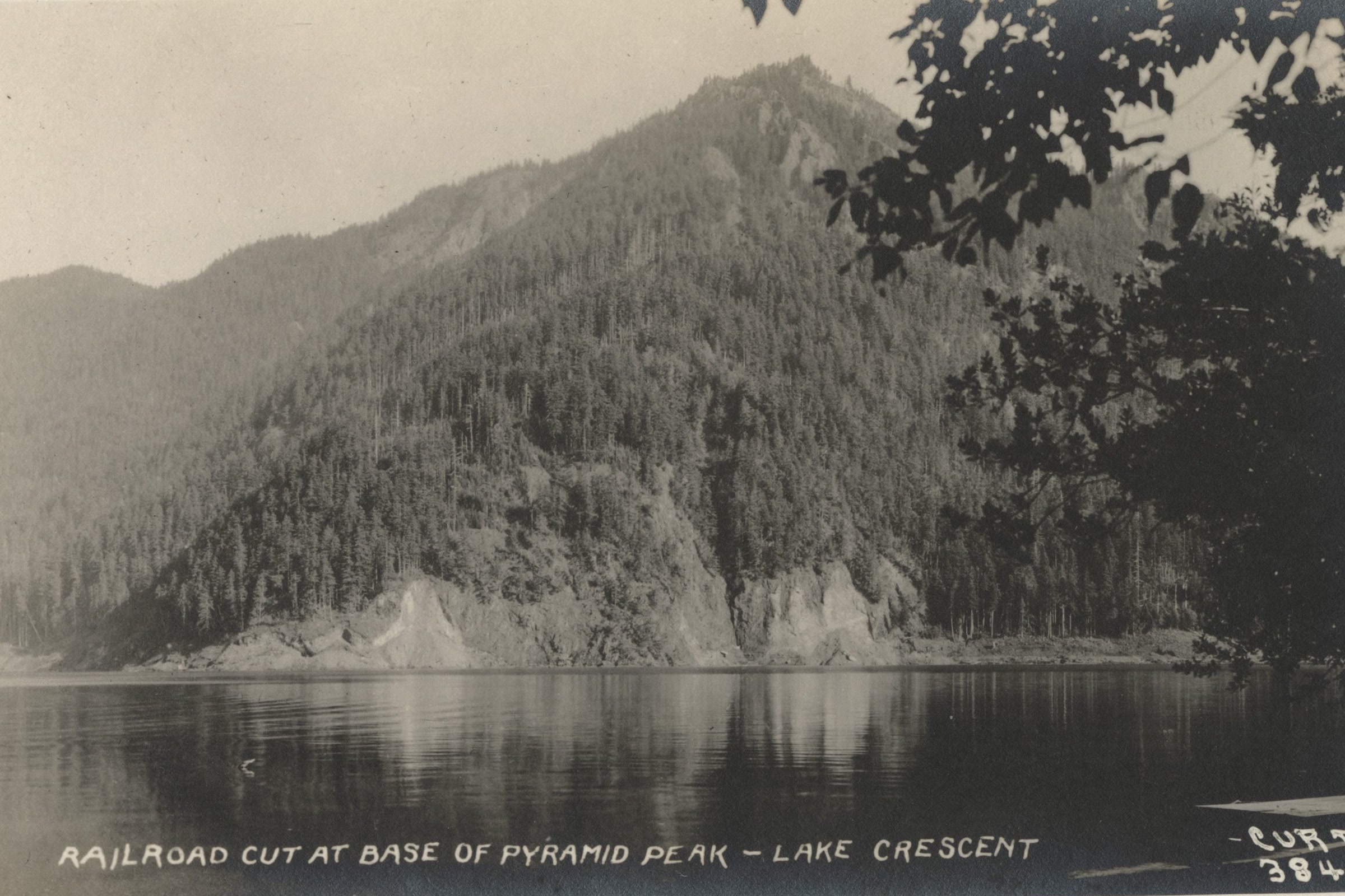
    A black and white photograph from about 1925 of the railroad cut at the base of Pyramid Peak on the north shore of Lake Crescent
    The railroad cut below Pyramid Peak, about 1925. Photo: Asahel Curtis, Seattle Public Library / Wikimedia Commons (public domain)

    The Spruce Railroad

    Along the north shore runs the grade of the Spruce Railroad, built in 1918 to haul Sitka spruce for World War I biplanes. The line was nearly finished that fall, but the war ended in November before any spruce was processed. It was sold and ran as a common carrier and logging railroad until it was abandoned in 1951.

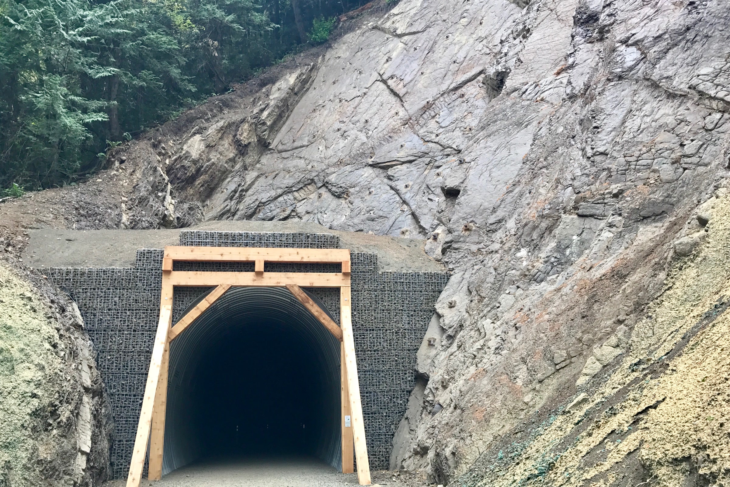
    Today the grade is a paved, universally accessible trail. In 2020 the park and Clallam County finished restoring about 10 miles of the Olympic Discovery Trail along the north shore, including the 450 foot McFee Tunnel and the Daley Rankin Tunnel.

    Things to do at Lake Crescent

    There are plenty of things to do at Lake Crescent, from flat strolls to stiff climbs. Distances below come from the park’s area brochure and are one way unless noted.

    Lake Crescent day hikes compared

    TrailDistance and gainWhat to expect
    Moments in Time0.6 mile loop, flatSelf guided old growth walk
    Marymere Falls0.9 mile, 400 feetOld growth forest to a 90 foot waterfall
    Spruce Railroad Trail4.0 miles, about 100 feetPaved shoreline path with two tunnels; bikes and leashed pets allowed
    Mount Storm King2.2 miles, 2,000 feetSteep switchbacks to big lake views
    Pyramid Peak3.5 miles, 2,600 feetClimbs to a World War II spotting tower
    The timber framed entrance of the restored McFee Tunnel cut into grey rock on the Spruce Railroad Trail
    The newly restored McFee Tunnel in 2017. Photo: Thejrudd / Wikimedia Commons (CC BY-SA 4.0)

    The Spruce Railroad Trail is the only trail in the area open to bikes and leashed pets; elsewhere both stay off the trails. Marymere Falls is a favourite short walk, and our roundup of waterfalls in Olympic National Park covers it with other falls. Pyramid Peak has a steep section across a landslide, so check conditions first.

    A hiker sitting on rocks at a viewpoint on Mount Storm King, looking out over Lake Crescent between forested slopes
    The reward for the Mount Storm King climb. NPS Photo

    On the water

    Boat launches sit at both the east and west ends of the lake, and rentals are offered at Lake Crescent Lodge, Log Cabin Resort and, in summer, the Fairholme Store. The lake is very cold and very deep, so wear a life jacket every time you go out. Alcohol and glass aren’t allowed on public beaches such as East Beach and Bovee’s Meadow.

    Please clean, drain and dry every kayak, canoe, paddleboard and boat. New Zealand mudsnails and Asian clams have already turned up in the lake, and in 2024 the park added free cleaning stations at the Fairholme, Storm King and Log Cabin Resort launches. It is the same idea behind our work on invasive plant removal on the Olympic Peninsula: stop the spread before it starts.

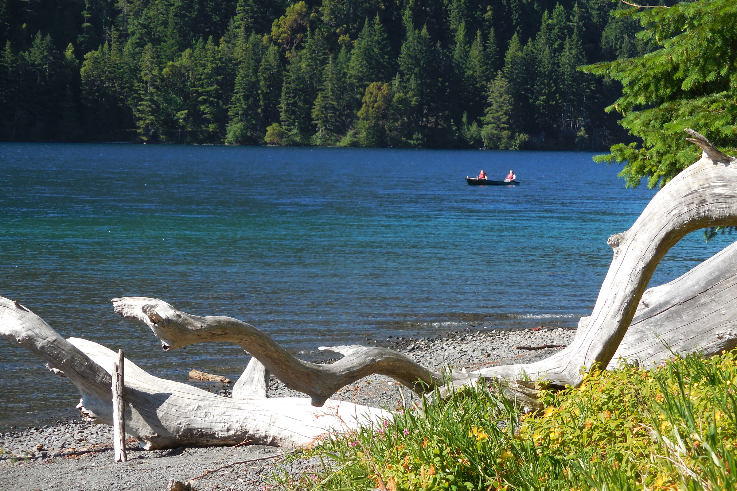
    Bleached driftwood on a pebble beach at Lake Crescent, with a canoe out on clear blue water beyond
    Summer paddlers on a calm day. NPS Photo / C. Bubar

    Where to stay: Lake Crescent Lodge, Log Cabin Resort and Fairholme

    Two park concessions offer rooms and cabins by reservation: Lake Crescent Lodge at Barnes Point, off Highway 101, and Log Cabin Resort on East Beach Road. Both are generally open from late spring to early fall and closed in winter. Opening dates change from year to year, so check the NPS page and the lodges’ own websites before you go.

    Campers can head to Fairholme Campground at the west end, with 87 sites (one accessible), potable water and animal proof food lockers, open late spring to early fall. Storm King Ranger Station opens in summer when staffing allows. You will need a park pass, and our guide to Olympic National Park entrance fees explains the options. The Sol Duc valley, covered in our Sol Duc Falls and valley guide, is less than a 30 minute drive away.

    How Friends of Olympic National Park helps

    We are Friends of Olympic National Park (FONP), a volunteer led friends group based in Port Angeles. Our volunteers run cleanups, guided walks and programs for young visitors, and our members help fund that work. If Lake Crescent is one of your favourite places, become a member or browse our volunteer opportunities.

    Frequently asked questions

    How deep is Lake Crescent?

    The park’s Lake Crescent brochure says the water plummets to 624 feet. It is a deep, glacially carved lake, and the park asks everyone on the water to wear a life jacket.

    Why is Lake Crescent so blue and clear?

    The lake has very little nitrogen, which limits the phytoplankton that cloud most lakes. In some places you can see 60 feet down, and clarity plus reflected light gives the blue green colour.

    Is Lake Crescent Lodge open all year?

    No. Lake Crescent Lodge and Log Cabin Resort are generally open from late spring to early fall and close in winter. Check the NPS page and the lodge website for this year’s dates.

    Do I need to clean my kayak before paddling Lake Crescent?

    Yes, please. New Zealand mudsnails and Asian clams have been found in the lake. Clean, drain and dry every boat and paddleboard, and use the free cleaning stations at the Fairholme, Storm King and Log Cabin Resort launches.

  • Olympic National Park Tide Pools: Where and When to Go

    Olympic National Park Tide Pools: Where and When to Go

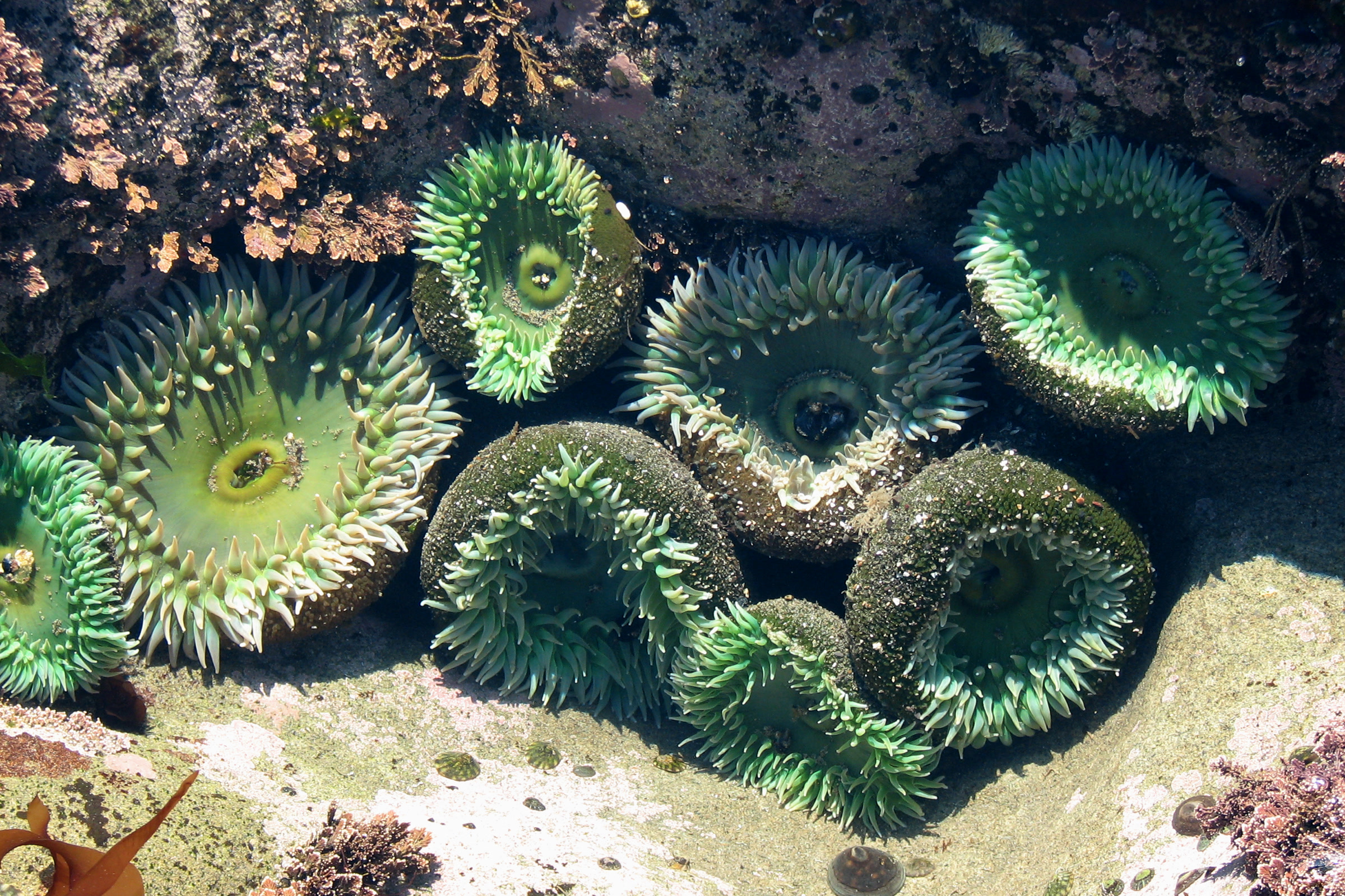
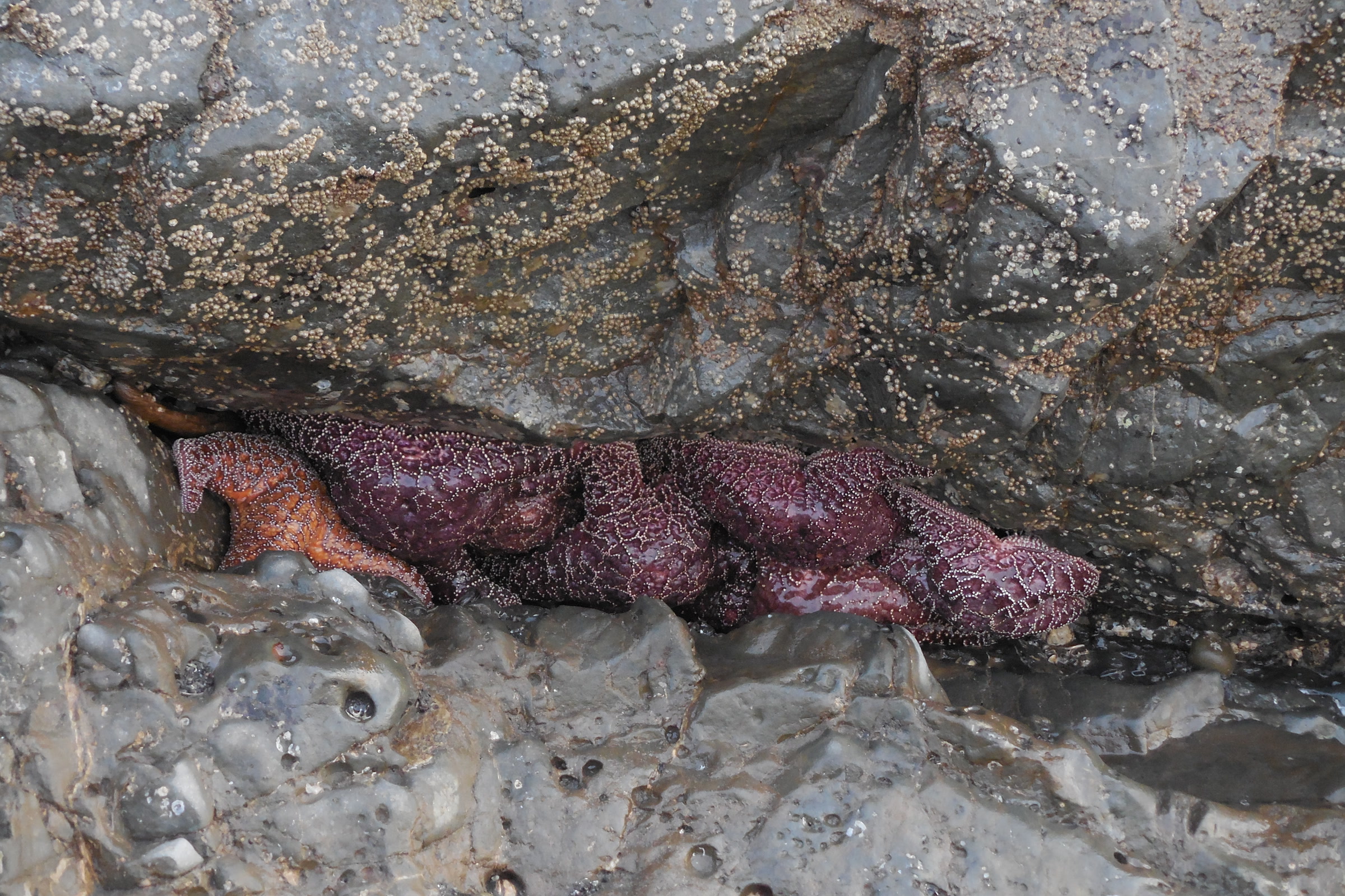
    Olympic National Park tide pools are some of the richest on the Pacific coast, full of giant green anemones, ochre sea stars and spiny urchins. The trick is timing: the pools only open up when the tide drops low. Here is our local guide to where to go, when to go and how to leave every pool as you found it.

    Quick answer

    Where and when are the best tide pools in Olympic National Park?

    The most popular tide pools in Olympic National Park are at Kalaloch’s Beach 4 and Hole in the Wall near Rialto Beach, with Ruby, Second and Third Beaches also excellent. Go on a minus tide, aim for tides lower than 1 foot, and arrive at least 30 minutes before the lowest tide.

    • Best tide pooling is on a minus tide
    • Summer generally has the lowest low tides
    • Hole in the Wall is 1.5 miles from Rialto Beach parking
    • No reservation needed beyond your park entrance pass

    When to go: reading the tide

    Tides rise and fall twice a day, and each low tide is different. The park’s tidepool activities page says the best tide pooling comes on a minus tide, one lower than normal, and recommends tides lower than 1 foot. A 3-foot low tide is not great for tide pooling.

    The park’s summer newspaper adds that a tide of about 2 feet or less shows most tide pools. Summer generally has the lowest low tides, which is why it is the favourite season; our guide to the best time to visit Olympic National Park covers the rest of the year.

    • Find a tide table: online at NOAA Tides and Currents, at visitor centers, or posted at Kalaloch, Mora and Ozette.
    • Look for the lowest number: a negative figure, such as minus 1.0 feet, is a minus tide.
    • Arrive early: be at the trailhead at least 30 minutes before the lowest tide, and allow for the walk.
    Rock formations offshore from Beach 4 near Kalaloch at sunset, with Destruction Island faint on the horizon
    Rocks off Beach 4 at Kalaloch, November 2020. Photo: Joe Mabel / Wikimedia Commons (CC BY-SA 4.0)

    The best Olympic National Park tide pools

    The park’s 73 miles of coastline hold many rocky reefs, but a handful are easy to reach and reliably rich. Trail distances below come from the park’s summer newspaper.

    Tide pool beaches compared

    BeachGetting thereEffort
    Beach 4, KalalochShort trail from Highway 101Easy
    Ruby Beach0.25 mile trail from the parking areaEasy
    Second Beach0.7 mile forest trail from La Push RoadModerate
    Third Beach1.4 miles one way from La Push RoadModerate
    Hole in the Wall1.5 mile beach walk from Rialto BeachModerate

    Hole in the Wall, Rialto Beach

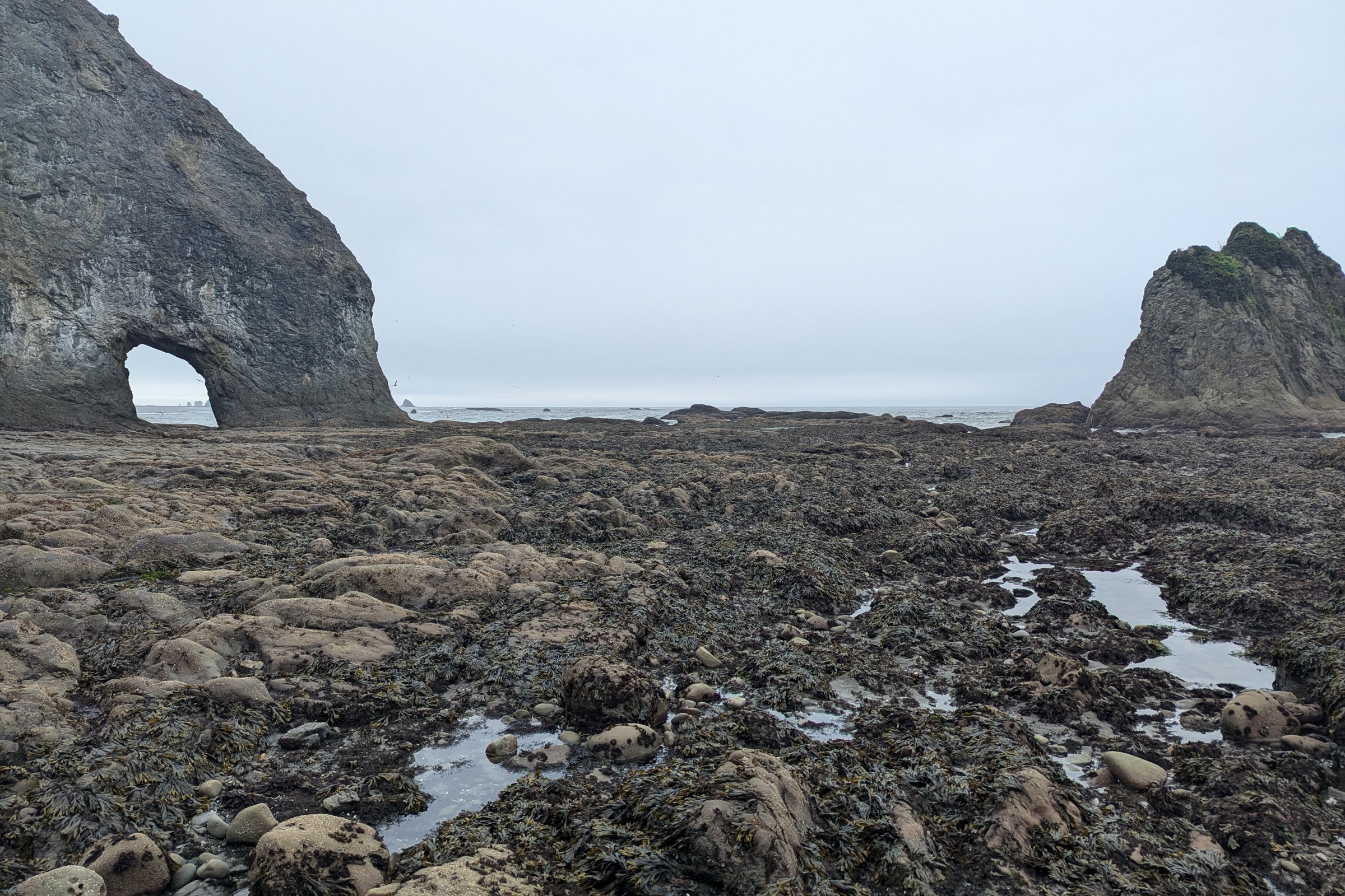
    This sea arch north of Rialto Beach stands above some of the park’s most popular pools. The walk from the Rialto Beach parking area takes about an hour each way. Do not cross through the arch once the tide starts to cover its floor, avoid lingering underneath, and if you hear falling rock, cover your head and move away.

    The Hole in the Wall sea arch north of Rialto Beach, with algae-covered rocks and shallow pools exposed at low tide
    Hole in the Wall at low tide. Photo: Roller Coaster Philosophy / Wikimedia Commons (CC BY 2.0)

    Beach 4 and Ruby Beach, Kalaloch area

    Beach 4 is the easy classic, a short walk down to rocky shelves just off Highway 101. To the north, Ruby Beach pairs pools with big sea stack views. Its short trail is steep with drainage dips, and the park says there is no accessible route to any of its coastal beaches. Both have accessible viewpoints.

    Purple and orange ochre sea stars packed into a rock crevice at low tide at Ruby Beach, one of the best Olympic National Park tide pools
    Ochre sea stars at Ruby Beach, March 2015. NPS Photo / C. Bubar

    Second Beach, Third Beach and Shi Shi

    Near La Push, Second and Third Beaches reward a forest walk with excellent tide pooling. The Olympic Coast National Marine Sanctuary also names Shi Shi Beach among its world class tide pooling spots. For a longer coastal outing, see our Ozette Triangle and Cape Alava loop guide.

    What lives in Olympic’s tide pools

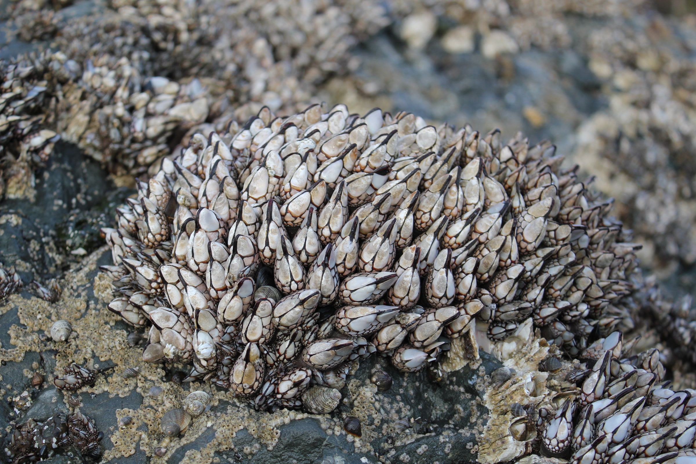
    The park sorts the shore into zones. The splash and high tide zones hold barnacles, limpets and mussels. The mid tide zone is where pools are most vibrant, with giant green and aggregating anemones, ochre sea stars, chitons and hermit crabs. The low tide zone, uncovered only on the lowest tides around the new and full moon, adds sea urchins and nudibranchs.

    A dense clump of gooseneck barnacles and mussels on a rock in the Ruby Beach tide pools
    Gooseneck barnacles at Ruby Beach. NPS Photo / D. Archuleta

    Look closely and slowly. Many animals hide under ledges and in crevices, and octopus and small fish sometimes slip into the pools. If you find a stranded or injured marine mammal, do not try to rescue it; tell a ranger or call the West Coast Marine Stranding Hotline at 1-866-767-6114.

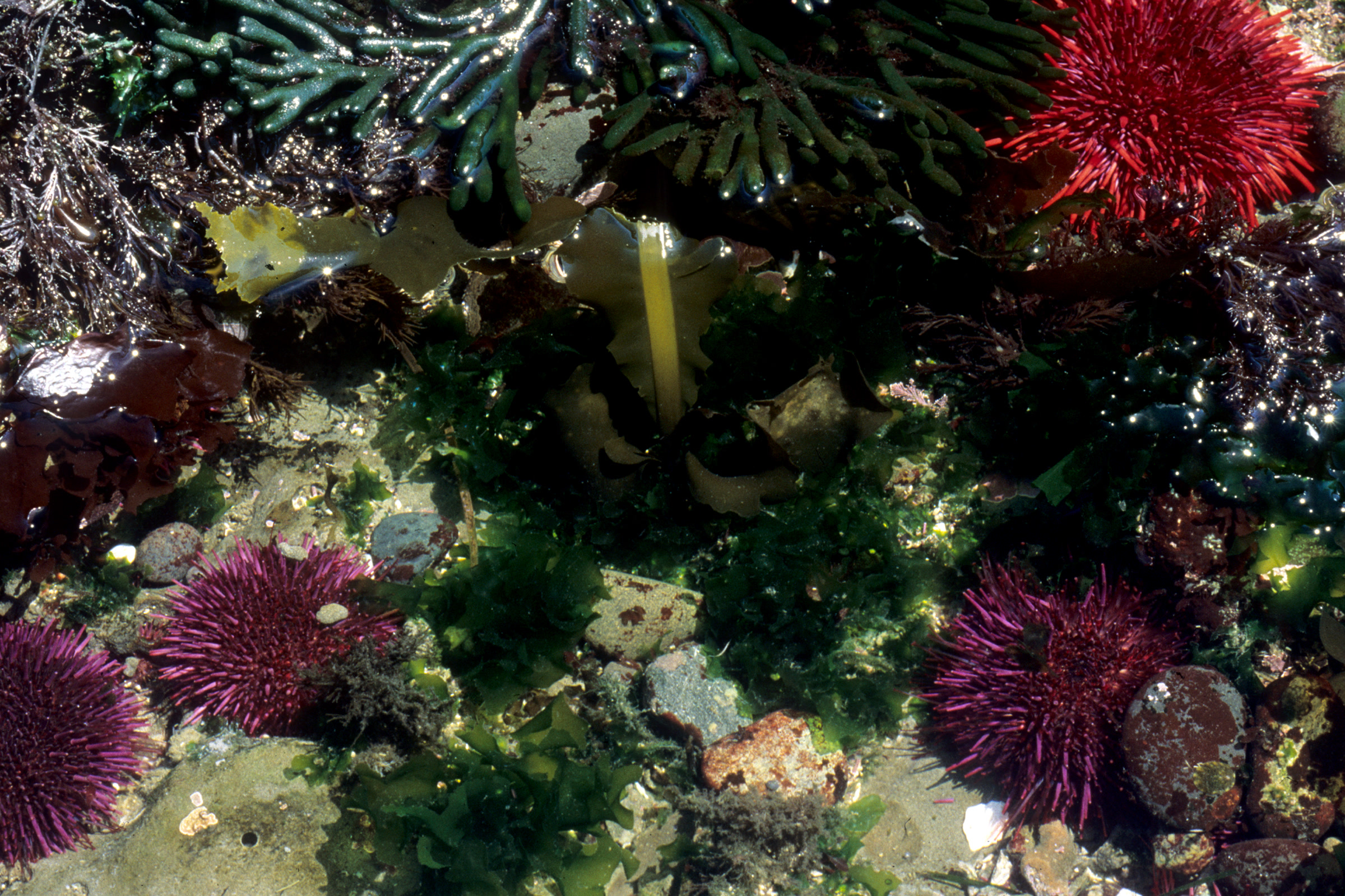
    Red and purple sea urchins among green surfgrass and seaweed in a low tide pool on the Olympic coast
    Sea urchins live in the low tide zone. NPS Photo

    Tide pooling tips for safety

    The ocean here is powerful and the rocks are slick. These are the park’s core tide pooling tips:

    • Watch closely for the returning tide and sneaker waves.
    • Algae and seaweed make rocks very slippery, so test each new surface.
    • Wear sturdy shoes you do not mind getting wet.
    • Keep children close; a fall on rock can cause severe injury.
    • Do not leap from rock to rock. Keep at least one foot on the ground.
    • Keep dogs off tidal rocks, where barnacles and mussels cut paws.
    Large waves breaking in white spray close to shore at Beach 4 on the Kalaloch coast
    Waves at Beach 4 in August. Photo: Bernd Thaller / Wikimedia Commons (CC BY 2.0)

    Tide pool etiquette

    The intertidal zone lies inside the Olympic Coast National Marine Sanctuary, and its etiquette protects animals that cannot move out of your way.

    • Step on bare rock. It is less slippery and spares the life on other surfaces.
    • Use the touch test. If an animal clings tighter, leave it be; never force one off its spot.
    • Put rocks back. Return any rock you lift to its original position.
    • Take nothing. Intertidal animals should not be collected for bait.
    • Carry a bag. Pick up any trash you find.

    Our Leave No Trace guide for Olympic coast beaches has more on camping, fires and wildlife along the shore.

    How Friends of Olympic National Park helps

    We are Friends of Olympic National Park (FONP), a volunteer-led friends group in Port Angeles. Our volunteers join beach cleanups in Olympic National Park, including our April 2026 Spring Coastal Cleanup in the Kalaloch area, to keep debris off the shore these animals call home. Every bag of litter helps.

    Frequently asked questions

    What tide is best for tide pooling in Olympic National Park?

    A minus tide, lower than normal. The park recommends tides lower than 1 foot, and says a tide of about 2 feet or less shows most tide pools.

    Where are the best tide pools in Olympic National Park?

    The most popular are Kalaloch’s Beach 4 and Hole in the Wall near Rialto Beach. Ruby Beach, Second Beach and Third Beach are also excellent.

    What time of year has the lowest tides?

    Summer generally has the lowest low tides on the Olympic coast, exposing more of the tide pools.

    Can I touch animals in the tide pools?

    Handle gently if at all. Use the touch test: if an animal clings tighter, leave it alone, and never force one off its spot. Return any rock you lift.

    Do I need a reservation to go tide pooling?

    No. There is no reservation and no extra fee beyond the normal park entrance fee. Check the NPS site for current fees before you go.

    Love the coast? See our volunteer opportunities at Olympic National Park and the Olympic National Park entrance fees guide before your trip.

  • Best Time to Visit Olympic National Park by Season

    Best Time to Visit Olympic National Park by Season

    The best time to visit Olympic National Park for most people is July through September, when the high country is open and the weather is at its kindest. But this park has glaciers, rain forest and 73 miles of wild coast, so every season has something to offer. Here is how we, as locals in Port Angeles, think about each one.

    Quick answer

    When is the best time to visit Olympic National Park?

    For mountain trails and the fullest range of services, summer and early fall are best, though June, July and August are also the three busiest months. Spring brings rain and quiet trails, fall brings color and elk season, and winter suits rain forest walks, coastal storms and weekend snow play at Hurricane Ridge.

    • The park is open 24 hours a day, year-round
    • Most precipitation falls from November through April
    • June, July and August are the busiest months
    • Hurricane Ridge Road opens Friday to Sunday in winter, weather permitting

    Olympic National Park weather by month and season

    Weather here depends as much on where you stand as on the calendar. The park’s weather page says the coast and west-facing valleys get 100 to 170 inches of precipitation a year, while Port Angeles, in the rain shadow, averages 25 to 30 inches. Hurricane Ridge traditionally records 30 to 35 feet of snow a year.

    The park does not publish month by month averages, so think in seasons. Conditions can also differ wildly across the park on the same day.

    Olympic seasons compared

    MonthsWhat to expectBest for
    March to MayCool to mild; snow and heavy rain can last into June up highRain forest, quiet trails
    June to AugustMild to warm; coastal fog, mountain thunderstorms possibleHigh country, full services
    September to OctoberCooling; high country snow possible from late SeptemberColor, elk, fewer people
    November to AprilWettest stretch; heavy snow at elevationStorm watching, snow play

    Spring: green, wet and quiet

    Spring is the park’s second most popular season, and it is easy to see why. The rain forests of the Hoh and Quinault glow with new moss and fern, and the rivers run full with snowmelt. Seasonal campgrounds begin to open as the weeks go by.

    Thick curtains of green moss hanging from tree branches in the Quinault Rain Forest in early spring
    Spring moss in the Quinault Rain Forest, March 2015. NPS Photo / R. McKenna

    Pack for rain, though. Up high, snow and heavy rain can continue into June, and many high-elevation trails may be impassable until it melts. Our guide to the temperate rain forests of Olympic National Park suggests low trails that are lovely in any spring weather.

    Summer: the high country opens

    Summer is mild to warm, though temperatures can vary by at least 10 degrees with elevation and location. It is the season for subalpine meadows, long ridge hikes and beach camping. The high meadows bloom as the snow melts; see our Hurricane Ridge wildflower season guide for how the timing shifts from year to year.

    A black-tailed deer grazing in sunlit summer grass beside a weathered log at the edge of the subalpine forest at Hurricane Ridge
    A July morning at Hurricane Ridge. Photo: cascadevideoproductions / Wikimedia Commons (CC BY 2.0)

    Expect some weather even now. Rain and thunderstorms are possible in the mountains, and fog can persist along the coastal strip. Summer also brings the lowest low tides of the year, so it is the prime season for Olympic National Park tide pools.

    Olympic National Park summer crowds

    June, July and August are the three busiest months, and the park’s summer visiting page warns that lots at Hurricane Ridge and the Hoh can fill completely. When Hurricane Ridge is full, cars are metered at the Heart O’ the Hills entrance station, and waits can reach two hours.

    • Hurricane Ridge: busiest from 10 am to 2 pm. Arrive before 10 or after 2 (after 3 on holidays).
    • Hoh Rain Forest: busiest from 10 am to 5 pm. Arrive before 10 or after 5 (after 6 on holidays).
    • Skip the drive: the park suggests the summer Clallam Transit bus from downtown Port Angeles; buy your park pass ahead.
    • Try somewhere else: Heart O’ the Hills, Deer Park, the beaches or the Quinault.
    Bleached driftwood logs on a cobble beach below a wind-shaped bluff at Kalaloch Beach on a sunny June day
    Kalaloch Beach in June. Photo: King of Hearts / Wikimedia Commons (CC BY-SA 4.0)

    The Hurricane Ridge Day Lodge burned in May 2023, so there is no food service up top. Bring snacks and water. Fees and passes change, so check our Olympic National Park entrance fees guide and the NPS site before you go.

    Fall: color, elk and mushrooms

    Many of us think early fall is the sweet spot. Summer crowds thin, maples turn gold along the rivers, and Roosevelt elk enter the rut in September. Our Roosevelt elk guide explains how to watch the bugling bulls from a safe distance.

    Orange and red maple leaves glowing against a deep blue autumn sky in Olympic National Park
    Autumn maple leaves. NPS Photo / C. Bubar

    The weather turns as the season goes on. Snow can reach the high country as early as late September, rain and wind reach the lowlands by late October, and some campgrounds and roads close for winter. When the rains return, the forest floor fills with fungi; our mushroom season guide covers what to look for.

    Orange and gold autumn shrubs lining the calm Quillayute River estuary near the coast, with forested islands beyond
    Fall color on the Quillayute River estuary. NPS Photo / D. Archuleta

    Olympic National Park in winter

    Visiting Olympic National Park in winter takes flexibility, but the rewards are real. Most precipitation falls from November through April, and low elevations stay cool to mild. Most areas remain open, though there are few ranger programs and many facilities are closed.

    Hurricane Ridge is the focus for snow play, with snowshoeing, cross-country and downhill skiing, snowboarding and tubing. Weather permitting, Hurricane Ridge Road opens Friday through Sunday in winter, but storms or avalanche hazard can close it at any time. It also closes on Thanksgiving and Christmas.

    Smooth fresh snow and frosted subalpine firs at Hurricane Ridge in winter, the best time to visit Olympic National Park for snow play
    Fresh snow at Hurricane Ridge, February 2011. NPS Photo

    Down on the coast, beaches stay mostly snow-free and winter storms bring strong winds, stronger tides and big waves, which makes for dramatic storm watching from a safe spot. The Hoh and Quinault rain forests are good destinations once a bit of snow melts. Conditions change fast, so call the road and weather line at 360-565-3131 before you set out.

    How to choose the best time to visit Olympic National Park

    • First visit, want it all: July to September, with early starts.
    • Want solitude: spring or late fall, in rain gear.
    • Love snow: a winter weekend at Hurricane Ridge.
    • Tide pools: summer minus tides on the coast.

    Whatever the month, start at a visitor center. Our Olympic National Park visitor center guide explains where to get maps, current alerts and advice from rangers.

    How Friends of Olympic National Park helps

    We are Friends of Olympic National Park (FONP), a volunteer-led friends group based in Port Angeles. Our crews help in every season, from beach cleanups in Olympic National Park to our Winter Perspectives lecture series in the darker months. If you love this park in all its weather, come and give a few hours back.

    Frequently asked questions

    What is the best month to visit Olympic National Park?

    For the high country and full services, July through September is best. July and August are also among the busiest months, so September is a good choice if you want fewer people.

    Is Olympic National Park open in winter?

    Yes. The park is open 24 hours a day, year-round. Some roads, campgrounds and facilities close or have reduced hours from October through May.

    Is Hurricane Ridge open in winter?

    Weather permitting, Hurricane Ridge Road opens Friday through Sunday in winter. Storms or avalanche hazard can close it at any time, and it closes on Thanksgiving and Christmas.

    When is the rainy season in Olympic National Park?

    Most precipitation falls from November through April. The coast and west-facing valleys get 100 to 170 inches a year, while Port Angeles averages 25 to 30 inches.

    How can I avoid summer crowds at Hurricane Ridge?

    Arrive before 10 am or after 2 pm, or after 3 pm on holidays. The park also suggests the summer bus from Port Angeles or nearby areas such as Heart O’ the Hills and Deer Park.

    Want to spend your next visit giving back? See our volunteer opportunities at Olympic National Park.