Author: Nobenaa Ahsan

  • Accessible Trails in Olympic National Park: A Guide

    Accessible Trails in Olympic National Park: A Guide

    Finding accessible trails in Olympic National Park is easier than many visitors expect, because the park publishes real measurements instead of a simple yes or no. For each path it lists length, surface, width and slope, so you can judge what works for your chair, walker or knees. Here they are by area, with services and passes.

    Quick answer

    Which trails in Olympic National Park are accessible?

    The park calls the paved Spruce Railroad Trail at Lake Crescent universally accessible, and describes Madison Falls as a 0.1 mile paved trail with a gentle slope. Other gentle options are the Hoh Mini Rain Forest Trail, the paved Hurricane Ridge overlook path and the Big Cedar Trail at Staircase. No coastal beach has an accessible route.

    • Madison Falls: 0.1 mile paved, 60 foot waterfall
    • Hoh Mini Rain Forest Trail: slopes under 5%
    • Ruby Beach has an accessible overlook, not beach access
    • Free ASL interpreters with two weeks’ notice

    How the park describes accessibility

    Everything below comes from the park’s physical and mobility accessibility page, as of October 2026. Running slope means steepness along the path. Many park trails are compacted gravel, and conditions change after storms, so check the NPS page or call the park at 360-565-3130 before you go.

    Accessible trails in Olympic National Park compared

    Trail and areaLength and surfaceWhat the park notes
    Madison Falls, Elwha0.1 mile, pavedGentle slope; vault toilet intended for wheelchair users
    Spruce Railroad Trail, Lake CrescentPavedPart of a universally accessible Olympic Discovery Trail section
    Mini Rain Forest Trail, Hoh0.1 mile loop, compacted gravel48 to 72 inches wide; running slope under 5%
    Overlook path, Hurricane Ridge400 feet, pavedWidest and easiest of three paths; slopes 6 to 13%
    Big Cedar Trail, Staircase0.2 mile, compacted gravel72 to 96 inches wide; running slope under 5%
    Maple Glade Trail, Quinault0.5 mile, compacted gravelUnder 5%, maximum 7%; at least one 4 inch step
    Living Forest Trail, Port Angeles0.4 mile lollipop, compacted gravelMostly 6% or less, short sections up to 12%

    Port Angeles and Hurricane Ridge

    The Living Forest Trail starts right behind the Olympic National Park Visitor Center in Port Angeles. The park lists its trailhead as wheelchair accessible, with van accessible parking, and says a wheelchair is available to check out at the visitor center. The first 420 feet climb three gentle switchbacks.

    At Hurricane Ridge, three paved paths leave the north side of the parking area. The middle one runs 400 feet to an overlook, and Big Meadow branches off it for 0.25 mile at up to 9%. The Cirque Rim path is steeper, and the paved Hurricane Hill Trail climbs 645 feet, with sections of 15 to 20% after the first half mile.

    Since the Day Lodge fire in 2023, the ridge has restrooms in temporary trailers but no drinking water or food, so come prepared.

    Lake Crescent and the Elwha

    The Spruce Railroad Trail follows the north shore of Lake Crescent. When the park finished the project in 2020, it described nearly ten miles of the Olympic Discovery Trail here as accessible to hikers, cyclists, riders and people using wheelchairs. Our Lake Crescent guide covers its history and tunnels.

    Madison Falls is a short paved walk to a 60 foot waterfall in the Elwha Valley. Olympic Hot Springs Road is closed to vehicles beyond it, but the Madison Falls parking area is open, with limited spaces and little room to turn around.
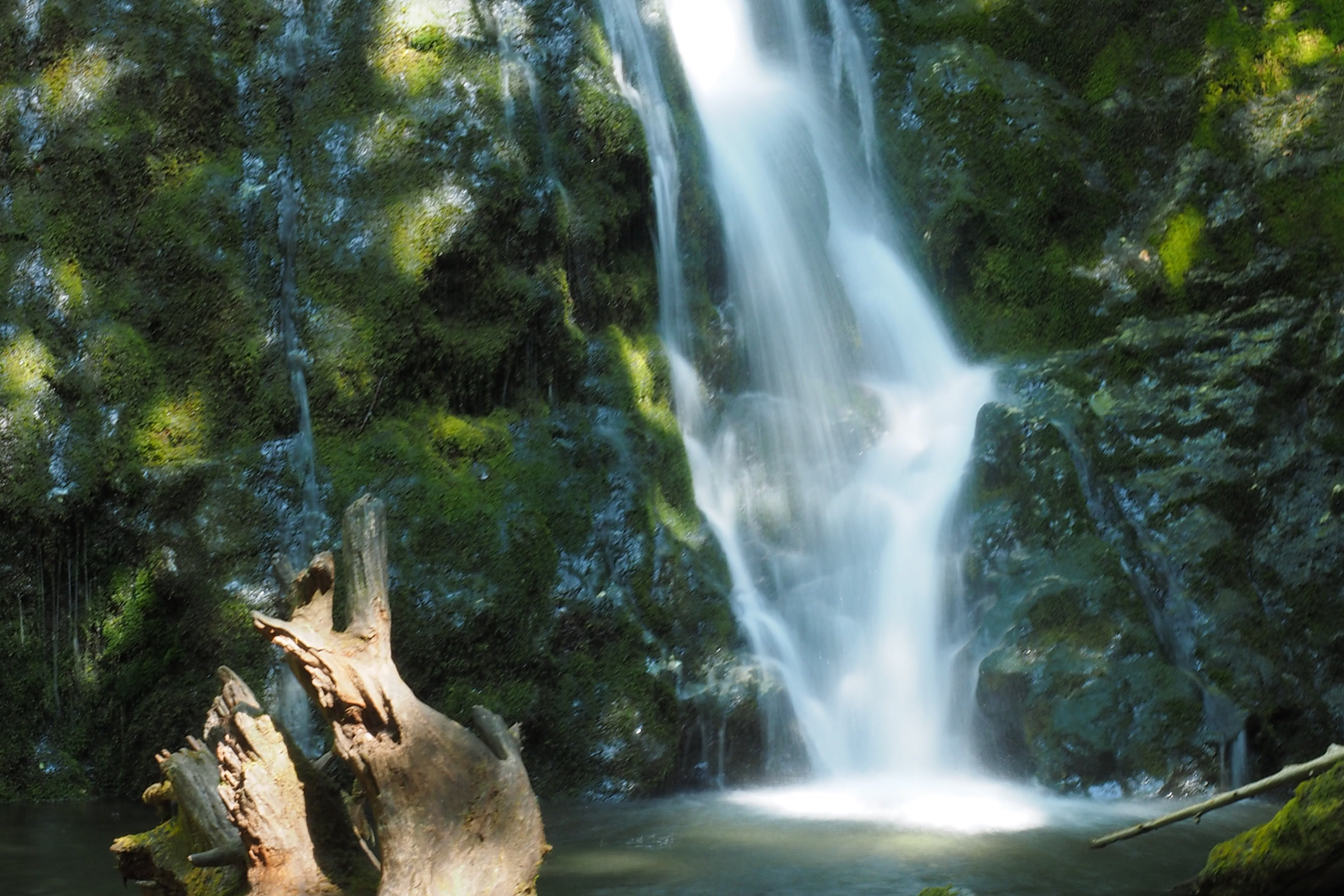
    Madison Falls pouring down a mossy rock face into a small pool, with a weathered stump in the foreground
    Madison Falls, at the end of a 0.1 mile paved trail. NPS Photo / J. Burger

    Marymere Falls is a different story. The park lists it only as a 1.8 mile out and back walk through old growth forest from Storm King Ranger Station, without accessibility measurements, so please don’t assume it suits a wheelchair.

    Hoh Rain Forest

    The Mini Rain Forest Trail is the Hoh’s gentlest walk: a 0.1 mile loop with less than 15 feet of elevation change. The famous Hall of Mosses is a harder walk. The park lists slopes of 7 to 25%, large steps and rocky ground, and the Spruce Nature Trail has steps and narrow sections too.
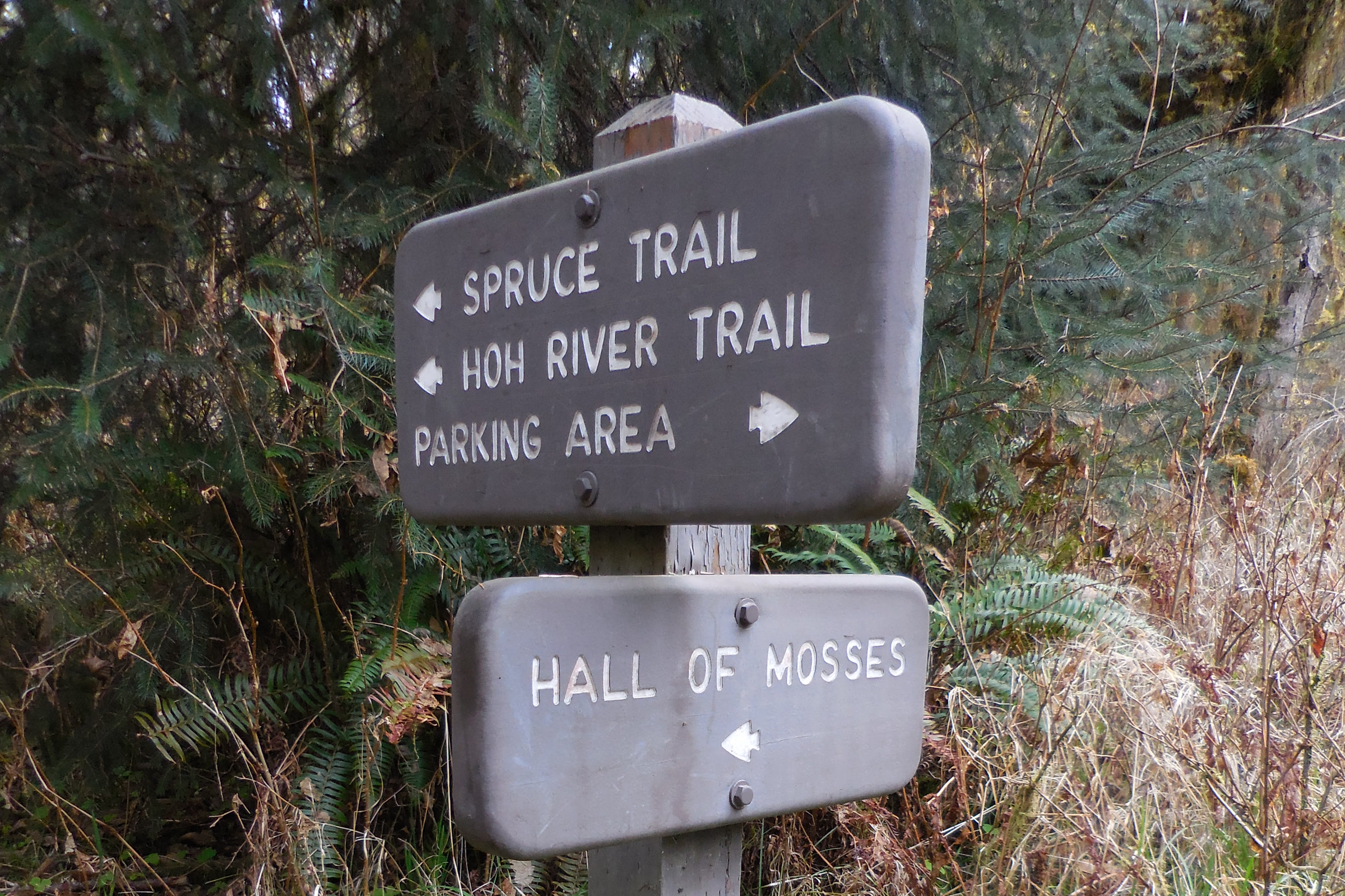
    Trail signs near the Hoh Rain Forest Visitor Center pointing to the Spruce Trail, Hoh River Trail, parking area and Hall of Mosses
    Trail signs by the Hoh Rain Forest Visitor Center. NPS Photo / C. Bubar

    The park lists five van accessible parking spaces for the Hoh trails. The visitor center is open daily in summer, closed January to early March, and generally open Friday through Sunday in spring and fall.
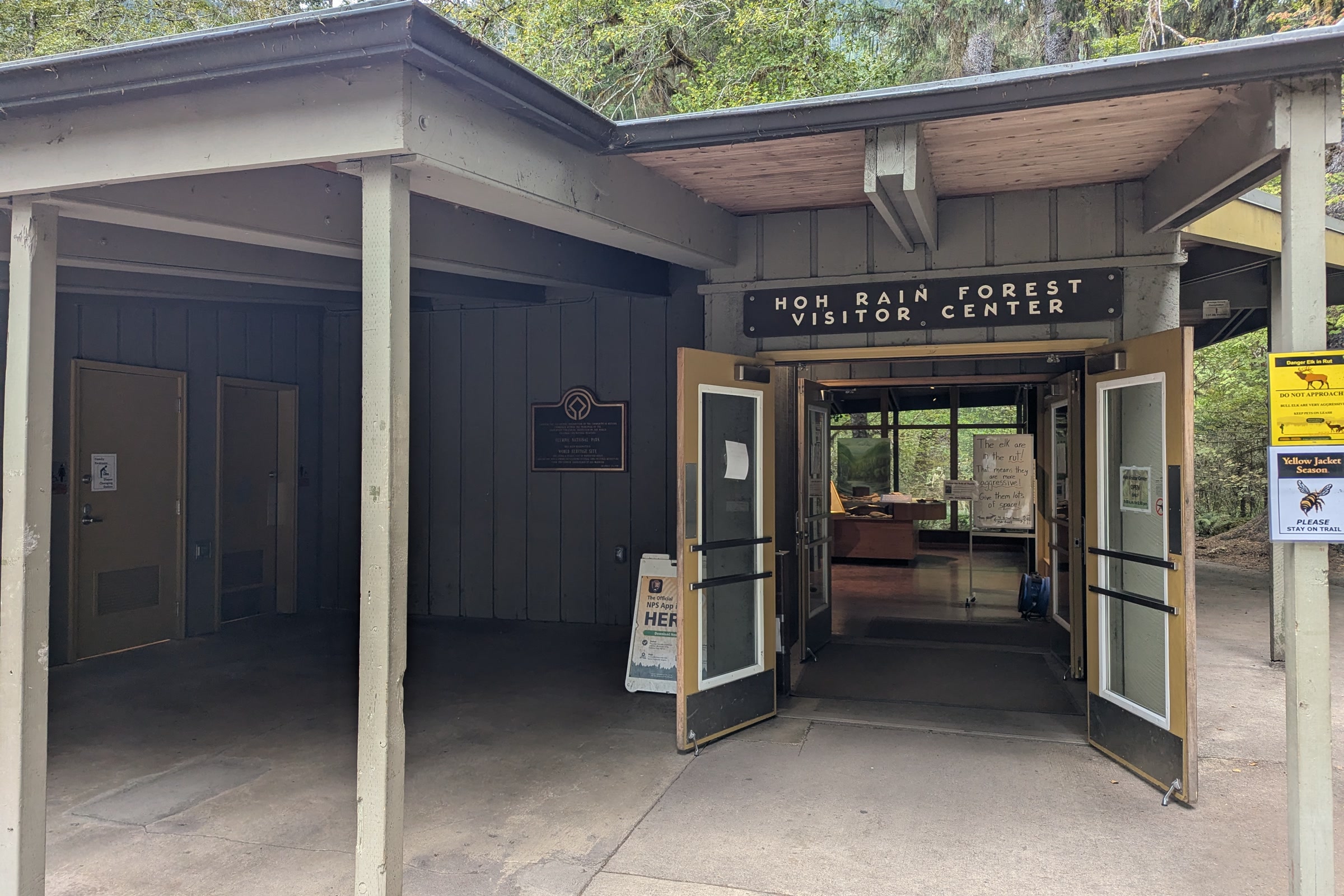
    The covered entrance of the Hoh Rain Forest Visitor Center, with open double doors and a broad concrete walkway
    The Hoh Rain Forest Visitor Center. Photo: Roller Coaster Philosophy / Wikimedia Commons (CC BY 2.0)

    Quinault and Staircase

    Quinault’s Maple Glade Rain Forest Trail loops through mossy bigleaf maples on firm gravel and wooden bridges. Parts may flood between October and May. For the Kestner Homestead, the park suggests starting at the trailhead kiosk for an easier 1.1 mile round trip, mostly under 5%, with roots up to 2 inches high.
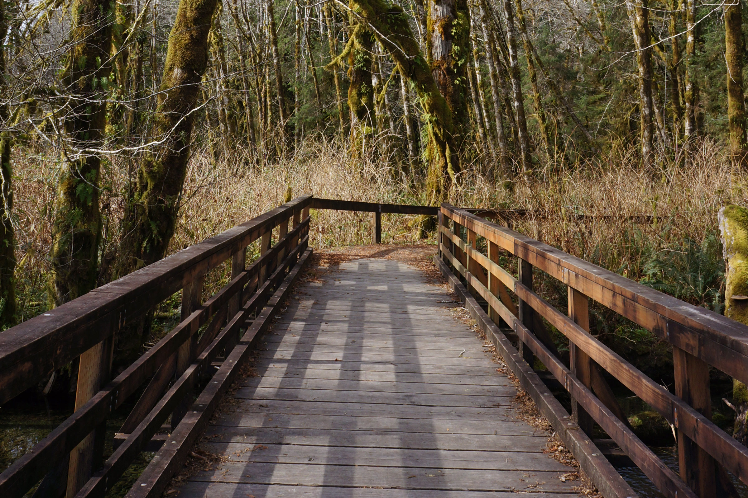
    A wooden boardwalk ramp with railings leading into a bare spring maple forest on the Maple Glade Trail
    A boardwalk ramp on the Maple Glade Trail. NPS Photo / R. McKenna

    At Staircase, the Big Cedar Trail starts across the Skokomish River bridge and is wide, with slopes under 5%. As of September 2026, Shady Lane and Four Stream were among the trails still closed after the Bear Gulch Fire. The developed area was open.
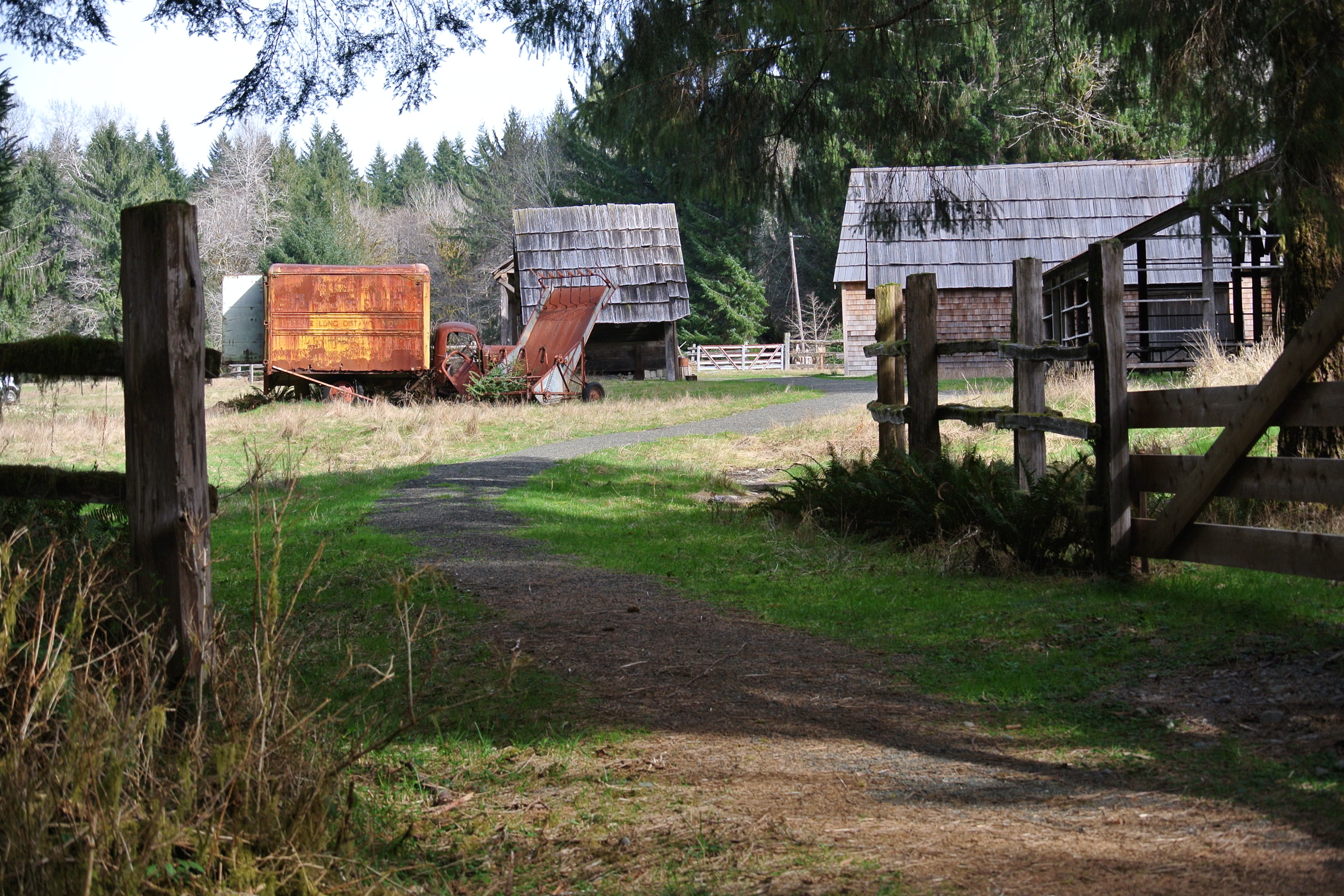
    A gravel path beside a wooden fence leading to the old barns, sheds and a rusty truck at the Kestner Homestead
    The path to the Kestner Homestead at Quinault. NPS Photo / C. Bubar

    The coast: overlooks, not beach access

    The park is clear that there is no accessible route to any coastal beach. Ruby Beach has an accessible overlook at the north end of its parking lot, with three van accessible and two standard accessible spaces, though plants may block the view at sitting height. Kalaloch Campground has four wheelchair accessible sites; see Olympic National Park campgrounds compared.

    Services for hearing, vision and service animals

    • Hearing: visitor center films are captioned, with assistive listening devices at the desk. For ranger programs, ask for assistive listening or a free ASL interpreter at least two weeks ahead.
    • Vision: audio description is available for the park films and brochure, and the brochure comes in braille. The Port Angeles visitor center has tactile models and a wall mounted relief map, without braille labels.
    • Service animals: trained service dogs may go anywhere visitors can, on a leash no longer than 6 feet. Emotional support animals count as pets; see dogs in Olympic National Park.
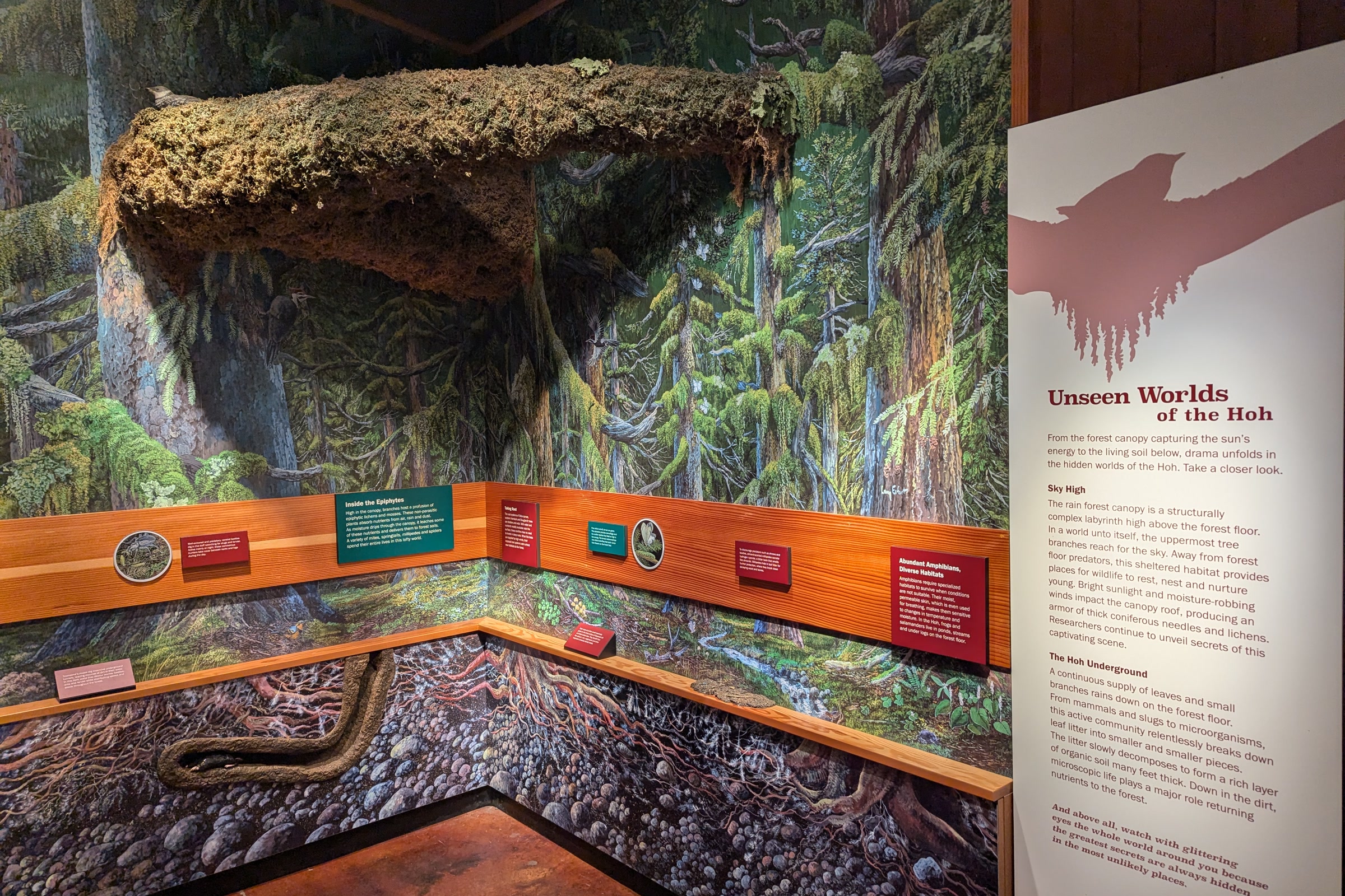
    An exhibit inside the Hoh Rain Forest Visitor Center showing a model of a mossy forest floor and an Unseen Worlds of the Hoh panel
    Exhibits at the Hoh Rain Forest Visitor Center. Photo: Roller Coaster Philosophy / Wikimedia Commons (CC BY 2.0)

    The Access Pass

    US citizens and residents with a permanent disability can get the free, lifetime Access Pass. The park says it gives free entry and 50% off expanded amenity fees such as camping. You can ask a ranger, or order online or by mail through the USGS Store Access Pass page, which charges a $5 processing fee and $7.50 handling. Our guide to Olympic National Park entrance fees compares it with other passes.

    How Friends of Olympic National Park helps

    We are Friends of Olympic National Park (FONP), a volunteer led friends group in Port Angeles. Our adopt-a-trail crew looks after the Heart O’ the Forest Trail, and we help with Visitor Center cleanups. To help, see our volunteer opportunities.

    Frequently asked questions

    Is Olympic National Park wheelchair accessible?

    Parts of it are. The park calls the paved Spruce Railroad Trail universally accessible, Madison Falls is a short paved path, and several gravel trails have gentle slopes. There is no accessible route to any coastal beach.

    Is Marymere Falls wheelchair accessible?

    The park does not say so. It lists Marymere Falls as a 1.8 mile out and back walk from Storm King Ranger Station without accessibility measurements. Madison Falls in the Elwha Valley is a paved alternative.

    Can I borrow a wheelchair in Olympic National Park?

    The park says a wheelchair is available to check out at the Olympic National Park Visitor Center in Port Angeles, next to the Living Forest Trail.

    Are service dogs allowed on trails in Olympic National Park?

    Yes. Trained service dogs may go anywhere visitors can, on a leash no longer than 6 feet. Emotional support animals and service dogs in training are treated as pets.

    How do I get an Access Pass?

    Ask a ranger, or order online or by mail from the USGS Store with ID and proof of a permanent disability. The pass is free; online and mail orders carry $12.50 in fees.

  • Olympic Peninsula Loop: A US 101 Road Trip Guide

    Olympic Peninsula Loop: A US 101 Road Trip Guide

    The Olympic Peninsula loop is the classic way to see Olympic National Park: US 101 wraps around three sides of the Olympic Mountains, and short spur roads lead into each part of the park. No single road crosses the middle, so you circle it. Here is how we would plan it, with links to our guides for each stop.

    Quick answer

    How long does the Olympic Peninsula loop take?

    Using the park’s mileage chart, the Olympic Peninsula loop from Port Angeles through Lake Crescent, Sol Duc, Mora, the Hoh, Kalaloch, Quinault and Staircase adds up to about 433 miles and 11.5 hours of driving. Hurricane Ridge adds about 1.5 hours round trip. With stops, we suggest four or five days.

    • US 101 circles the park; spur roads reach each area
    • Longest leg: Quinault to Staircase, 126 miles
    • Hoh River Bridge on US 101 is single lane at 25 mph
    • Hurricane Ridge Road check line: 360-565-3131

    How the loop works

    The park describes US 101 as the highway that circumnavigates the peninsula. Hurricane Ridge Road climbs 17 miles from Port Angeles, Sol Duc Road runs 14 miles up its valley, and the Upper Hoh Road runs 18 miles to the rain forest. Staircase sits 16 miles in from Hoodsport on a road that is part paved and part gravel.

    The park suggests two home bases: Port Angeles or Lake Crescent for the mountains and Sol Duc, and the Forks area for the Hoh and the coast. We like driving clockwise from Port Angeles, because the Olympic National Park Visitor Center in Port Angeles is the best first stop for maps, conditions and passes.

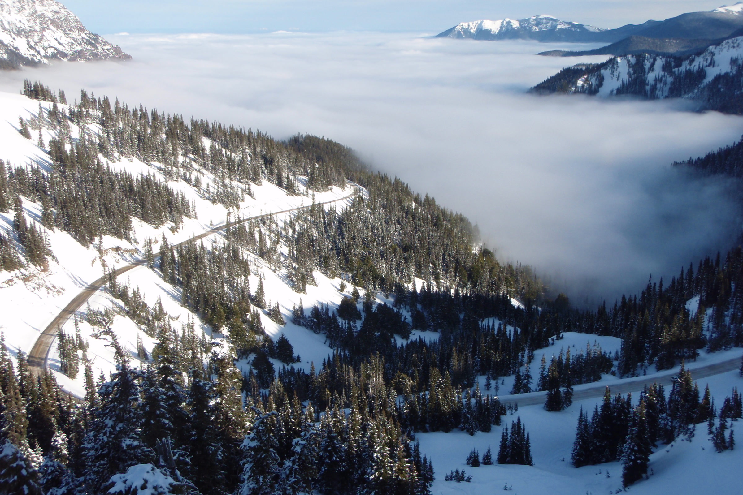
    Hurricane Ridge Road winding across snowy forested slopes above a valley filled with cloud
    Hurricane Ridge Road in winter. NPS Photo

    Olympic National Park road trip drive times

    These legs come from the park’s Getting Around mileage chart. Add time for stops, summer traffic and roadwork.

    Loop legs compared

    LegMilesDrive time
    Port Angeles visitor center to Hurricane Ridge1745 minutes
    Port Angeles visitor center to Lake Crescent2130 minutes
    Lake Crescent to Sol Duc161 hour
    Sol Duc to Mora (Rialto Beach area)501 hour 30 minutes
    Mora to Hoh Rain Forest471 hour 30 minutes
    Hoh Rain Forest to Kalaloch401 hour
    Kalaloch to Quinault3345 minutes
    Quinault to Staircase1262 hours 45 minutes
    Staircase to Port Angeles visitor center1002 hours 30 minutes

    Check roads before you go: fall 2026

    This fall brings one big change. Washington State Department of Transportation engineers found cracks in support beams on the 95 year old US 101 Hoh River Bridge south of Forks. Since July 14, 2026 the bridge has carried one lane of alternating traffic at 25 mph, and WSDOT says that single lane stays until a permanent repair is made.

    As of October 14, 2026, the WSDOT Hoh River Bridge project page lists overnight full closures from 7 pm to 5:30 am each night through the morning of Monday, October 19. There is no detour across the Hoh River. During a closure you cannot drive between Forks and Kalaloch, and going around the east side of the peninsula adds at least four hours, according to the park.

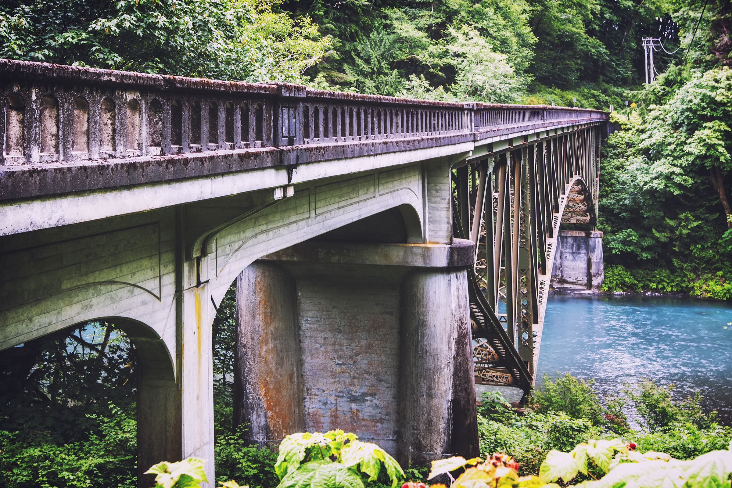
    The concrete arches and steel span of the US 101 Hoh River Bridge seen from below among riverside trees
    The US 101 Hoh River Bridge, built in 1931. Photo: Steven Pavlov / Wikimedia Commons (CC BY-SA 4.0)

    Other changes the park listed as of October 2026:

    • Mora Road: closed beyond Mora Campground for construction from July 8 to October 15, so Rialto Beach could not be reached by car.
    • Staircase: the developed area reopened July 8 after the Bear Gulch Fire, but wilderness trails beyond it, including Shady Lane and Four Stream, remain closed.
    • Hurricane Ridge Road: the winter season generally runs late November through March, with the road open Friday through Sunday and some holidays, weather permitting, and chains required in every vehicle.

    Check the park’s road conditions page and the WSDOT travel map before each day’s drive.

    A five day Olympic National Park itinerary

    This is the order we suggest for a first Olympic Peninsula loop. Each day stays around three hours of driving or less, apart from the long run home.

    Day 1: Port Angeles and Hurricane Ridge

    Start at the visitor center, then drive up to Hurricane Ridge. Since the Day Lodge burned in 2023, the ridge has restrooms in temporary trailers but no drinking water, food or gift shop, so fill bottles first. In summer, Clallam Transit runs a shuttle from downtown Port Angeles. Watch for the Olympic marmot at Hurricane Ridge.

    Day 2: Lake Crescent and Sol Duc

    US 101 runs right along the south shore of Lake Crescent, close to the Marymere Falls trail, and the Spruce Railroad Trail follows the north shore. Our Lake Crescent guide covers hikes, paddling and lodging. Then head up the valley with our Sol Duc Falls and valley guide.

    Day 3: Rialto Beach and the Hoh Rain Forest

    From Forks it is a short run to the coast, where our guide to Rialto Beach and Hole-in-the-Wall explains tides and the walk north. Then turn inland on the Upper Hoh Road. The park says the Hoh is under an hour from Forks, and our temperate rainforest guide covers the Hall of Mosses and Spruce Nature Trail.

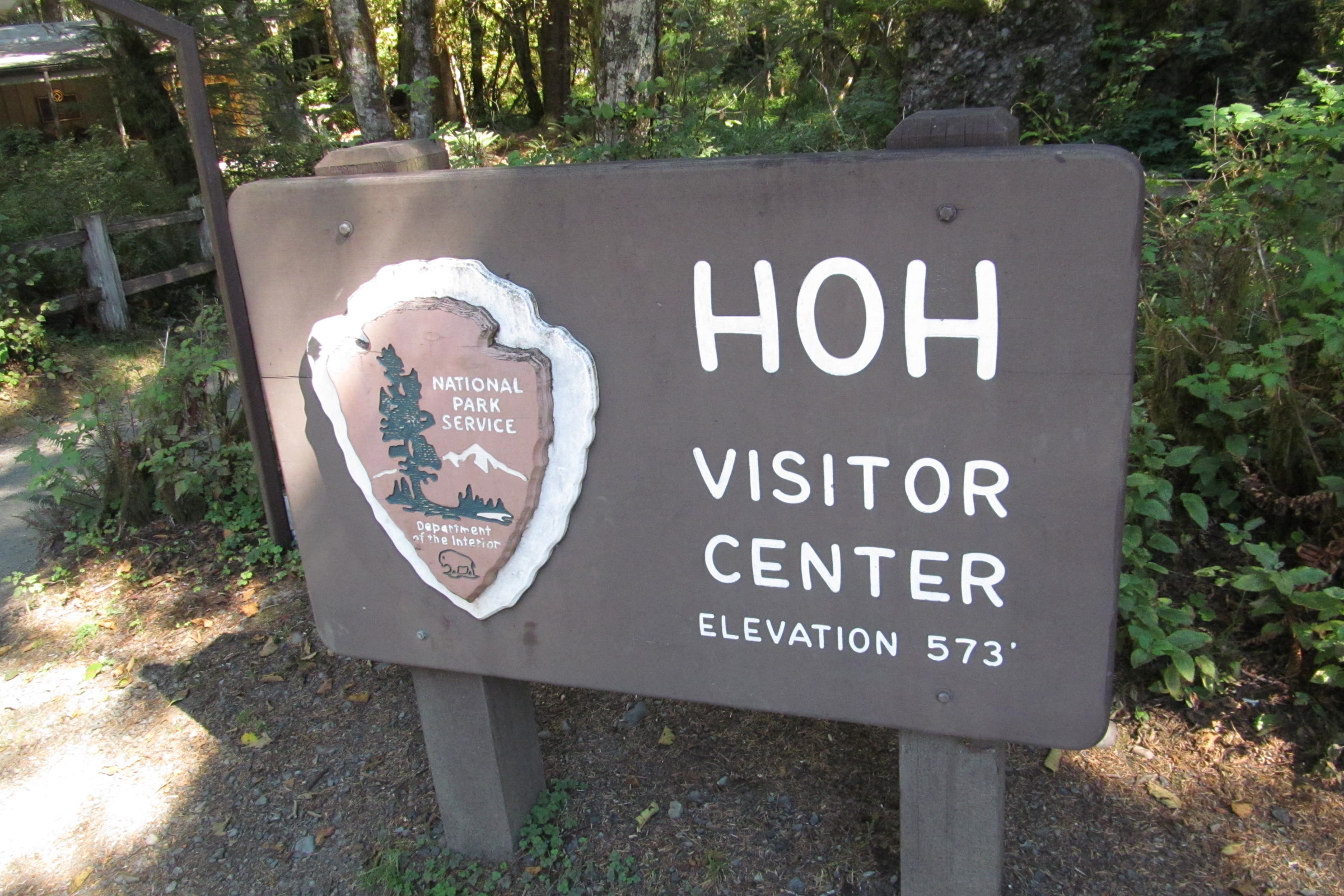
    The brown wooden Hoh Visitor Center sign with the National Park Service arrowhead and an elevation of 573 feet, among ferns and trees
    At the end of the Upper Hoh Road. Photo: Doug Kerr / Wikimedia Commons (CC BY-SA 2.0)

    Day 4: Kalaloch, Ruby Beach and Quinault

    South of the Hoh River, US 101 meets the ocean. Stop at Ruby Beach for sea stacks, then see the Kalaloch Tree of Life clinging to its eroded bluff.

    The cedar shingled Quinault Rain Forest Ranger Station with a steep gabled roof, surrounded by grass, shrubs and trees
    Quinault Rain Forest Ranger Station. Photo: Steven Pavlov / Wikimedia Commons (CC BY-SA 4.0)

    Quinault has a scenic loop drive and short rain forest trails, including the 1.3 mile Kestner Homestead loop. The valley is also the gateway to the East Fork trail, the route behind our story on moving the Enchanted Valley Chalet.

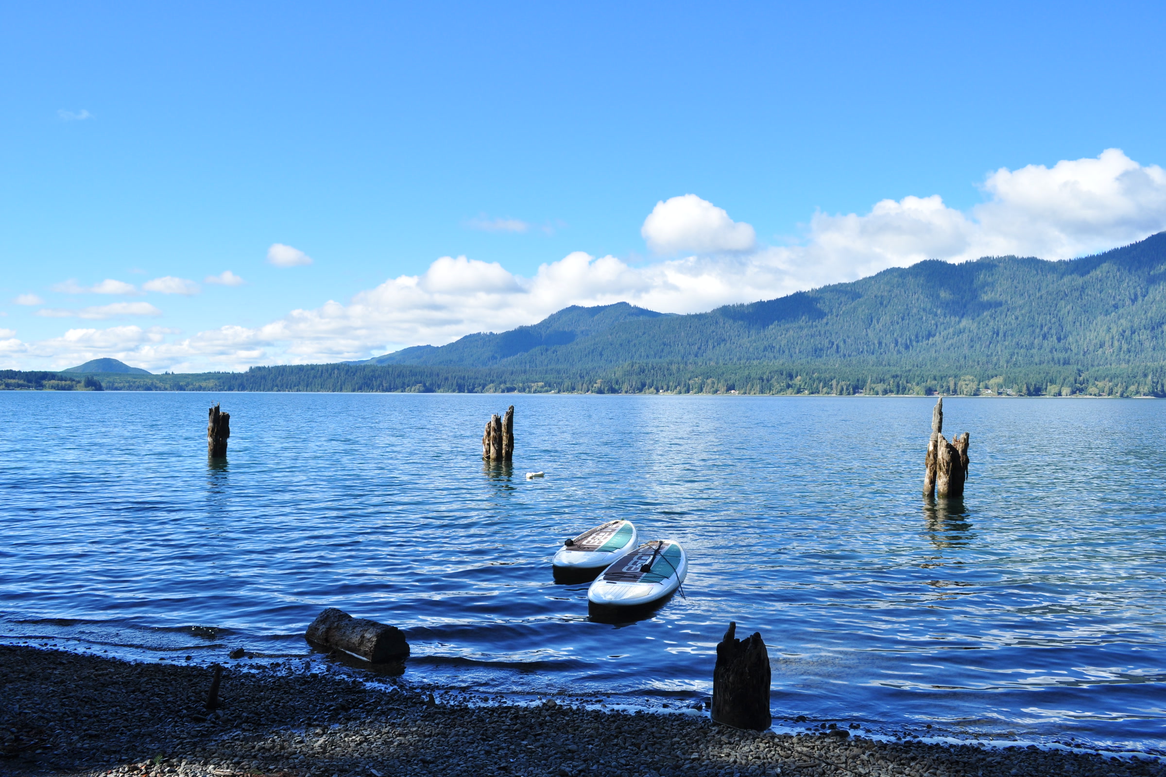
    Two small boats and old pilings in the blue water of Lake Quinault below forested hills, seen from the beach at Lake Quinault Lodge
    Lake Quinault from the lodge beach. Photo: Joe Mabel / Wikimedia Commons (CC BY-SA 4.0)

    Day 5: Staircase and the drive home

    This is the longest leg: 126 miles from Quinault to Staircase, via Aberdeen and Hood Canal. The park describes Staircase as a cathedral of Douglas firs along the Skokomish River, reached on a road past Lake Cushman. The Staircase Rapids Loop and campground are open.

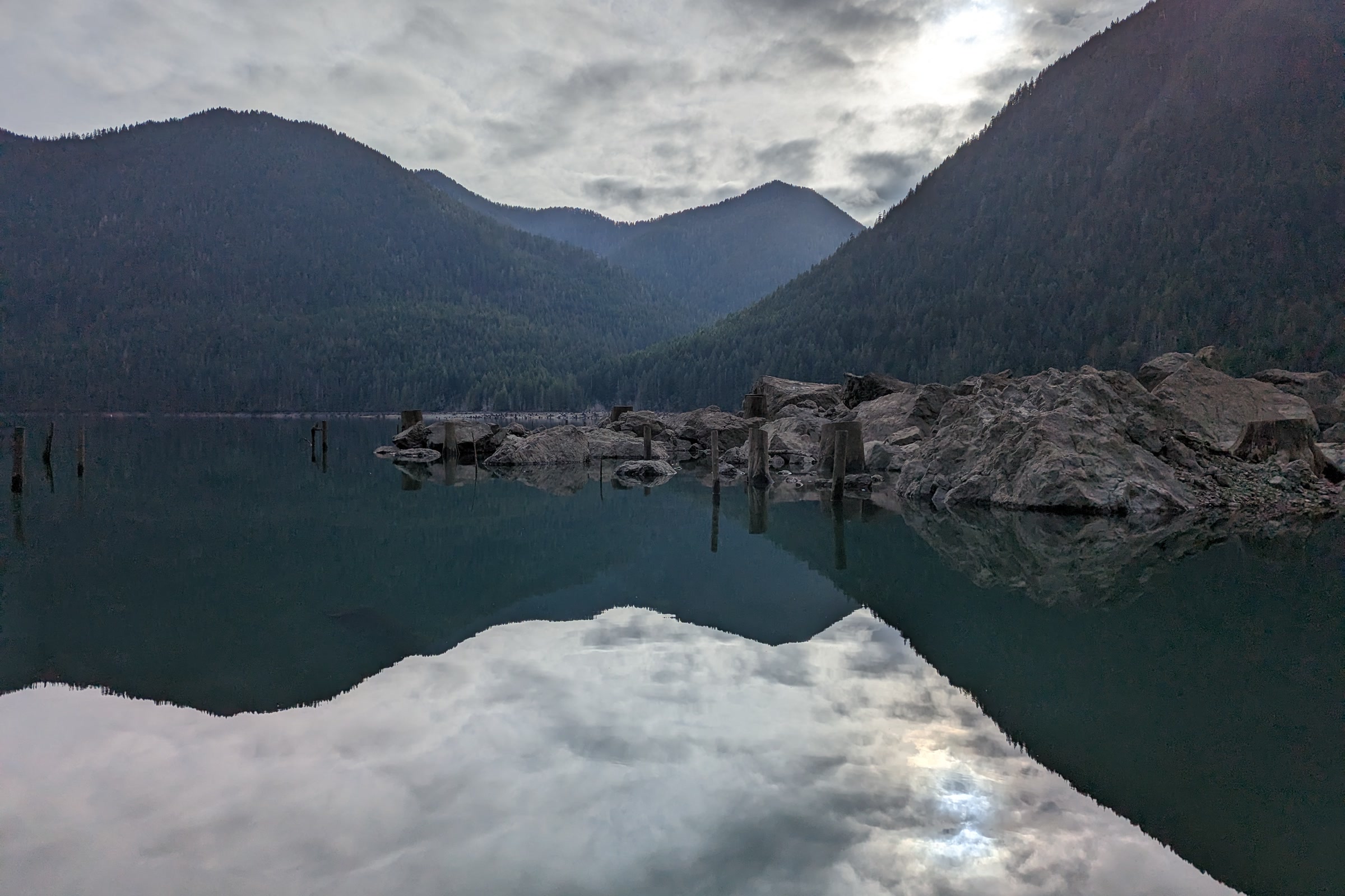
    Still water on Lake Cushman reflecting dark forested mountains and a cloudy sky
    Lake Cushman, near Staircase. Photo: SleepGap / Wikimedia Commons (CC BY-SA 4.0)

    Staircase to Port Angeles is another 100 miles, so leave time. Burned slopes from the Bear Gulch Fire raise the risk of falling trees, rockfall and debris on the road, and the park asks drivers to slow down and carry extra food and water.

    Practical tips for the loop

    How Friends of Olympic National Park helps

    We are Friends of Olympic National Park (FONP), a volunteer led friends group based in Port Angeles. Our volunteers help care for places on this route, from the Visitor Center grounds to Kalaloch area beaches. If the loop wins you over, become a member or look at our volunteer opportunities for your next visit.

    Frequently asked questions

    How many days do you need for the Olympic Peninsula loop?

    The park’s mileage chart puts the main loop at about 11.5 hours of driving, plus about 1.5 hours for Hurricane Ridge. We suggest four or five days with stops.

    Can you drive through the middle of Olympic National Park?

    No. The park’s roads are spurs off US 101, which circles the peninsula, so you reach each area from the outside.

    Is the Hoh River Bridge on US 101 open?

    As of October 14, 2026, WSDOT runs one lane of alternating traffic at 25 mph, with overnight full closures from 7 pm to 5:30 am through the morning of October 19. Check the WSDOT project page before you drive.

    Do I need a separate pass for each part of the park?

    No. One Olympic National Park entrance pass covers every area of the park for seven days.

  • Dogs in Olympic National Park: Where Pets Can Go

    Dogs in Olympic National Park: Where Pets Can Go

    Dogs in Olympic National Park are welcome in a short list of places: six trails and beach stretches, drive in campgrounds, picnic areas and park roads. Almost everywhere else, including most trails and all of the wilderness, is off limits to pets. Here is where you can go with your dog, as of October 2026, and what the park asks of you when you do.

    Quick answer

    Are dogs allowed in Olympic National Park?

    Yes, in a few places. Leashed dogs may use the Peabody Creek, Madison Falls, Spruce Railroad and July Creek Loop trails, Rialto Beach to Ellen Creek and the Kalaloch area beaches, plus drive in campgrounds, picnic areas and roads. Pets are not allowed on other trails, in public buildings, on interpretive walks or in the wilderness.

    • Leash no longer than 6 feet, at all times
    • Six pet friendly trails and beach stretches
    • Keep dogs off tidal rocks
    • Bark Ranger badges at the Kalaloch Ranger Station

    The rules of BARK

    The park sums up its pet rules in four letters. These lines are quoted from the park’s pets page, last updated in September 2026. Rules can change, so check the NPS page before you go.

    • Bag your pet’s poop: “Pet owners are responsible for removing pet waste from all areas in the park including campgrounds, picnic areas, parking lots, roads, pet-friendly trails, and other developed areas.”
    • Always wear a leash: “Pets must be restrained on a leash no longer than 6 feet.”
    • Respect wildlife: “Pets can harass or harm wildlife by making noise or scaring wildlife away.”
    • Know where you can go: the list of trails and beaches below.
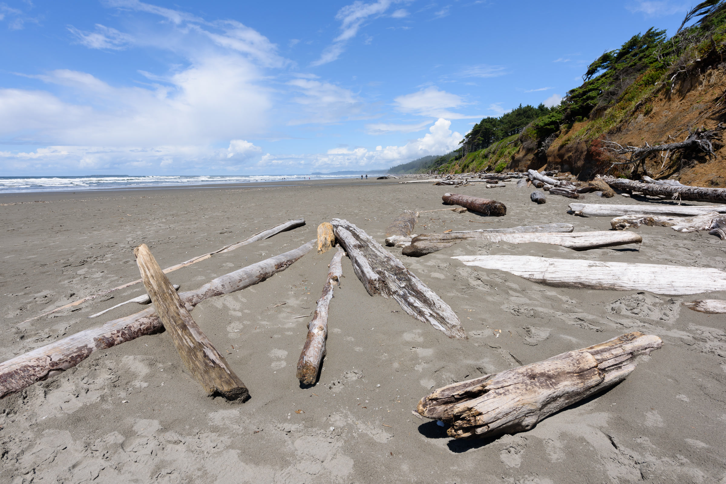
    Bleached driftwood logs lying on wide grey sand at Kalaloch Beach below an eroding, tree topped bluff
    The Kalaloch area beaches are among the few park places open to leashed dogs. Photo: King of Hearts / Wikimedia Commons (CC BY-SA 4.0)

    Pet friendly trails and beaches in the park

    The park lists exactly six places where pets may walk on trails or beaches. Details below come from the park’s trail and accessibility pages; distances are one way unless noted.

    PlaceAreaWhat to expect
    Peabody Creek TrailVisitor Center, Port AngelesHalf mile loop or a 5.2 mile out and back; steep bits, steps and bridges
    Madison Falls TrailElwha0.1 mile paved, gentle path to a 60 foot waterfall
    Spruce Railroad TrailNorth shore of Lake CrescentPaved section of the Olympic Discovery Trail
    July Creek Loop TrailNorth shore of Lake Quinault0.2 mile loop past big Douglas firs
    Rialto BeachMora areaParking lot to Ellen Creek, half a mile
    Kalaloch area beachesBetween the Hoh and Quinault ReservationsLong sandy beaches with driftwood

    Two notes help on the ground. The Living Forest Trail, which starts behind the Visitor Center, is not open to pets, so take the Peabody Creek trailhead at the western edge of the parking lot instead. In the Elwha, the road beyond the Madison Falls parking lot is closed to vehicles after flood damage, and the park says pets are allowed on leash on the road and bypass trail only.

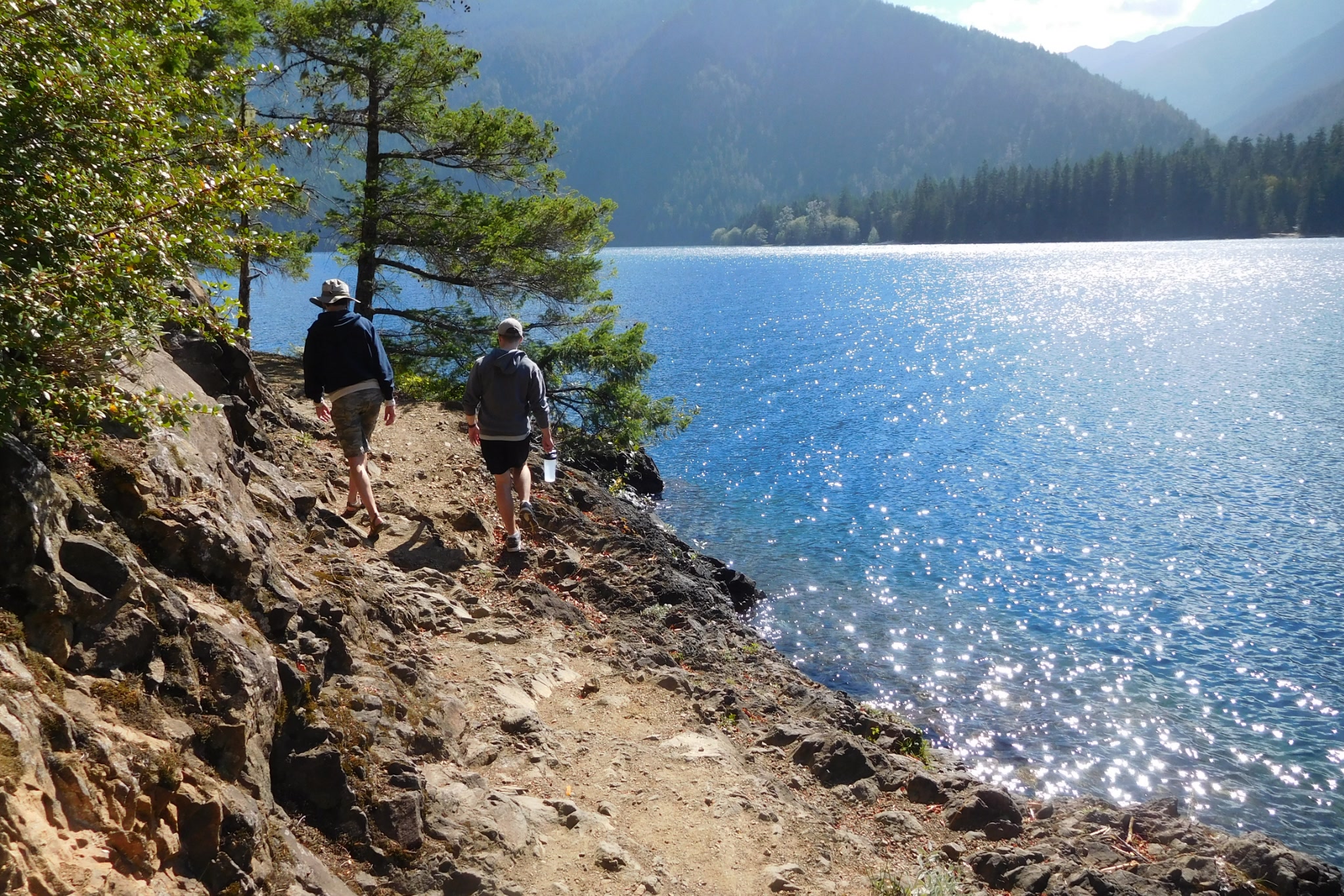
    Two walkers on a rocky shoreline path beside sparkling blue Lake Crescent, with forested mountains across the water
    The Spruce Railroad Trail in 2016, before its restoration was finished. Photo: Robert Ashworth / Wikimedia Commons (CC BY 2.0)

    The Spruce Railroad Trail with a dog

    This is the longest dog friendly walk in the park. It follows the north shore of Lake Crescent from trailheads at the end of East Beach Road and off Camp David Junior Road. Bikes share the path, so keep your dog close on its short leash. Our Lake Crescent guide covers the trail’s tunnels and railroad history.

    Dog friendly beaches on the coast

    Only two stretches of the park’s coast are open to dogs: Rialto Beach from the parking lot to Ellen Creek, and the beaches between the Hoh and Quinault Reservations around Kalaloch. The wilderness coast beyond them is closed to pets. Our guide to Leave No Trace on Olympic coast beaches covers the wider beach rules, and our Rialto Beach and Hole-in-the-Wall guide covers the walk north. The park puts that sea arch about 1.5 miles north of Rialto Beach, inside the wilderness, so it is past the point where dogs must turn back.

    One beach warning is worth repeating. The park says: “Do not bring dogs onto tidal rocks as the sharp stone, along with barnacles and mussels, can cut their paws and lead to infection.”

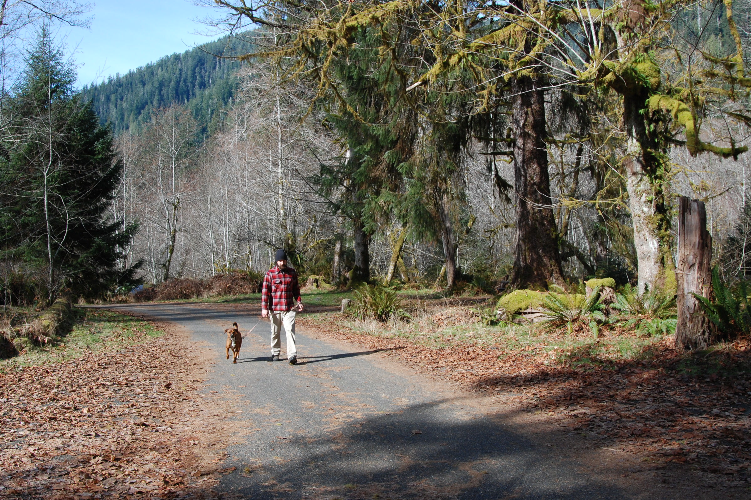
    A visitor in a red plaid shirt walking a small brown dog on a leash along a paved campground road under mossy trees
    A leashed walk on the road through Hoh Campground. NPS Photo / D. Archuleta

    Campgrounds, picnic areas and roads

    The park says pets “are welcome in drive in campgrounds and picnic areas as well as paved or dirt roads, but no digging or rolling on plants as that will damage vegetation.” So a leashed dog can camp with you at sites such as Kalaloch or the Hoh and stretch its legs on campground roads. Our Olympic National Park campgrounds compared guide helps you choose a site.

    Never leave a pet alone. The park warns that “Summer heat poses a threat to pets left in vehicles.”

    A visitor sitting at a campsite picnic table holding a fluffy orange Pomeranian, with tall dark forest behind
    Pets are welcome at drive in campsites such as Kalaloch Campground. NPS Photo / C. Bubar

    Where dogs in Olympic National Park cannot go

    In the park’s words, “Pets are not permitted on any trails not listed above, in public buildings, on interpretive walks, or in the wilderness.” In practice that rules out some favourite places:

    • Trails at Hurricane Ridge, including Hurricane Hill
    • Hoh Rain Forest trails such as the Hall of Mosses
    • Sol Duc Falls, Marymere Falls and other trails not on the list
    • The wilderness coast, including the Ozette area beaches
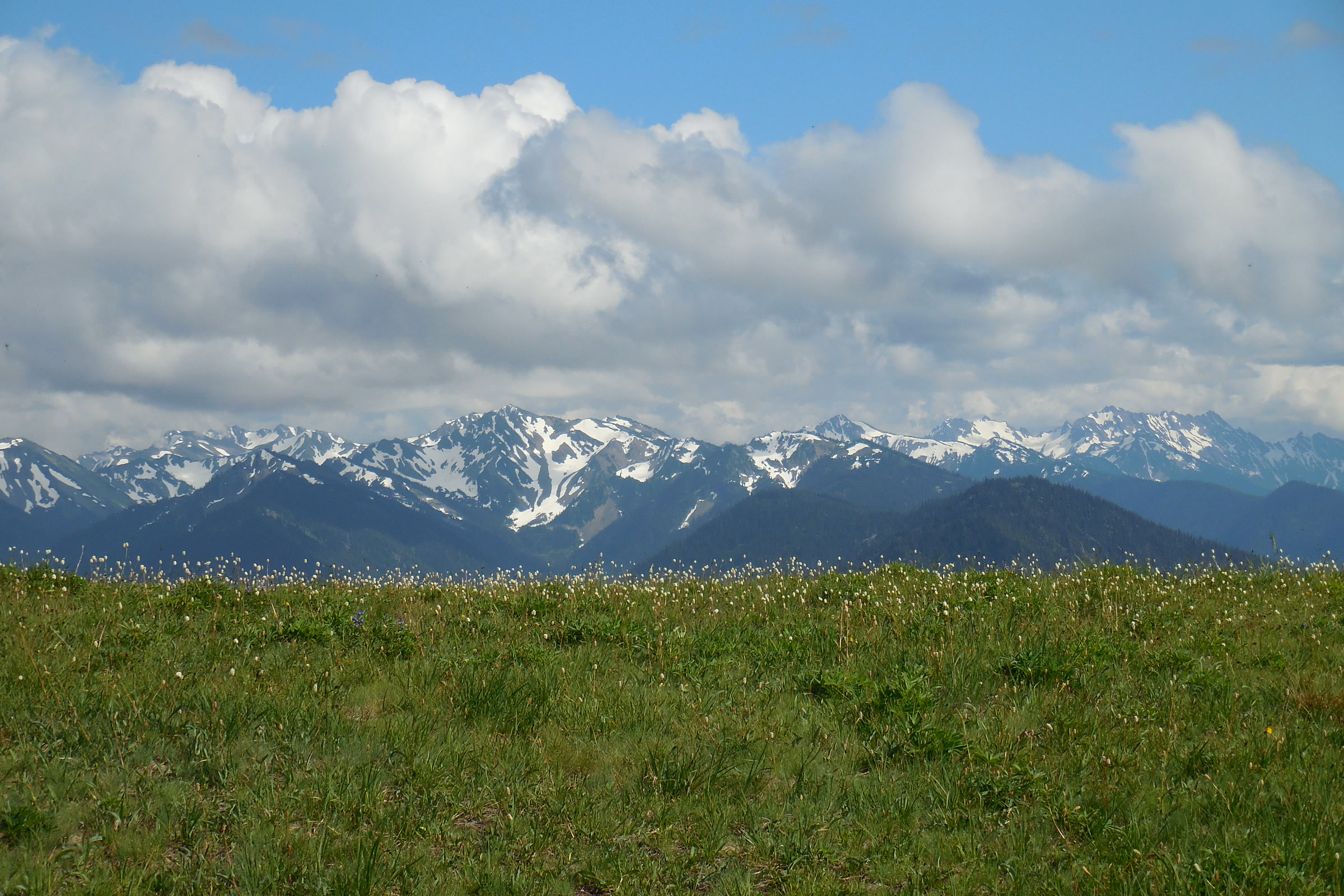
    A green subalpine meadow at Hurricane Ridge in front of a line of snowy Olympic peaks under big white clouds
    Hurricane Ridge meadows are fragile, and its trails are closed to pets. NPS Photo / C. Bubar

    Service animals

    Service animals are an exception and may go with their owners to all park locations. The park notes that under the Americans with Disabilities Act, “Dogs whose sole function is to provide comfort or emotional support do not qualify as service animals.”

    Become a Bark Ranger

    Olympic has its own Bark Ranger program. The park invites well behaved dogs and their people to learn the BARK rules and earn a Bark Ranger badge. To take part, the park says to visit the Kalaloch Ranger Station, so it fits well with a beach day at Kalaloch.

    Blue Lake Quinault seen through leafy shrubs from a shoreline day use area, with a forested ridge across the water
    Lake Quinault from Willaby Creek in Olympic National Forest, looking toward the park’s north shore. Photo: Chris Light / Wikimedia Commons (CC BY-SA 4.0)

    Longer hikes with your dog: Olympic National Forest

    If you want a real hike together, the park points dog owners to its neighbour. Leashed pets are allowed on trails in Olympic National Forest, which is a different agency from the park, so check its own rules and trail reports first. The park also asks you to keep your pet free of seeds to stop invasive plants spreading.

    How Friends of Olympic National Park helps

    We are Friends of Olympic National Park (FONP), a volunteer led friends group based in Port Angeles. Our volunteers join beach cleanups in Olympic National Park on the same Kalaloch beaches where many dog owners walk. If you would like to give back, see our volunteer opportunities.

    Frequently asked questions

    Can I take my dog to Hurricane Ridge?

    Your leashed dog can ride up and walk on roads and in developed areas, but Hurricane Ridge trails are not on the park’s list of pet friendly trails, so pets cannot use them.

    Are dogs allowed on Rialto Beach?

    Yes, from the parking lot to Ellen Creek, about half a mile. Dogs must be on a leash no longer than 6 feet and kept off tidal rocks. Hole-in-the-Wall is beyond that limit.

    Can dogs go in the Hoh Rain Forest?

    Leashed pets can stay at the Hoh drive in campground and walk on roads, but the rain forest trails are not on the park’s pet friendly list.

    What is the leash rule in Olympic National Park?

    Pets must be restrained on a leash no longer than 6 feet, everywhere pets are allowed. Owners must also pick up pet waste and never leave pets unattended.

    How does my dog become a Bark Ranger?

    Visit the Kalaloch Ranger Station. Well behaved dogs and their people learn the BARK rules and can earn an Olympic National Park Bark Ranger badge.

  • Olympic Mountains Geology: How the Range Formed

    Olympic Mountains Geology: How the Range Formed

    Olympic Mountains geology starts somewhere surprising: the bottom of the Pacific Ocean. The rocks of Mount Olympus, Hurricane Ridge and the wild coast were laid down on the sea floor, then pushed against North America and lifted into peaks. Here is that story in plain words.

    Quick answer

    How were the Olympic Mountains formed?

    The Olympic Mountains formed from sea floor rock. Lava cooled into basalt and sand and mud piled up offshore. As the Juan de Fuca Plate slid beneath North America, those layers were scraped off, folded and pushed up. Ice sheets and alpine glaciers then carved the valleys, and erosion still wears the peaks down.

    • Three main rocks: sandstone, shale and basalt
    • Crescent Formation basalt forms a horseshoe around the core
    • Mount Olympus, the highest peak, is 7,980 feet
    • The Cordilleran Ice Sheet was about 3,500 feet thick

    Olympic Mountains geology begins on the sea floor

    The park puts it simply: the Olympic Mountains were born in the sea. Its Olympic National Park geology page says the basalts and sedimentary rocks of these peaks were laid down offshore between about 57 and 18 million years ago. Underwater volcanoes poured out lava that cooled into basalt, while rivers carried sand and mud out to sea, where it hardened into sandstone and shale.

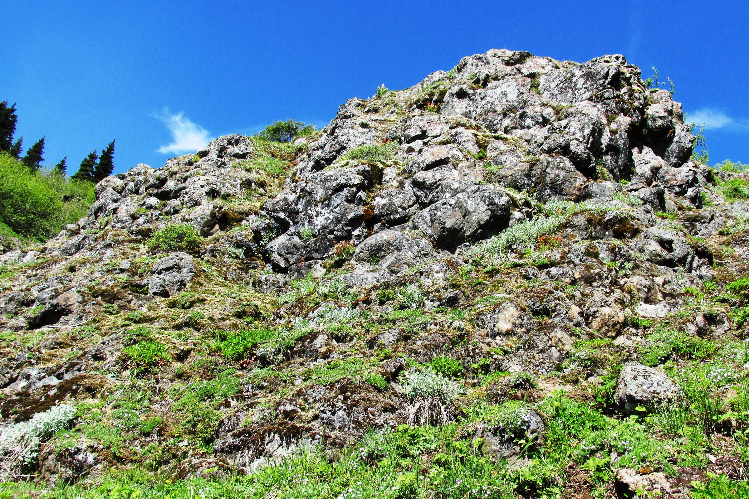
    A craggy outcrop of dark, rounded basalt pillows rising above a green slope under a deep blue sky
    Pillow basalt in the Olympic Mountains, photographed in Olympic National Forest. Photo: brewbooks / Wikimedia Commons (CC BY-SA 2.0)

    The Crescent basalts and their horseshoe

    With a few exceptions, the oldest rocks in the range are the Crescent Formation basalts. A park geology handout dates them to more than 55 million years ago, erupted on the sea floor, sometimes as rounded blobs called pillows. The flows stack up to 12 miles deep and reach from Coos Bay, Oregon, north to Victoria on Vancouver Island.

    On a map the basalt makes a striking shape. The Washington Geological Survey describes a horseshoe shaped border of Crescent Formation basalt around a core of highly folded sedimentary and metamorphic rock. Near Hurricane Ridge you look along part of that curve.

    A plate collision and an accretionary wedge

    Off the coast, the Juan de Fuca Plate is sliding beneath the North American Plate, a process called subduction. The park dates the collision that began building the Olympics to about 34 million years ago. The state survey says this oceanic crust was added to the continent over the last 40 million years along the Cascadia subduction zone.

    Not everything on the sinking plate goes down with it. Much of the sea floor sediment is scraped off and crumpled against the continent, like frost piling up ahead of a windshield scraper. Geologists call that pile an accretionary wedge, and in the Olympics it was jammed under the older basalts to form the central core.

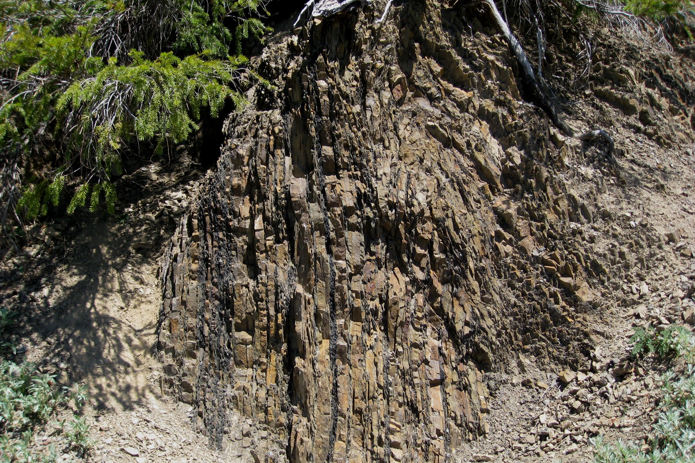
    Thin layers of brown sandstone and dark shale standing almost vertical in a trailside rock face on Hurricane Hill
    Former sea floor tilted on end beside the Hurricane Hill trail. Photo: brewbooks / Wikimedia Commons (CC BY-SA 2.0)

    You can see the result on the Hurricane Hill trail, where the park points out rock layers standing upright like pressed pages. They are old ocean floor, now just shy of 6,000 feet above sea level. The squeeze continues, but the park says erosion keeps pace, so Mount Olympus is not getting any taller.

    Its handout goes further: without rain, snow, rivers, glaciers and gravity wearing them down, the Olympics would be taller than Mount Everest.

    Olympic Peninsula rocks compared

    The state survey names three main rock types in the Olympics: sandstone, shale and basalt. A fourth, granite, arrived from far away on the ice.

    RockHow it formedWhere to look
    BasaltLava that cooled on the sea floor, often as pillowsThe horseshoe of ridges on the north, east and south sides
    SandstoneSand from underwater landslides, pressed into rockThe interior peaks and the tilted ledges at Beach 4
    Shale and slateSea floor mud; more pressure makes slateThin dark layers between sandstone, as on Hurricane Hill
    Granite (erratic)Carried in from Canada by an ice sheetLight speckled stones in the Elwha River
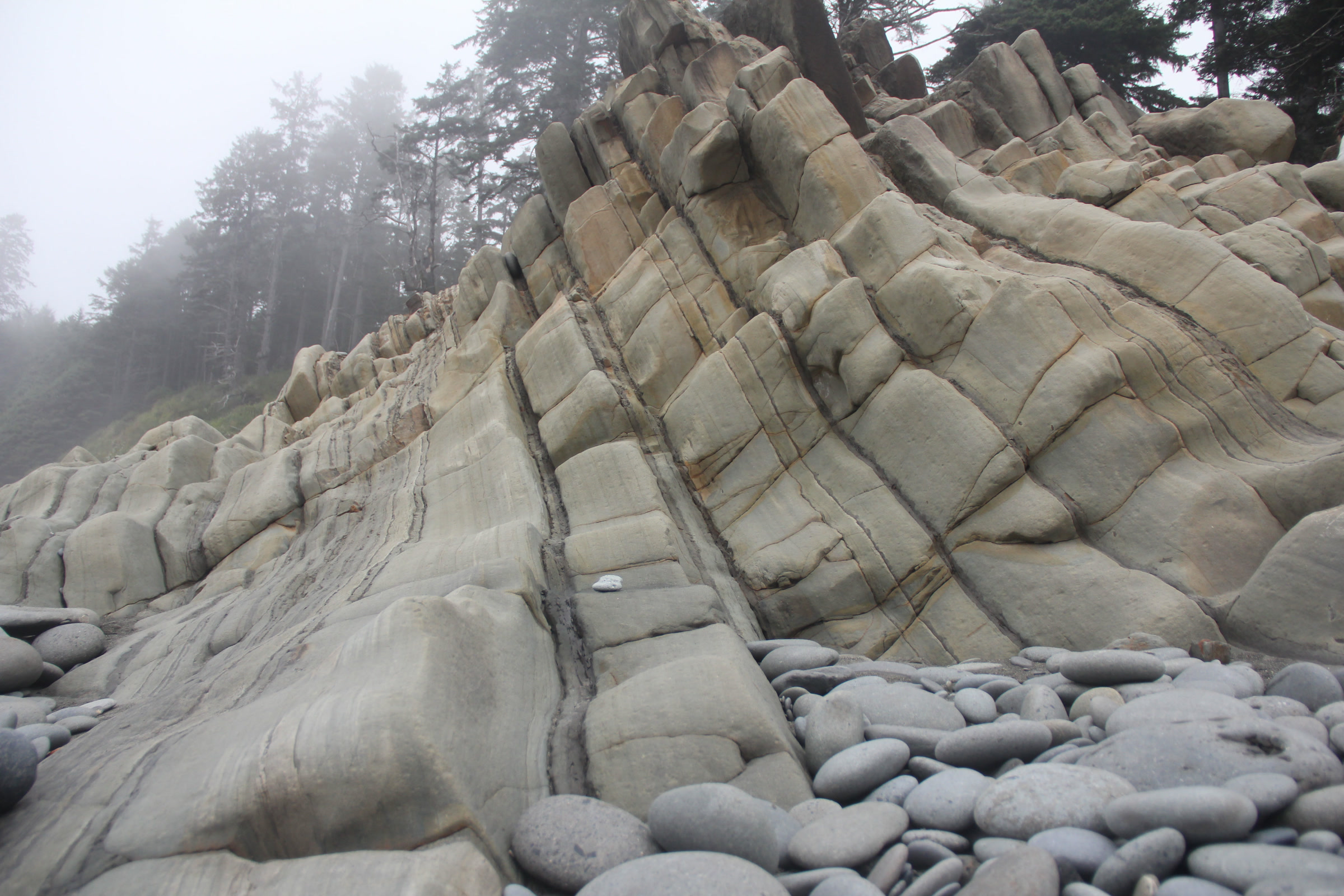
    Steeply tilted beds of pale grey sandstone rising from a beach of smooth round cobbles, with misty forest above
    Tilted sandstone layers on an Olympic coast beach. NPS Photo / Zaidel

    Much of that sandstone began as turbidity currents, huge underwater landslides that earthquakes can set off. Heavy sand settles first and fine mud drifts down on top, leaving a sorted layer. At Beach 4, near Kalaloch, the park notes the sandstone panels are not only tilted but upside down.

    How ice shaped Olympic National Park geology

    Uplift built the range, but ice gave it shape. The most recent ice sheet, the Cordilleran Ice Sheet, advanced about 16,900 years ago and began to retreat around 14,000 years ago. At about 3,500 feet thick, it dug out Puget Sound, scoured the northern and eastern edges of the Olympics and dammed valleys such as the Elwha.

    A deep forested valley below the grassy summit of Hurricane Hill on the left and the rocky crags of Unicorn Peak on the right
    Hurricane Hill and Unicorn Peak seen from Hurricane Ridge. Photo: Miguel Hermoso Cuesta / Wikimedia Commons (CC BY-SA 4.0)

    Alpine glaciers once reached down into today’s rainforest valleys. Ice grinds across a whole valley floor and leaves a broad U shape, unlike the narrow V a river cuts. Lake Crescent fills one of these glacier carved basins, and our Lake Crescent guide tells how a landslide later split it from Lake Sutherland.

    The ice sheet also left visitors behind. Granite from Canada’s Fraser Valley rode in on the ice more than 13,000 years ago, and the Elwha River still tumbles these erratics downstream. Glaciers remain on the high peaks but are shrinking fast; our post on Olympic National Park glaciers and a changing climate covers that story.

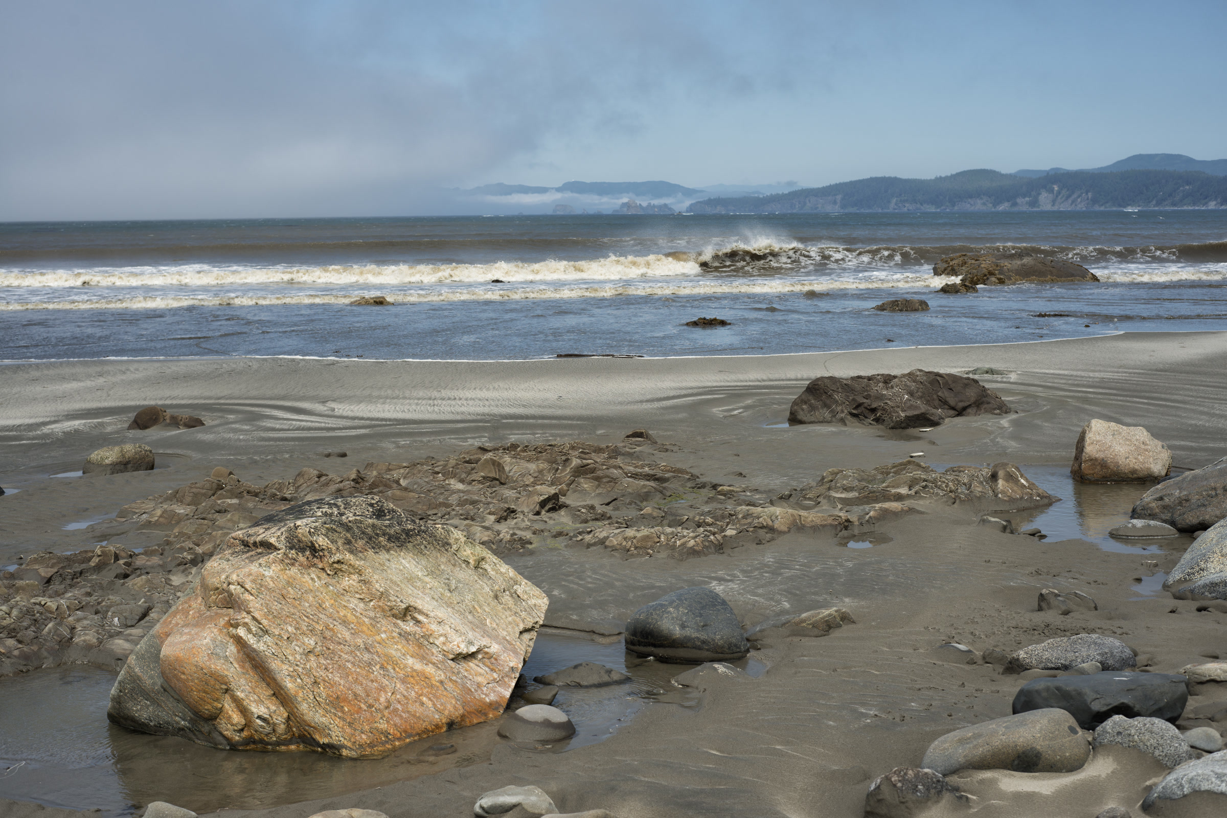
    A sandy beach scattered with boulders and flat rock ledges, with surf and the distant sea stacks of Point of Arches under low cloud
    Looking north toward Point of Arches from near Cape Alava. Photo: John Fowler / Wikimedia Commons (CC BY 2.0)

    Sea stacks: where the coast tells the story

    The coast’s sea stacks belong to what geologists call the Hoh Rock Assemblage. The park compares it to chocolate chip cookie dough: hard volcanic and sedimentary chunks set in softer mudstone. Waves wear away the soft dough first and leave the tough chips standing offshore, at beaches from Shi Shi to Ruby Beach.

    Our Ruby Beach visitor guide and tide pool guide help you time a visit for low tide.

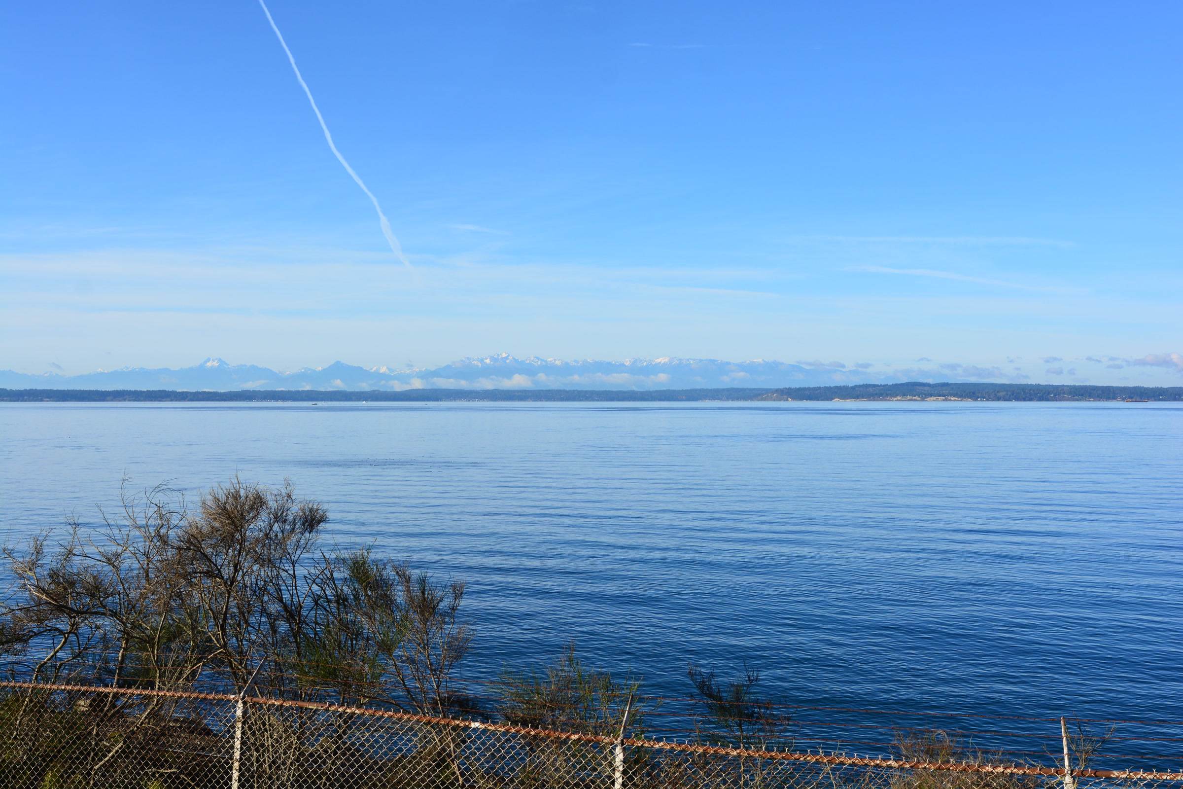
    The snowy line of the Olympic Mountains on the far horizon across the calm blue water of Puget Sound
    The Olympics seen across Puget Sound from Carkeek Park in Seattle. Photo: Joe Mabel / Wikimedia Commons (CC BY-SA 4.0)

    Where to see the geology on a visit

    • Hurricane Ridge and Hurricane Hill: views of the interior peaks and upturned sea floor beside the trail. Pair it with our Hurricane Ridge wildflower guide.
    • Beach 4 at Kalaloch: tilted, overturned sandstone a short walk down from the parking area.
    • The Elwha River: dark basalt, grey sandstone and the odd speckled granite erratic among the cobbles.

    Geologists still debate parts of this story, as the park’s own handout says. Please leave rocks where you find them so the next visitor can read them too.

    How Friends of Olympic National Park helps

    We are Friends of Olympic National Park (FONP), a volunteer led friends group based in Port Angeles. We support the park’s Winter Perspectives lecture series and lead guided nature walks. If you love these mountains, become a member and help keep that curiosity going.

    Frequently asked questions

    Are the Olympic Mountains volcanic?

    No. The park says the Olympic range is not volcanic, even though it holds a lot of basalt. That basalt came from underwater eruptions on the ancient sea floor and was later pushed onto the continent.

    How old are the Olympic Mountains?

    The rocks are older than the mountains. The park says they were laid down offshore between about 57 and 18 million years ago, and dates the collision that began building the range to about 34 million years ago.

    Are the Olympic Mountains still rising?

    Yes, but erosion wears the peaks down about as fast as they rise, so the park says Mount Olympus is not getting any taller.

    What is the Crescent Formation?

    A thick series of basalt lava flows that erupted on the sea floor more than 55 million years ago. In the Olympics it forms a horseshoe of ridges around the northern, eastern and southern edges of the range.

    Where can I see Olympic geology up close?

    Try the Hurricane Hill trail for upturned sea floor, Beach 4 at Kalaloch for tilted sandstone, the Elwha River for mixed cobbles, and coastal beaches for sea stacks.

  • Olympic National Park Campgrounds Compared

    Olympic National Park Campgrounds Compared

    Olympic National Park campgrounds put you on an ocean bluff, beside a rain forest river, on a lakeshore or high in the mountains. Each one books differently, and seasons shift every year. This guide compares the frontcountry campgrounds you can drive to, using the National Park Service and recreation.gov listings as of October 2026.

    Quick answer

    Which Olympic National Park campgrounds take reservations?

    As of October 2026 the park lists 14 frontcountry campgrounds. Fairholme, Hoh, Kalaloch, Mora, Sol Duc and Staircase take recreation.gov reservations during set seasons, and Log Cabin Resort books by phone. The other seven, and the reservable ones outside their windows, are first come, first served. Check the NPS page before you go.

    • 14 frontcountry campgrounds on the NPS list
    • Kalaloch is the largest, with 170 sites
    • Loops release 6 months, 2 weeks or 4 days ahead
    • Campers need a valid park pass, not a Discover Pass

    Olympic National Park campgrounds at a glance

    Dates below are the 2026 season as published on the park’s camping page, which the park updated on October 10, 2026. Campgrounds can close at short notice for weather, so call (360) 565-3131 or check that page before you go.

    CampgroundSettingSitesSeason and booking (2026)
    KalalochCoast bluff170Year round; reserve May 15 to Sep 20
    South BeachCoast bluff55May 19 to Oct 10; first come
    MoraCoastal forest94Year round; reserve May 15 to Sep 20
    OzetteLake Ozette15Year round; first come
    Hoh Rain ForestRain forest river78Year round; reserve Jun 12 to Sep 6
    Graves CreekQuinault rain forest30Year round; first come; no RVs
    North ForkQuinault rain forest9Year round; first come
    QueetsQueets River20Year round; first come
    FairholmeLake Crescent88Apr 25 to Sep 29; reserve May 15 to Sep 29
    Log Cabin ResortLake Crescent38May to October; phone booking
    Sol DucSol Duc River82 plus 17 RVReserve Mar 20 to Nov 1
    Heart O’ the HillsOld growth forest97Year round; first come
    Deer ParkMountains, 5,400 feet14June to mid October; first come; tents only
    StaircaseSkokomish River49Seasonal; reserve Jul 8 to Sep 29

    Campground reservations and first come, first served sites

    Campground reservations go through recreation.gov, and the busiest campgrounds release their loops in stages. At Kalaloch, for example, the A and B loops open six months ahead, C and D two weeks ahead, and E and F just four days ahead. Hoh works the same way with its A, C and B loops, so a last minute trip is not always hopeless.

    At first come campgrounds you pick an open site and self register at the board. Where a reservable campground has an unreserved site, you can usually claim it in person for one night only. In mid October most reservable campgrounds have already switched to first come, Sol Duc takes bookings through November 1, and Fairholme and South Beach have closed for the season.

    A paved campsite pad and picnic table beneath wind shaped coastal trees in a loop of Kalaloch Campground
    A campsite in one of Kalaloch’s six loops. Photo: Chris Light / Wikimedia Commons (CC BY-SA 4.0)

    Camping on the coast

    Kalaloch Campground

    Kalaloch Campground is the park’s biggest, and some sites sit right above the Pacific. The bluff is wearing away: the recreation.gov listing reports serious erosion in the A, D and E loops, and a number of bluff sites are permanently closed. Stays are capped at seven days in the reservation season, gathering wood is not allowed, and firewood is sold at Kalaloch Lodge about half a mile south.

    South Beach, Mora and Ozette

    South Beach, in the Kalaloch area, is a simpler bluff top campground with big ocean views and beach access, flush toilets but no drinking water. Mora sits in coastal forest two miles from Rialto Beach, the starting point in our guide to Rialto Beach and Hole in the Wall. Tiny Ozette, on Lake Ozette, is the base for the Ozette Triangle hike; some of its sites flood in winter.

    A visitor in a red jacket walking along the grassy bluff at South Beach Campground above Pacific surf
    The bluff at South Beach Campground. NPS Photo / C. Bubar

    Rain forest campgrounds

    Hoh Rain Forest Campground has summer ranger programs and some sites along the Hoh River. Recreation.gov notes that loops may close for winter, bad weather, or the elk rut and calving seasons, and that entrance lines are common, so arrive before 10 AM or after 5 PM. Our guide to the temperate rainforests of Olympic National Park covers the trails nearby.

    A small red teardrop trailer parked at a campsite with a picnic table among mossy trees at Hoh Campground
    Most Hoh sites fit rigs up to 21 feet. NPS Photo / D. Archuleta

    The three small rain forest campgrounds are quieter and more basic, with pit toilets and no running water. Graves Creek sits by a stream in the Quinault Rain Forest and doesn’t allow RVs or trailers. North Fork has just nine sites, and Queets can only be reached by the Upper Queets Road after a past mudslide.

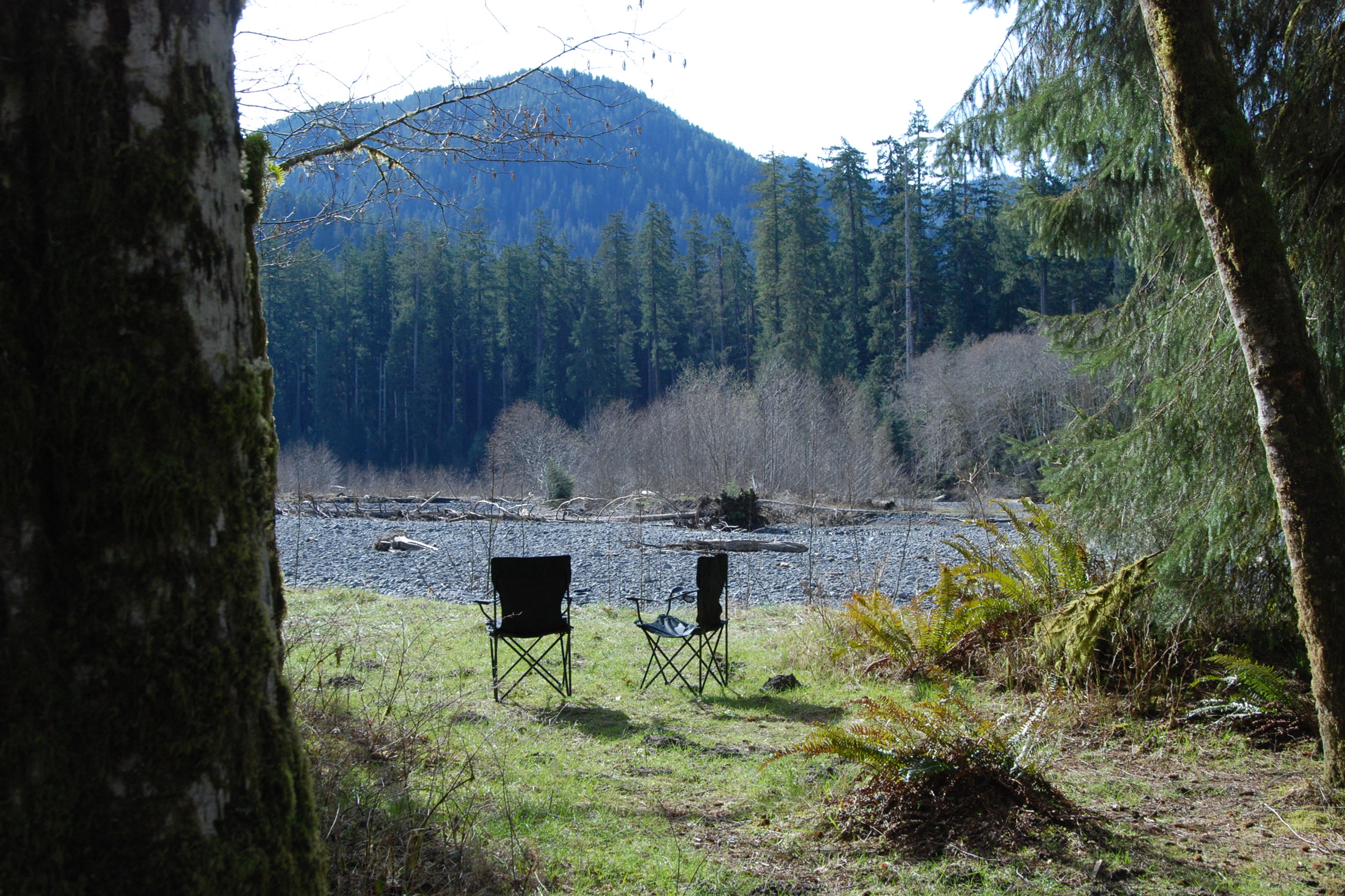
    Two camp chairs on a grassy campsite at Hoh Campground looking out over the Hoh River gravel bar to forested hills
    A riverside site at Hoh. NPS Photo / D. Archuleta

    Lakes, rivers and mountains

    Fairholme, at the west end of Lake Crescent, has lakeside sites and a boat launch nearby. Log Cabin Resort, a concession on the same lake, adds full hookup RV sites, showers and laundry; our Lake Crescent guide has more on the area. Sol Duc’s campground and RV park, run by Sol Duc Hot Springs Resort, sit by the river in old growth forest.

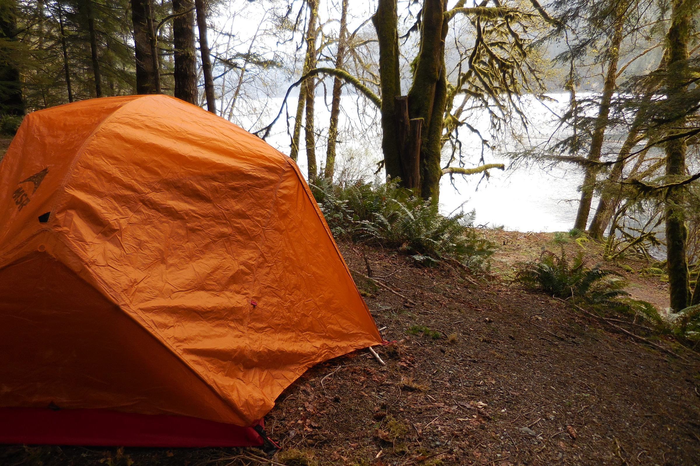
    An orange dome tent pitched on a forest campsite in the Lake Crescent area
    Tent camping near Lake Crescent. NPS Photo

    Heart O’ the Hills, surrounded by old growth, has 97 sites, summer ranger programs and year round camping, walk in only during heavy snow. Deer Park sits at 5,400 feet at the end of a steep, winding gravel road, with mountain views, starry skies and tent sites only. Staircase offers old growth and riverside sites on the Skokomish River.

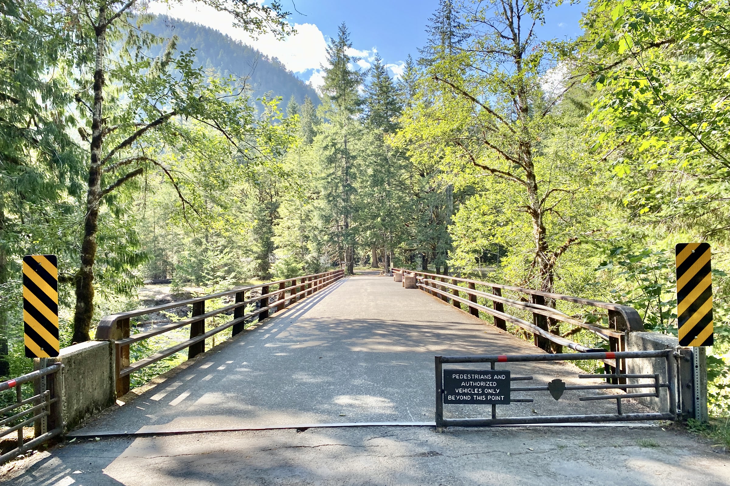
    A gated wooden road bridge over the Skokomish River at Staircase, framed by sunlit maples and a forested ridge
    The bridge at Staircase. Photo: w_lemay / Wikimedia Commons (CC BY-SA 2.0)

    Rules to know before you pitch a tent

    • Bring a valid park pass; recreation.gov listings say the state Discover Pass is not accepted. Our guide to Olympic National Park entrance fees covers passes and nightly camping fees.
    • Up to 8 people per site, quiet hours 10 PM to 6 AM, checkout at 11 AM.
    • Stay up to 14 consecutive days a year in the park, and 7 at Kalaloch, Mora and Hoh in the reservation season.
    • Keep food, scented items and trash in your car or a food locker; our black bear safety guide explains why.
    • Pets stay on a 6 foot leash; see where dogs can go in the park.

    Vehicle camping is only allowed in these campgrounds. For backcountry trips, read our wilderness permit guide.

    How Friends of Olympic National Park helps

    We are Friends of Olympic National Park (FONP), a volunteer led friends group in Port Angeles. We don’t run any campgrounds, but our volunteers help care for places campers love, including our beach cleanups in Olympic National Park. If you camp here often, become a member and help us keep that work going.
    Frequently asked questions

    Do you need a reservation to camp in Olympic National Park?

    Not always. Seven campgrounds are always first come, first served, and the reservable ones switch to first come outside their reservation seasons. In summer, book Kalaloch, Mora, Hoh, Fairholme, Sol Duc and Staircase on recreation.gov.
    Is Kalaloch Campground open year round?

    Yes. The NPS lists Kalaloch as open year round, though it can close temporarily in severe weather and some loops may close in winter. It takes reservations May 15 to September 20 in 2026 and is first come the rest of the year.

    How far ahead can I book an Olympic campground?

    Up to six months ahead for some loops. At Kalaloch and Hoh, other loops open two weeks or four days ahead, so check recreation.gov again close to your dates.

    Which Olympic National Park campgrounds have RV hookups?

    The NPS lists hookups only at the two concession sites: Log Cabin Resort on Lake Crescent and the Sol Duc Hot Springs RV Park. Most other sites fit rigs up to 21 feet.

    Can you camp anywhere in Olympic National Park?

    No. Vehicle camping is allowed only in established campgrounds. Overnight trips into the wilderness need a wilderness permit.

  • The Northern Spotted Owl in Olympic National Park

    The Northern Spotted Owl in Olympic National Park

    The northern spotted owl is a quiet, dark eyed hunter of old forests, and Olympic National Park was long one of its best refuges. Protected from logging, its ancient valleys once held an estimated 230 pairs. Today a newer arrival, the barred owl, has pushed most of them out. Here is what makes the bird special and what is happening to it.

    Quick answer

    Are there northern spotted owls in Olympic National Park?

    Yes, but far fewer than before. The northern spotted owl, listed as threatened in 1990, lives in the park’s old growth forests. The National Park Service reports that spotted owl numbers on the Olympic Peninsula fell by over 80 percent between 1995 and 2017, mainly because invasive barred owls displaced them.

    • Listed as threatened under the Endangered Species Act in 1990
    • Nests only in large stretches of old forest
    • Peninsula numbers fell by over 80 percent, 1995 to 2017
    • In 2022, 474 acoustic recorders listened for owls in Olympic

    Meet the northern spotted owl

    The US Fish and Wildlife Service describes a medium sized, chocolate brown owl with dark eyes and round or irregular white spots on its head, neck, back and underparts. It ranges from southwestern British Columbia through Washington and Oregon into northern California. It hunts at night, catching prey with its talons.

    Its menu is mostly small forest mammals: flying squirrels, woodrats, voles and mice. Spotted owls are relatively long lived, invest heavily in parental care and have high adult survival compared with other North American owls.

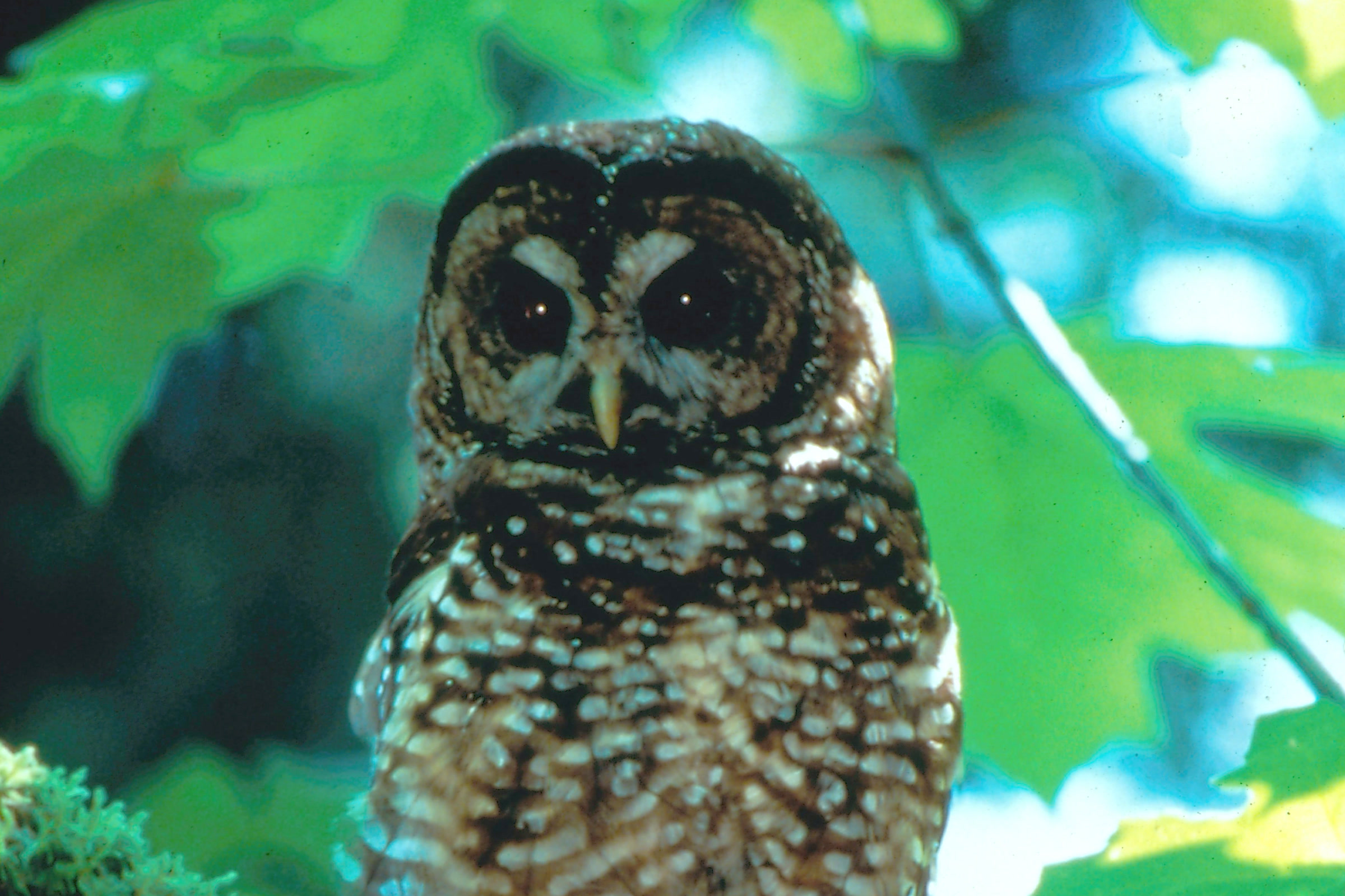
    A northern spotted owl with dark eyes and white spotted brown feathers perched on a branch beside a tree trunk, photographed in southern Oregon
    A northern spotted owl in the BLM Medford District, southern Oregon. Photo: Kyle Sullivan, BLM / Wikimedia Commons (public domain)

    Why spotted owls need old growth forest

    The link between the spotted owl and old growth forest is about structure. The park’s Dosewallips area brochure explains that low limbs give owls a cool, shaded perch on warm days, while high limbs help them keep warm on cool ones. Old forests also hold enough prey, such as flying squirrels and voles.

    Some owls hunt among younger trees, but they will only nest in large stretches of old forest. If a pair cannot find a patch big enough and far enough from another nesting pair, it simply skips nesting that year. You can read more about the forests themselves in our guide to the temperate rainforests of Olympic National Park.

    Looking straight up the trunks of tall old growth conifers to a pale sky in Olympic National Park
    Old growth offers perches at every height. NPS Photo

    The same forests shelter other wildlife, including the fishers covered in our story of the fisher reintroduction in Olympic National Park.

    A Virginia northern flying squirrel, an eastern subspecies, clinging to a pale dead branch at night
    A northern flying squirrel of an eastern subspecies, not photographed in Olympic. Photo: USFWS / Wikimedia Commons (public domain)

    A listed species and a forest plan

    The spotted owl was listed as threatened under the Endangered Species Act in 1990, and as the park’s brochure puts it, it soon made the news more than any other animal in the Northwest. For some it became a symbol of economic hardship from reduced logging. For others it signalled healthy forest.

    The multi agency Northwest Forest Plan followed in 1994, and under it Olympic takes part in the Northern Spotted Owl Monitoring Program. In December 2020 the Fish and Wildlife Service found that moving the owl from threatened to endangered was warranted but precluded by higher priority work, so it remains listed as threatened.

    Black and white photograph of a northern spotted owl perched on a branch in Pacific Northwest old growth forest around 1990
    A spotted owl photographed around the year it was listed. Photo: US Forest Service / Wikimedia Commons (public domain)

    Barred owl and spotted owl: a newcomer takes over

    Inside the park, logging is not the chief threat. The barred owl is. According to the Fish and Wildlife Service, barred owls spread west from eastern North America after human caused changes to the landscape, reached British Columbia around 1959 and were first documented in Washington in the 1970s.

    Barred owls displace spotted owls, disrupt their nesting, compete for the same food and sometimes attack them. Park biologist Scott Gremel, who has studied Olympic’s owls since the 1990s, notes that barred owls eat a much wider range of prey, down to insects and salamanders, and are having a huge effect on the wider ecosystem.

    Spotted owl and barred owl compared

    FeatureNorthern spotted owlBarred owl
    OriginNative to the Pacific NorthwestSpread west from eastern North America
    In WashingtonLong residentFirst documented in the 1970s
    Legal statusThreatened since 1990Treated as invasive in the spotted owl’s range
    DietMainly flying squirrels, woodrats, voles, miceWide range, including insects and salamanders
    A barred owl with dark eyes and streaked grey brown feathers perched among leafy branches, photographed in the Midwest
    A barred owl in its native Midwest range. Photo: Courtney Celley, USFWS / Wikimedia Commons (public domain)

    What the numbers show for the spotted owl on the Olympic Peninsula

    Gremel recalls an early estimate of 230 spotted owl pairs in the park’s protected habitat. The National Park Service’s monitoring article now reports that numbers on the Olympic Peninsula fell by over 80 percent between 1995 and 2017. The park’s own brochure warns that if trends continue, spotted owls will likely soon disappear from this part of their range.

    Olympic is not alone. A 2021 range wide analysis summarised by the US Geological Survey found drops of 65 to 85 percent on many study areas over the same years.

    Listening for owls

    For decades, crews called for owls at night and checked nests at dawn. Since 2020 the program has shifted to small, battery powered recorders left in the woods for about six weeks, with software sorting the calls. In 2022 alone, 474 units in Olympic captured more than 30 years’ worth of audio, tracking both spotted owls and barred owls.

    Rays of early sunlight streaming through misty conifers in Olympic National Park
    Morning light in an Olympic forest. NPS Photo / S. Sheltren

    The 2024 barred owl management strategy

    In August 2024 the Fish and Wildlife Service finalized a Barred Owl Management Strategy covering Washington, Oregon and California. It allows trained specialists, who must reliably tell the two species apart by sight and sound, to remove barred owls around spotted owl sites. Taking part is voluntary for land managers, and the Olympic Peninsula is one of 11 regions the strategy covers.

    At full implementation, the Service estimates a maximum of about 15,600 barred owls a year could be removed over 30 years, which it puts at under half of one percent of the North American population. It builds on a USGS led experiment: where barred owls were removed, spotted owl populations held nearly steady, while areas without removal kept falling by about 12 percent a year.

    The plan is contested. Animal welfare groups sued to stop it in late 2024, and several Northwest conservation groups joined the government in defending it in 2025. The Service’s FAQ doesn’t say how the strategy applies inside Olympic, so check current news and the park for the latest.

    How Friends of Olympic National Park helps

    We are Friends of Olympic National Park (FONP), a volunteer led friends group in Port Angeles. We don’t do owl research, but we share the park’s forests through our guided nature walks and fund practical projects through member gifts. If old forest wildlife matters to you, please support Olympic National Park with a gift of any size.

    Frequently asked questions

    Why is the northern spotted owl threatened?

    It was listed in 1990 because logging removed the old growth it needs for nesting. Inside protected areas like Olympic National Park, the main threat today is invasive barred owls.

    What is the difference between a barred owl and a spotted owl?

    The spotted owl is native to the Pacific Northwest. The barred owl spread west from eastern North America, reached Washington in the 1970s, eats a wider range of prey and displaces spotted owls.

    How many spotted owls are left in Olympic National Park?

    The park has not published a current count. The National Park Service reports that numbers on the Olympic Peninsula fell by over 80 percent between 1995 and 2017. A park biologist recalls an earlier estimate of 230 pairs in the park’s protected habitat.

    Why are barred owls being removed?

    A 2024 federal strategy lets trained specialists remove barred owls around spotted owl sites, after an experiment found spotted owl populations held nearly steady where barred owls were removed. It is voluntary and has been challenged in court.

    What do northern spotted owls eat?

    Mostly small forest mammals. The US Fish and Wildlife Service lists flying squirrels, woodrats, voles and mice as their main prey, caught at night.

  • Black Bears in Olympic National Park: Staying Safe

    Black Bears in Olympic National Park: Staying Safe

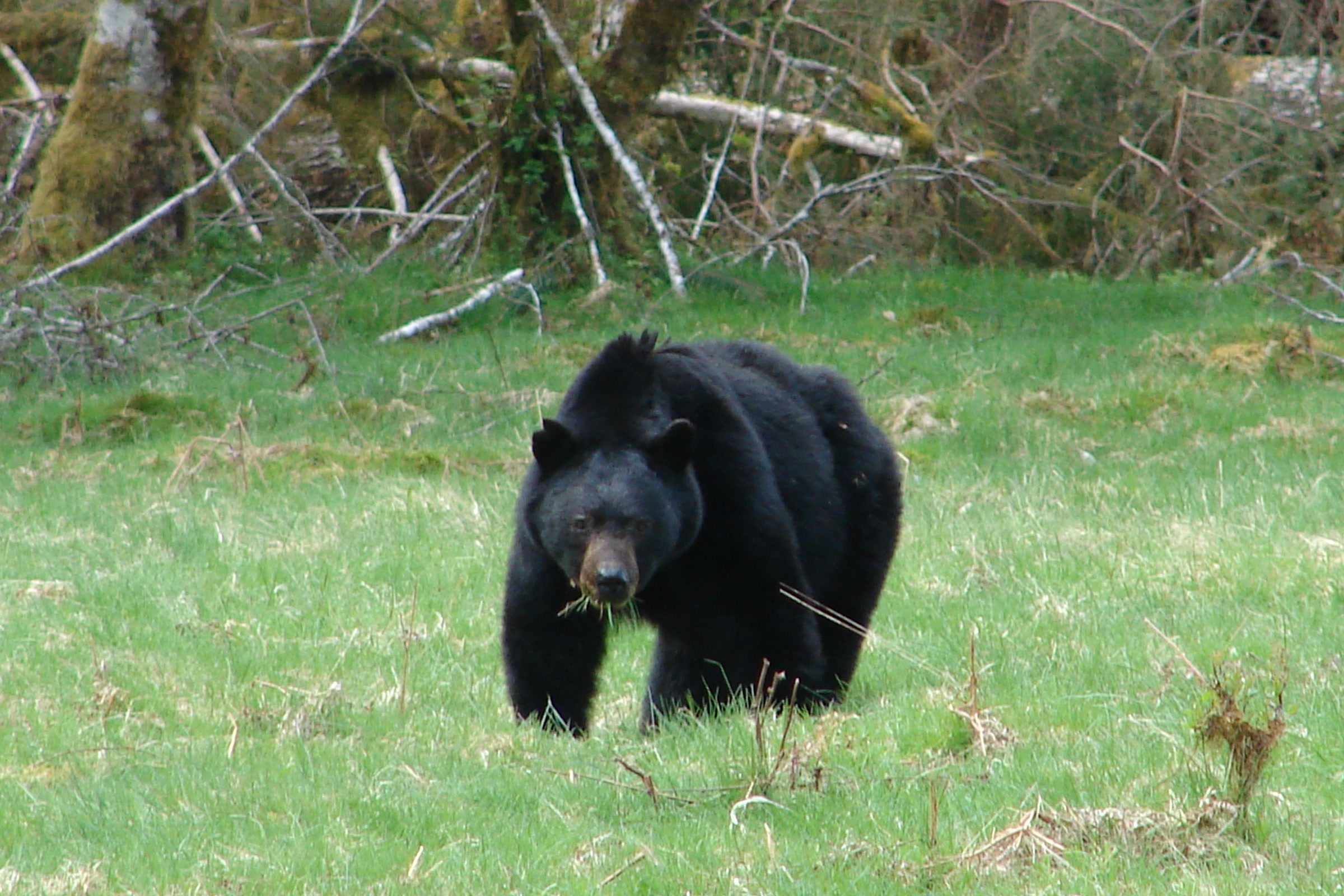
    Black bears in Olympic National Park are the only bears you will meet here. The park says they live in riparian, coastal, subalpine and forested areas, so a sighting can happen almost anywhere, from a river bar to a mountain meadow. Spotting one is a thrill, and a few simple habits keep that moment safe for you and for the bear.

    Quick answer

    What should you do if you see a black bear in Olympic National Park?

    Stay at least 100 feet away and never approach; if a bear notices you, talk calmly and loudly, stand your ground, slowly wave your arms and pick up small children. Don’t run or climb a tree. Back away slowly and sideways, leaving the bear an escape route. If a black bear attacks, fight back.

    • Black bears are the only bear species in the park
    • Keep 100 feet, or three bus lengths, from any bear
    • Store food in a hard sided vehicle, food locker or approved container
    • Report bears that get food or approach people to a ranger

    Meet the black bears in Olympic National Park

    Don’t let the name fool you. The Washington Department of Fish and Wildlife (WDFW) says black bears can be black, brown, blond, cinnamon or rust, and black or brown with a light brown snout is most common. In Washington they average 100 to 300 pounds, with males larger than females, and stand about 2.5 to 3 feet at the shoulder on all fours.

    The park does not give a population count on its black bear page, and we won’t guess one. Statewide, WDFW estimates about 22,000 black bears across all land ownerships, cubs included. Grizzlies are not part of the picture here: WDFW says Washington’s grizzly populations are limited to the northeast of the state.

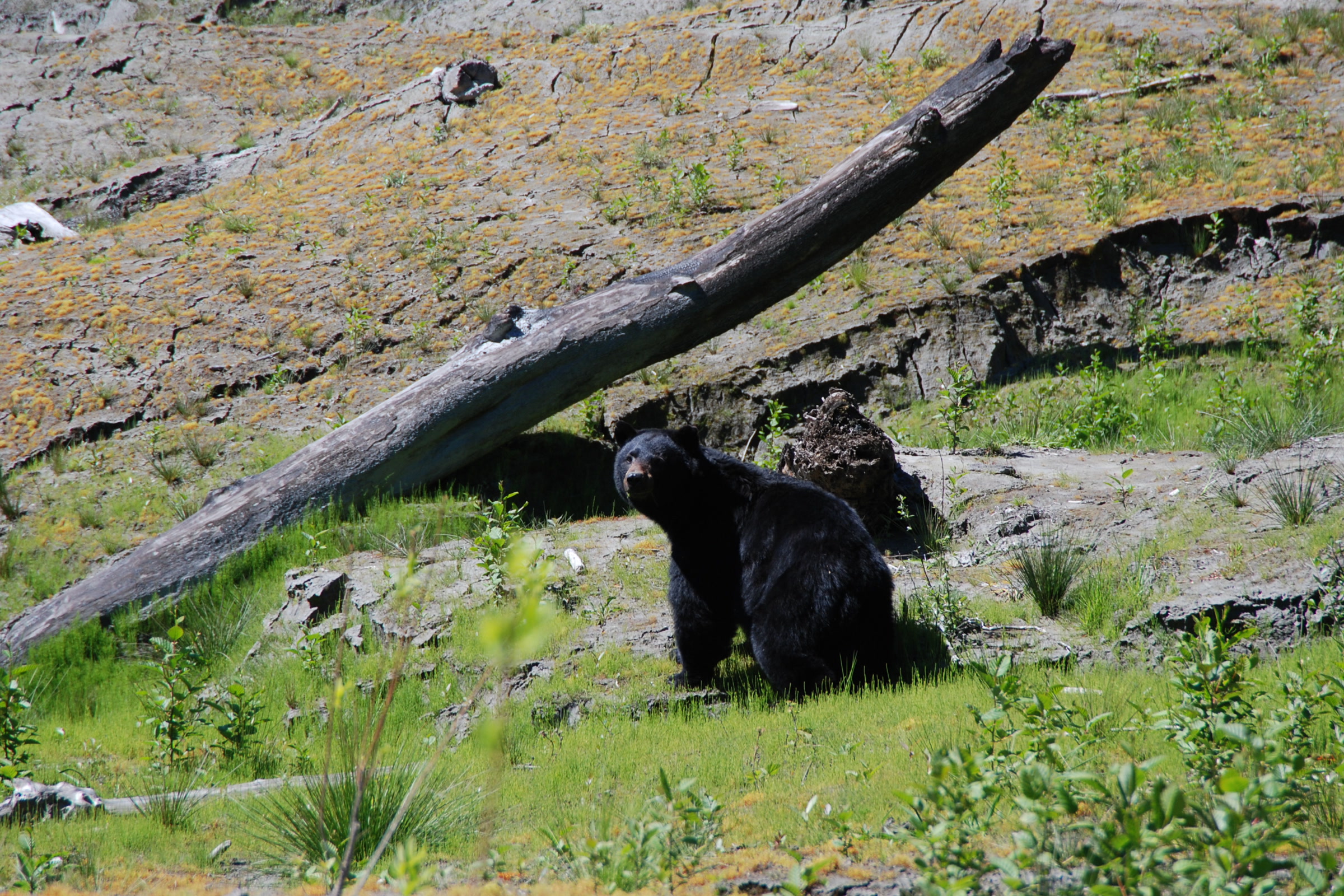
    A black bear among low plants and a fallen log at Lake Mills in the Elwha valley, photographed in May 2013
    A black bear at Lake Mills in the Elwha valley, May 2013. NPS Photo

    Lake Mills, where this bear was photographed, was one of two Elwha reservoirs drained when the dams came out. Our guide to Elwha River restoration tells that story.

    What bears eat through the year

    Their menu follows the seasons, as the park’s black bear page describes.

    A black bear’s year in Olympic

    SeasonWhat bears are doing
    Before berries ripenFeeding on tree sapwood, young bark and insect mounds until berries ripen
    Spring and fall salmon runsFishing in shallow water and eating salmon carcasses
    Late summer to fallGrazing berries, nuts and seeds; often raiding huckleberries on mountain slopes in early fall
    WinterHibernating for several months, breathing about once every 45 seconds
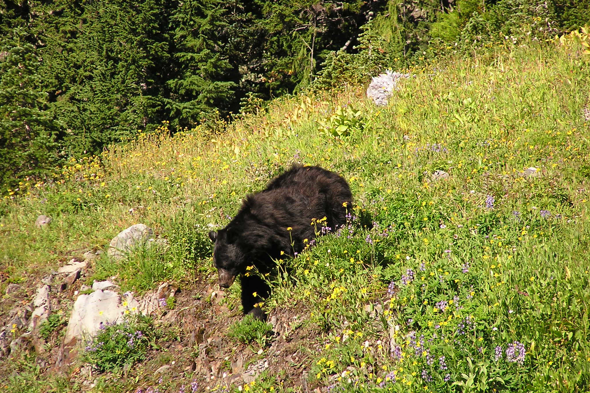
    A black bear feeding on a steep subalpine slope of grass and wildflowers near Heart Lake in Olympic National Park
    Feeding on a subalpine slope near Heart Lake. NPS Photo

    That variety matters to the whole forest. Undigested seeds pass through bears and sprout in their scat, bears tear into fallen logs for insects, and they scavenge carcasses, returning nutrients to the soil. WDFW adds a caution: bears may look for food near people in early spring, before natural foods are ready, and in late fall as they fatten for winter.

    Bear safety in Olympic National Park: avoiding trouble

    Good bear safety starts before you see one. The park asks every visitor to:

    • Never feed bears. Secure all food, trash and scented items in a hard sided vehicle, a park food locker or a park approved animal resistant food container.
    • Give bears space. Stay at least 100 feet, or three bus lengths, away. If you see a bear near the road, stay in your vehicle.
    • Travel in groups and make noise so you don’t surprise a bear. WDFW notes that simply talking will do the trick.
    • Keep children and pets close. Children stay between adults and dogs stay on leash; our guide to dogs in Olympic National Park explains where pets may go.
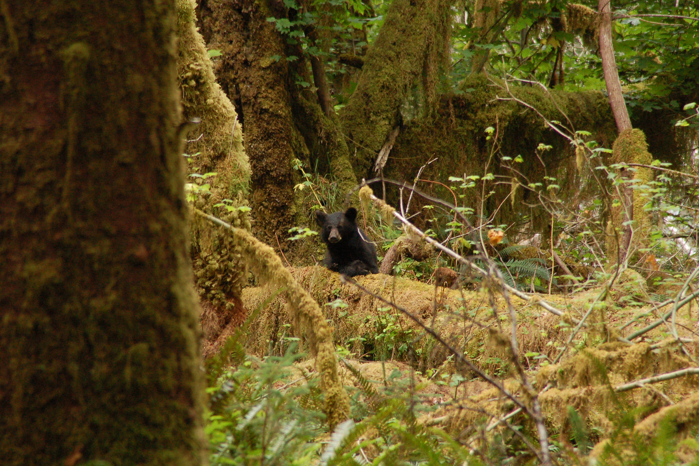
    A small black bear half hidden among mossy trunks and ferns in the Hoh Rain Forest
    Easy to miss: a bear in the Hoh Rain Forest. NPS Photo / J. Preston

    Camping overnight? Approved bear canisters are required for wilderness trips, and our Olympic National Park wilderness permit guide covers the rules and where to borrow one. On the coast, raccoons are the usual raiders, which our Leave No Trace guide to the Olympic coast explains.

    What to do if you see a bear

    Here is what to do if you see a bear while hiking, in the order the park lists it:

    1. Talk calmly and loudly so the bear knows you are a human, not prey.
    2. Stand your ground and slowly wave your arms. A bear standing on its hind legs is usually curious, not threatening.
    3. Pick up small children.
    4. Keep your food away from the bear, and don’t drop your pack; it protects your back.
    5. If the bear stays put, move away slowly and sideways, keeping it in view.
    6. Leave the area or detour. If you can’t, wait for it to move on, and always leave it an escape route.

    If a black bear charges or attacks

    Stay calm, stamp your feet and make yourself as big as possible. Bears may bluff charge and turn away at the last second, and if you carry bear spray, use it. WDFW says a spray with 1.3 to 2 percent capsaicin works when sprayed into the bear’s face within 20 to 30 feet.

    Don’t run: bears can run up to 35 mph, says WDFW, and the park notes that, like dogs, they chase fleeing animals. Don’t climb a tree either, because black bears climb well. If a black bear attacks, fight back and aim for the eyes and nose. Unlike the advice for grizzlies, the NPS says not to play dead with a black bear.

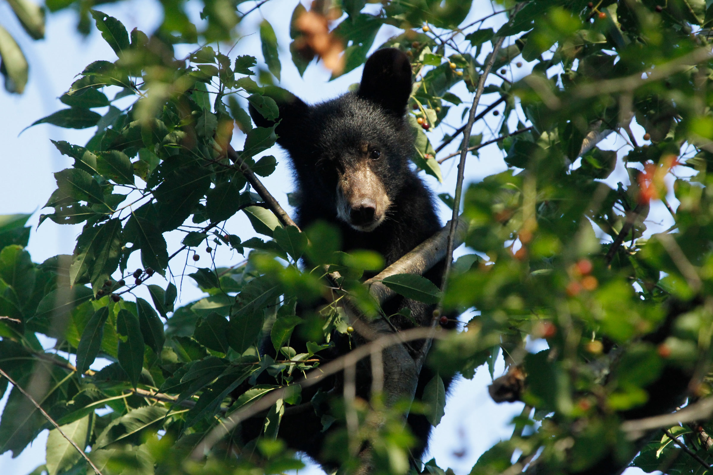
    A young black bear perched high in a leafy tree in Shenandoah National Park
    Why climbing a tree won’t help: black bears are expert climbers. Photographed in Shenandoah National Park, not Olympic. NPS Photo / D. Machado

    Mothers with cubs

    Be especially careful around a female with cubs. Never put yourself between a mother and her cub. The park warns that the chance of an attack rises sharply if she sees you as a danger to her young.

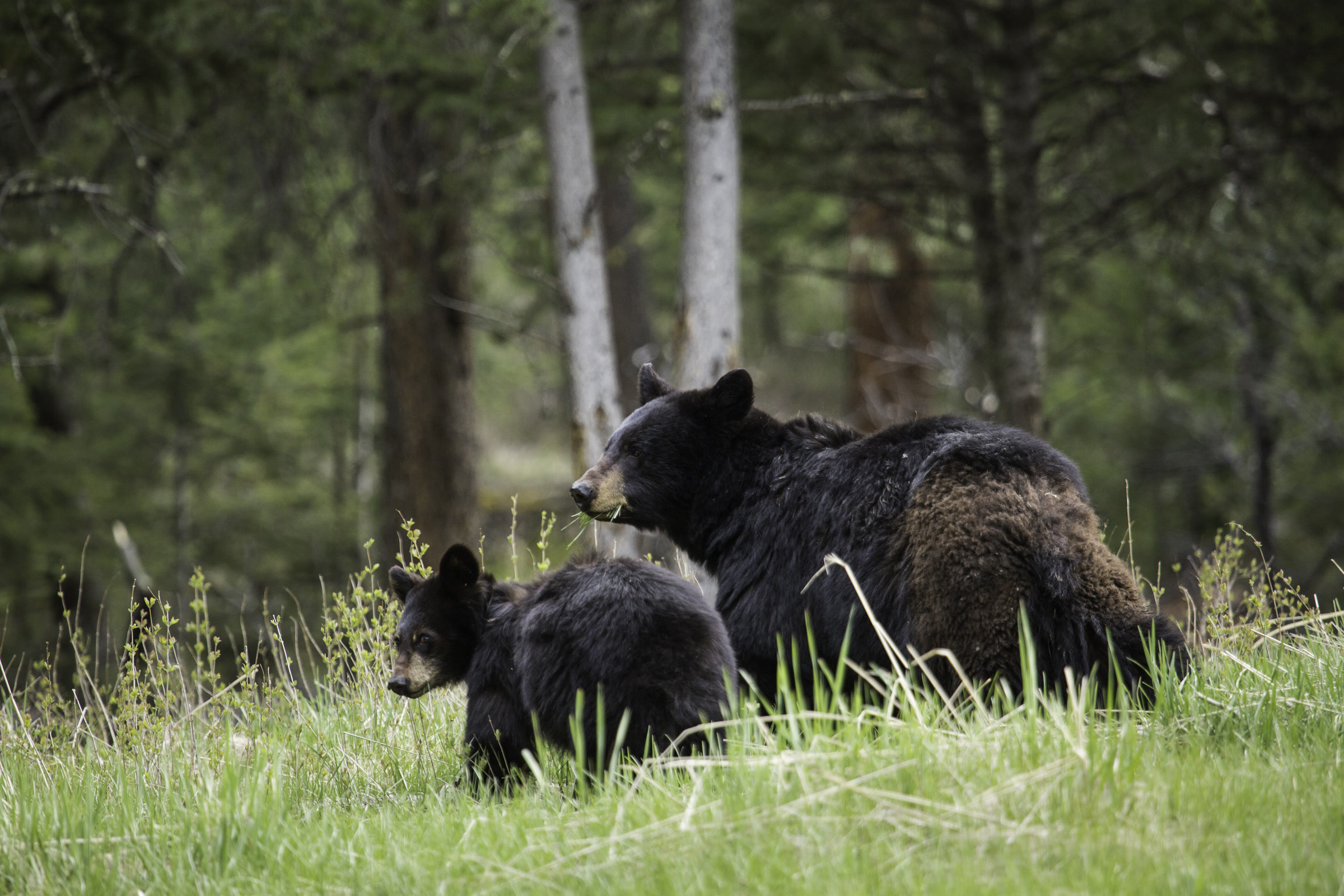
    A black bear mother with her cub in tall grass at the edge of a pine forest near Tower Fall in Yellowstone National Park
    A mother and cub, photographed in Yellowstone National Park, not Olympic. NPS Photo / Neal Herbert

    A fed bear is a dangerous bear

    WDFW reports that over 90 percent of human and bear conflicts happen because bears learn to link people with food. Olympic has seen it happen. In April 2015 the park closed the Enchanted Valley to camping after black bears got human food and approached hikers without fear, and the superintendent warned that such bears are extremely dangerous.

    Camping reopened about seven weeks later, once rangers and biologists found that bear behaviour had returned to normal, with bear canisters required. If a bear gets food, damages property, approaches you or enters your campsite, tell a park ranger or fill out the park’s online wildlife report.

    A black bear with its head in a tipped over trash can, surrounded by scattered food containers at a campground in Shenandoah National Park
    What we never want to see: a bear in campground trash, photographed in Shenandoah National Park. NPS Photo

    How Friends of Olympic National Park helps

    We are Friends of Olympic National Park (FONP), a volunteer led friends group based in Port Angeles. WDFW lists access to trash among the top causes of bear conflicts, and our beach cleanups in Olympic National Park and Visitor Center cleanups help clear it away. You can volunteer at Olympic National Park with us, or support Olympic National Park with a gift that keeps that work going.

    Frequently asked questions

    Are there grizzly bears in Olympic National Park?

    No. The park says black bears are the only bear species found in Olympic National Park. WDFW says grizzly populations in Washington are limited to the northeast of the state.

    How close can you get to a bear in Olympic National Park?

    Stay at least 100 feet, or about three bus lengths, from any bear, and never approach one.

    Should I carry bear spray in Olympic National Park?

    The park advises using bear spray if you have it and a bear charges, and WDFW says most experts recommend carrying it in bear country. Choose an EPA approved spray made for bears.

    Do I need a bear canister in Olympic National Park?

    Yes, for overnight wilderness trips. Approved animal resistant food containers are required in the park wilderness. In campgrounds, store food in a hard sided vehicle or a park food locker.

    Should you play dead if a black bear attacks?

    No. The National Park Service says not to play dead with a black bear. Fight back, aiming for sensitive areas such as the eyes and nose, or escape to a car or building if you can.

  • Kalaloch Tree of Life: A Spruce Hanging On

    Kalaloch Tree of Life: A Spruce Hanging On

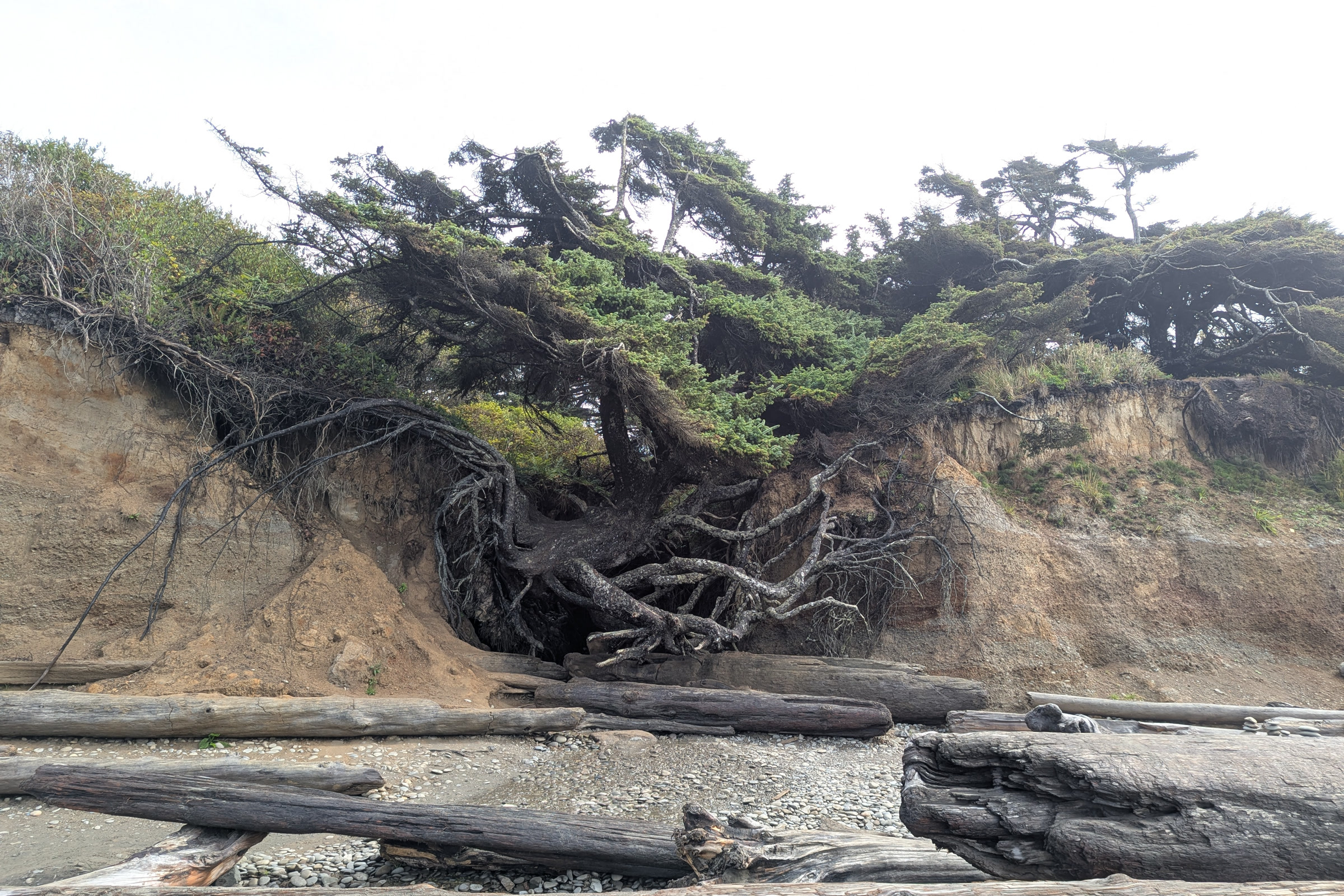
    The Kalaloch Tree of Life is a Sitka spruce that hangs on the edge of an eroding bluff above Kalaloch Beach, on the southern coast of Olympic National Park. A small creek has washed the ground out from under it, so its roots span an open hollow that many visitors call the tree root cave. Here is what is holding it up, how it has changed since recent storms, and how to see it with care.

    Quick answer

    What is the Kalaloch Tree of Life?

    The Kalaloch Tree of Life is a Sitka spruce on an eroding bluff at Kalaloch Beach in Olympic National Park, north of Kalaloch Lodge near the campground. A creek has carved the soil from beneath it, leaving roots spanning a hollow. Winter storms in 2024-25 dropped it about five feet, but recent reports say it still clings on.

    • A Sitka spruce, about 40 feet tall, with no official name
    • Near a staircase from Kalaloch Campground to the beach
    • Dropped about five feet in storms around January 2025
    • The park does not plan to prop it up or fence it off

    Where to find the Tree of Life on Kalaloch Beach

    Kalaloch sits right off Highway 101 on the park’s southwest coast. The tree grows just north of Kalaloch Lodge, near Kalaloch Campground, and a 2023 Seattle Met feature placed it about 50 yards from a staircase that runs from the campground down to Kalaloch Beach. You won’t find it on any park map or brochure, and it has no official name.

    Kalaloch Campground is open all year, and sites fill quickly in summer; our guide to Olympic National Park campgrounds compares it with the others. Our Ruby Beach visitor guide covers the next stop north on Highway 101.

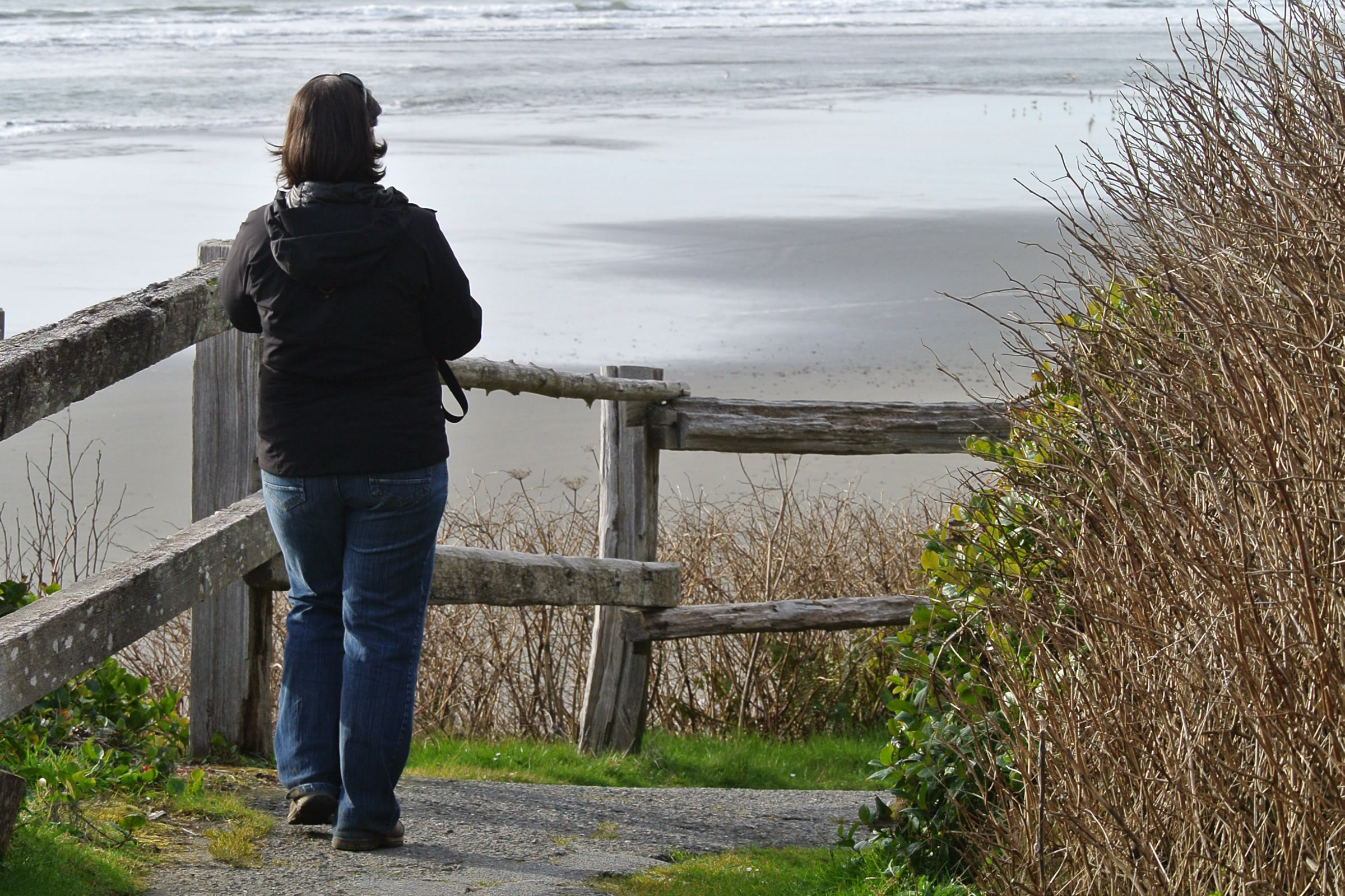
    A visitor seen from behind at a weathered wooden railing where the beach access path from Kalaloch Campground meets the sand
    Trails from the campground and lodge lead down to the beach. NPS Photo / C. Bubar

    Coming from Forks? As of October 2026, the US 101 Hoh River Bridge south of Forks is down to one alternating lane, with overnight full closures scheduled for repairs. When it is closed you cannot drive south from Forks to Kalaloch, so check the WSDOT Hoh River Bridge project page before you set out.

    How the tree root cave formed

    The tree stands above a small creek that drains the bluff onto the sand. Seattle Met reported that a culvert built in the 1960s to move water through the campground sent that flow toward the beach, where it carved a little canyon beneath the spruce. Over time the soil washed away, and the roots were left reaching across the gap.

    The ocean works on it too. Janet Coles, then the park’s vegetation branch chief, told the magazine that structures built along the bluffs to slow erosion tend to increase it where they end, which is at the tree. In her words, it has been “taking it from both sides”: creek water from behind and waves from the front.

    Grey snags and bare root wads along the foot of the eroding sandy bluff below Kalaloch Campground, with drift logs scattered on the beach
    The soft bluff below Kalaloch Campground in June 2018. Photo: King of Hearts / Wikimedia Commons (CC BY-SA 4.0)

    Why the Kalaloch Tree of Life still stands

    Part of the answer is simple: not all of it is hanging in the air. In 2023, Coles estimated that about a third of the root system still gripped the earth on the inland side. The News Tribune described the spruce itself as thick and squat, its limbs bent by decades of storms and wind.

    Then came the winter of 2024-25. The News Tribune reported in January 2025 that waves and creek water had greatly enlarged the cavity and that the tree had dropped about five feet into the gully, with its roots now resting on drift logs. By March 2025, SFGate reported that visitors could no longer stand directly beneath it.

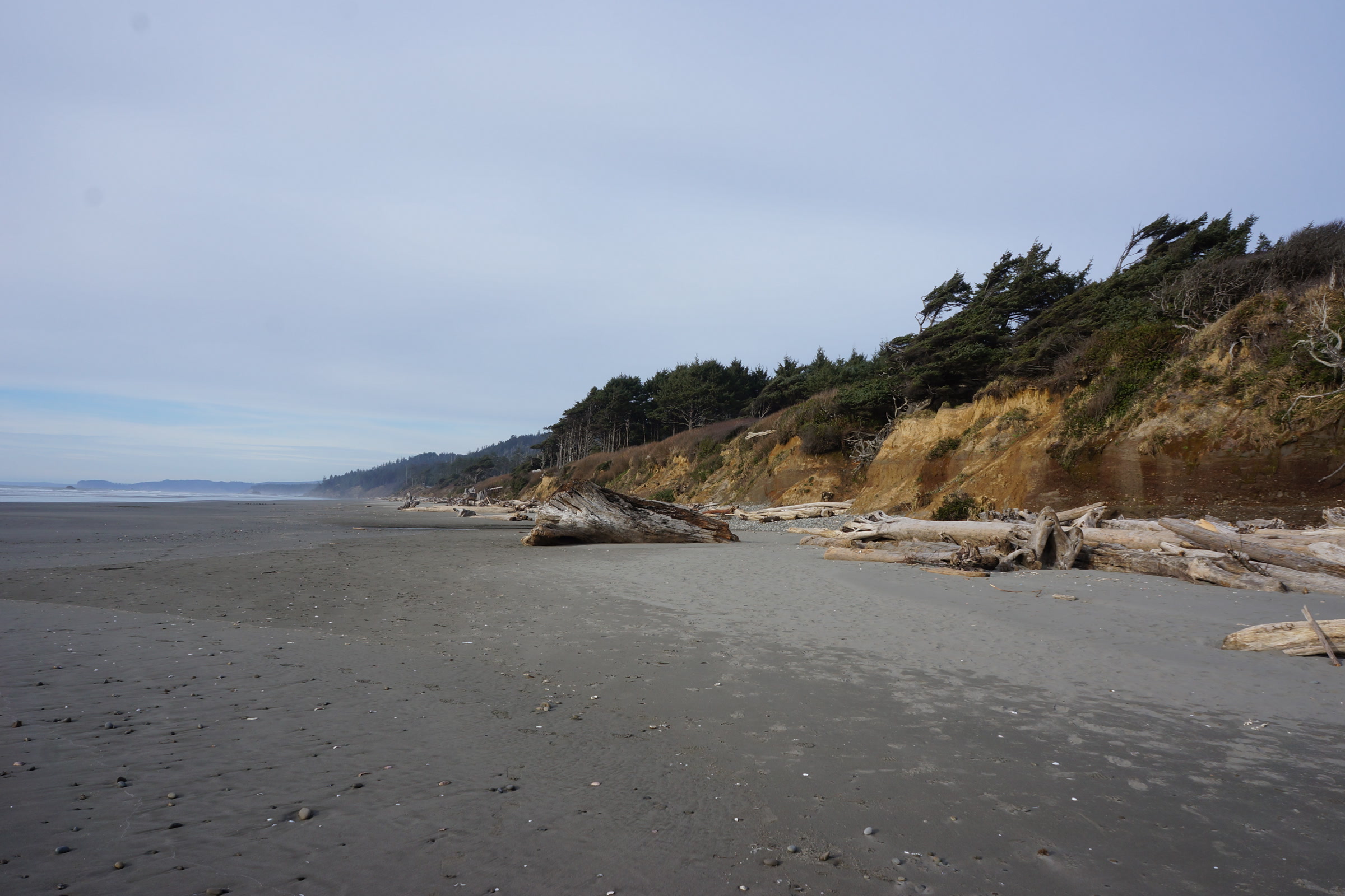
    A wide grey sand beach at Kalaloch with drift logs at the foot of a low forested bluff under an overcast sky
    The bluff and beach below Kalaloch Campground. NPS Photo / R. McKenna

    Today the Kalaloch Lodge website says the ground beneath the tree continues to erode and its branches show signs of decline. False rumours of its fall have spread online before, so trust recent photos over social media posts.

    How the tree and bluff have changed

    WhenWhat happenedReported by
    1960sCampground culvert sends water toward the treeSeattle Met
    2023About a third of the roots still grip the bluffSeattle Met, quoting the park
    Dec 2023 to Jan 2024Over four meters of bluff collapse in placesNational Park Service
    March 2024Ten lodge cabins near the edge removedNational Park Service
    January 2025Tree drops about five feet into the gullyThe News Tribune
    March 2025No longer possible to stand beneath itSFGate

    A bluff on the move at Kalaloch

    In March 2024 the park announced it was removing ten Kalaloch cabins that sat within five meters of the bluff edge, after over four meters of bluff collapsed in some areas that winter. The park’s news release blamed higher than usual tides, winter storms and freeze thaw cycles working on loose sand, gravel and stone, and said this natural erosion has sped up over the past decade.

    Ian Miller, a coastal hazards specialist with Washington Sea Grant, told SFGate in 2025 that bluffs south of Kalaloch Creek, nearer the lodge, have retreated as much as 3.5 feet a year. Once a bluff is gone, he said, it can’t be repaired.

    Kalaloch Creek winding through drift logs to the Pacific beside a forested headland under a clear blue sky
    Kalaloch Creek meets the ocean between the campground and the lodge. Photo: Joe Mabel / Wikimedia Commons (CC BY-SA 4.0)

    The park has chosen not to prop the tree up, add earth beneath it or rope it off. “We’ll let what passes for nature take its course,” Coles said in 2023.

    How to visit the Tree of Life safely

    Photos online show people climbing the roots and even hanging hammocks beneath them. Please don’t: every footstep loosens the soil the tree depends on.

    • Look, don’t climb. Stay off the roots and out of the hollow. Coles said she personally would not stand beneath the tree.
    • Check the tides. The park says to always check the tides before walking the coast; tide charts are posted at the Kalaloch Information Station.
    • Stay off beach logs. The NPS warns that powerful waves can roll and tumble driftwood logs, especially at high tide.
    • Keep back from the bluff edge, above and below. Loose sand and gravel can give way without warning.
    A visitor in a red jacket standing on a jumble of large drift logs piled at the top of Kalaloch Beach below the bluff
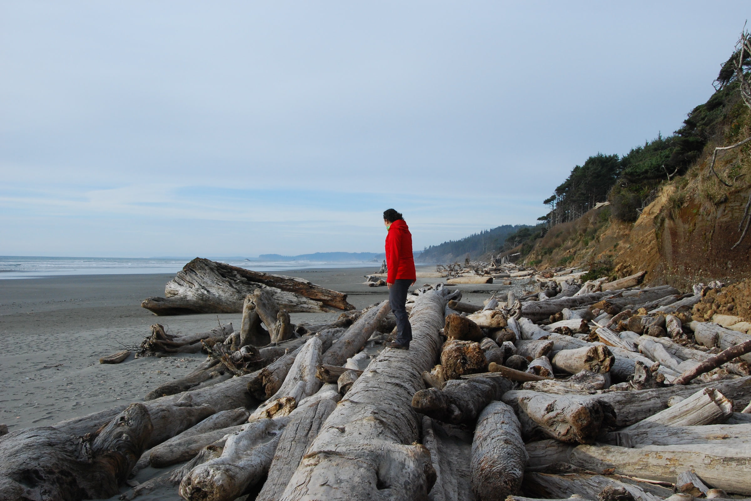
    Drift logs pile up below the Kalaloch bluff; waves can move them at high tide. NPS Photo / D. Archuleta

    Our Leave No Trace guide for Olympic coast beaches covers the rest, from packing out trash to camping rules. Low tide is also a good time to explore nearby, and our tide pools guide explains how to do it gently.

    Destruction Island and its lighthouse on the horizon beyond breaking waves, seen from Kalaloch Campground in February 2025
    Destruction Island from Kalaloch Campground, February 2025. Photo: Chris Light / Wikimedia Commons (CC BY-SA 4.0)

    How Friends of Olympic National Park helps

    We are Friends of Olympic National Park (FONP), a volunteer led friends group based in Port Angeles. Kalaloch is close to our hearts: in April 2026 our volunteers held a Kalaloch beach cleanup, part of our ongoing beach cleanups in Olympic National Park. If places like this matter to you, become a member and help us keep caring for the coast.

    Frequently asked questions

    Is the Kalaloch Tree of Life still standing?

    Recent reports say yes, but barely. Storms dropped it about five feet in early 2025, and the Kalaloch Lodge website says the ground beneath it keeps eroding. False rumours of its fall have spread before, so check recent photos or ask park staff.

    Where is the Tree of Life at Kalaloch?

    It is on Kalaloch Beach in Olympic National Park, just north of Kalaloch Lodge near Kalaloch Campground, about 50 yards from a staircase that runs from the campground to the beach. It is not marked on park maps.

    Why is it called the tree root cave?

    A small creek drains the bluff beneath the tree. Its water, plus winter waves, has carved away the soil, leaving the spruce roots spanning an open hollow that looks like a cave.

    Can you climb on the Tree of Life?

    Please don’t. Climbing loosens the soil the roots still grip, and the undercut bluff is unstable. The park does not fence the tree off, so its survival depends on visitors looking without touching.

  • Ruby Beach: What to Know Before You Go

    Ruby Beach: What to Know Before You Go

    Ruby Beach is the northernmost beach access in the Kalaloch area of Olympic National Park, right off US 101 about 7.5 miles north of Kalaloch. A short, steep trail drops from the parking area to a shore of sea stacks, drift logs and the mouth of Cedar Creek, with Abbey Island standing just offshore. Here is what to expect, how the rocks got there and when to go.

    Quick answer

    What should you know before visiting Ruby Beach?

    Ruby Beach is on US 101, 7.5 miles north of Kalaloch in Olympic National Park. A 735 foot trail drops steeply from the parking area to sea stacks, Cedar Creek and Abbey Island. Visit around low tide, keep off drift logs in the surf, and keep dogs leashed. The lot has restrooms and an accessible overlook.

    • Beach trail is 735 feet of compacted gravel
    • The only park beach trail wide enough for a wheelchair
    • Named for red garnet crystals in the sand
    • Leashed dogs are allowed on the beach

    Getting to Ruby Beach and down the trail

    The parking area sits right beside US 101, where the highway meets the coast heading south from the Hoh River. It is a sloped gravel lot with two vault toilets in the middle and an accessible overlook at the north end. The Washington Trails Association’s hike guide puts room for about two dozen cars in the lot, with overflow along the entrance road.

    According to the park’s Ruby Beach accessibility details, the trail runs 735 feet on compacted gravel, mostly 4 to 5 feet wide. It starts steep, with grades of 10 to 20 percent and several drain dips, then eases near the bottom; there is a bench at the first switchback. It is the only beach access in the park wide enough for a wheelchair, though winter swells keep rearranging the logs where the trail meets the sand.

    The view from the Ruby Beach trail through coastal trees down to the beach, the creek and Abbey Island
    The first view of the beach from the trail. Photo: KimonBerlin / Wikimedia Commons (CC BY-SA 2.0)

    Ruby Beach sea stacks and how they formed

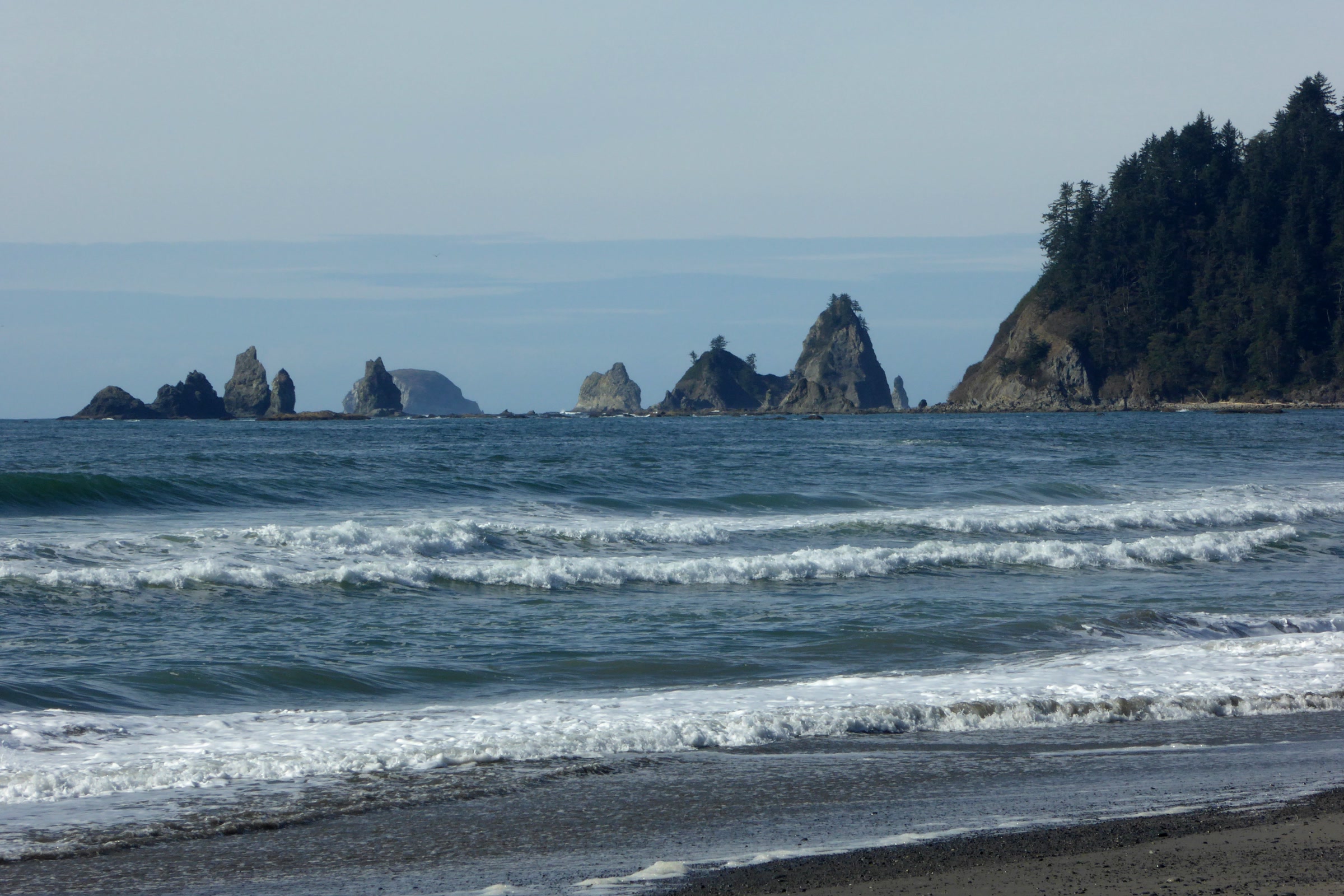
    The Ruby Beach sea stacks are pieces of old coastline that the ocean has not yet worn away. The Washington Geological Survey describes them as part of the Hoh assemblage, volcanic rock and debris flow deposits laid down under the sea in the Miocene, then buried, hardened, squeezed and lifted by tectonic forces. As the ocean slowly wore that old shoreline back, the stacks were left standing.

    A state geology bulletin, Washington Department of Natural Resources Bulletin 66 by Weldon Rau, splits the beach in two. South of Cedar Creek, the cliffs and stacks are badly fractured sandstone whose cracks later filled with calcite, leaving thin white veins. North of the creek, Abbey Island and the nearby stacks are mostly volcanic breccia, formed when volcanic material erupted onto the sea floor and cooled fast.

    Dark sea stacks standing on the sand at Ruby Beach behind a pile of drift logs, with a forested bluff and a distant headland
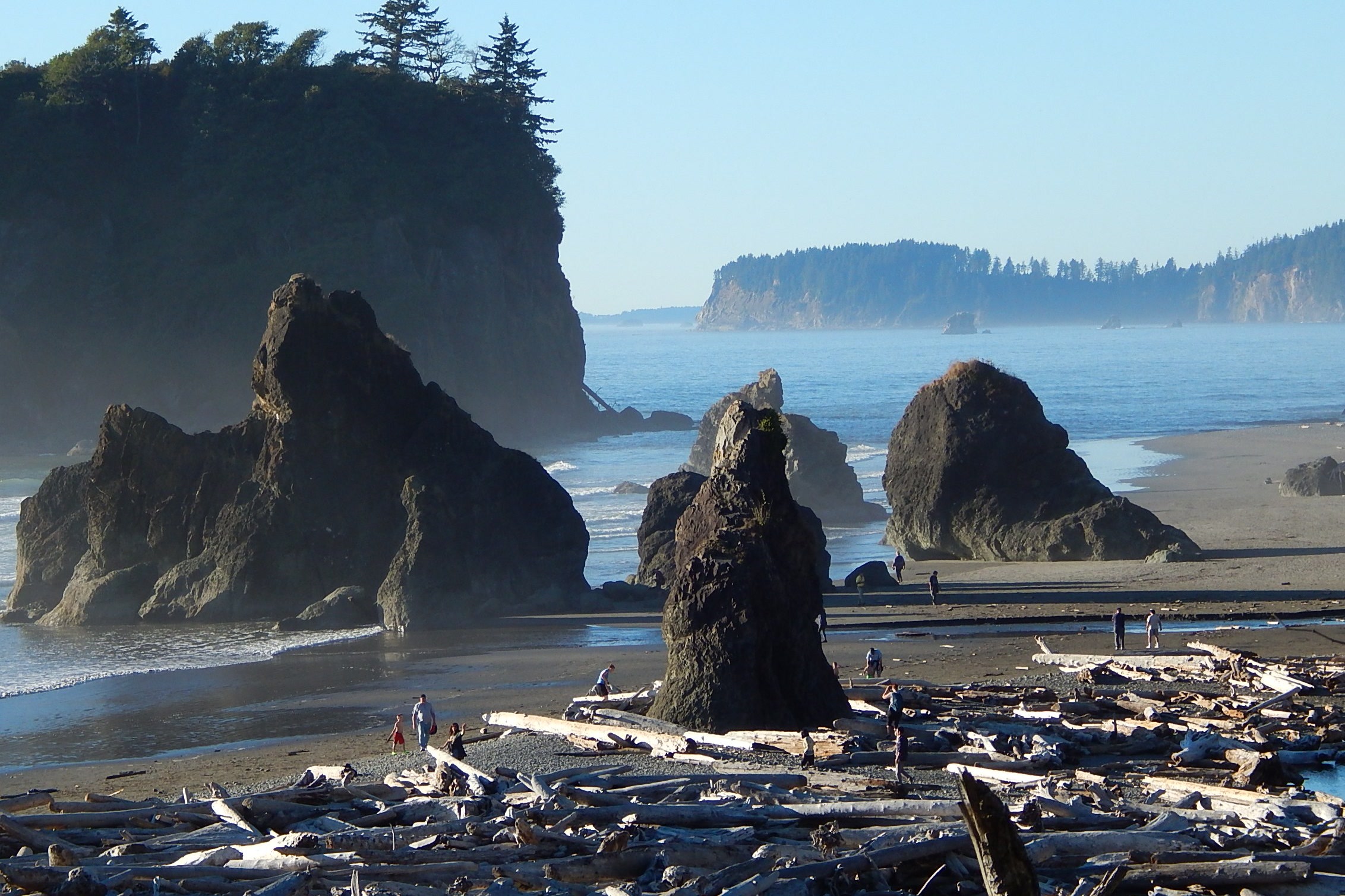
    Sea stacks above the drift logs. Photo: Ron Clausen / Wikimedia Commons (CC BY-SA 4.0)

    Why it’s called Ruby Beach

    The same bulletin explains the name: reddish patches of sand coloured by concentrations of small, heavy garnet crystals. Look along the cliffs as well. A level line on top of the bedrock marks an Ice Age wave cut surface, and old piddock clam borings sit about 50 feet above today’s sea level.

    Abbey Island, Cedar Creek and Destruction Island

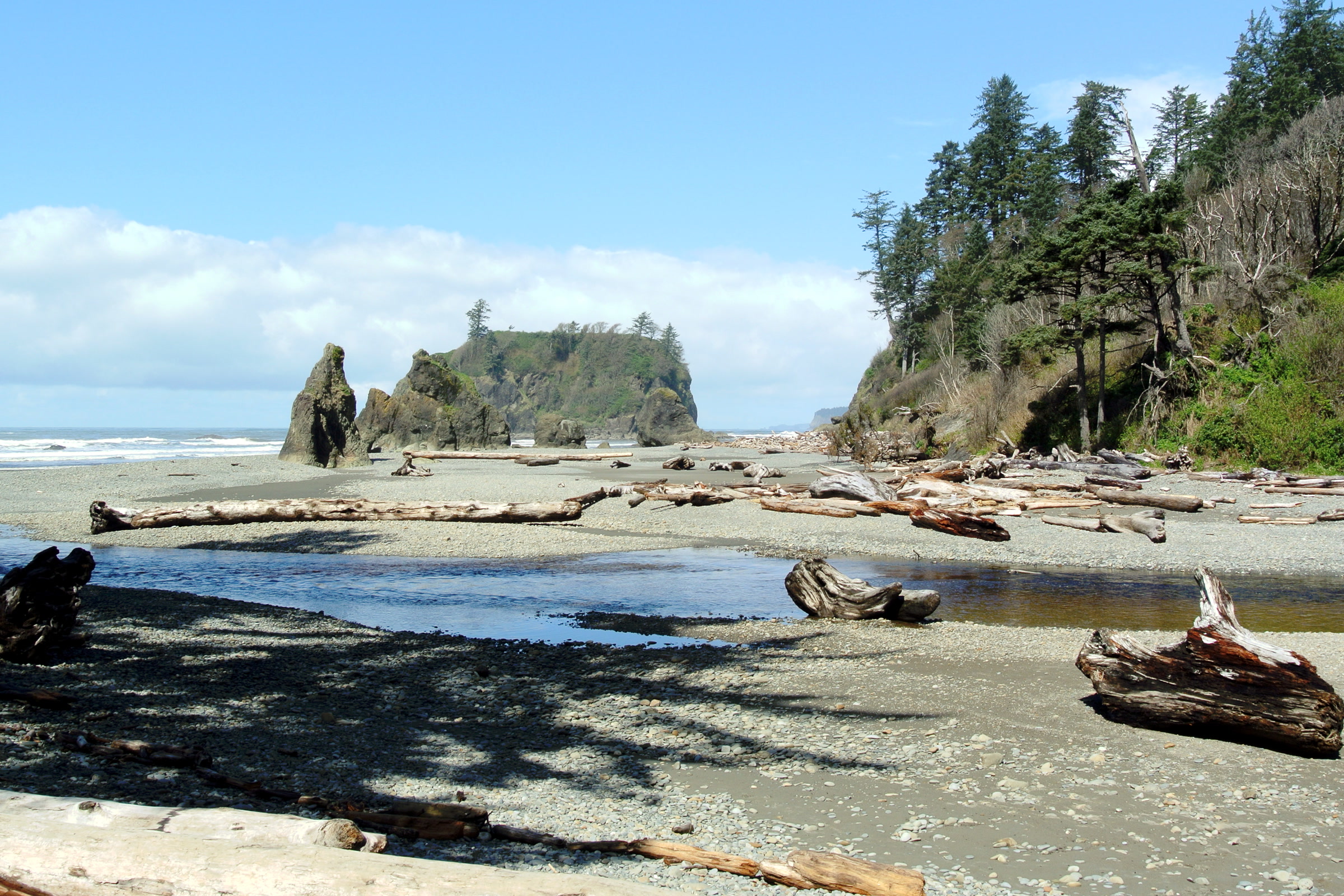
    Cedar Creek meets the Pacific at Ruby Beach, cutting a shallow channel across the sand below the trail. Abbey Island, the big tree topped rock just north of the creek mouth, is the beach’s signature view. The park notes that driftwood sometimes covers parts of the beach, so expect to clamber.

    Cedar Creek winding across Ruby Beach toward the ocean, with drift logs, sea stacks and Abbey Island beyond
    Cedar Creek and Abbey Island. Photo: Adbar / Wikimedia Commons (CC BY-SA 3.0)

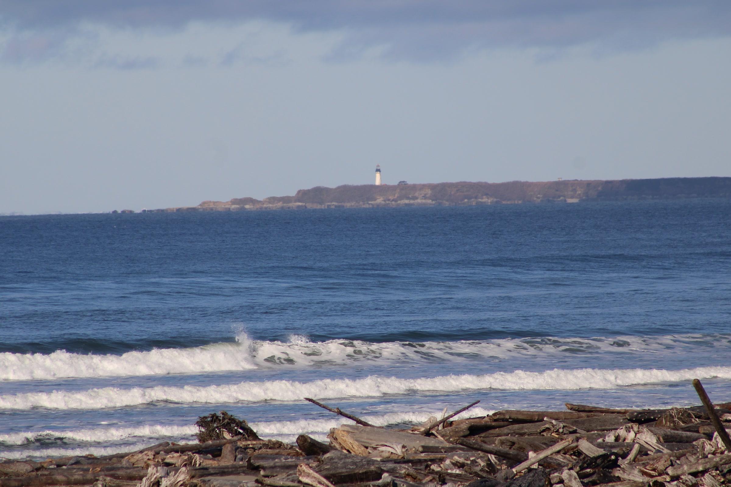
    Out on the horizon to the southwest is Destruction Island, a low island with an old lighthouse. It belongs to the Quillayute Needles National Wildlife Refuge, which President Theodore Roosevelt set aside in 1907 to protect seabirds. The park says common murres and tufted puffins nest on these offshore islands, so bring binoculars rather than trying to get closer.

    Low, flat Destruction Island on the horizon with its lighthouse tower, seen across the ocean from Ruby Beach
    Destruction Island and its lighthouse. Photo: Chris Light / Wikimedia Commons (CC BY-SA 4.0)

    The best time to visit Ruby Beach

    The best time to visit Ruby Beach is around low tide. More sand opens up around the stacks, Cedar Creek is easier to cross, and the tide pools at the rocks appear; our guide to Olympic National Park tide pools covers the pools and how to explore them gently. Tide charts are available at the Kalaloch Information Station.

    Because the beach faces west, late afternoon brings the stacks into silhouette. The Kalaloch area is open year round, but winter brings big swells that move logs and storms that push tides higher than predicted. Summer has the lowest tides and the most visitors, so arrive early: hikers report the small lot filling by around noon.

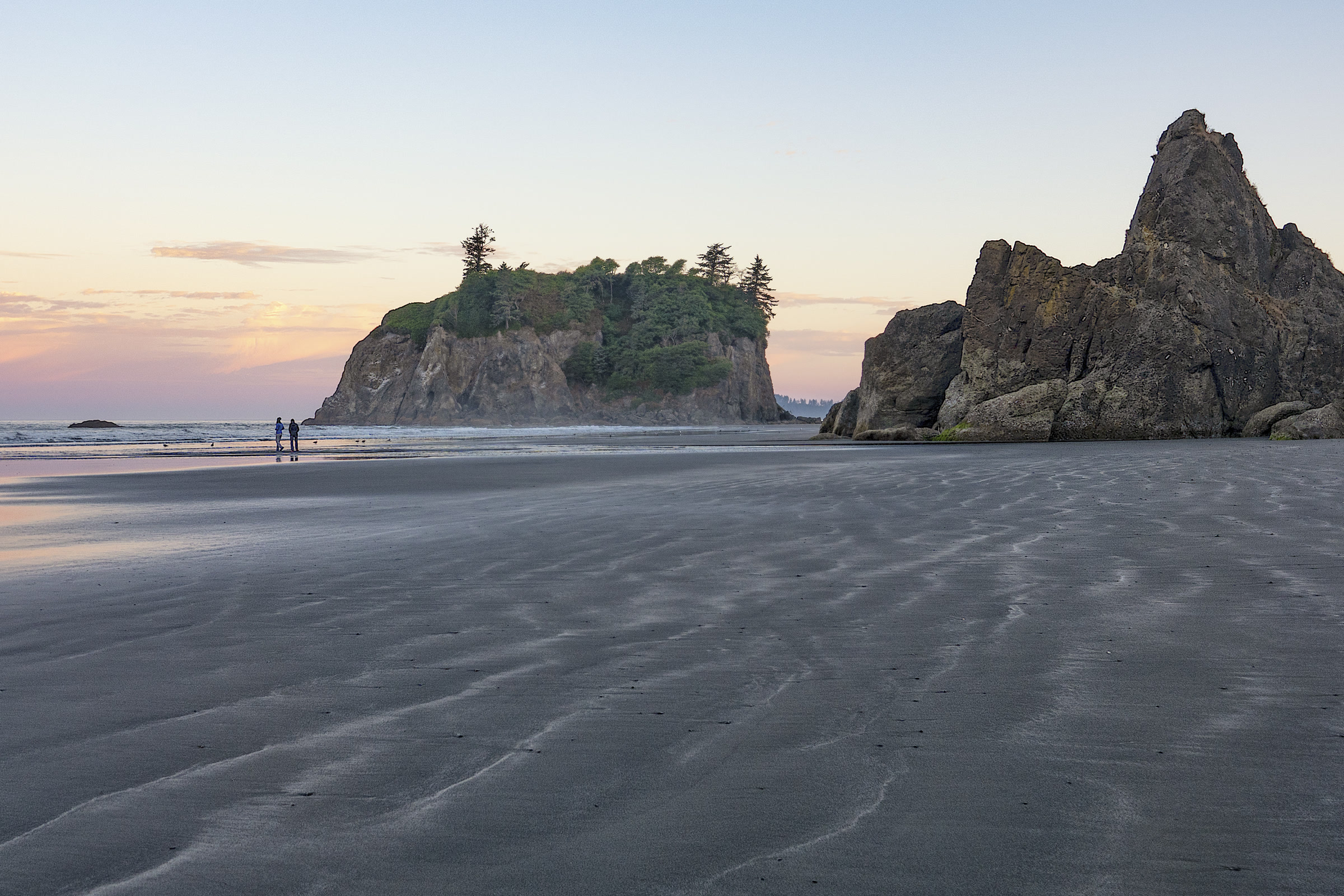
    Abbey Island and a jagged sea stack at Ruby Beach in soft evening light, with ripples in the wet sand and two small figures walking
    Wet sand and low light at Ruby Beach. Photo: John Fowler / Wikimedia Commons (CC BY 2.0)

    Staying safe on the logs and rocks

    The drift logs that make Ruby Beach so photogenic are also its main hazard. The park asks visitors not to play on beach logs, especially at high tide, because waves can roll and tumble them. Algae make the rocks very slippery, so test each step and keep children close.

    • Check the tide before you walk out around the stacks.
    • Stay off logs in or near the surf.
    • Keep dogs on a leash and off the tidal rocks.
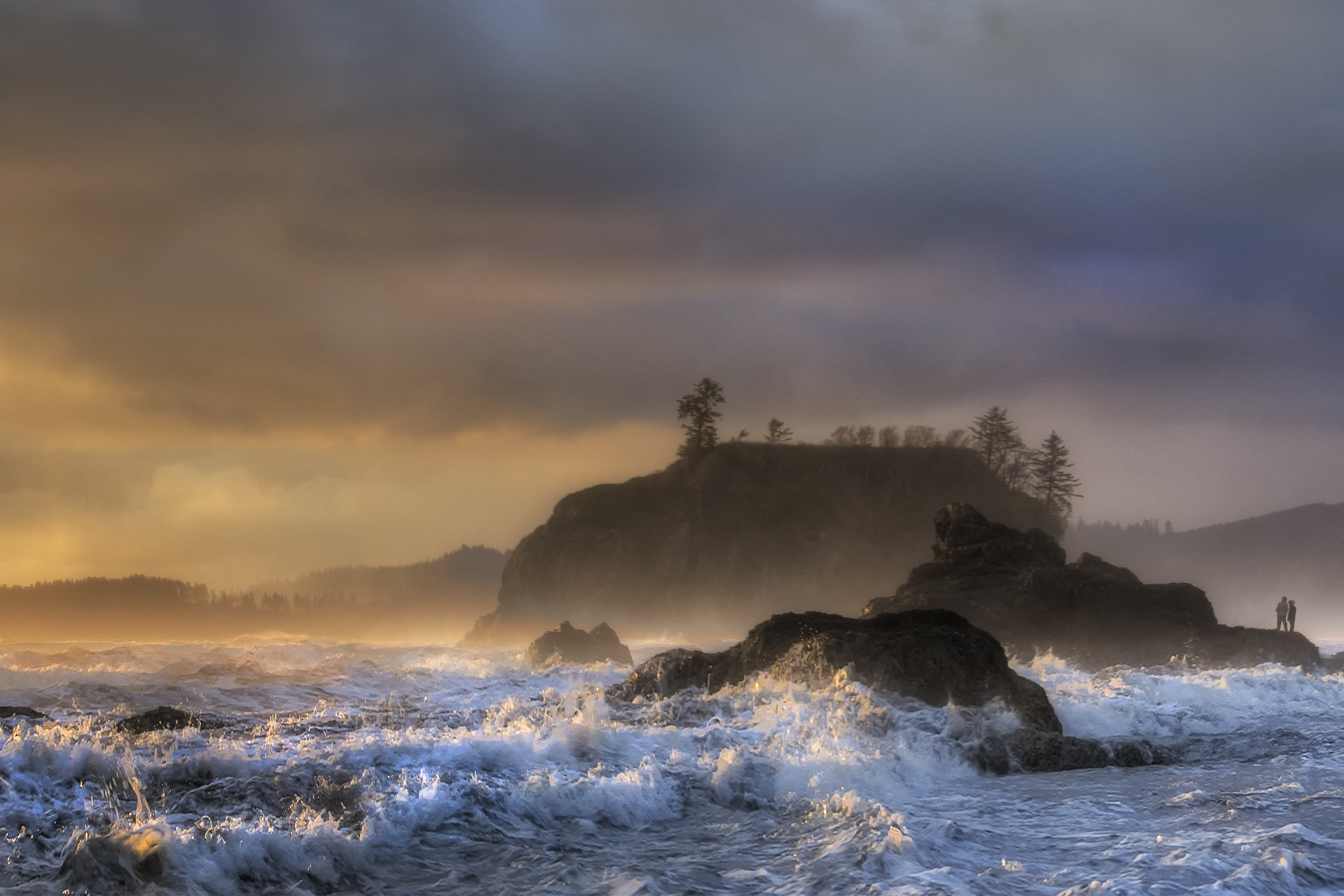
    Storm surf foaming around rocks at the north end of Ruby Beach under dark clouds lit gold by a low sun
    Storm surf at the north end of the beach. Photo: John Fowler / Wikimedia Commons (CC BY 2.0)

    Our Leave No Trace guide to Olympic coast beaches covers the wider coast rules, from fires to pets. Dogs are welcome at Ruby Beach on a leash, and our guide to dogs in Olympic National Park lists the rest of the park’s pet rules.

    Ruby Beach and nearby beaches compared

    BeachGetting to the sandKnown for
    Ruby Beach735 foot trail from US 101Sea stacks, Abbey Island, Cedar Creek
    Beach 4, KalalochShort trail from US 101Easy tide pools
    Rialto Beach200 foot path from the Mora Road lotDrift logs and the walk to Hole-in-the-Wall

    Kalaloch, 7.5 miles south, and nearby South Beach have the only campgrounds on the park’s southern coast, and Kalaloch also has a lodge and the clifftop tree described in our story of the Kalaloch Tree of Life. For a wilder day farther north, see our Rialto Beach and Hole-in-the-Wall guide.

    How Friends of Olympic National Park helps

    We are Friends of Olympic National Park (FONP), a volunteer led friends group based in Port Angeles. Our volunteers join beach cleanups in Olympic National Park, including our spring coastal cleanup in the Kalaloch area. To help keep beaches like Ruby clean, browse our volunteer opportunities.

    Frequently asked questions

    How long is the walk down to Ruby Beach?

    The park measures the trail at 735 feet from the parking area to the beach. It is compacted gravel but steep near the top, with drain dips and a bench at the first switchback.

    Why is it called Ruby Beach?

    A Washington Department of Natural Resources geology bulletin says the name comes from reddish patches of sand, coloured by concentrations of small red garnet crystals.

    Are dogs allowed at Ruby Beach?

    Yes. Pets are allowed at Ruby Beach and the other Kalaloch area beaches, but they must be on a leash at all times. Keep them off the tidal rocks.

    Is Ruby Beach wheelchair accessible?

    Partly. The parking area has an accessible overlook, and the park says the Ruby Beach trail is the only beach access wide enough for a wheelchair, though it is steep with drain dips and logs at the bottom.

  • Rialto Beach and Hole-in-the-Wall: A Visitor Guide

    Rialto Beach and Hole-in-the-Wall: A Visitor Guide

    Rialto Beach sits on the north side of the Quillayute River mouth, at the end of Mora Road west of Forks. It is a wild, rocky shore of giant drift logs, pounding surf and sea stacks, and the starting point for the beach walk to Hole-in-the-Wall. Here is how to get there, when to go and how to stay safe once you are on the sand.

    Quick answer

    How do you visit Rialto Beach and Hole-in-the-Wall?

    Rialto Beach is reached by Mora Road off La Push Road, less than 30 minutes from Forks. Hole-in-the-Wall, a sea arch 1.5 miles north, takes about an hour each way on the beach. Go at low tide, arrive 30 minutes before low tide, and stay well clear of drift logs in the surf.

    • Hole-in-the-Wall is 1.5 miles north of the parking area
    • Leashed dogs may go as far as Ellen Creek only
    • Overnight stays north of Ellen Creek need a wilderness permit
    • Mora Road was closed for repairs through October 15, 2026

    Getting to Rialto Beach

    From US 101 just north of Forks, head west on La Push Road (State Route 110), then turn right onto Mora Road and follow it past Mora Campground to the parking area at the road’s end. The park puts Forks less than 30 minutes away and Port Angeles about 75 miles away. Ruby Beach, Kalaloch and the Hoh Rain Forest are all within about an hour’s drive.

    At the trailhead you will find a paved picnic area and accessible restrooms. A 200 foot path leads to an ocean view, with a temporary accessible ramp in summer. Hikers’ trip reports describe the lot filling by midday on summer weekends, so an early start helps.

    The calm lower Quillayute River beside Rialto Beach, with drift logs on a gravel bar and a misty forested island beyond
    The Quillayute River separates Rialto Beach from La Push. NPS Photo / C. Bubar

    Mora Road closure, as of October 2026

    As of October 2026, the park’s current road and area conditions page lists Mora Road closed to all traffic beyond Mora Campground from July 8 to October 15, 2026, so Rialto Beach cannot be reached by road during the work. The repairs fix damage from 2019 flooding. Mora Campground stayed open, and the park suggested Ruby Beach as an alternative. Check that page before you go.

    The walk to Hole-in-the-Wall

    Hole-in-the-Wall is a sea carved arch about 1.5 miles north of the parking area, inside the Olympic wilderness. The park allows about an hour each way. The route is flat, but loose cobbles and sand make it tiring.

    Rialto Beach landmarks, walking north

    LandmarkDistance from parkingWhat to know
    Ocean view path200 feetSummer ramp; restrooms and picnic area nearby
    Ellen CreekAbout 0.8 mileCreek crossing; dogs turn back here
    Beach campsitesEllen Creek to Hole-in-the-WallWilderness permit and bear canister required
    Hole-in-the-WallAbout 1.5 milesArch and tidepools; reach it on a low tide

    Ellen Creek is the first real obstacle. The park lists it as a river crossing, so be ready to get your feet wet. Near the arch, the park says a pit toilet may be available just south of Hole-in-the-Wall, close to Split Rock.

    Split Rock, a twin sea stack on Rialto Beach, seen from above in morning light with drift logs piled along the shore
    Split Rock, a landmark near Hole-in-the-Wall. NPS Photo / D. Archuleta

    At the arch

    At low tide you can walk through the arch to the rocks beyond. Waves batter it constantly, so the park asks you not to cross once the tide begins to cover its floor. Falling rock is a real hazard here: don’t linger right next to or under the arch, and if you hear rock falling, cover your head and move away.

    For the pools around the arch, our guide to Olympic National Park tide pools covers what lives there and how to explore gently.

    Looking through the rock arch of Hole-in-the-Wall at low tide, with wet boulders on the floor and forest on the far side
    Through the arch at low tide. Photo: Roller Coaster Philosophy / Wikimedia Commons (CC BY 2.0)

    Timing the tide

    The tide decides your day here. Hole-in-the-Wall is easiest to pass on a low tide, and the park advises arriving at the arch at least 30 minutes before the lowest point, which means leaving the parking area about 90 minutes before it.

    For Rialto Beach tide times, use the predictions for NOAA’s nearby La Push, Quillayute River tide station. Strong winds and storms can push water higher than predicted.

    Big green waves breaking toward the steep shore at Rialto Beach, with a rocky sea stack on the horizon
    Surf at Rialto Beach in March. NPS Photo / D. Archuleta

    Staying safe around headlands and drift logs

    The park warns that beyond the arch some headlands cannot be rounded even at the lowest tides, so hikers going farther need a tide chart, a topographic map and the willingness to climb steep overland trails. Our Leave No Trace guide to Olympic coast beaches explains headland routes, fires and camping rules in detail.

    The park says powerful waves can roll and tumble the giant drift logs, and asks visitors not to play on beach logs, especially at high tide. The National Weather Service adds that a wet log can weigh hundreds of pounds and that people have been crushed beneath them.

    • Stay off logs in or near the surf line.
    • Watch the ocean for a while before walking out, and never turn your back on it.
    • Keep children close and well back from the water.
    A large drift log with its root wad being lifted by breaking surf on Rialto Beach under a grey sky
    Waves can lift and roll even huge logs. NPS Photo

    Rialto Beach camping and dogs

    Rialto Beach camping comes in two kinds. On the beach, camping is not allowed between the Quillayute River and Ellen Creek, but there are numerous campsites between Ellen Creek and Hole-in-the-Wall. You need a wilderness camping permit, a park approved bear canister for food and scented items, and a site above the high tide line; our guide to Olympic National Park wilderness permits walks through booking.

    Mora Campground has 94 sites about three miles inland, with water, accessible restrooms and food storage lockers. In 2026 the park listed reservations as required from May 15 to September 20, with first come, first served sites outside that window and some loops closed in winter. Compare it with other options in our Olympic National Park campgrounds guide.

    Leashed dogs are welcome on Rialto Beach from the trailhead to Ellen Creek during daylight hours, but not beyond it and not in beach camps. Our guide to dogs in Olympic National Park lists the other places pets can go.

    Nearby: James Island, La Push and Ruby Beach

    Looking south from the beach, you’ll see James Island standing off the mouth of the Quillayute River at La Push. The park lists April through October as the best season for this stretch of coast.

    Forested James Island off the mouth of the Quillayute River, seen across the surf from Rialto Beach on a clear summer morning
    James Island from Rialto Beach on a summer morning. NPS Photo / D. Archuleta

    If Mora Road is closed or the tide is wrong, drive about an hour south to Ruby Beach, where a short trail drops to sea stacks and the mouth of Cedar Creek.

    How Friends of Olympic National Park helps

    We are Friends of Olympic National Park (FONP), a volunteer led friends group based in Port Angeles. Each spring our volunteers join beach cleanups in Olympic National Park, removing the marine debris that washes onto beaches like this one. Browse our volunteer opportunities to lend a hand.

    Frequently asked questions

    How long is the hike from Rialto Beach to Hole-in-the-Wall?

    About 1.5 miles each way on the beach, which the park says takes about an hour. The route is flat but the sand and cobbles are tiring, and you cross Ellen Creek on the way.

    Can you walk through Hole-in-the-Wall at high tide?

    No. The park asks visitors not to cross through the arch once the tide begins to cover its floor. Plan to arrive at least 30 minutes before low tide and avoid lingering under the arch because of falling rock.

    Are dogs allowed on Rialto Beach?

    Yes, on a leash and in daylight, from the trailhead north to Ellen Creek. Dogs are not allowed beyond Ellen Creek, so they cannot go to Hole-in-the-Wall, and camping with pets is prohibited.

    Can you camp on Rialto Beach?

    Not between the Quillayute River and Ellen Creek. North of Ellen Creek you can camp on the beach with a wilderness permit and a bear canister. Mora Campground, about three miles inland, has 94 drive in sites.